Filtered by Category:United States(Show All Categories)
Showing results for:Auction 135
Catalog Archive
221 lots
Page 1 of 5
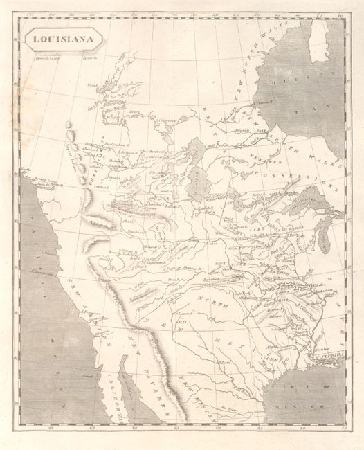
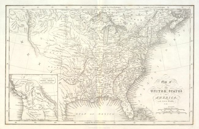
Auction 135, Lot 111
Subject: Western North America
Arrowsmith & Lewis
Louisiana, 1804
Size: 8 x 10 inches (20.3 x 25.4 cm)
Estimate: $600 - $800
Sold for: $475
Closed on 2/16/2011
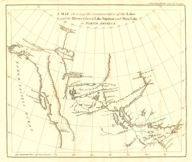
Auction 135, Lot 112
Subject: Western Canada and Alaska
Anon.
A Map Shewing the Communication of the Lakes and the Rivers between Lake Superior and Slave Lake in North America, 1790
Size: 9.25 x 7.8 inches (23.5 x 19.8 cm)
Estimate: $180 - $220
Sold for: $300
Closed on 2/16/2011
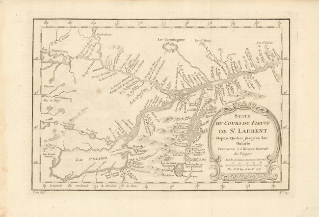
Auction 135, Lot 117
Subject: Canada
Bellin, Jacques Nicolas
Suite du Cours du Fleuve de St. Laurent Depuis Quebec jusqu'au Lac Ontario, 1757
Size: 11.3 x 7.5 inches (28.7 x 19.1 cm)
Estimate: $160 - $200
Sold for: $70
Closed on 2/16/2011
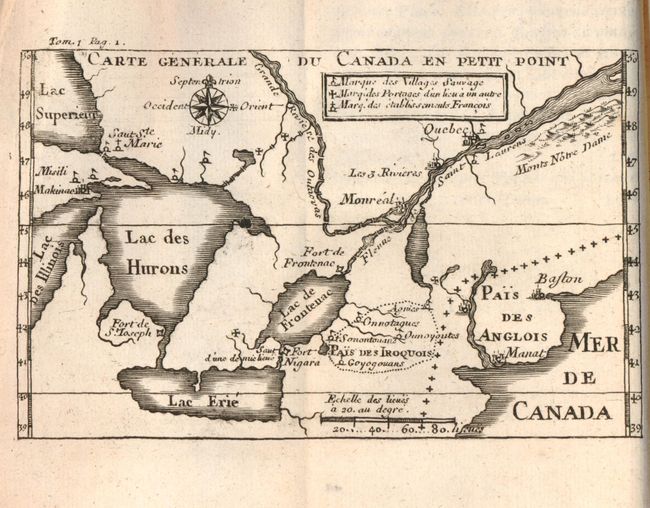
Auction 135, Lot 126
Subject: Colonial Canada & United States, Exploration
Lahontan, Louis Armand, Baron de
[Lot of 2] Nouveaux Voyages de Mr le Baron de Lahontan, dans l'Amerique Septentrionale… Tome Premier … 1704 [and] Memoires de l'Amerique Septentrionale … Tome Second … 1703, 1703-1704
Size: 4 x 6.5 inches (10.2 x 16.5 cm)
Estimate: $2,750 - $3,250
Sold for: $4,000
Closed on 2/16/2011
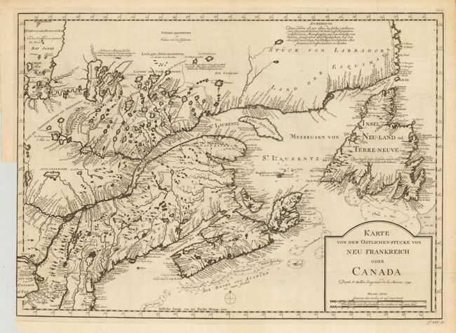
Auction 135, Lot 127
Subject: Colonial New England and Canada
Bellin, Jacques Nicolas
Karte von dem Ostlichen-Stucke von Neu Frankreich oder Canada, 1744
Size: 22 x 15.5 inches (55.9 x 39.4 cm)
Estimate: $400 - $500
Sold for: $250
Closed on 2/16/2011
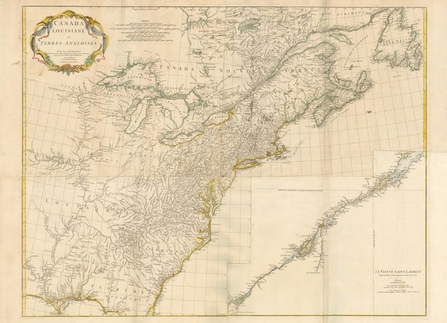
Auction 135, Lot 128
Subject: Colonial United States and Canada
Anville, Jean Baptiste Bourguignon d'
Canada Louisiane et Terres Angloises, 1755
Size: 44.5 x 34 inches (113 x 86.4 cm)
Estimate: $2,500 - $3,500
Sold for: $1,600
Closed on 2/16/2011
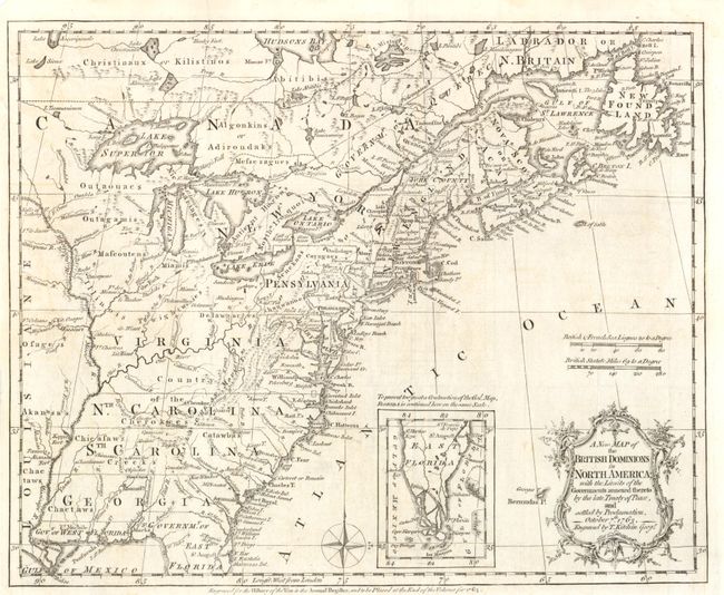
Auction 135, Lot 129
Subject: Colonial United States and Canada
Kitchin, Thomas
A New Map of the British Dominions in North America; with the Limits of the Governments Annexed thereto by the Late Treaty of Peace, and Settled by Proclamation, October 7th, 1763, 1763
Size: 12 x 9.5 inches (30.5 x 24.1 cm)
Estimate: $500 - $600
Sold for: $275
Closed on 2/16/2011
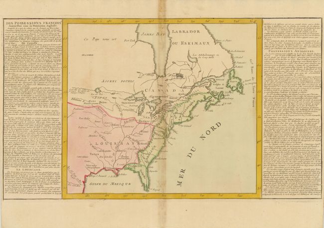
Auction 135, Lot 130
Subject: Colonial United States and Canada
Clouet, Jean Baptiste Louis
[Des Possessions Francoises Aujourd'hui sous la Domination Angloises ...], 1767
Size: 13.7 x 12.3 inches (34.8 x 31.2 cm)
Estimate: $180 - $220
Unsold
Closed on 2/16/2011
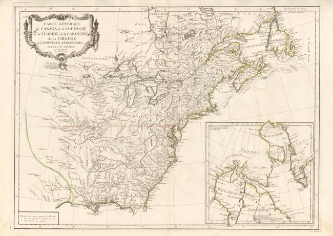
Auction 135, Lot 131
Subject: Colonial United States and Canada
D'Anville/Santini
Carte Generale du Canada, de la Louisiane, de la Floride, de la Caroline, de la Virginie, de la Nouvelle Angleterre etc. par le Sr. d'Anville, 1776
Size: 25.8 x 18.8 inches (65.5 x 47.8 cm)
Estimate: $600 - $800
Sold for: $400
Closed on 2/16/2011
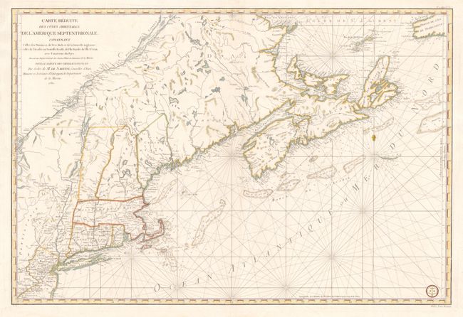
Auction 135, Lot 132
Subject: Colonial New England and Canada
Sartine
Carte Reduite des Cotes Orientales de l'Amerique Septentrionale Contenant Celles des Provinces de New-York et de la Nouvelle Angleterre, Celles de l'Acadie ou Nouvelles Ecosse, de L'Ile Royale, de L'Ile St.Jean, avec L'Interieure du Pays…, 1780
Size: 34.3 x 23 inches (87.1 x 58.4 cm)
Estimate: $1,900 - $2,200
Sold for: $1,200
Closed on 2/16/2011
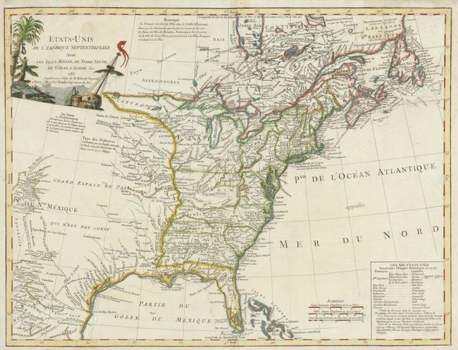
Auction 135, Lot 133
Subject: United States and Canada
Robert de Vaugondy/Boudet
Etats-Unis de l'Amerique Septentrionale avec les Isles Royale, de Terre Neuve, de St. Jean, l'Acadie &c., 1785
Size: 24.5 x 18.6 inches (62.2 x 47.2 cm)
Estimate: $800 - $1,000
Sold for: $600
Closed on 2/16/2011
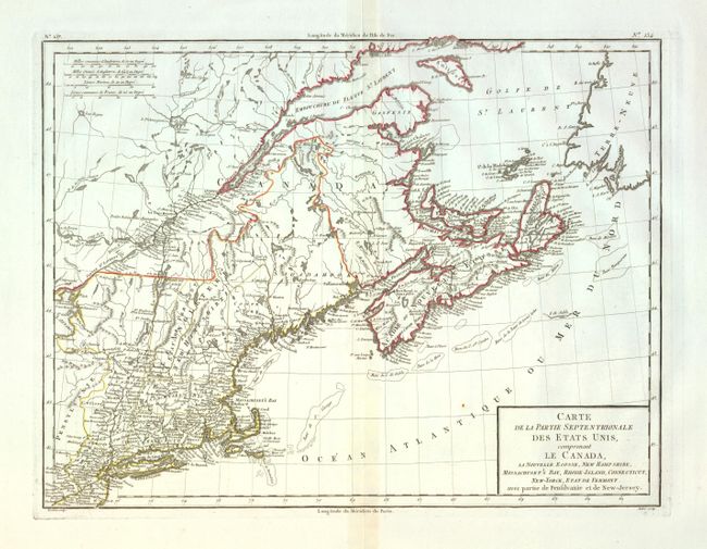
Auction 135, Lot 134
Subject: Eastern Canada & United States
Tardieu, Pierre Francois
Carte de la Partie Septentrionale des Etats Unis, comprenant le Canada, La Nouvelle Ecosse, New Hampshire, Massachuset's Bay, Rhode-Island, Connecticut, New-Yorck, Etat de Vermont avec partie de Pensilvanie et de New-Jersey, 1797
Size: 16.5 x 12.7 inches (41.9 x 32.3 cm)
Estimate: $300 - $400
Sold for: $170
Closed on 2/16/2011
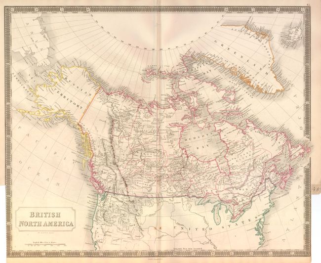
Auction 135, Lot 135
Subject: Canada and United States
Hall, Sidney
British North America, 1848
Size: 20 x 16.3 inches (50.8 x 41.4 cm)
Estimate: $200 - $250
Unsold
Closed on 2/16/2011
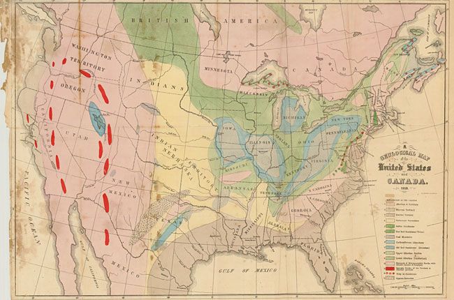
Auction 135, Lot 136
Subject: Canada & United States
Hitchcock, Edward
A Geological Map of the United States and Canada, 1853
Size: 24.4 x 16.7 inches (62 x 42.4 cm)
Estimate: $400 - $500
Sold for: $550
Closed on 2/16/2011
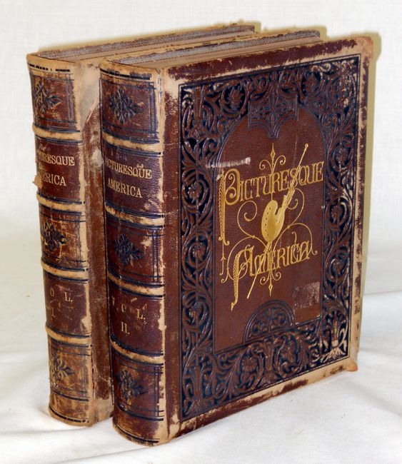
Auction 135, Lot 137
Subject: Canada and United States
Bryant, William C.
[2 Volumes] Picturesque America; or, the Land we Live in…, 1872-74
Size: 10.5 x 13 inches (26.7 x 33 cm)
Estimate: $400 - $600
Sold for: $300
Closed on 2/16/2011
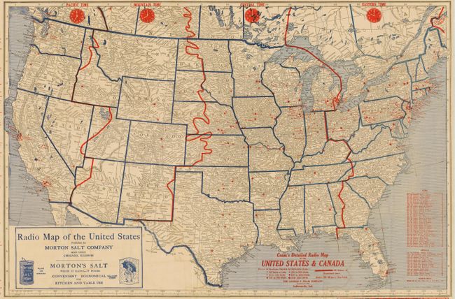
Auction 135, Lot 138
Subject: United States and Canada
Cram, George F. & Company
Cram's Detailed Radio Map of the United States and Canada, 1926
Size: 29 x 19.3 inches (73.7 x 49 cm)
Estimate: $100 - $150
Sold for: $350
Closed on 2/16/2011
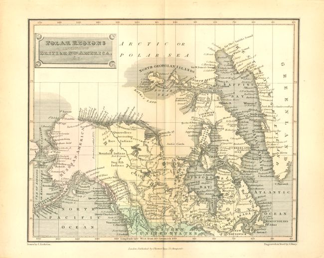
Auction 135, Lot 139
Subject: Canadian Arctic and Alaska
Tegg, Thomas
Polar Regions including British Nth. America, &c., 1820
Size: 10 x 8.2 inches (25.4 x 20.8 cm)
Estimate: $100 - $140
Sold for: $70
Closed on 2/16/2011
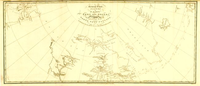
Auction 135, Lot 140
Subject: Canada & Alaska
[Lot of 2] General Chart Shewing the Track of H.M. Ships Fury and Hecla… [and] Carte des Voyages du King George et de la Reine Charlotte…, 1787-1824
Size: See Description
Estimate: $400 - $800
Unsold
Closed on 2/16/2011
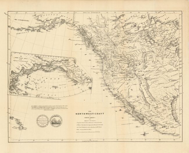
Auction 135, Lot 141
Subject: Western United States and Canada
Burr, David H.
The North-West Coast of North America and adjacent Territories…, 1840
Size: 21.3 x 16 inches (54.1 x 40.6 cm)
Estimate: $275 - $325
Sold for: $240
Closed on 2/16/2011
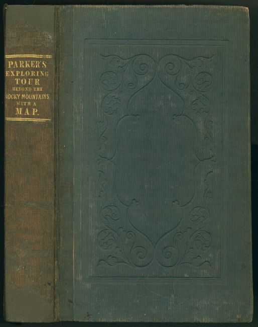
Auction 135, Lot 142
Subject: Western United States and Canada
Parker, Samuel (Rev.)
Journal of an Exploring Tour Beyond the Rocky Mountains … with a Map of Oregon Territory, 1840
Size: 5 x 7.8 inches (12.7 x 19.8 cm)
Estimate: $500 - $600
Sold for: $550
Closed on 2/16/2011
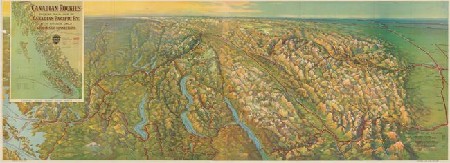
Auction 135, Lot 143
Subject: Western United States and Canada
Railroad Companies, (Various)
Canadian Rockies Showing Main Line of Canadian Pacific Ry. with Branch Lines & Steamship Connections, 1926
Size: 46.6 x 16.7 inches (118.4 x 42.4 cm)
Estimate: $100 - $150
Sold for: $170
Closed on 2/16/2011
Auction 135, Lot 144
Subject: United States
Hinton, Simpkin & Marshall
Map of the United States of America and Nova Scotia, &c.&c., 1832
Size: 15.6 x 9.8 inches (39.6 x 24.9 cm)
Estimate: $200 - $250
Sold for: $120
Closed on 2/16/2011
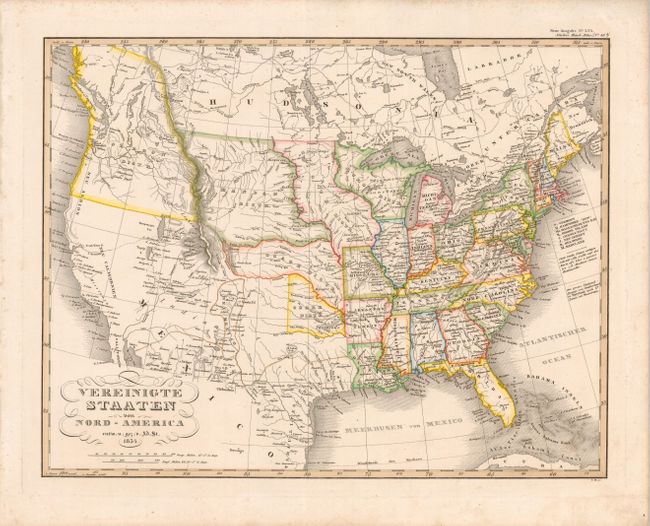
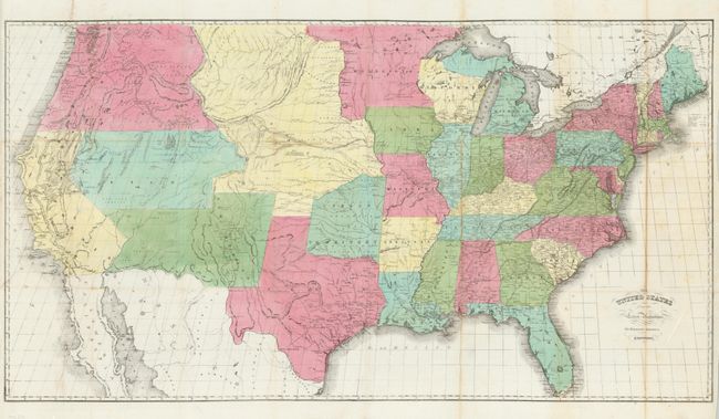
Auction 135, Lot 145
Subject: United States
Stieler, Adolph
Vereinigte Staaten von Nord-America, 1834
Size: 15.4 x 12 inches (39.1 x 30.5 cm)
Estimate: $275 - $325
Sold for: $180
Closed on 2/16/2011
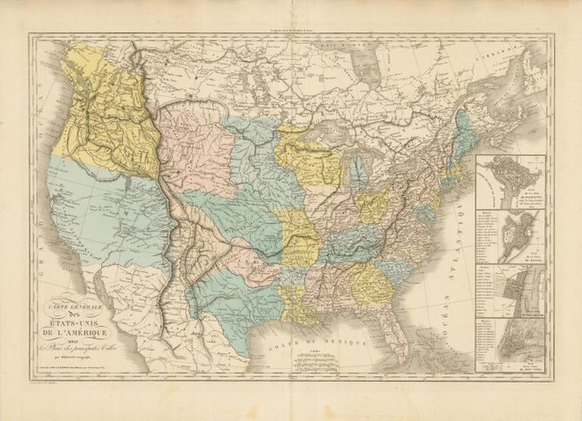
Auction 135, Lot 146
Subject: United States
Herisson, Eustache
Carte Generale des Etats-Unis de l'Amerique avec les Plans des principales Villes, 1838
Size: 30.2 x 19.8 inches (76.7 x 50.3 cm)
Estimate: $800 - $1,000
Sold for: $650
Closed on 2/16/2011
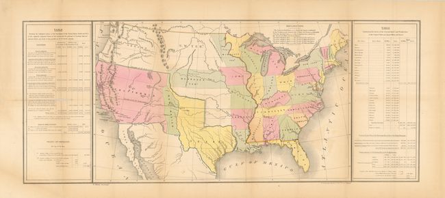
Auction 135, Lot 147
Subject: United States, Texas
Gilman, E.
[Map of the United States with Tables], 1848
Size: 21.3 x 13.7 inches (54.1 x 34.8 cm)
Estimate: $600 - $800
Sold for: $450
Closed on 2/16/2011
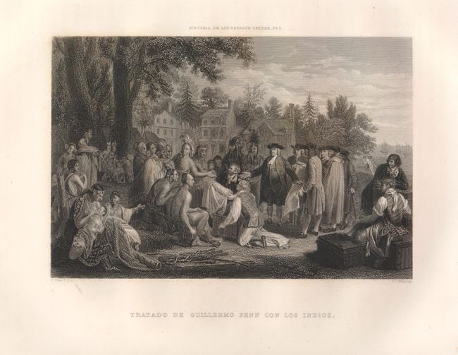
Auction 135, Lot 148
Subject: United States
[Lot of 6 - U.S. Historical Engravings], 1850
Size: 7 x 5.7 inches (17.8 x 14.5 cm)
Estimate: $220 - $300
Unsold
Closed on 2/16/2011
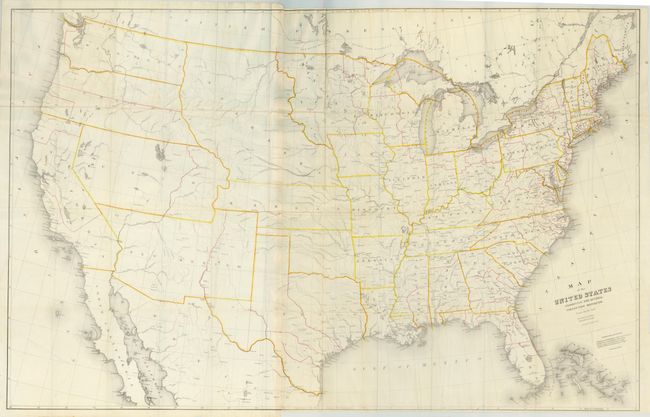
Auction 135, Lot 149
Subject: United States
Hayward, George
The United States from the Latest Authorities for Haywood's Gazetteer, 1853
Size: 40 x 21.5 inches (101.6 x 54.6 cm)
Estimate: $475 - $550
Sold for: $275
Closed on 2/16/2011
Auction 135, Lot 150
Subject: United States
Burr, David H.
Map of the United States Exhibiting the Several Collection Districts, 1854
Size: 48.4 x 31 inches (122.9 x 78.7 cm)
Estimate: $150 - $200
Sold for: $140
Closed on 2/16/2011
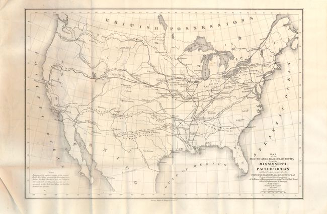
Auction 135, Lot 151
Subject: United States
U.S. War Department
Map of the Practicable Rail Road Routes from the Mississippi to the Pacific Ocean and their Connection with the Principal Seaports of the Atlantic Ocean… [with] Report, 1859
Size: 14 x 9.5 inches (35.6 x 24.1 cm)
Estimate: $200 - $400
Sold for: $100
Closed on 2/16/2011
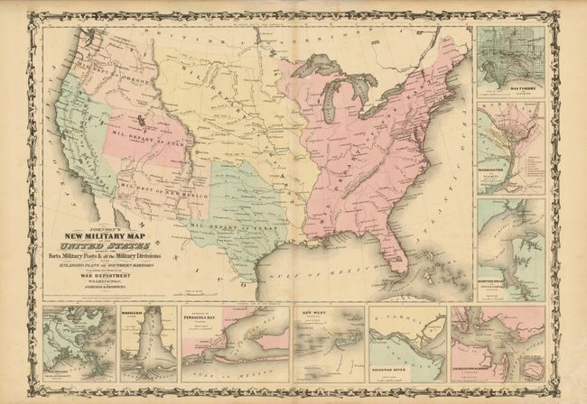
Auction 135, Lot 152
Subject: United States
Johnson & Browning
Johnson's New Military Map of the United States Showing the Forts, Military Posts &c. all the Military Divisions with Enlarged Plans of Southern Harbors…, 1861
Size: 23.5 x 17 inches (59.7 x 43.2 cm)
Estimate: $200 - $250
Sold for: $170
Closed on 2/16/2011
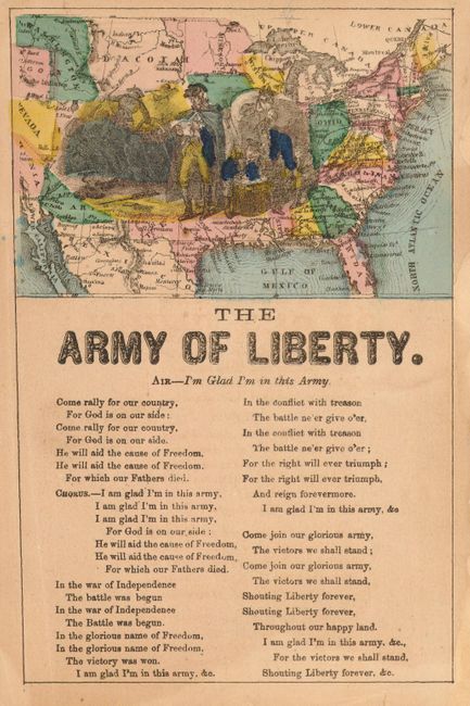
Auction 135, Lot 153
Subject: United States [Song Sheet]
Anon.
[Map of United States with The Army of Liberty Song], 1862-63
Size: 4.8 x 7.4 inches (12.2 x 18.8 cm)
Estimate: $150 - $200
Sold for: $475
Closed on 2/16/2011
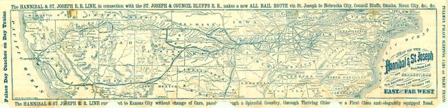
Auction 135, Lot 154
Subject: United States
Fisk & Russell
Map of the Hannibal & St. Joseph Railroad Line and Connections. The Old Reliable Short Line route Between the East and the Far West, 1870
Size: 25 x 5.3 inches (63.5 x 13.5 cm)
Estimate: $90 - $120
Sold for: $100
Closed on 2/16/2011
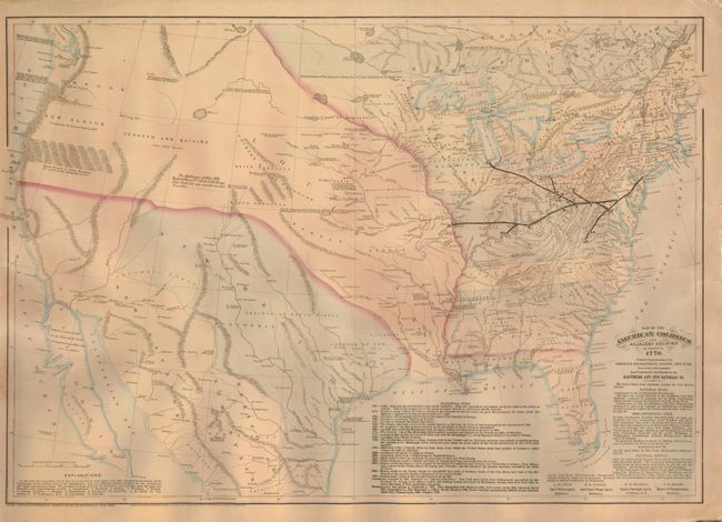
Auction 135, Lot 155
Subject: United States
Asher & Adams
Map of the American Colonies and Adjacent Country As known in 1776, 1875
Size: 23 x 16 inches (58.4 x 40.6 cm)
Estimate: $160 - $200
Sold for: $120
Closed on 2/16/2011
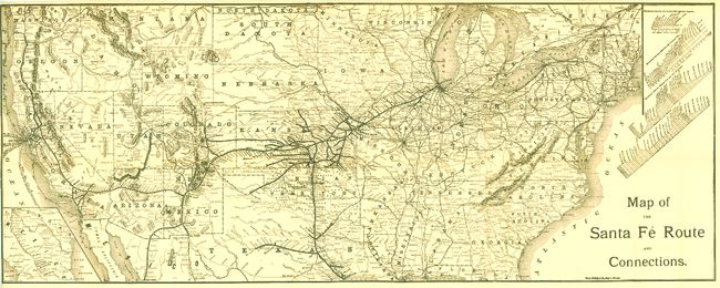
Auction 135, Lot 156
Subject: United States
Rand McNally & Co.
Map of the Santa Fe and Connections, 1890
Size: 38.5 x 15.3 inches (97.8 x 38.9 cm)
Estimate: $120 - $160
Sold for: $80
Closed on 2/16/2011
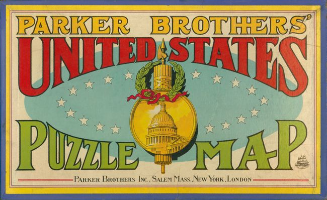
Auction 135, Lot 157
Subject: United States Puzzle Map
Parker Brothers
Parker Brothers' United States Puzzle Map, 1915
Size: 20 x 12 inches (50.8 x 30.5 cm)
Estimate: $120 - $160
Sold for: $230
Closed on 2/16/2011
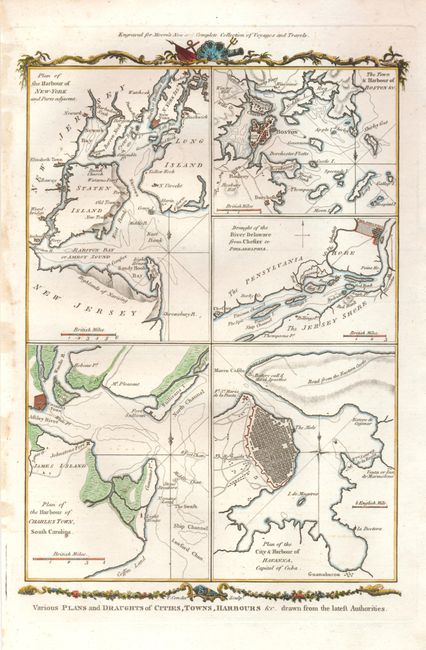
Auction 135, Lot 158
Subject: Eastern United States - Cuba
Conder, Thomas
Various Plans and Draughts of Cities, Towns, Harbours &c. Drawn from the latest Authorities, 1779
Size: 7.5 x 12 inches (19.1 x 30.5 cm)
Estimate: $300 - $350
Sold for: $220
Closed on 2/16/2011
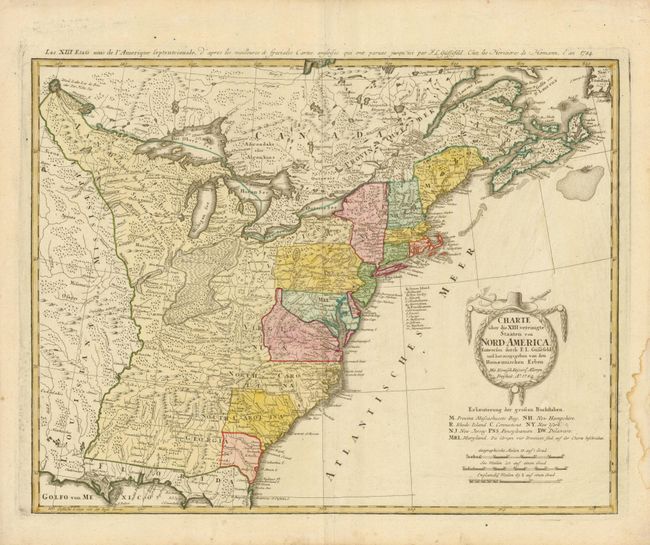
Auction 135, Lot 159
Subject: Eastern United States
Gussefeld/Homann Heirs
Charte uber die XIII vereinigte Staaten von Nord-America…, 1784
Size: 22.5 x 17.5 inches (57.2 x 44.5 cm)
Estimate: $600 - $700
Sold for: $650
Closed on 2/16/2011
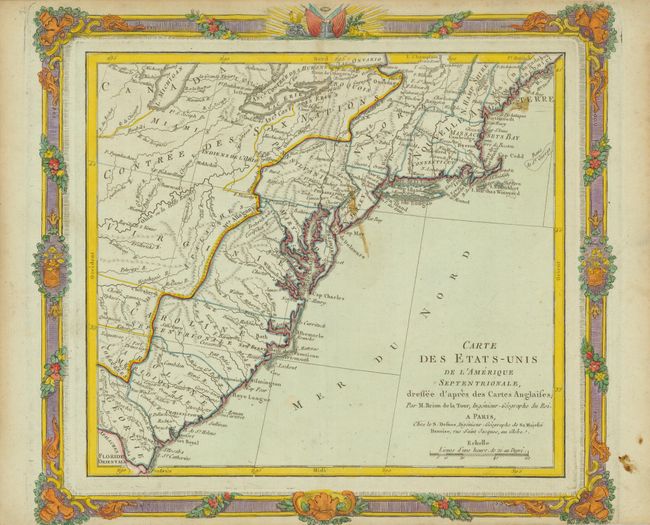
Auction 135, Lot 160
Subject: Eastern United States
Brion de la Tour/Desnos
Carte des Etats-Unis de l'Amerique Septentrionale, Dressee d'apres des Cartes Anglaises, 1784
Size: 12 x 10.7 inches (30.5 x 27.2 cm)
Estimate: $200 - $275
Sold for: $150
Closed on 2/16/2011
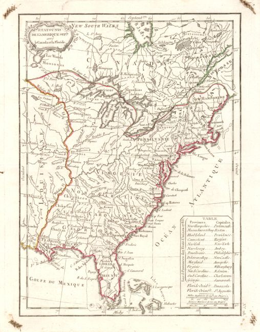
Auction 135, Lot 161
Subject: Eastern United States
Lattre, Jean
Etats-Unis de l'Amerique Seple avec le Canada et la Floride, 1790
Size: 7.3 x 9.8 inches (18.5 x 24.9 cm)
Estimate: $200 - $250
Sold for: $160
Closed on 2/16/2011
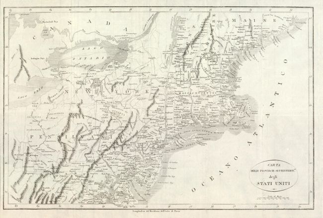
Auction 135, Lot 162
Subject: Eastern United States
Rochefoucald Liancourt, Francois Alexander
Carta delle Provincie Settentrionli degli Stati Uniti, 1800
Size: 19.2 x 12.5 inches (48.8 x 31.8 cm)
Estimate: $240 - $300
Sold for: $150
Closed on 2/16/2011
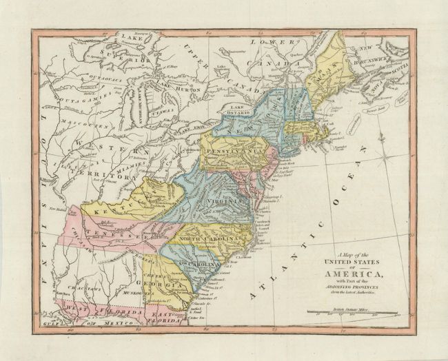
Auction 135, Lot 163
Subject: Eastern United States
Anon.
A Map of the United States of America, with Part of the Adjoining Provinces from the latest Authorities, 1810
Size: 10.5 x 8.5 inches (26.7 x 21.6 cm)
Estimate: $250 - $300
Unsold
Closed on 2/16/2011
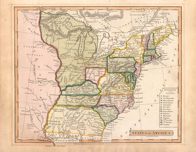
Auction 135, Lot 164
Subject: Eastern United States
Nuttall, Fisher & Dixon
States of America, 1814
Size: 8.5 x 7 inches (21.6 x 17.8 cm)
Estimate: $275 - $325
Sold for: $210
Closed on 2/16/2011
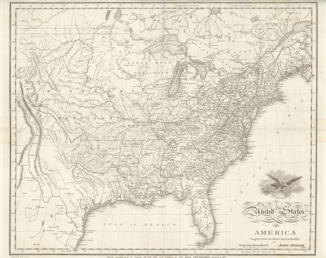
Auction 135, Lot 165
Subject: Eastern United States
Melish, John
United States of America Compiled from the latest & best Authorities, 1822
Size: 19.3 x 15.8 inches (49 x 40.1 cm)
Estimate: $700 - $900
Sold for: $650
Closed on 2/16/2011
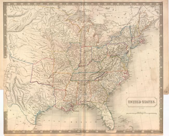
Auction 135, Lot 166
Subject: Eastern United States, Texas
Hall, Sidney
United States, 1847
Size: 20 x 16.6 inches (50.8 x 42.2 cm)
Estimate: $250 - $350
Sold for: $325
Closed on 2/16/2011
Auction 135, Lot 167
Subject: Eastern United States
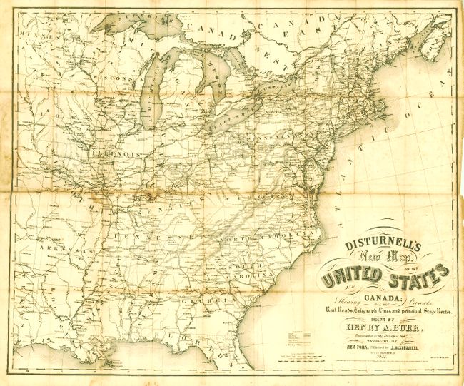
Burr, Henry A.
Disturnell's New Map of the United States and Canada Showing All the Canals, Rail Roads, Telegraph Lines and Principal Stage Routes, 1851
Size: 25.5 x 21.3 inches (64.8 x 54.1 cm)
Estimate: $300 - $500
Sold for: $200
Closed on 2/16/2011
Auction 135, Lot 168
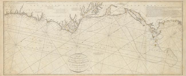
Subject: Eastern United States
Norie, John William
To the Independent Mariners of America, This Chart of their Coast from Savannah to Boston is most Respectfully Dedicated…, 1852
Size: 61 x 25.3 inches (154.9 x 64.3 cm)
Estimate: $2,750 - $3,500
Unsold
Closed on 2/16/2011
Auction 135, Lot 169
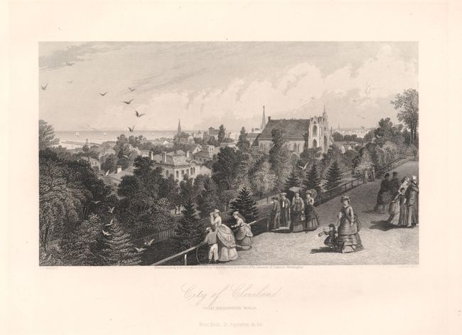
Subject: Eastern United States
[Lot of 5 - U.S. City Views], 1875
Size: 9 x 6.8 inches (22.9 x 17.3 cm)
Estimate: $140 - $210
Sold for: $90
Closed on 2/16/2011
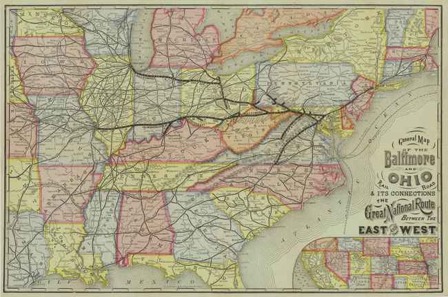
Auction 135, Lot 170
Subject: Eastern United States
Railroad Companies, (Various)
General Map of the Baltimore and Ohio Rail Road & its Connections The Great National Route Between the East and West, 1877
Size: 20.3 x 13.3 inches (51.6 x 33.8 cm)
Estimate: $160 - $200
Sold for: $120
Closed on 2/16/2011
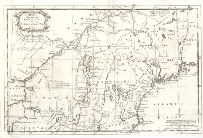
Auction 135, Lot 171
Subject: Colonial New England and Mid-Atlantic
Anon.
A Map of that Part of America which was the Principal Seat of War, in 1756, 1757
Size: 13 x 8.5 inches (33 x 21.6 cm)
Estimate: $400 - $500
Unsold
Closed on 2/16/2011
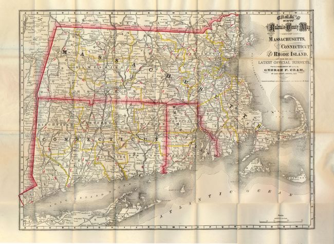
Auction 135, Lot 172
Subject: New England
Cram, George F. & Company
Cram's New Railroad and County Map of Massachusetts, Connecticut and Rhode Island, from the Latest Official Surveys, 1879
Size: 20.5 x 15.3 inches (52.1 x 38.9 cm)
Estimate: $160 - $200
Sold for: $140
Closed on 2/16/2011
221 lots
Page 1 of 5