Filtered by Category:United States(Show All Categories)
Showing results for:Auction 126
Catalog Archive
254 lots
Page 1 of 6
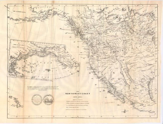
Auction 126, Lot 107
Subject: Western North America, Texas
Burr, David H.
The North-West-Coast of North America and Adjacent Territories…, 1840
Size: 21.3 x 16 inches (54.1 x 40.6 cm)
Estimate: $250 - $350
Sold for: $190
Closed on 12/3/2008
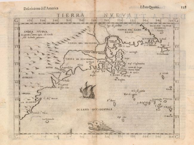
Auction 126, Lot 118
Subject: Colonial United States & Canada
Ruscelli, Girolamo
Tierra Nueva, 1598
Size: 9.7 x 7 inches (24.6 x 17.8 cm)
Estimate: $900 - $1,100
Sold for: $900
Closed on 12/3/2008
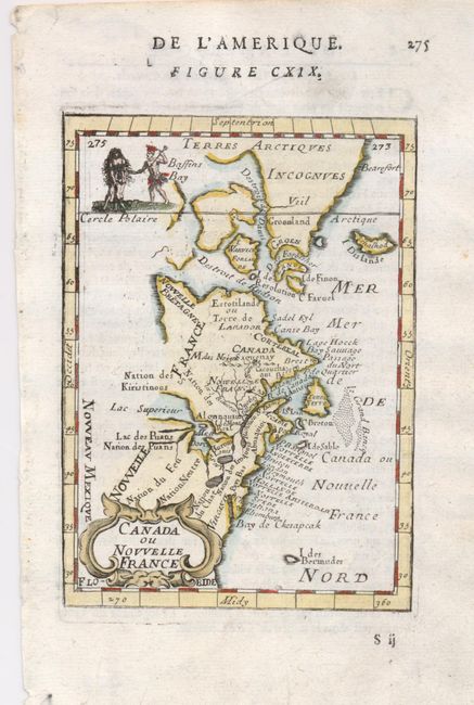
Auction 126, Lot 119
Subject: Colonial United States and Canada
Mallet, Alain Manesson
Canada ou Nouvelle France, 1683
Size: 4 x 5.5 inches (10.2 x 14 cm)
Estimate: $200 - $250
Sold for: $210
Closed on 12/3/2008
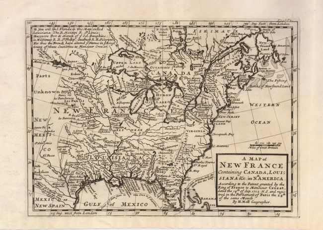
Auction 126, Lot 120
Subject: Colonial United States and Canada
Moll, Herman
A Map of New France Containing Canada, Louisiana &c. in Nth. America According to the Patent granted by the King of France to Monsieur Crozat, dated the 14th of Sep. 1712 N.S. and registered in the Parliament of Paris the 24th of the same Month, 1717
Size: 10 x 7.3 inches (25.4 x 18.5 cm)
Estimate: $600 - $700
Sold for: $450
Closed on 12/3/2008
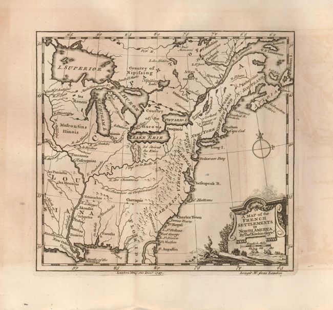
Auction 126, Lot 121
Subject: Colonial United States and Canada
Kitchin, Thomas
A Map of the French Settlements in North America, 1747
Size: 7 x 6.5 inches (17.8 x 16.5 cm)
Estimate: $200 - $250
Sold for: $130
Closed on 12/3/2008
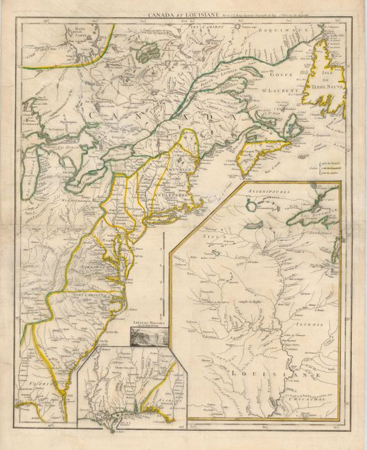
Auction 126, Lot 122
Subject: Colonial United States and Canada
Le Rouge, George Louis
Canada et Louisiane…, 1755
Size: 19.5 x 24.3 inches (49.5 x 61.7 cm)
Estimate: $1,500 - $1,800
Sold for: $1,000
Closed on 12/3/2008
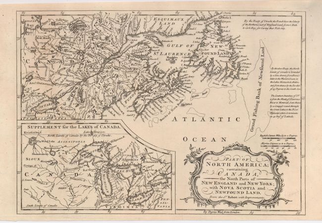
Auction 126, Lot 123
Subject: Colonial United States and Canada
Anon.
Part of North America; containing Canada, the North Parts of New England and New York; with Nova Scotia and Newfoundland. From the Sr. Robert with Improvements, 1760
Size: 11.5 x 8 inches (29.2 x 20.3 cm)
Estimate: $200 - $250
Sold for: $120
Closed on 12/3/2008
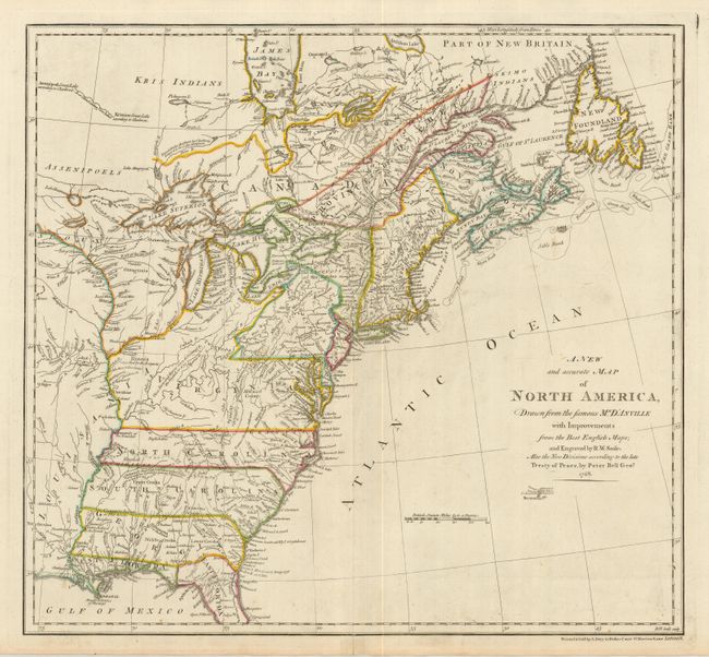
Auction 126, Lot 124
Subject: Colonial United States and Canada
Seale, Richard William
A New and Accurate Map of North America, Drawn from the Famous Mr. D'Anville with Improvements…, 1768
Size: 20 x 18.5 inches (50.8 x 47 cm)
Estimate: $1,800 - $2,200
Sold for: $1,100
Closed on 12/3/2008
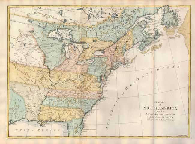
Auction 126, Lot 125
Subject: Colonial United States and Canada
Blair, Rev. John
A Map of North America from the Latest Surveys and Maps, 1768
Size: 22 x 16 inches (55.9 x 40.6 cm)
Estimate: $900 - $1,100
Sold for: $600
Closed on 12/3/2008
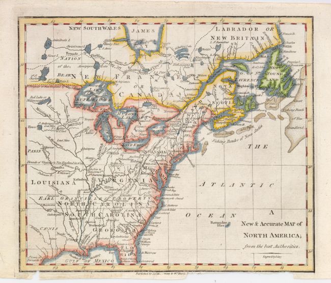
Auction 126, Lot 126
Subject: Colonial United States and Canada
Cary, John
A New & Accurate Map of North America; from the Best Authorities, 1770
Size: 8.8 x 7.6 inches (22.4 x 19.3 cm)
Estimate: $160 - $220
Sold for: $120
Closed on 12/3/2008
Auction 126, Lot 127
Subject: Colonial United States and Canada
Lotter, Mathias Albrecht
Carte Nouvelle de l'Amerique Angloise contenant tout ce que Anglois possedent sur le Continent de l'Amerique Septentrionale Savoir le Canada, la Nouvelle Ecosse ou Acadie, les treize Provinces Unies…, 1776
Size: 19 x 23 inches (48.3 x 58.4 cm)
Estimate: $1,200 - $1,500
Sold for: $700
Closed on 12/3/2008
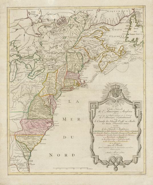
Auction 126, Lot 128
Subject: Canada & United States
Robert de Vaugondy
Etats-Unis de l'Amerique Divises en 13 Provinces avec leurs Limites, suivant le Traite de Paix fait le 20 Janvier 1783, 1785
Size: 9 x 7.3 inches (22.9 x 18.5 cm)
Estimate: $200 - $250
Sold for: $120
Closed on 12/3/2008
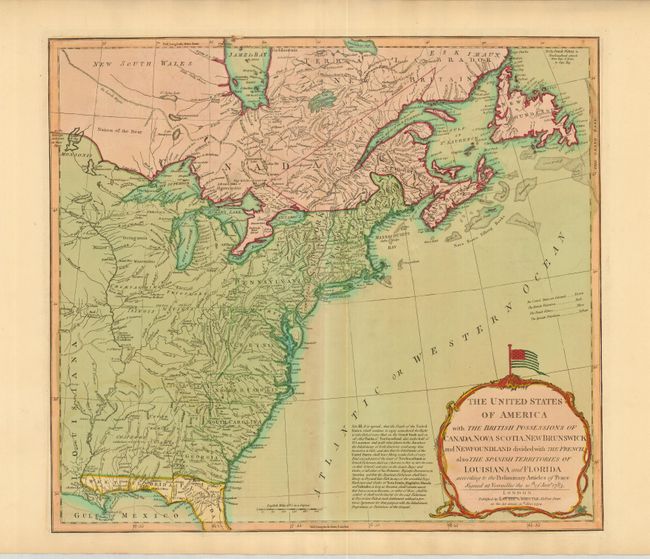
Auction 126, Lot 129
Subject: Eastern United States and Canada
Laurie & Whittle
The United States of America with the British Possessions of Canada, Nova Scotia, New Brunswick and Newfoundland divided with the French, also the Spanish Territories of Louisiana and Florida…, 1794
Size: 20 x 17.8 inches (50.8 x 45.2 cm)
Estimate: $1,600 - $1,800
Sold for: $1,200
Closed on 12/3/2008
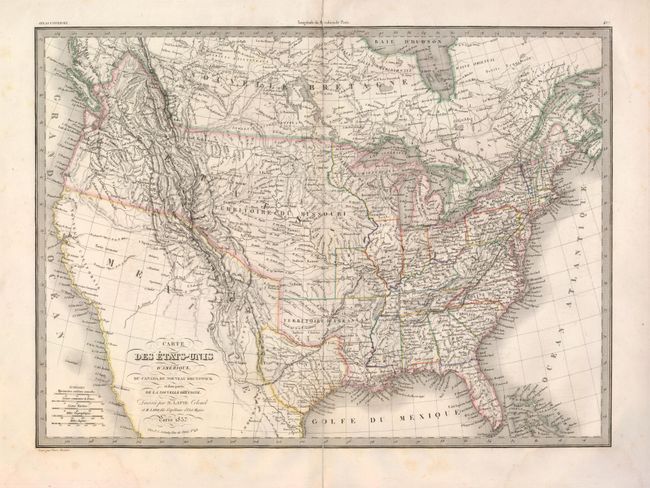
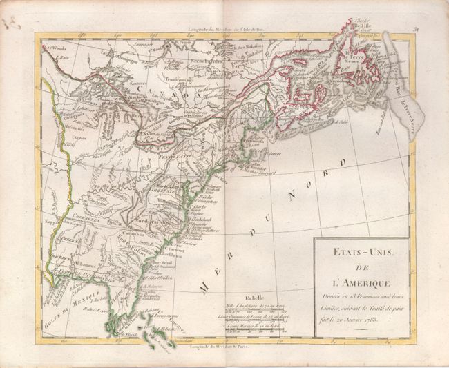
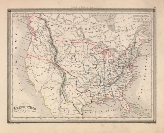
Auction 126, Lot 130
Subject: Canada & United States, Texas
Lapie, Alexander Emile & Pierre
Carte des Etats-Unis d'Amerique, du Canada, du Nouveau Brunswick et d'une partie de la Nouvelle Bretagne, 1837
Size: 21 x 15 inches (53.3 x 38.1 cm)
Estimate: $400 - $500
Sold for: $230
Closed on 12/3/2008

Auction 126, Lot 131
Subject: Northwestern United States and Canada
Wilkes, Charles
Map of the Oregon Territory from the Best Authorities, 1849
Size: 13 x 8 inches (33 x 20.3 cm)
Estimate: $150 - $250
Sold for: $210
Closed on 12/3/2008
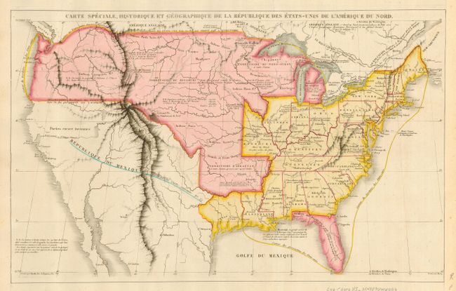
Auction 126, Lot 132
Subject: United States
[Lot of 3] Carte Speciale, Historique et Geographique de la Republique Des Etats-Unis de l'Amerique du Nord [and] Verein-Staaten von Nord-America, Mexico, Yucatan u. A. [and] Johnson's United States, 1825-1875
Size: See Description
Estimate: $300 - $400
Sold for: $220
Closed on 12/3/2008
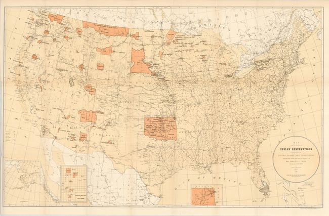
Auction 126, Lot 133
Subject: United States, Native Americans
U.S. Government
[Lot of 5 - Indian Reservations], 1833-1920
Size: See Description
Estimate: $200 - $400
Sold for: $100
Closed on 12/3/2008
Auction 126, Lot 134
Subject: United States, Texas
Vuillemin, Alexander A.
Etats-Unis, 1843
Size: 10 x 7.5 inches (25.4 x 19.1 cm)
Estimate: $120 - $160
Unsold
Closed on 12/3/2008
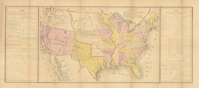
Auction 126, Lot 135
Subject: United States, Texas
Gilman, E.
[U.S. Tables Map], 1848
Size: 21.5 x 13.5 inches (54.6 x 34.3 cm)
Estimate: $400 - $500
Sold for: $300
Closed on 12/3/2008
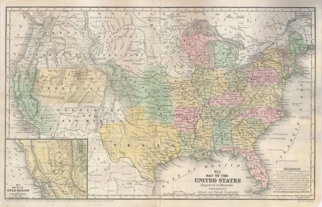
Auction 126, Lot 136
Subject: United States
Mitchell, Samuel Augustus
No. 5 Map of the United States Engraved to Illustrate Mitchell's School and Family Geography, 1849
Size: 16.8 x 10.3 inches (42.7 x 26.2 cm)
Estimate: $150 - $200
Sold for: $110
Closed on 12/3/2008
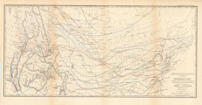
Auction 126, Lot 137
Subject: United States
Stevens, Isaac Ingalls
Isothermal chart of the Region North of the 36th Parallel &c. &c. between the Atlantic & Pacific Oceans, 1855
Size: 27.5 x 13 inches (69.9 x 33 cm)
Estimate: $75 - $100
Sold for: $55
Closed on 12/3/2008
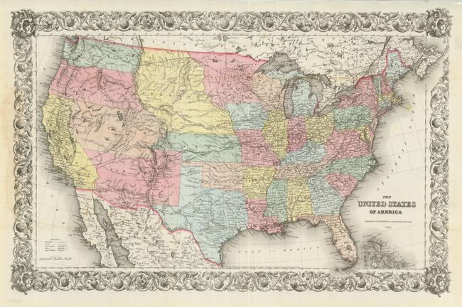
Auction 126, Lot 138
Subject: United States
Colton, Joseph Hutchins
The United States of America, 1855
Size: 26.5 x 17.5 inches (67.3 x 44.5 cm)
Estimate: $600 - $800
Unsold
Closed on 12/3/2008
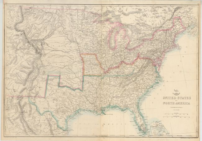
Auction 126, Lot 139
Subject: Eastern United States, Civil War
Ettling, Theodor
United States of North America (Eastern & Central), 1861
Size: 25 x 17 inches (63.5 x 43.2 cm)
Estimate: $150 - $200
Sold for: $100
Closed on 12/3/2008
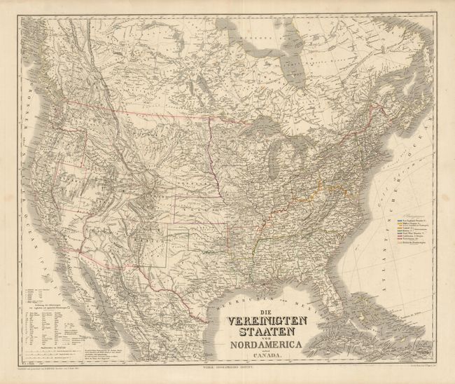
Auction 126, Lot 140
Subject: United States
Geographisches Institut
Die Vereinigten Staaten von Nord America nebst Canada, 1865
Size: 25 x 21 inches (63.5 x 53.3 cm)
Estimate: $180 - $220
Unsold
Closed on 12/3/2008
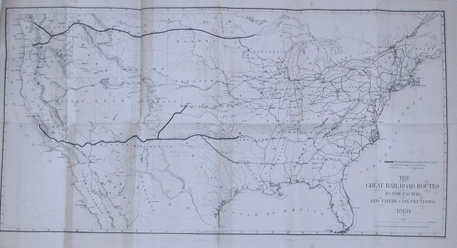
Auction 126, Lot 141
Subject: United States
Gorlinski, Joseph
The Great Railroad Routes to the Pacific, and Their Connections, 1869
Size: 27.5 x 14 inches (69.9 x 35.6 cm)
Estimate: $250 - $350
Sold for: $190
Closed on 12/3/2008
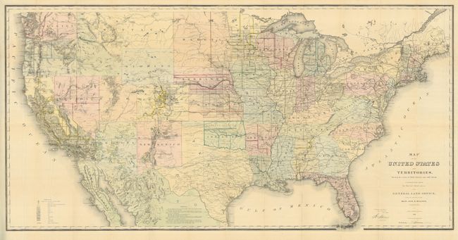
Auction 126, Lot 142
Subject: United States
General Land Office
Map of the United States and Territories Showing the extent of Public Surveys and other details constructed from the Plats and official sources of the General Land Office…, 1869
Size: 55.8 x 28 inches (141.7 x 71.1 cm)
Estimate: $350 - $450
Sold for: $425
Closed on 12/3/2008
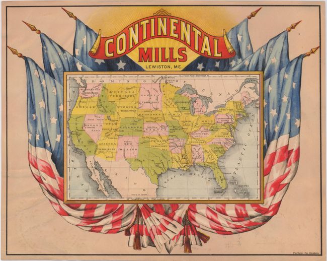
Auction 126, Lot 143
Subject: United States
[United States - Continental Mills, Lewiston, ME], 1876
Size: 11 x 8.7 inches (27.9 x 22.1 cm)
Estimate: $140 - $180
Unsold
Closed on 12/3/2008
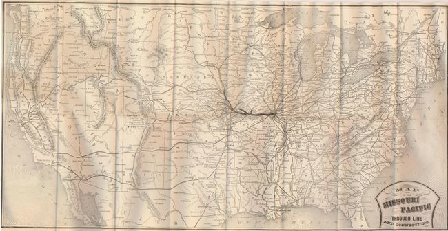
Auction 126, Lot 144
Subject: United States
Railroad Companies, (Various)
Map of the Missouri Pacific Through Line and Connections, 1878
Size: 24 x 12 inches (61 x 30.5 cm)
Estimate: $150 - $250
Sold for: $100
Closed on 12/3/2008
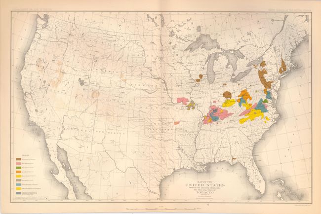
Auction 126, Lot 145
Subject: United States
U.S. Department of Interior
Map of the United States Showing the Regions Producing the Principal Types of Tobacco, 1881
Size: 16.3 x 10.3 inches (41.4 x 26.2 cm)
Estimate: $80 - $100
Sold for: $60
Closed on 12/3/2008
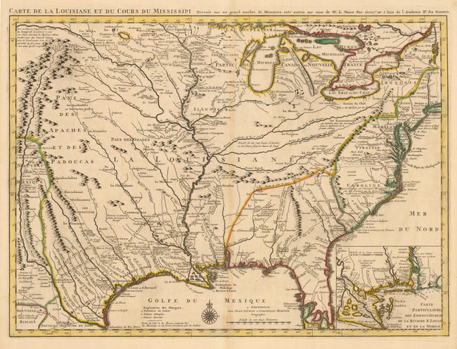
Auction 126, Lot 146
Subject: Colonial United States
Delisle/Covens & Mortier
Carte de la Louisiane et du Cours du Mississipi Dressee sur un Grand Nombre de Memoires entrautres sur ceux de Mr. le Maire, 1733
Size: 23.5 x 17.5 inches (59.7 x 44.5 cm)
Estimate: $2,750 - $3,500
Sold for: $2,500
Closed on 12/3/2008
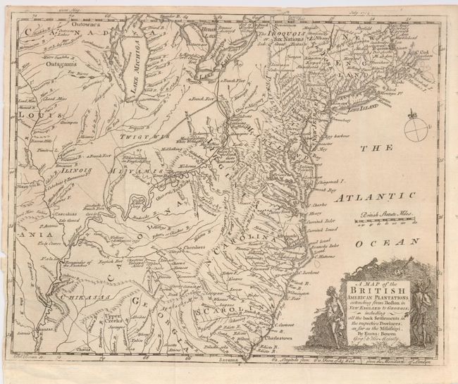
Auction 126, Lot 147
Subject: Colonial United States
Bowen, Emanuel
A Map of the British American Plantations extending from Boston in New England to Georgia; including all the back Settlements in the respective Provinces, as far as the Mississipi, 1754
Size: 10.7 x 8.6 inches (27.2 x 21.8 cm)
Estimate: $450 - $550
Sold for: $425
Closed on 12/3/2008
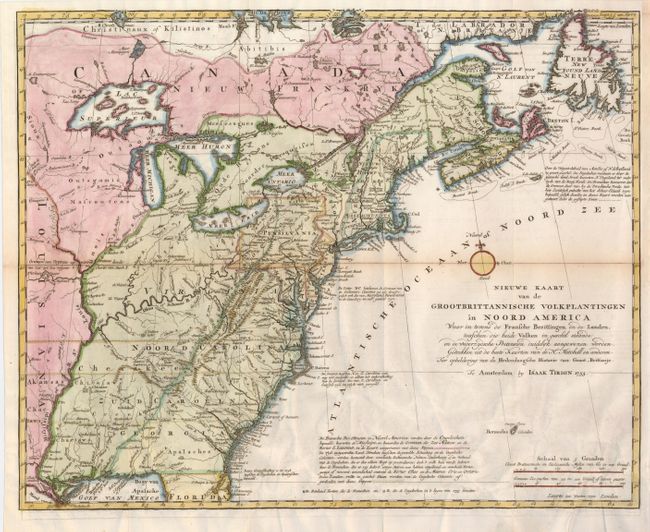
Auction 126, Lot 148
Subject: Colonial United States
Tirion, Isaac
Nieuwe Kaart van de Grootbrittannische Volkplantingen in Noord America…, 1755
Size: 18 x 14.3 inches (45.7 x 36.3 cm)
Estimate: $750 - $850
Sold for: $550
Closed on 12/3/2008
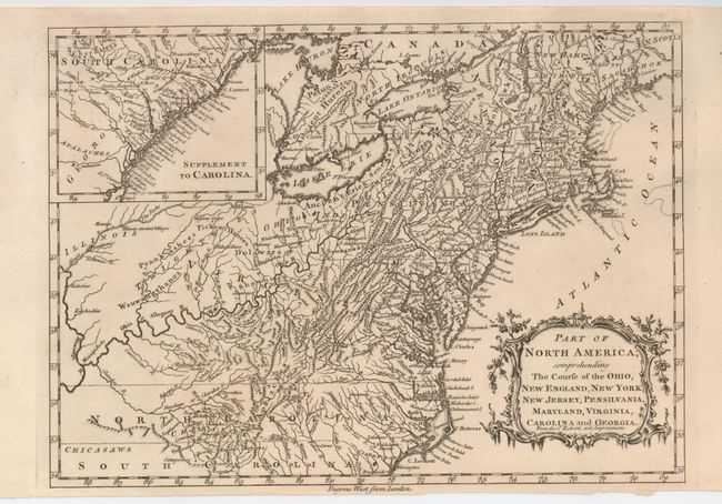
Auction 126, Lot 149
Subject: Colonial United States
Anon.
Part of North America, comprehending the Course of the Ohio, New England, New York, New Jersey, Pensilvania, Maryland, Virginia, Carolina and Georgia, 1760
Size: 11.7 x 8.5 inches (29.7 x 21.6 cm)
Estimate: $375 - $425
Sold for: $275
Closed on 12/3/2008
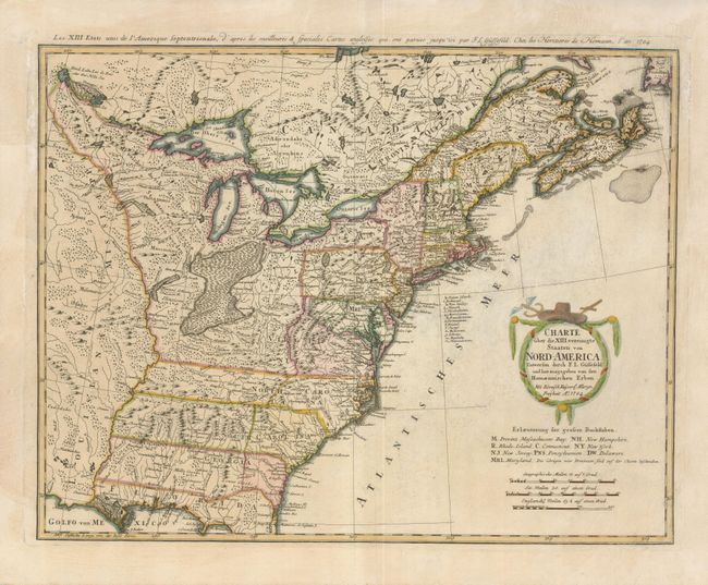
Auction 126, Lot 150
Subject: Eastern United States
Gussefeld/Homann Heirs
Charte uber die XIII vereinigte Staaten von Nord-America…, 1784
Size: 22.5 x 17.5 inches (57.2 x 44.5 cm)
Estimate: $850 - $950
Sold for: $650
Closed on 12/3/2008
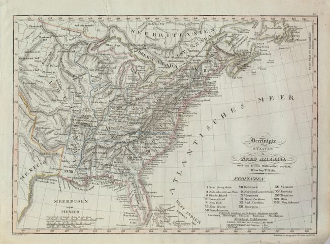
Auction 126, Lot 151
Subject: Eastern United States
Mollo, Tranquillo
Vereinigte Staaten in Nord America nach den Besten Hulfsmittel Verfast, 1800
Size: 17.5 x 12.5 inches (44.5 x 31.8 cm)
Estimate: $400 - $475
Unsold
Closed on 12/3/2008
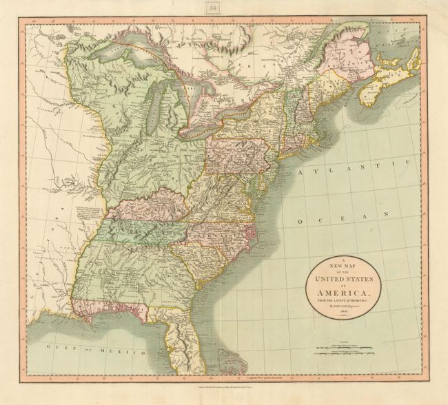
Auction 126, Lot 152
Subject: Eastern United States
Cary, John
A New Map of the United States of America, from the Latest Authorities, 1806
Size: 19.8 x 17.8 inches (50.3 x 45.2 cm)
Estimate: $750 - $850
Sold for: $450
Closed on 12/3/2008
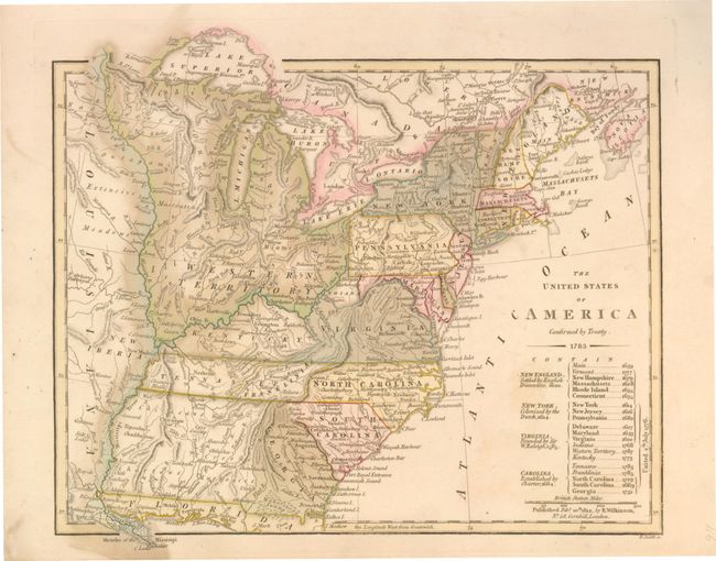
Auction 126, Lot 153
Subject: Eastern United States
Wilkinson, Robert
The United States of America Confirmed by Treaty 1783, 1812
Size: 11 x 9.3 inches (27.9 x 23.6 cm)
Estimate: $500 - $700
Sold for: $550
Closed on 12/3/2008
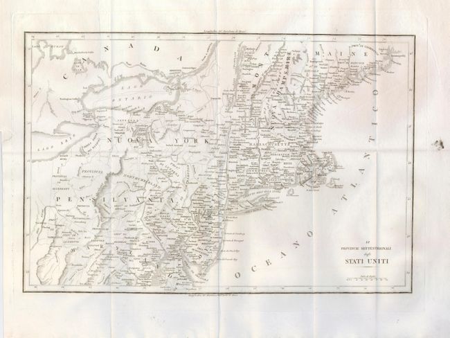
Auction 126, Lot 154
Subject: Eastern United States
Anon.
[Lot of 2] Le Provincie Settentrionali degli Stati Uniti [with] Le Provincie Meridionali degli Stati Uniti, 1822
Size: 17.4 x 12.4 inches (44.2 x 31.5 cm)
Estimate: $400 - $600
Unsold
Closed on 12/3/2008
Auction 126, Lot 155
Subject: Eastern United States
Lizars, Daniel
United States, 1827
Size: 19.8 x 16 inches (50.3 x 40.6 cm)
Estimate: $180 - $230
Sold for: $120
Closed on 12/3/2008
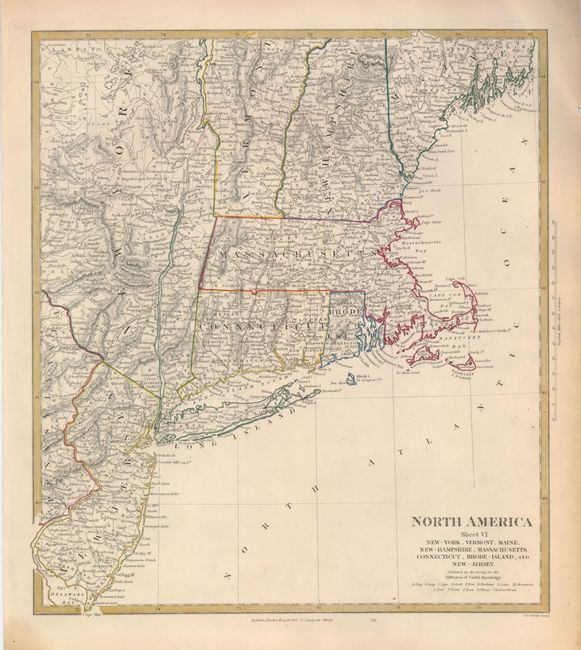
Auction 126, Lot 156
Subject: Eastern United States
SDUK Society for the Diffusion of Useful Knowledge
[Lot of 4 - Regional Maps], 1833
Size: 12.3 x 13.8 inches (31.2 x 35.1 cm)
Estimate: $200 - $300
Sold for: $150
Closed on 12/3/2008
Auction 126, Lot 157
Subject: Eastern United States
SDUK Society for the Diffusion of Useful Knowledge
[Lot of 4 - Regional Maps], 1833
Size: 12.3 x 13.8 inches (31.2 x 35.1 cm)
Estimate: $200 - $300
Sold for: $150
Closed on 12/3/2008
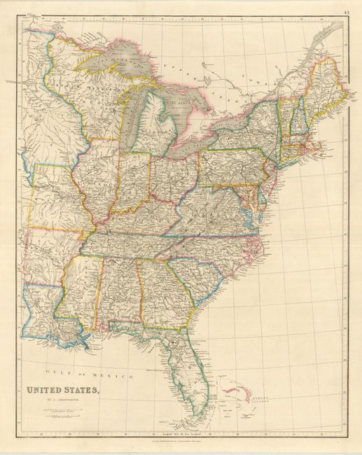
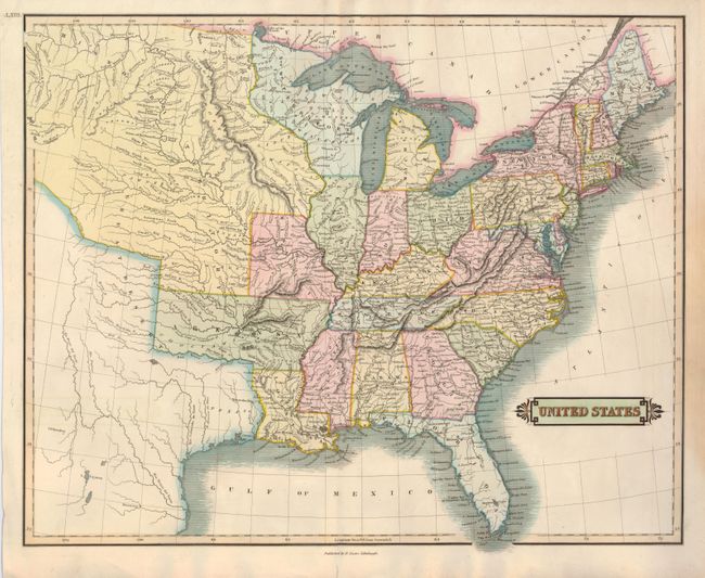
Auction 126, Lot 158
Subject: Eastern United States
Arrowsmith, John
United States, 1842
Size: 18.8 x 23.5 inches (47.8 x 59.7 cm)
Estimate: $250 - $300
Sold for: $190
Closed on 12/3/2008
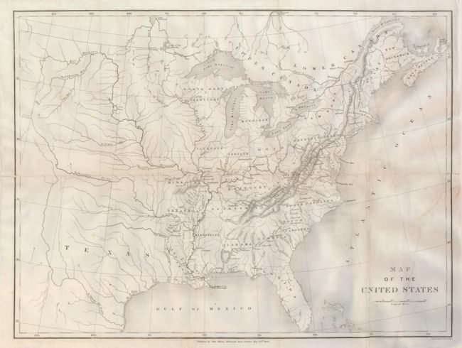
Auction 126, Lot 159
Subject: Eastern United States, Texas
Murray, John
Map of the United States, 1844
Size: 20 x 15 inches (50.8 x 38.1 cm)
Estimate: $140 - $180
Sold for: $70
Closed on 12/3/2008
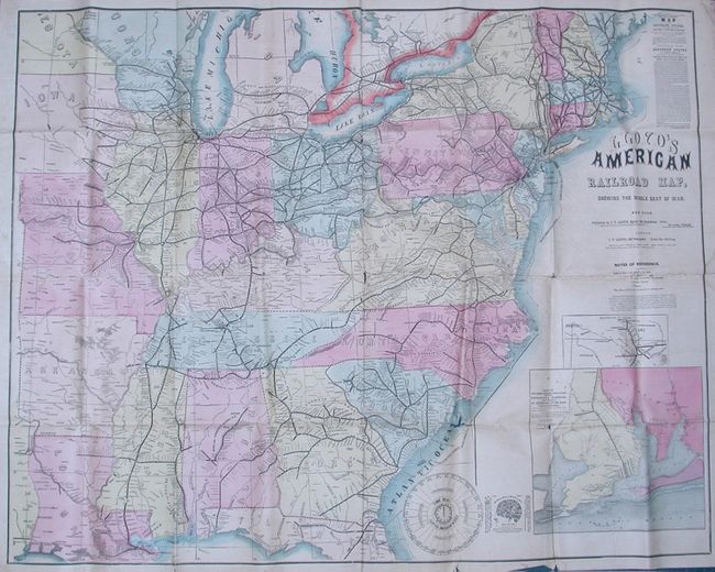
Auction 126, Lot 160
Subject: Eastern United States, Civil War
Lloyd, James T.
Lloyd's American Railroad Map, Showing the Whole Seat of War, 1861
Size: 47.5 x 37 inches (120.7 x 94 cm)
Estimate: $1,000 - $1,400
Sold for: $600
Closed on 12/3/2008
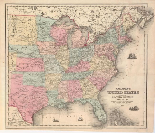
Auction 126, Lot 161
Subject: Eastern United States
Colton, Joseph Hutchins
Colton's United States shewing the Military Stations, Forts &c, 1862
Size: 16.3 x 14.5 inches (41.4 x 36.8 cm)
Estimate: $275 - $325
Sold for: $200
Closed on 12/3/2008
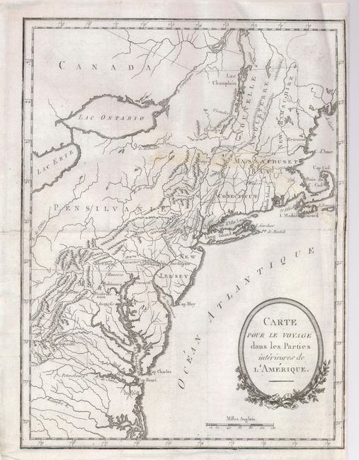
Auction 126, Lot 162
Subject: Northeastern United States
Anville/Anburey
Carte pour le Voyage dans les Parties Interieures de l'Amerique, 1790
Size: 8.8 x 11.5 inches (22.4 x 29.2 cm)
Estimate: $140 - $180
Sold for: $100
Closed on 12/3/2008
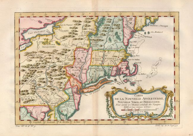
Auction 126, Lot 163
Subject: Colonial New England and Mid-Atlantic
Bellin, Jacques Nicolas
Carte de la Nouvelle Angleterre, Nouvelle Yorck et Pensilvanie, 1757
Size: 11.8 x 8 inches (30 x 20.3 cm)
Estimate: $375 - $450
Sold for: $275
Closed on 12/3/2008
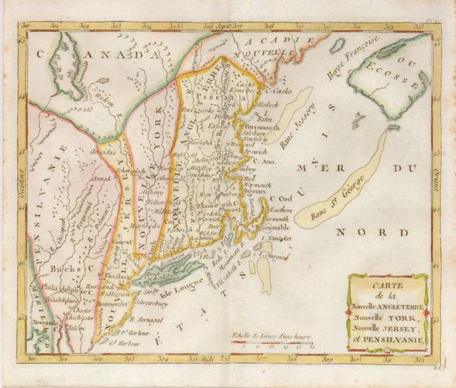
Auction 126, Lot 164
Subject: New England
Laporte, Joseph de
Carte de la Nouvelle Angleterre, Nouvelle York, Nouvelle Jersey, et Pensilvanie, 1783
Size: 8.7 x 7 inches (22.1 x 17.8 cm)
Estimate: $240 - $300
Sold for: $240
Closed on 12/3/2008
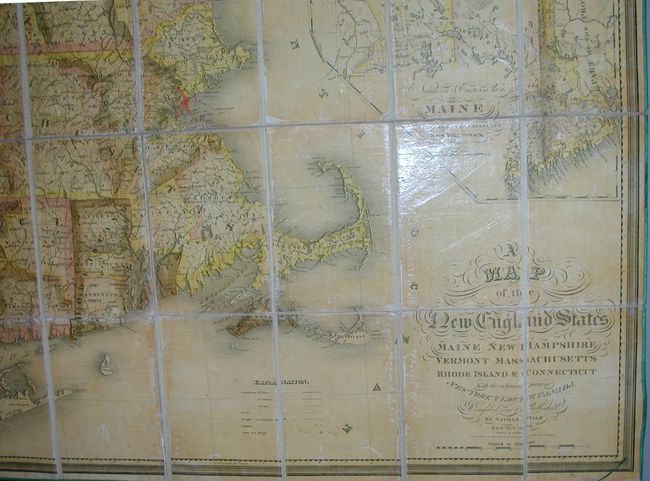
Auction 126, Lot 165
Subject: New England
Hale, Nathan
A Map of the New England States, Maine, New Hampshire, Vermont, Massachusetts, Rhode Island & Connecticut with the Adjacent Parts of New York & Lower Canada, 1826
Size: 40 x 44 inches (101.6 x 111.8 cm)
Estimate: $1,500 - $3,000
Sold for: $900
Closed on 12/3/2008
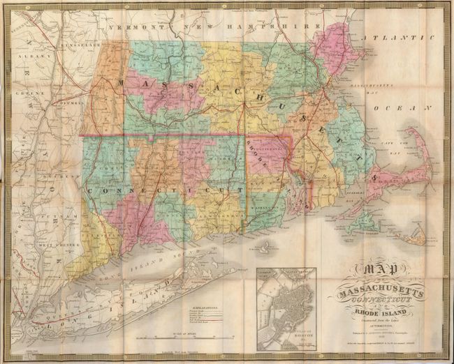
Auction 126, Lot 166
Subject: New England
Mitchell, Samuel Augustus
Map of Massachusetts, Connecticut, and Rhode Island Constructed from the Latest Authorities, 1843
Size: 21 x 17 inches (53.3 x 43.2 cm)
Estimate: $300 - $400
Unsold
Closed on 12/3/2008
254 lots
Page 1 of 6