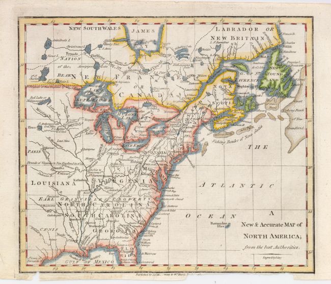
"A New & Accurate Map of North America; from the Best Authorities", Cary, John
Subject: Colonial United States and Canada
Period: 1770 (circa)
Publication:
Color: Hand Color
Size:
8.8 x 7.6 inches
22.4 x 19.3 cm
This uncommon map covers the eastern part of North America from James Bay to the Gulf of Mexico. It shows boundaries, colonies, towns, cities, forts, and Indian tribal territory. Earl Granville's Property is shown to extend past the Mississippi to the western edge of the map. The southwest region is called Cenis and there is a town with the same name. Fort St. Charles is the furthest west settlement. Engraved by J. Cary.
References: cf Sellers & Van Ee #105.
Condition: B+
The map image is fine with good impression and fine hand coloring. It is close trimmed at bottom with some loss into imprint below neatline.