Filtered by Category:United States(Show All Categories)
Showing results for:Auction 124
Catalog Archive
214 lots
Page 1 of 5
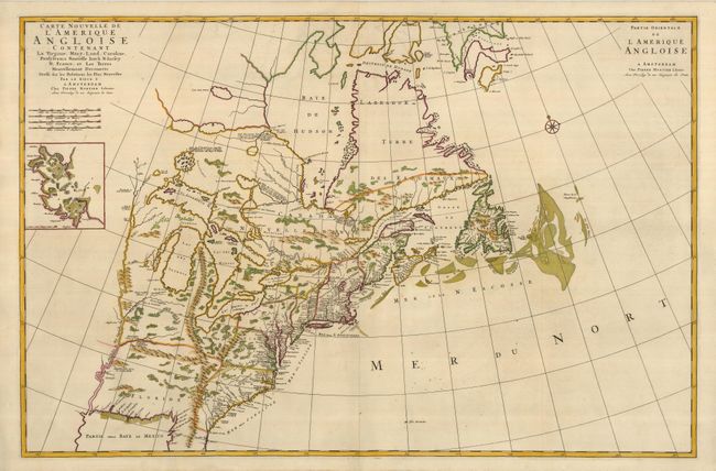
Auction 124, Lot 88
Subject: Colonial Mid-Atlantic
Mortier, Pierre
Carte Nouvelle de l'Amerique Angloise Contenant la Virginie, Mary-Land, Caroline, Pensylvanie, Nouvelle Iorck, N: Iarsey N: France, et les Terres… / Partie Orientale de l'Amerique Angloise, 1700
Size: 35.8 x 23.5 inches (90.9 x 59.7 cm)
Estimate: $4,250 - $5,000
Sold for: $3,250
Closed on 5/7/2008
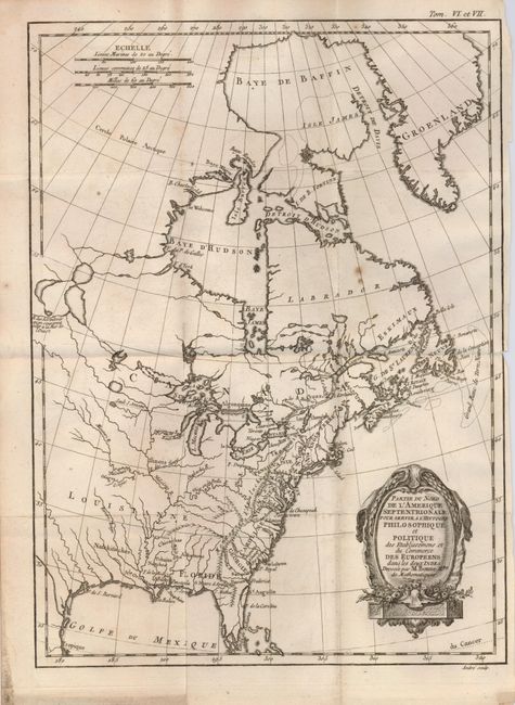
Auction 124, Lot 92
Subject: Colonial United States and Canada
Bonne, Rigobert
Partie du Nord de l'Amerique Septentrionale pour Servir a l'Histoire Philosophique et Politique…, 1774
Size: 9.3 x 12.6 inches (23.6 x 32 cm)
Estimate: $180 - $220
Sold for: $130
Closed on 5/7/2008
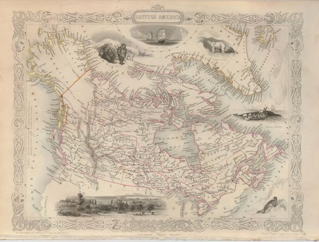
Auction 124, Lot 108
Subject: Canada and Alaska
Tallis, John
British America, 1860
Size: 13 x 10 inches (33 x 25.4 cm)
Estimate: $150 - $200
Sold for: $160
Closed on 5/7/2008
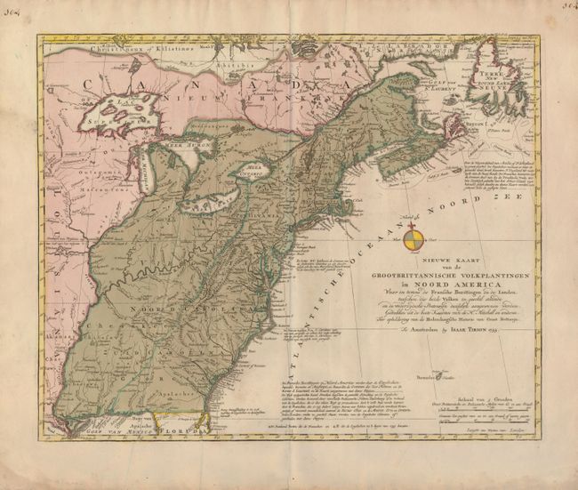
Auction 124, Lot 111
Subject: Colonial United States and Canada
Tirion, Isaac
Nieuwe Kaart van de Grootbrittannische Volkplantingen in Noord America…, 1755
Size: 17.8 x 14.3 inches (45.2 x 36.3 cm)
Estimate: $800 - $1,000
Sold for: $600
Closed on 5/7/2008
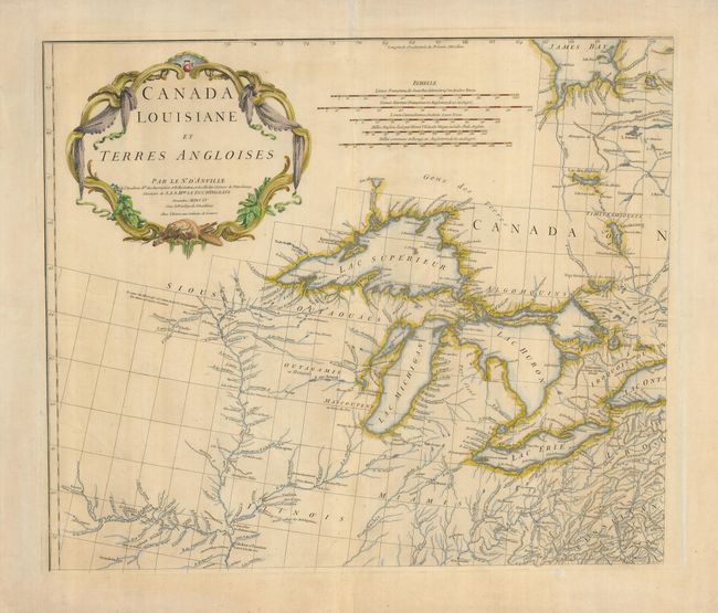
Auction 124, Lot 112
Subject: Colonial Great Lakes
Anville, Jean Baptiste Bourguignon d'
Canada Louisiane et Terres Angloises, 1755
Size: 21.8 x 18.7 inches (55.4 x 47.5 cm)
Estimate: $1,000 - $1,300
Sold for: $750
Closed on 5/7/2008
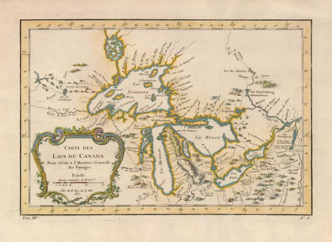
Auction 124, Lot 113
Subject: Colonial Great Lakes
Bellin, Jacques Nicolas
Carte des Lacs du Canada Pour servir a l'Histoire Generale des Voyages, 1757
Size: 11.4 x 7.6 inches (29 x 19.3 cm)
Estimate: $600 - $800
Sold for: $700
Closed on 5/7/2008
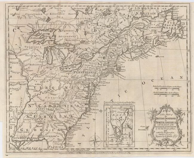
Auction 124, Lot 114
Subject: Colonial United States and Canada
Kitchin, Thomas
A New Map of the British Dominions in North America; with the Limits of the Governments Annexed thereto by the Late Treaty of Peace, and Settled by Proclamation, October 7th, 1763, 1763
Size: 11.8 x 9.4 inches (30 x 23.9 cm)
Estimate: $450 - $550
Sold for: $425
Closed on 5/7/2008
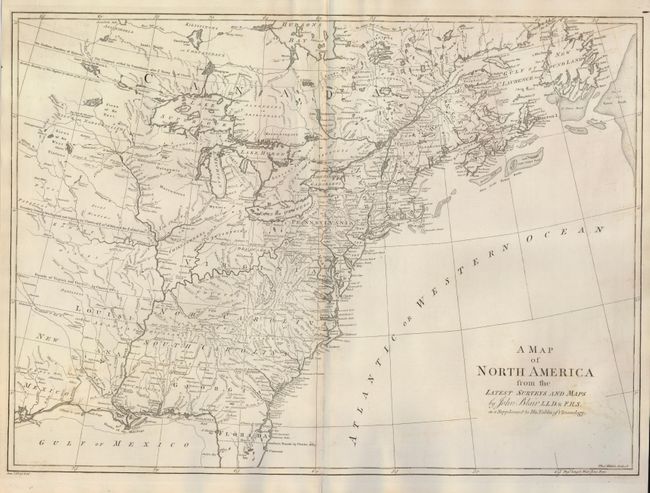
Auction 124, Lot 115
Subject: Colonial United States and Canada
Blair, Rev. John
A Map of North America from the Latest Surveys and Maps, 1768
Size: 22 x 16 inches (55.9 x 40.6 cm)
Estimate: $800 - $900
Sold for: $700
Closed on 5/7/2008
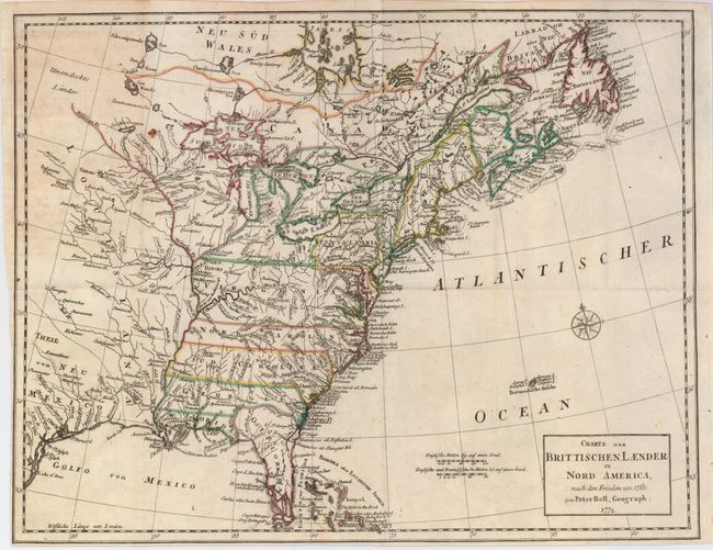
Auction 124, Lot 116
Subject: Colonial United States and Canada
Bell, Peter
Charte der Brittischen Laender in Nord America, nach den Frieden von 1763, 1772
Size: 15.3 x 11.6 inches (38.9 x 29.5 cm)
Estimate: $350 - $450
Sold for: $250
Closed on 5/7/2008
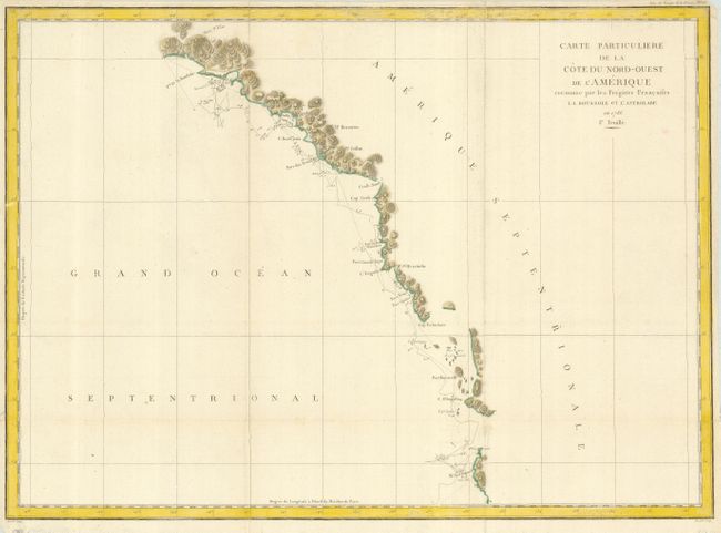
Auction 124, Lot 117
Subject: Western Canada and United States
La Perouse, Comte Jean F. Galoup, de
Carte Particuliere de la Cote du Nord-Ouest de l'Amerique reconnue par les Fregates Francaises la Boussole et l'Astrolabe en 1786. 1e. Feuille, 1797
Size: 27 x 19.5 inches (68.6 x 49.5 cm)
Estimate: $150 - $200
Sold for: $110
Closed on 5/7/2008
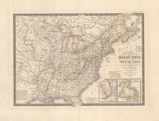
Auction 124, Lot 118
Subject: Eastern United States and Canada
Brue, Adrien Hubert
Carte Generale des Etats-Unis, des Haut et Bas-Canada…, 1838
Size: 20.3 x 14.3 inches (51.6 x 36.3 cm)
Estimate: $200 - $275
Sold for: $150
Closed on 5/7/2008
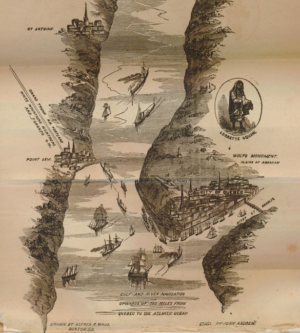
Auction 124, Lot 119
Subject: Canada & United States
Waud, Alfred R.
Hunter's Panoramic Guide from Niagara to Quebec, 1857
Size: 5 x 7.5 inches (12.7 x 19.1 cm)
Estimate: $200 - $275
Sold for: $210
Closed on 5/7/2008
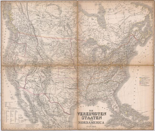
Auction 124, Lot 120
Subject: Canada & United States
Graf, C.
[Lot of 2] Die Vereinigten Staaten von Nordamerica nebst Canada [and] Die Vereinigten Staaten von Nordamerika (Ostlicher Theil), 1860
Size: See Description
Estimate: $220 - $275
Unsold
Closed on 5/7/2008
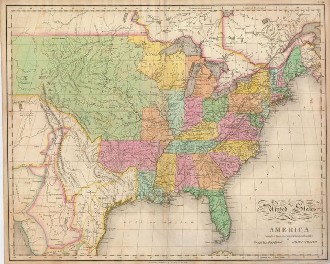
Auction 124, Lot 121
Subject: United States
Melish, John
United States of America Compiled from the latest & best Authorities, 1821
Size: 21.5 x 17 inches (54.6 x 43.2 cm)
Estimate: $800 - $1,100
Sold for: $850
Closed on 5/7/2008
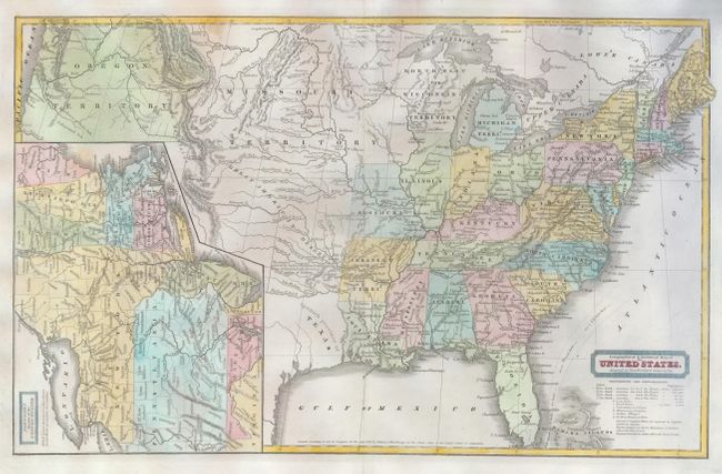
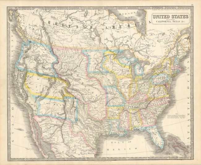
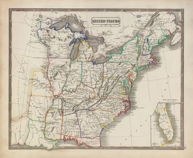
Auction 124, Lot 122
Subject: United States
Woodbridge, William Channing
Geographical & Statistical Map of the United States. Adapted to Woodbridge's Geography, 1831
Size: 16.7 x 10.3 inches (42.4 x 26.2 cm)
Estimate: $120 - $160
Sold for: $110
Closed on 5/7/2008
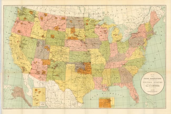
Auction 124, Lot 123
Subject: United States
U.S. Government
[Lot of 5 - Indian Reservations], 1833-1920
Size: See Description
Estimate: $200 - $300
Sold for: $450
Closed on 5/7/2008
Auction 124, Lot 124
Subject: United States & North America
Carey & Lea
[Lot of 2] United States [and] North America, 1834
Size: See Description
Estimate: $190 - $240
Sold for: $150
Closed on 5/7/2008
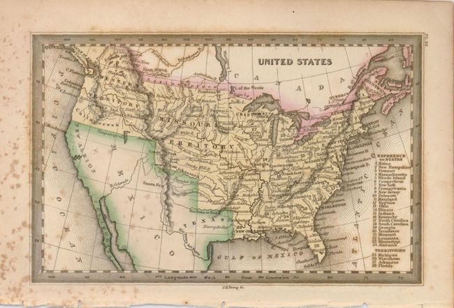
Auction 124, Lot 125
Subject: United States
Mitchell, Samuel Augustus
No. 5 Map of the United States Engraved to Illustrate Mitchell's School and Family Geography, 1852
Size: 16.8 x 10.5 inches (42.7 x 26.7 cm)
Estimate: $120 - $160
Sold for: $60
Closed on 5/7/2008
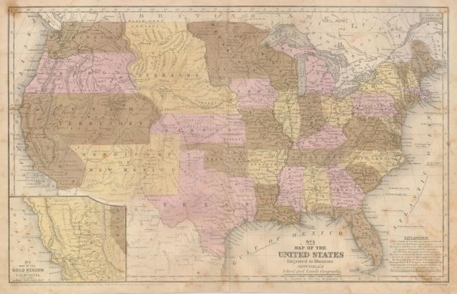
Auction 124, Lot 126
Subject: United States
Philip, George
United States Including California, Texas, &c., 1852
Size: 24 x 19.8 inches (61 x 50.3 cm)
Estimate: $500 - $600
Sold for: $475
Closed on 5/7/2008
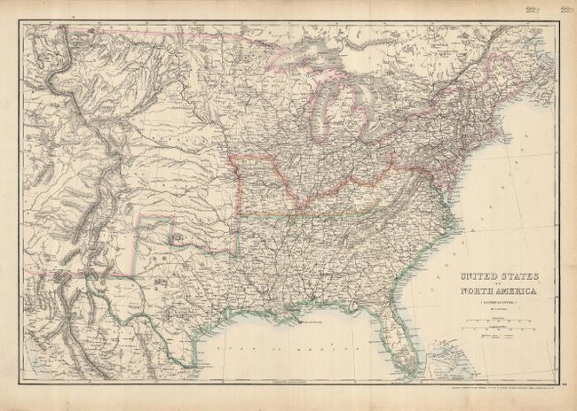
Auction 124, Lot 127
Subject: Eastern United States, Civil War
Ettling, Theodor
United States of North America (Eastern & Central), 1861
Size: 25 x 17 inches (63.5 x 43.2 cm)
Estimate: $150 - $200
Sold for: $120
Closed on 5/7/2008
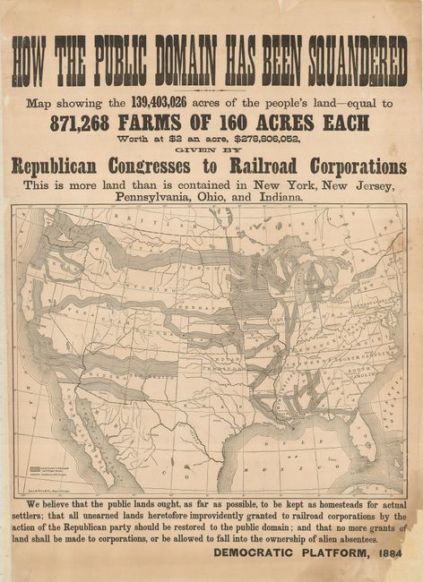
Auction 124, Lot 128
Subject: United States
Rand McNally & Co.
How the Public Domain has Been Squandered…, 1884
Size: 15.5 x 20.5 inches (39.4 x 52.1 cm)
Estimate: $900 - $1,100
Sold for: $650
Closed on 5/7/2008
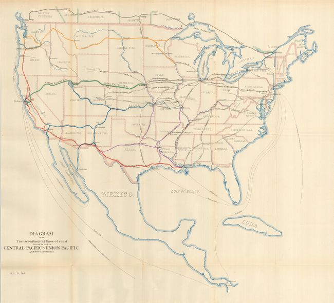
Auction 124, Lot 129
Subject: United States
U.S. Government
Diagram of the Transcontinental Lines of Road Showing the Original Central Pacific and Union Pacific and their Competitors, 1887
Size: 20 x 18.5 inches (50.8 x 47 cm)
Estimate: $80 - $100
Sold for: $110
Closed on 5/7/2008
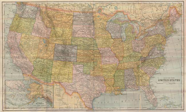
Auction 124, Lot 130
Subject: United States
Matthews-Northrup Co
Map of the United States, 1891
Size: 20.3 x 11.4 inches (51.6 x 29 cm)
Estimate: $100 - $150
Unsold
Closed on 5/7/2008
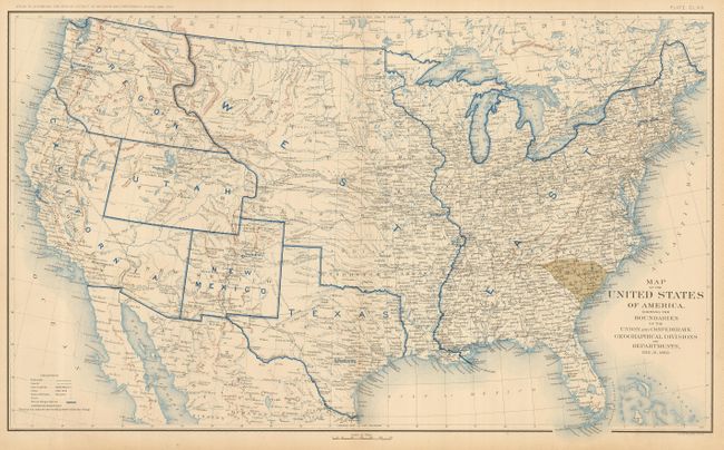
Auction 124, Lot 131
Subject: United States
U.S. Government
[Lot of 10] Map of the United States of America, Showing the Boundaries of the Union and Confederate Geographical Divisions and Departments, 1891-95
Size: 27.7 x 16.5 inches (70.4 x 41.9 cm)
Estimate: $1,100 - $1,300
Sold for: $800
Closed on 5/7/2008
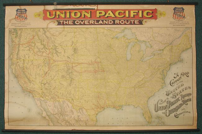
Auction 124, Lot 132
Subject: United States
Rand McNally & Co.
A Correct Map of the United States Showing the Union Pacific Railroad. The Overland Route and Connections, 1896
Size: 53.5 x 35 inches (135.9 x 88.9 cm)
Estimate: $600 - $800
Unsold
Closed on 5/7/2008
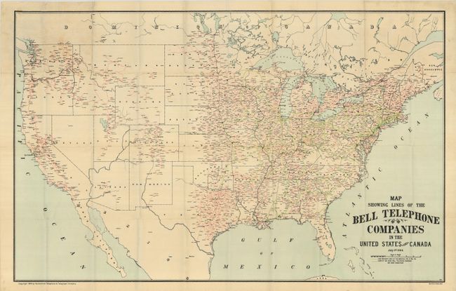
Auction 124, Lot 133
Subject: United States
Map Showing the Lines of the Bell Telephone Company in the United States and Canada, 1904
Size: 39 x 25 inches (99.1 x 63.5 cm)
Estimate: $150 - $200
Sold for: $150
Closed on 5/7/2008
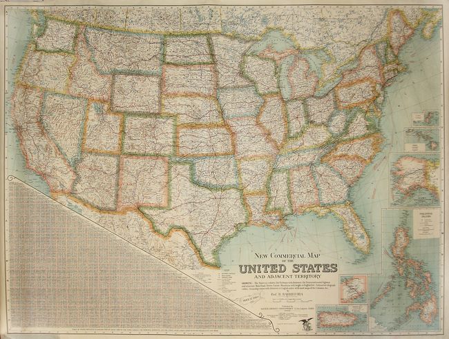
Auction 124, Lot 134
Subject: United States
Barrecchia, Bartholomeo
New Commercial Map of the United States and Adjacent Territory, 1925
Size: 51 x 38 inches (129.5 x 96.5 cm)
Estimate: $300 - $450
Sold for: $325
Closed on 5/7/2008
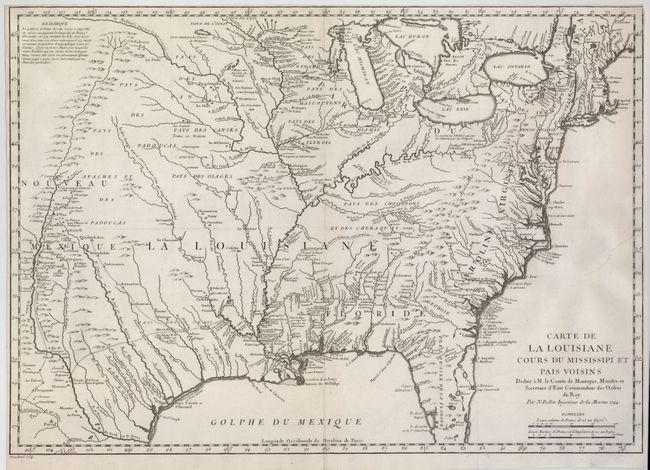
Auction 124, Lot 135
Subject: Colonial United States
Bellin, Jacques Nicolas
Carte de la Louisiane Cours du Mississipi et Pais Voisins…, 1744
Size: 22 x 15.5 inches (55.9 x 39.4 cm)
Estimate: $750 - $900
Sold for: $550
Closed on 5/7/2008
Auction 124, Lot 136
Subject: Eastern United States
Tardieu, Pierre Francois
Carte Generale des Etats-Unis de l'Amerique Septentrionale, Renfermant Aussi quelques Provinces Angloises adjacentes…, 1787
Size: 16.3 x 9.8 inches (41.4 x 24.9 cm)
Estimate: $425 - $500
Sold for: $600
Closed on 5/7/2008
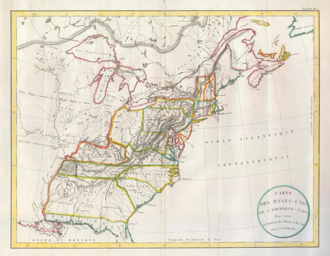
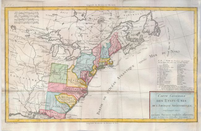
Auction 124, Lot 137
Subject: Eastern United States
Volney, C. F.
Carte des Etats-Unis de l'Amerique-Nord pour Servir au Tableau du Climat et du Sol, 1800
Size: 21.4 x 16.5 inches (54.4 x 41.9 cm)
Estimate: $230 - $300
Sold for: $170
Closed on 5/7/2008
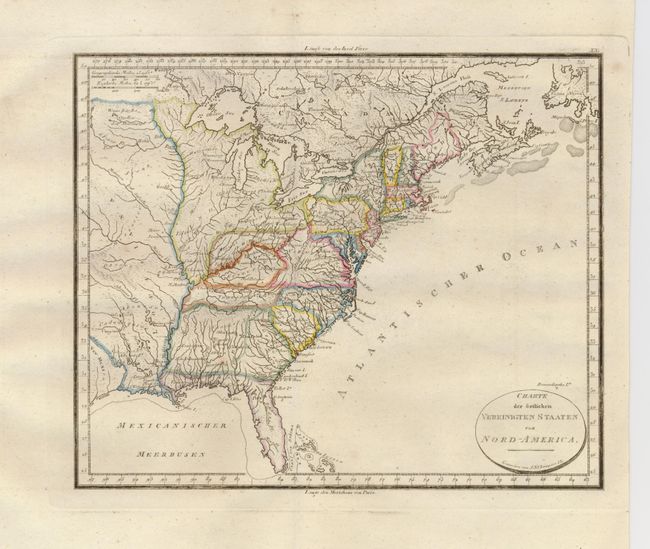
Auction 124, Lot 138
Subject: Eastern United States
[Lot of 2] Charte der ostlichen Vereinigten Staaten von Nord-America [and] United States, 1800-1835
Size: See Description
Estimate: $150 - $200
Sold for: $120
Closed on 5/7/2008
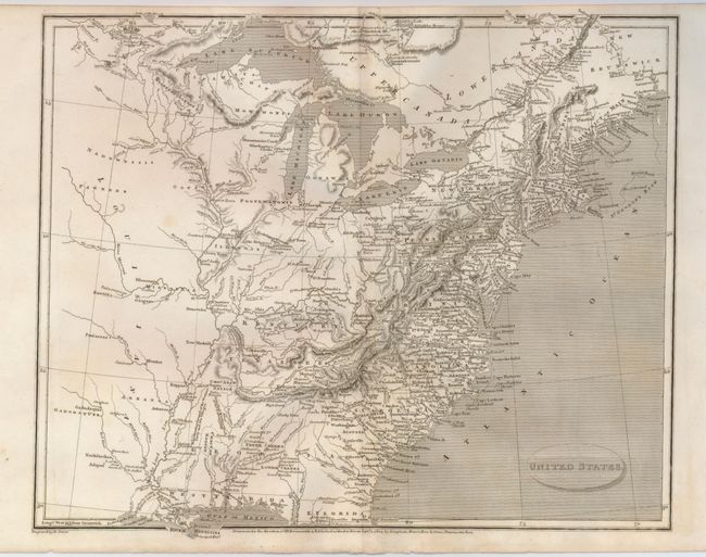
Auction 124, Lot 139
Subject: Eastern United States
Arrowsmith, Aaron, Sr.
United States, 1805
Size: 12.3 x 10 inches (31.2 x 25.4 cm)
Estimate: $150 - $200
Sold for: $110
Closed on 5/7/2008
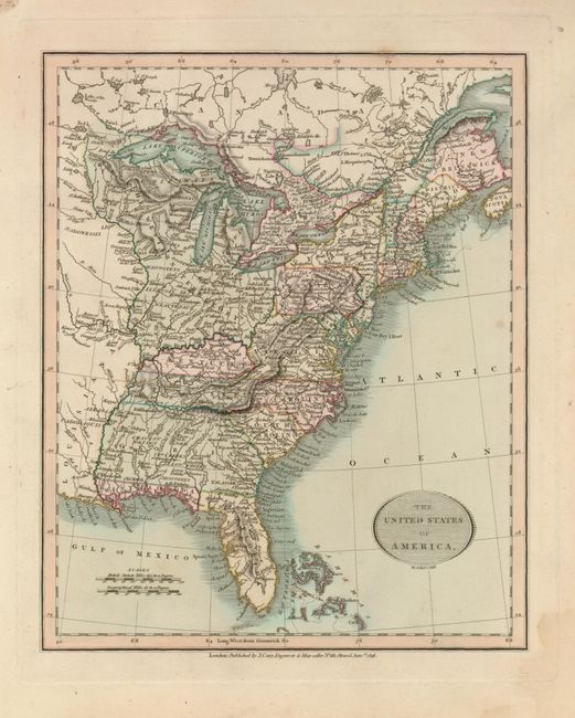
Auction 124, Lot 140
Subject: Eastern United States
Cary, John
The United States of America, 1816
Size: 9 x 11 inches (22.9 x 27.9 cm)
Estimate: $200 - $300
Sold for: $150
Closed on 5/7/2008
Auction 124, Lot 141
Subject: Eastern United States
[Lot of 2] United States [and] Etats-Unis, 1835
Size: See Description
Estimate: $130 - $160
Sold for: $100
Closed on 5/7/2008
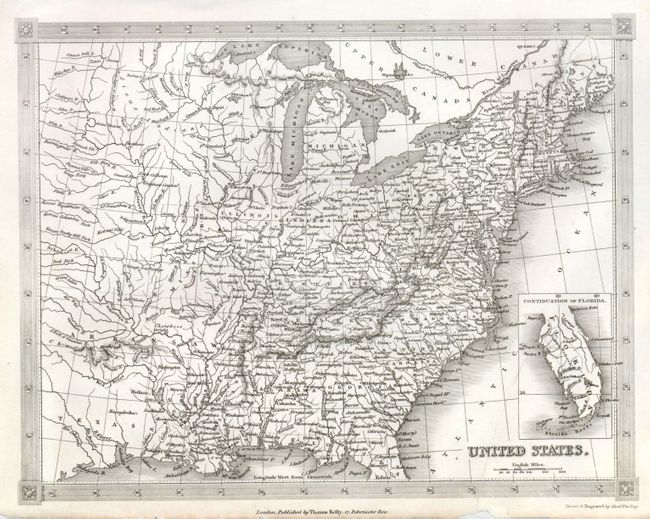
Auction 124, Lot 142
Subject: Eastern United States
Lothian, John
United States, 1838
Size: 13 x 11 inches (33 x 27.9 cm)
Estimate: $100 - $150
Sold for: $75
Closed on 5/7/2008
Auction 124, Lot 143
Subject: Eastern United States
[Lot of 2] United States, 1837-54
Size: See Description
Estimate: $275 - $350
Sold for: $160
Closed on 5/7/2008
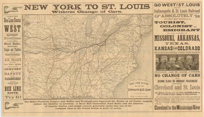
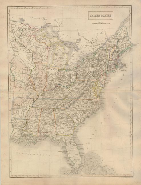
Auction 124, Lot 144
Subject: Eastern United States
Rand McNally & Co.
Bee Line Route Map of the Indianapolis & St. Louis Railroad, and Connections, 1880
Size: 18.5 x 12 inches (47 x 30.5 cm)
Estimate: $200 - $300
Sold for: $150
Closed on 5/7/2008
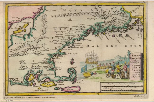
Auction 124, Lot 145
Subject: Colonial New England
Aa, Pieter van der
Nieuw Engeland in Twee Scheepstogten door Kapitein Johan Smith in de Jaren 1614 en 1615, 1707
Size: 9.3 x 6 inches (23.6 x 15.2 cm)
Estimate: $800 - $900
Sold for: $550
Closed on 5/7/2008
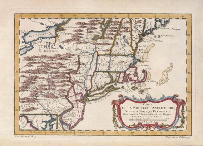
Auction 124, Lot 146
Subject: Colonial New England and Mid-Atlantic
Bellin, Jacques Nicolas
Carte de la Nouvelle Angleterre, Nouvelle Yorck et Pensilvanie, 1757
Size: 11.5 x 8 inches (29.2 x 20.3 cm)
Estimate: $425 - $500
Sold for: $250
Closed on 5/7/2008
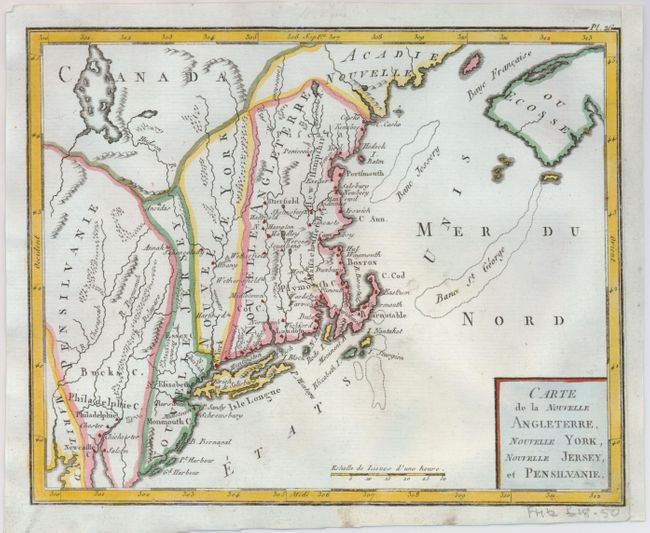
Auction 124, Lot 147
Subject: New England
Bertholon, C.
Carte de la Nouvelle Angleterre, Nouvelle York, Nouvelle Jersey, et Pensilvanie, 1799
Size: 8.5 x 6.8 inches (21.6 x 17.3 cm)
Estimate: $200 - $275
Sold for: $200
Closed on 5/7/2008
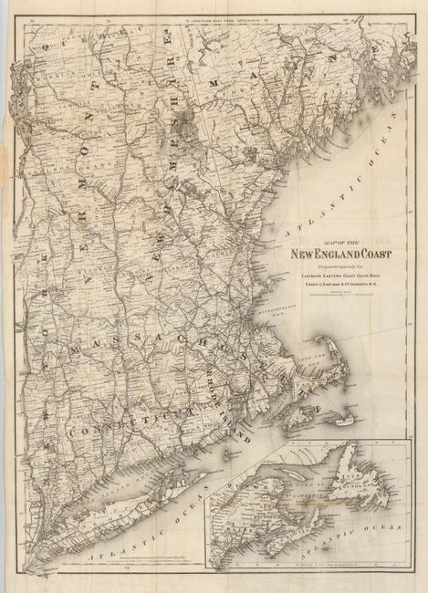
Auction 124, Lot 148
Subject: New England
Colton, G.W. & C.B.
Map of the New England Coast Prepared Expressly for Eastman's East Coast Guide Book, 1871
Size: 17.3 x 24 inches (43.9 x 61 cm)
Estimate: $140 - $180
Unsold
Closed on 5/7/2008
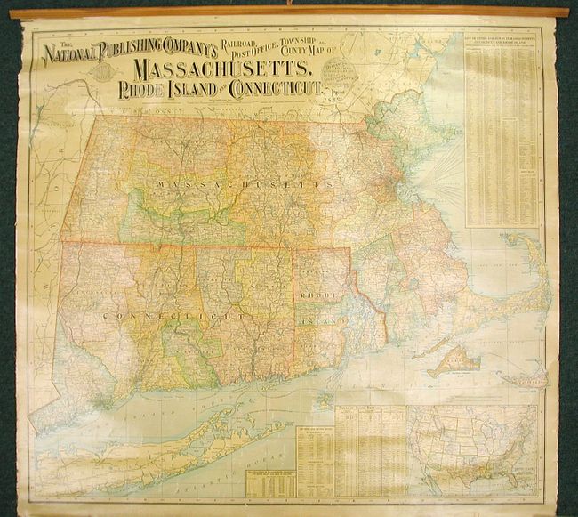
Auction 124, Lot 149
Subject: New England
National Publishing Co.
The National Publishing Company's Railroad, Post Office, Township and County Map of Massachusetts, Rhode Island, and Connecticut, 1900
Size: 37.3 x 34.5 inches (94.7 x 87.6 cm)
Estimate: $200 - $300
Sold for: $150
Closed on 5/7/2008
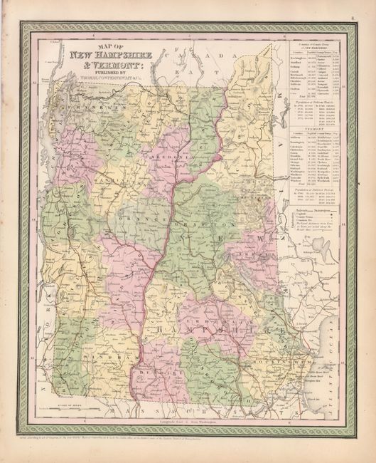
Auction 124, Lot 150
Subject: New Hampshire & Vermont
[Lot of 2] Map of New Hampshire & Vermont [and] Vermont and New Hampshire, 1835-1850
Size: See Description
Estimate: $90 - $120
Sold for: $130
Closed on 5/7/2008
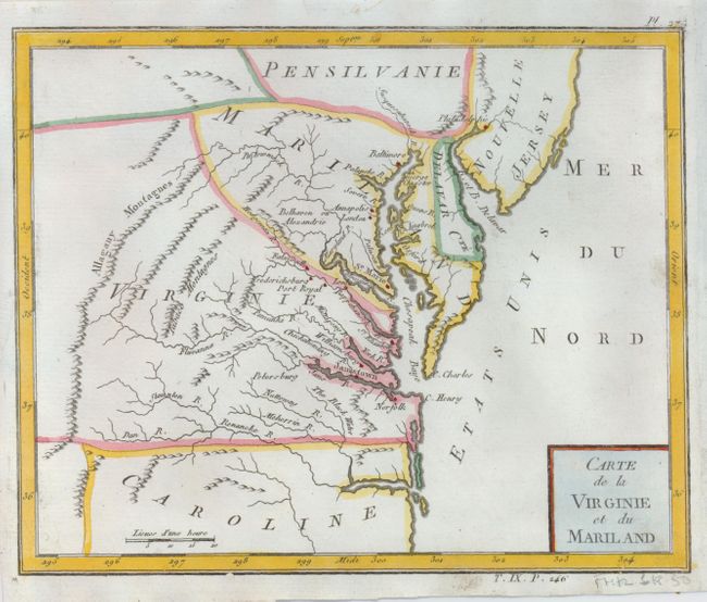
Auction 124, Lot 151
Subject: Mid-Atlantic
Bertholon, C.
Carte de la Virginie et du Mariland, 1799
Size: 8.5 x 6.8 inches (21.6 x 17.3 cm)
Estimate: $200 - $275
Sold for: $325
Closed on 5/7/2008
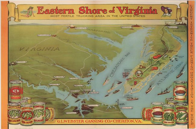
Auction 124, Lot 152
Subject: Chesapeake Bay, Virginia
Eastern Shore of Virginia Most Fertile Trucking Area in the United States, 1930
Size: 15.4 x 10.3 inches (39.1 x 26.2 cm)
Estimate: $100 - $150
Sold for: $200
Closed on 5/7/2008
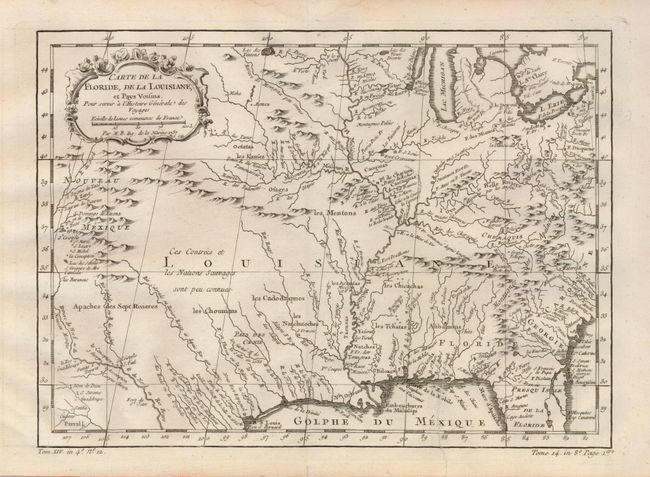
Auction 124, Lot 153
Subject: Colonial Central and Southern United States
Bellin, Jacques Nicolas
Carte de la Floride, de la Louisiane, et Pays Voisins, 1757
Size: 11.8 x 8.5 inches (30 x 21.6 cm)
Estimate: $200 - $275
Sold for: $170
Closed on 5/7/2008
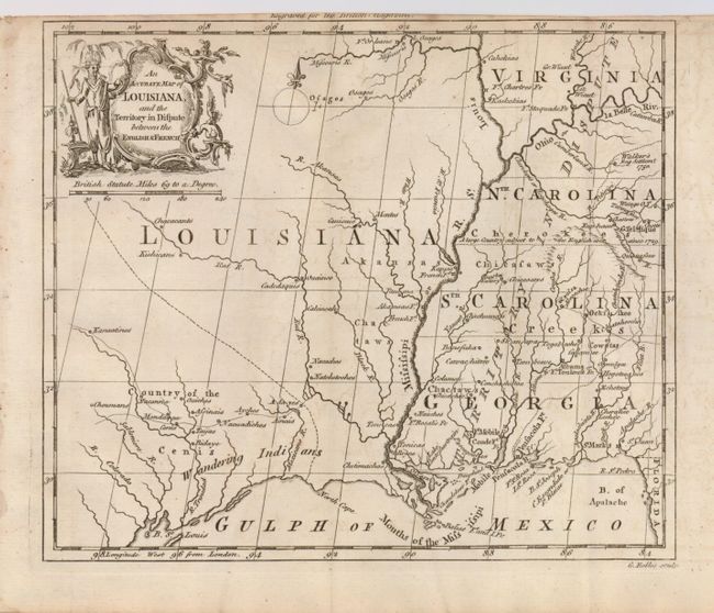
Auction 124, Lot 154
Subject: Colonial Central and Southern United States
Rollos, George
An Accurate Map of Louisiana, and the Territory in Dispute between the English & French, 1760
Size: 8.5 x 7.2 inches (21.6 x 18.3 cm)
Estimate: $450 - $550
Sold for: $350
Closed on 5/7/2008
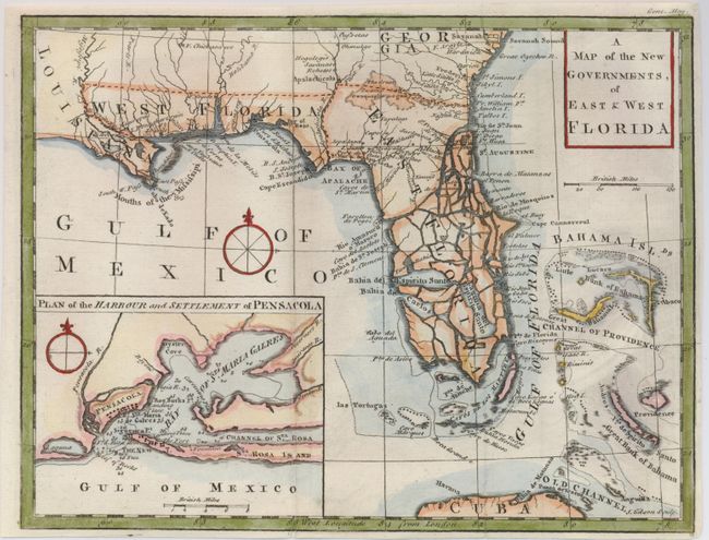
Auction 124, Lot 155
Subject: Colonial South, Florida
Gibson, John
A Map of the New Governments, of East & West Florida, 1763
Size: 9.8 x 7.5 inches (24.9 x 19.1 cm)
Estimate: $350 - $450
Sold for: $350
Closed on 5/7/2008
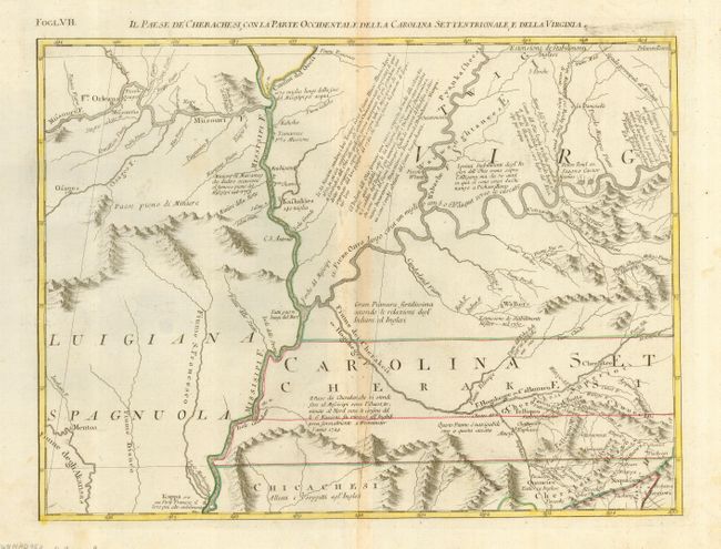
Auction 124, Lot 156
Subject: Colonial South Central United States
Zatta, Antonio
Il Paese de Cherachesi, con la Parte Occidentale della Carolina Settentrionale, e della Virginia, 1778
Size: 16.5 x 12.5 inches (41.9 x 31.8 cm)
Estimate: $300 - $375
Sold for: $220
Closed on 5/7/2008
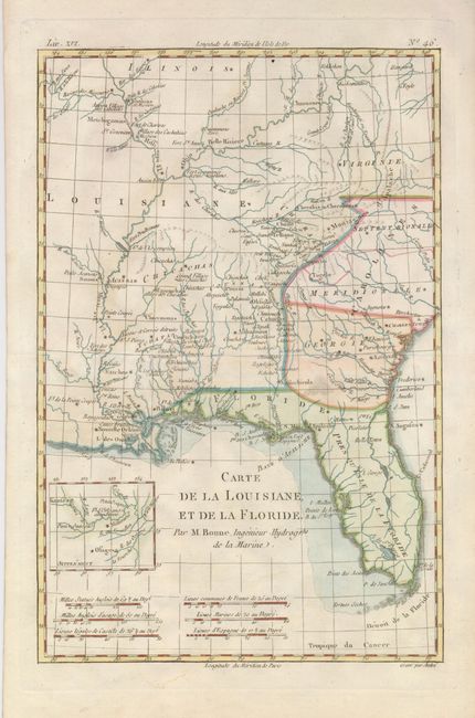
Auction 124, Lot 157
Subject: Colonial South
Bonne, Rigobert
Carte de la Louisiane, et de la Floride, 1780
Size: 8.4 x 12.6 inches (21.3 x 32 cm)
Estimate: $180 - $230
Sold for: $170
Closed on 5/7/2008
214 lots
Page 1 of 5