Filtered by Category:Canada(Show All Categories)
Showing results for:Auction 124
Catalog Archive
28 lots
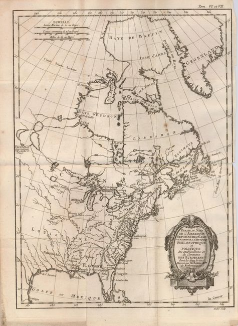
Auction 124, Lot 92
Subject: Colonial United States and Canada
Bonne, Rigobert
Partie du Nord de l'Amerique Septentrionale pour Servir a l'Histoire Philosophique et Politique…, 1774
Size: 9.3 x 12.6 inches (23.6 x 32 cm)
Estimate: $180 - $220
Sold for: $130
Closed on 5/7/2008
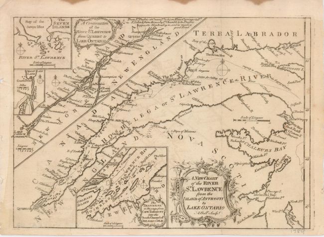
Auction 124, Lot 95
Subject: Canada
Bell, Andrew
A New Chart of the River St. Lawrence from the Island of Anticosti to Lake Ontario, 1759
Size: 10 x 7.2 inches (25.4 x 18.3 cm)
Estimate: $120 - $170
Sold for: $90
Closed on 5/7/2008
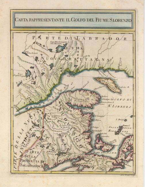
Auction 124, Lot 96
Subject: Canada
Pazzi, Giuseppe
Carta Rappresentante il Golfo del Fiume S. Lorenzo, 1763
Size: 7.5 x 10 inches (19.1 x 25.4 cm)
Estimate: $200 - $250
Sold for: $150
Closed on 5/7/2008
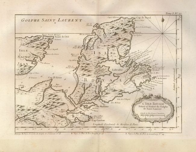
Auction 124, Lot 97
Subject: Canada
Bellin, Jacques Nicolas
[Lot of 2 - Maritimes], 1764
Size: See Description
Estimate: $120 - $160
Sold for: $240
Closed on 5/7/2008
Auction 124, Lot 98
Subject: Canada, Nova Scotia
Bellin, Jacques Nicolas
[Lot of 4 - Nova Scotia], 1764
Size: See Description
Estimate: $150 - $200
Sold for: $210
Closed on 5/7/2008
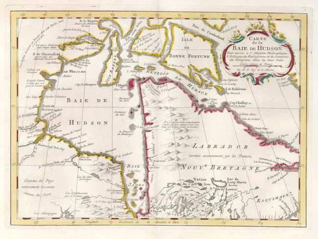
Auction 124, Lot 99
Subject: Canada
Bellin, Jacques Nicolas
Carte de la Baie de Hudson Pour Servir a l'Histoire Philosophique…, 1773
Size: 11.8 x 8.5 inches (30 x 21.6 cm)
Estimate: $200 - $250
Unsold
Closed on 5/7/2008
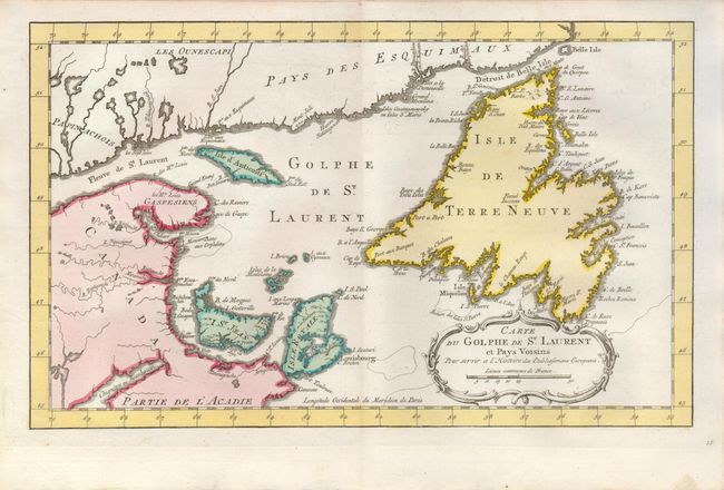
Auction 124, Lot 100
Subject: Canada
Bellin, Jacques Nicolas
Carte du Golphe de St. Laurent et Pays Voisins, 1773
Size: 14 x 8.5 inches (35.6 x 21.6 cm)
Estimate: $140 - $180
Sold for: $100
Closed on 5/7/2008
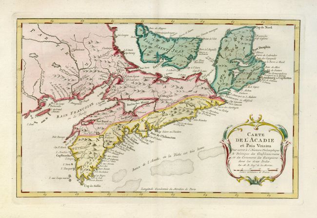
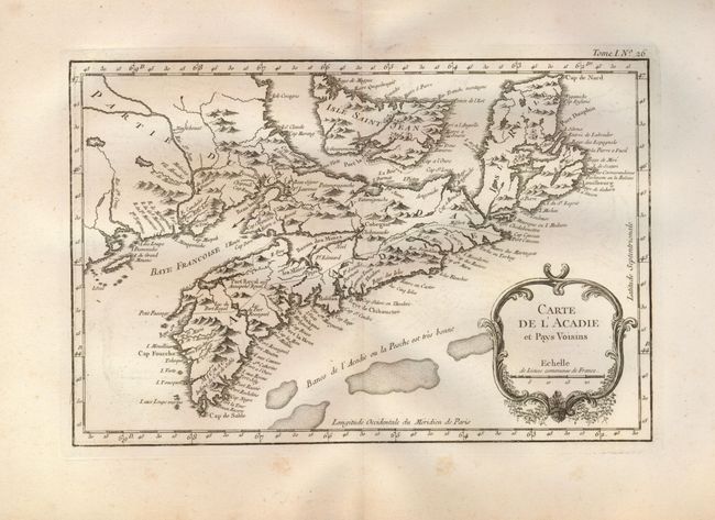
Auction 124, Lot 101
Subject: Canada
Bellin, Jacques Nicolas
Carte de l'Acadie et Pais Voisins…, 1773
Size: 12.7 x 8 inches (32.3 x 20.3 cm)
Estimate: $180 - $220
Sold for: $150
Closed on 5/7/2008
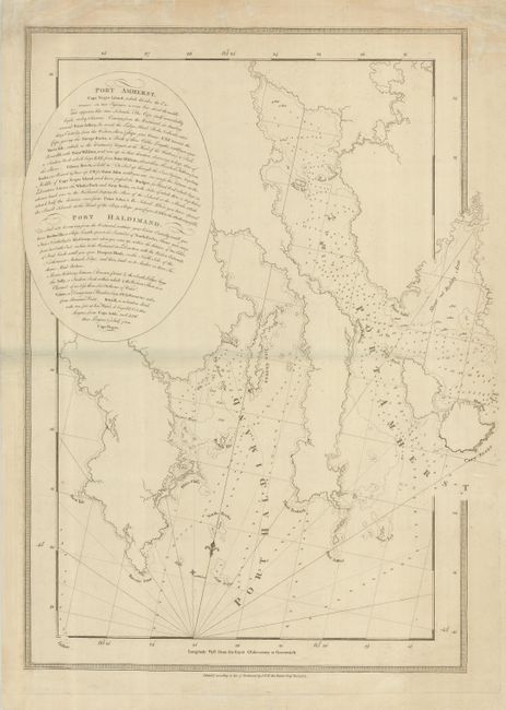
Auction 124, Lot 102
Subject: Canada, Nova Scotia
Des Barres, Joseph Frederick Wallet
Port Amherst … Port Haldimand, 1775
Size: 19 x 28.5 inches (48.3 x 72.4 cm)
Estimate: $450 - $550
Sold for: $350
Closed on 5/7/2008
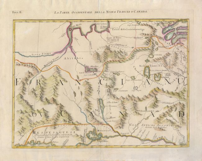
Auction 124, Lot 103
Subject: Canada
Zatta, Antonio
La Parte Occidentale della Nuova Francia o Canada, 1778
Size: 16.5 x 12 inches (41.9 x 30.5 cm)
Estimate: $200 - $275
Sold for: $150
Closed on 5/7/2008
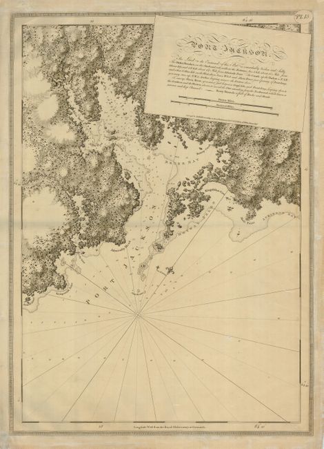
Auction 124, Lot 104
Subject: Canada, Medway Harbor
Des Barres, Joseph Frederick Wallet
Port Jackson…, 1779
Size: 20.5 x 29.3 inches (52.1 x 74.4 cm)
Estimate: $425 - $500
Sold for: $375
Closed on 5/7/2008
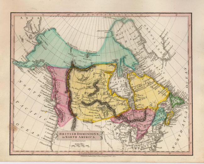
Auction 124, Lot 105
Subject: Canada
[Lot of 2] British Dominions, in North America [and] British Colonies in North America, 1814-15
Size: See Description
Estimate: $150 - $200
Sold for: $210
Closed on 5/7/2008
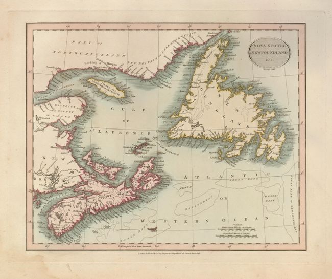
Auction 124, Lot 106
Subject: Canada
Cary, John
Nova Scotia, Newfoundland &cc., 1816
Size: 11 x 9 inches (27.9 x 22.9 cm)
Estimate: $140 - $180
Sold for: $140
Closed on 5/7/2008
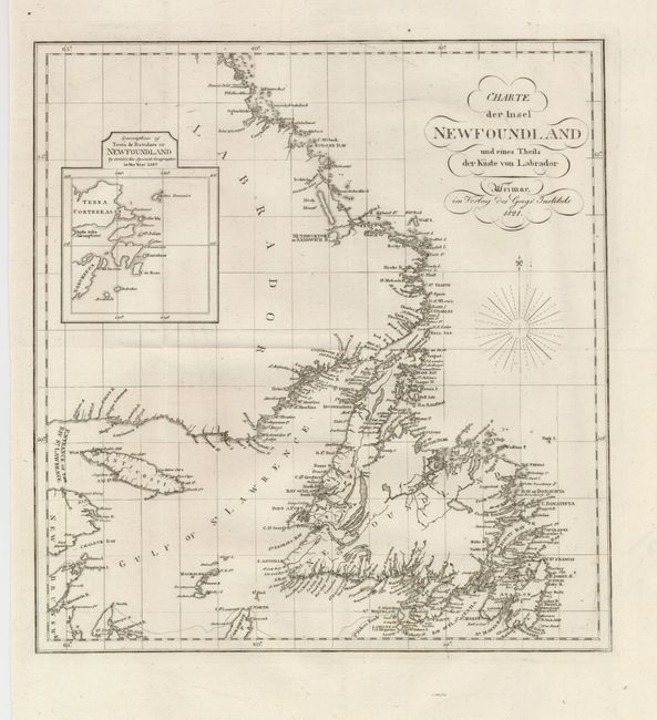
Auction 124, Lot 107
Subject: Canada, Newfoundland
Geographisches Institut
Charte der Insel Newfoundland und eines Theils der Kuste von Labrador, 1821
Size: 11.8 x 12.5 inches (30 x 31.8 cm)
Estimate: $150 - $200
Sold for: $110
Closed on 5/7/2008
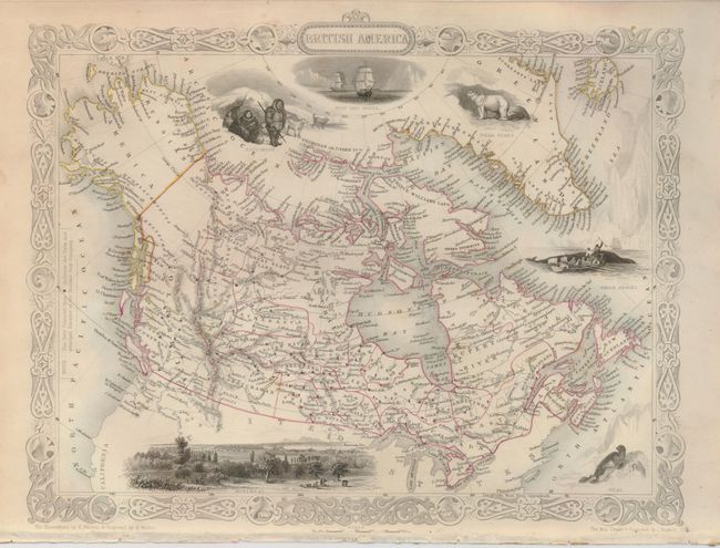
Auction 124, Lot 108
Subject: Canada and Alaska
Tallis, John
British America, 1860
Size: 13 x 10 inches (33 x 25.4 cm)
Estimate: $150 - $200
Sold for: $160
Closed on 5/7/2008
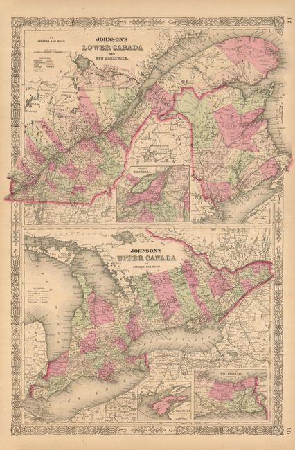
Auction 124, Lot 109
Subject: Canada
[Lot of 8 - Canada], 1855-1875
Size: See Description
Estimate: $100 - $150
Sold for: $220
Closed on 5/7/2008
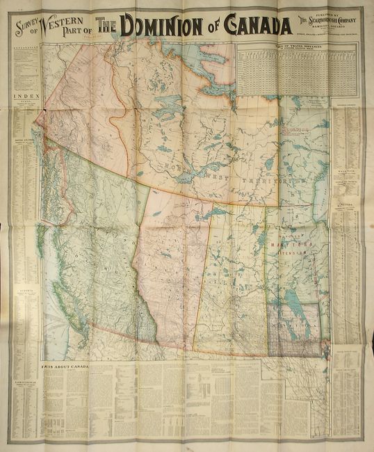
Auction 124, Lot 110
Subject: Western Canada
Scarborough Company, The
Survey of Western Part of the Dominion of Canada, 1908
Size: 33 x 39.5 inches (83.8 x 100.3 cm)
Estimate: $100 - $150
Sold for: $50
Closed on 5/7/2008
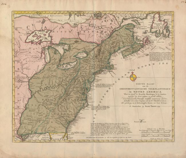
Auction 124, Lot 111
Subject: Colonial United States and Canada
Tirion, Isaac
Nieuwe Kaart van de Grootbrittannische Volkplantingen in Noord America…, 1755
Size: 17.8 x 14.3 inches (45.2 x 36.3 cm)
Estimate: $800 - $1,000
Sold for: $600
Closed on 5/7/2008
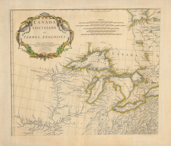
Auction 124, Lot 112
Subject: Colonial Great Lakes
Anville, Jean Baptiste Bourguignon d'
Canada Louisiane et Terres Angloises, 1755
Size: 21.8 x 18.7 inches (55.4 x 47.5 cm)
Estimate: $1,000 - $1,300
Sold for: $750
Closed on 5/7/2008
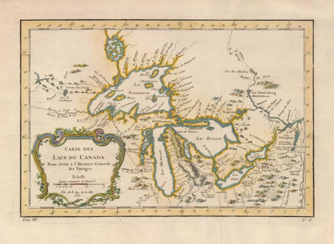
Auction 124, Lot 113
Subject: Colonial Great Lakes
Bellin, Jacques Nicolas
Carte des Lacs du Canada Pour servir a l'Histoire Generale des Voyages, 1757
Size: 11.4 x 7.6 inches (29 x 19.3 cm)
Estimate: $600 - $800
Sold for: $700
Closed on 5/7/2008
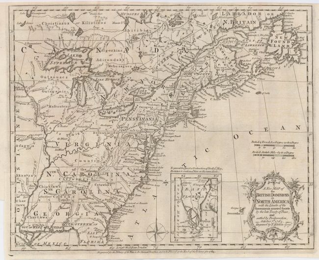
Auction 124, Lot 114
Subject: Colonial United States and Canada
Kitchin, Thomas
A New Map of the British Dominions in North America; with the Limits of the Governments Annexed thereto by the Late Treaty of Peace, and Settled by Proclamation, October 7th, 1763, 1763
Size: 11.8 x 9.4 inches (30 x 23.9 cm)
Estimate: $450 - $550
Sold for: $425
Closed on 5/7/2008
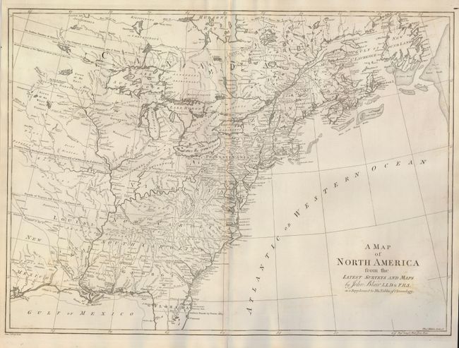
Auction 124, Lot 115
Subject: Colonial United States and Canada
Blair, Rev. John
A Map of North America from the Latest Surveys and Maps, 1768
Size: 22 x 16 inches (55.9 x 40.6 cm)
Estimate: $800 - $900
Sold for: $700
Closed on 5/7/2008
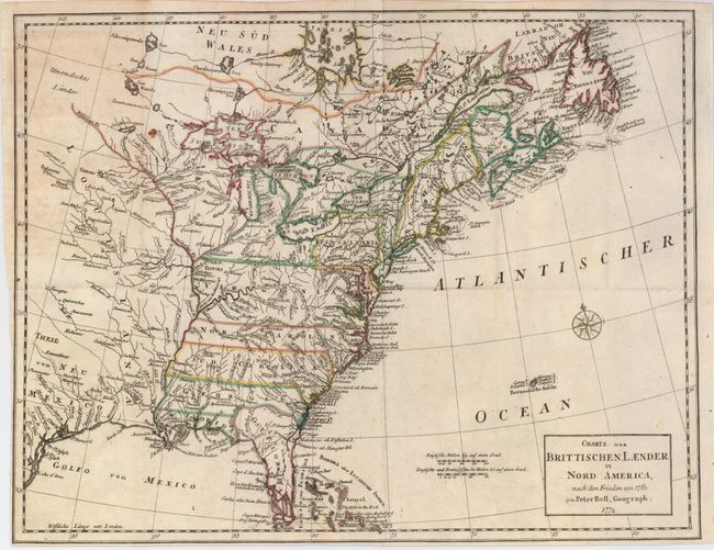
Auction 124, Lot 116
Subject: Colonial United States and Canada
Bell, Peter
Charte der Brittischen Laender in Nord America, nach den Frieden von 1763, 1772
Size: 15.3 x 11.6 inches (38.9 x 29.5 cm)
Estimate: $350 - $450
Sold for: $250
Closed on 5/7/2008
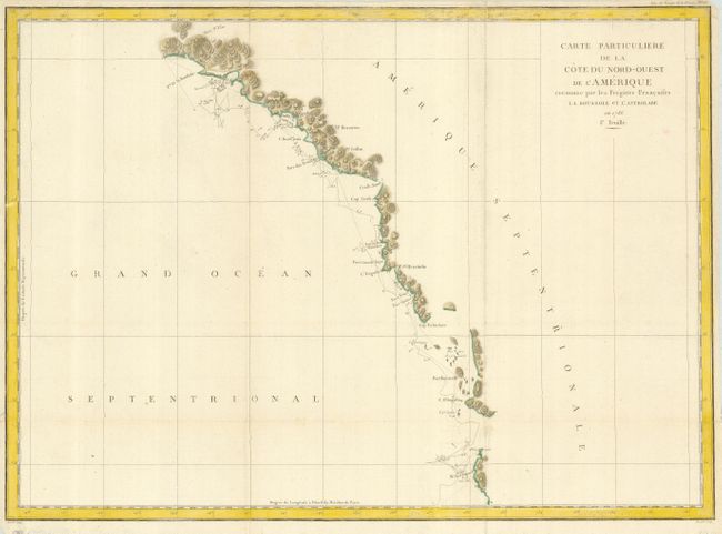
Auction 124, Lot 117
Subject: Western Canada and United States
La Perouse, Comte Jean F. Galoup, de
Carte Particuliere de la Cote du Nord-Ouest de l'Amerique reconnue par les Fregates Francaises la Boussole et l'Astrolabe en 1786. 1e. Feuille, 1797
Size: 27 x 19.5 inches (68.6 x 49.5 cm)
Estimate: $150 - $200
Sold for: $110
Closed on 5/7/2008
Auction 124, Lot 118
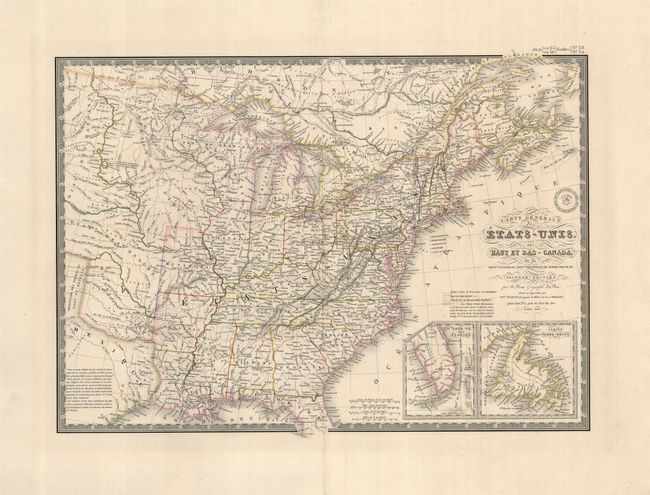
Subject: Eastern United States and Canada
Brue, Adrien Hubert
Carte Generale des Etats-Unis, des Haut et Bas-Canada…, 1838
Size: 20.3 x 14.3 inches (51.6 x 36.3 cm)
Estimate: $200 - $275
Sold for: $150
Closed on 5/7/2008
Auction 124, Lot 119
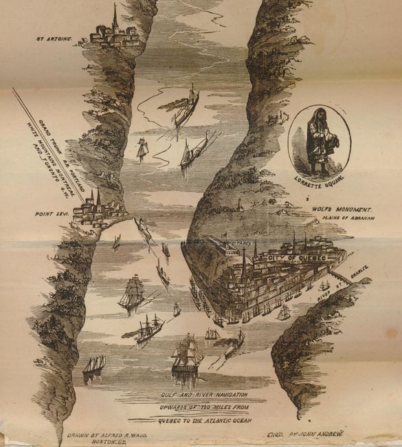
Subject: Canada & United States
Waud, Alfred R.
Hunter's Panoramic Guide from Niagara to Quebec, 1857
Size: 5 x 7.5 inches (12.7 x 19.1 cm)
Estimate: $200 - $275
Sold for: $210
Closed on 5/7/2008
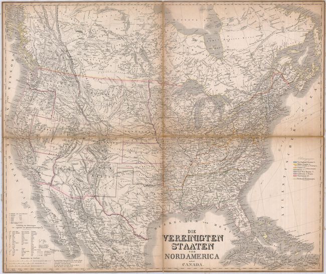
Auction 124, Lot 120
Subject: Canada & United States
Graf, C.
[Lot of 2] Die Vereinigten Staaten von Nordamerica nebst Canada [and] Die Vereinigten Staaten von Nordamerika (Ostlicher Theil), 1860
Size: See Description
Estimate: $220 - $275
Unsold
Closed on 5/7/2008
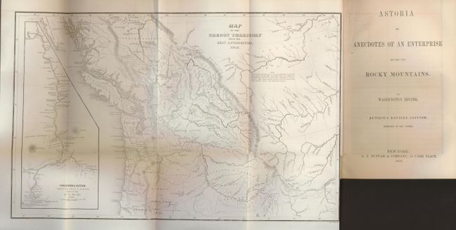
Auction 124, Lot 773
Subject: Western Canada and United States
Wilkes, Charles
Map of the Oregon Territory from the Best Authorities, 1854
Size: 13 x 8 inches (33 x 20.3 cm)
Estimate: $400 - $600
Unsold
Closed on 5/7/2008
28 lots