Filtered by Category:United States(Show All Categories)
Showing results for:Auction 120
Catalog Archive
225 lots
Page 1 of 5
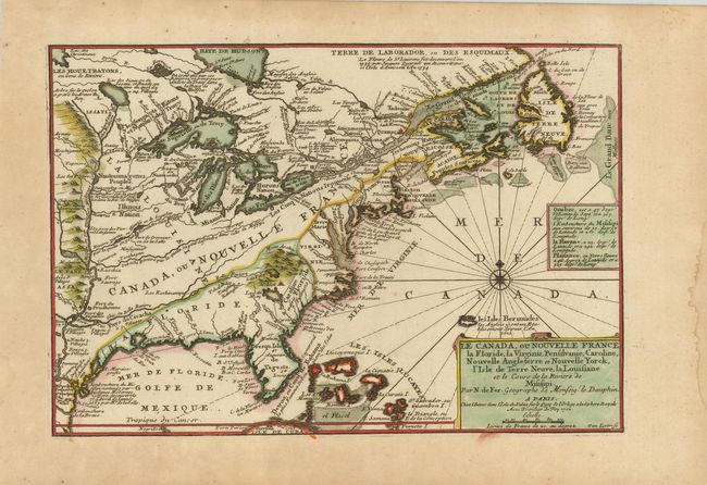
Auction 120, Lot 114
Subject: Colonial North America
Fer, Nicolas de
Le Canada, ou Nouvelle France, la Floride, la Virginie, Pensilvanie, Caroline, Nouvelle Angleterre et Nouvelle Yorck, l'Isle de Terre Neuve, la Louisiane et le cours de la Riviere de Misisipi, 1702
Size: 13.5 x 9 inches (34.3 x 22.9 cm)
Estimate: $850 - $950
Sold for: $750
Closed on 7/18/2007
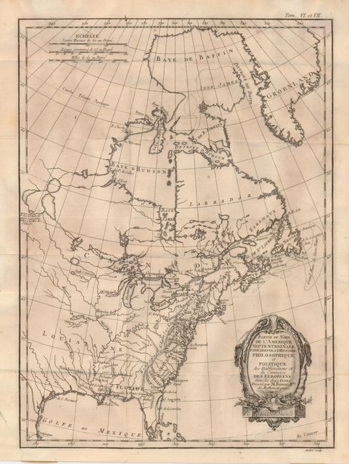
Auction 120, Lot 118
Subject: Colonial United States and Canada
Bonne, Rigobert
Partie du Nord de l'Amerique Septentrionale pour Servir a l'Histoire Philosophique et Politque…, 1774
Size: 9.3 x 12.6 inches (23.6 x 32 cm)
Estimate: $250 - $300
Sold for: $180
Closed on 7/18/2007
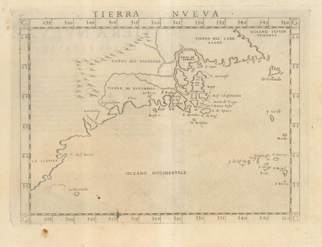
Auction 120, Lot 140
Subject: Colonial United States & Canada
Ruscelli, Girolamo
Tierra Nueva, 1574
Size: 9.5 x 7 inches (24.1 x 17.8 cm)
Estimate: $1,200 - $1,400
Unsold
Closed on 7/18/2007
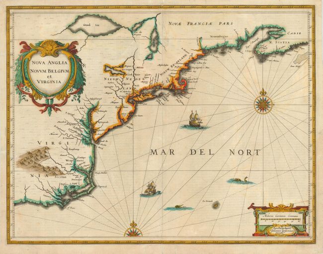
Auction 120, Lot 141
Subject: Colonial New England and Mid-Atlantic
Jansson, Jan
Nova Anglia Novum Belgium et Virginia, 1636
Size: 19.5 x 15 inches (49.5 x 38.1 cm)
Estimate: $2,000 - $2,400
Unsold
Closed on 7/18/2007
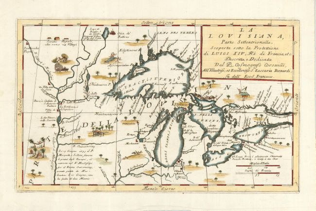
Auction 120, Lot 142
Subject: Great Lakes, United States & Canada
Coronelli, Vincenzo Maria
La Louisiana, Parte Settentrionalle, Scoperta Sotto la Protettione di Luigi XIV, Re di Francia, etc. Descritta, e Dedicata, 1695
Size: 16.8 x 10 inches (42.7 x 25.4 cm)
Estimate: $3,500 - $4,250
Sold for: $4,250
Closed on 7/18/2007
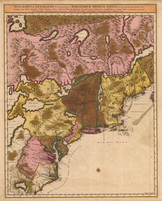
Auction 120, Lot 143
Subject: Colonial United States & Canada
Visscher, Nicolas
[Lot of 2] Nova Tabula Geographica Complectens Borealiorem Americae Partem… [and] Carte Nouvelle contenant la Partie d'Amerique la Plus Septentrionale…, 1699
Size: 18.6 x 23.5 inches (47.2 x 59.7 cm)
Estimate: $1,800 - $2,200
Sold for: $2,300
Closed on 7/18/2007
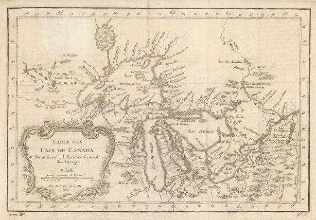
Auction 120, Lot 144
Subject: Great Lakes, United States & Canada
Bellin, Jacques Nicolas
Carte des Lacs du Canada Pour servir a l'Histoire Generale des Voyages, 1757
Size: 11.4 x 7.6 inches (29 x 19.3 cm)
Estimate: $550 - $600
Unsold
Closed on 7/18/2007
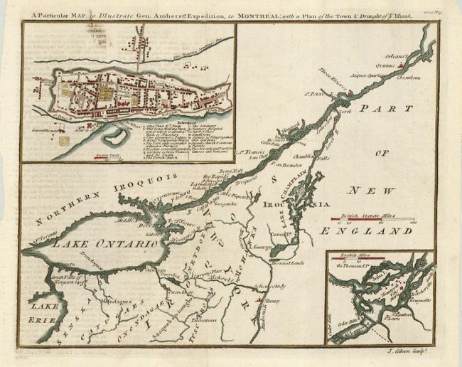
Auction 120, Lot 145
Subject: United States & Canada
Gibson, John
A Particular Map, to Illustrate Gen. Amherst's Expedition, to Montreal; with a Plan of the Town & Draught of ye Island, 1759
Size: 9 x 7 inches (22.9 x 17.8 cm)
Estimate: $150 - $180
Sold for: $150
Closed on 7/18/2007
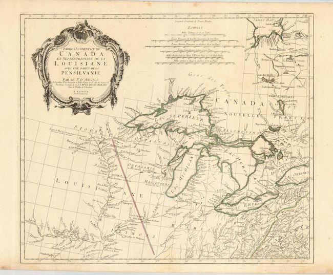
Auction 120, Lot 146
Subject: Great Lakes, United States & Canada
D'Anville/Santini
Partie Occidentale du Canada et Septentrionale de la Louisiane avec une Partie de la Pensilvanie, 1775
Size: 22.5 x 19 inches (57.2 x 48.3 cm)
Estimate: $1,100 - $1,400
Sold for: $800
Closed on 7/18/2007
Auction 120, Lot 147
Subject: United States & Canada
D'Anville/Santini
Carte Generale du Canada, de la Louisiane, de la Floride, de la Caroline, de la Virginie, de la Nouvelle Angleterre etc. par le Sr. d'Anville, 1776
Size: 25.5 x 18.8 inches (64.8 x 47.8 cm)
Estimate: $1,200 - $1,400
Sold for: $850
Closed on 7/18/2007
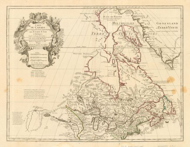
Auction 120, Lot 148
Subject: United States & Canada
Delisle/Dezauche
Carte du Canada qui Comprend la Partie Septentrionale des Etats Unis…, 1783
Size: 25.3 x 19.5 inches (64.3 x 49.5 cm)
Estimate: $800 - $1,100
Sold for: $500
Closed on 7/18/2007
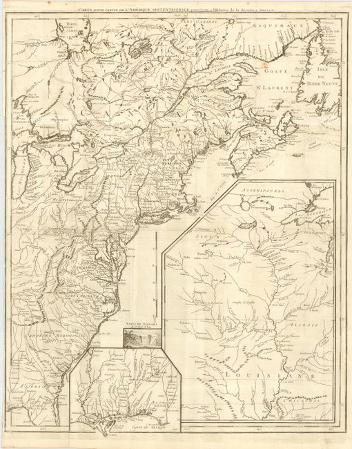
Auction 120, Lot 149
Subject: United States & Canada
Le Rouge, George Louis
Carte d'une Partie de l'Amerique Septentrionale, pour servir a l'Histoire de la derniere Guerre, 1787
Size: 19.5 x 24.2 inches (49.5 x 61.5 cm)
Estimate: $1,500 - $1,700
Sold for: $1,100
Closed on 7/18/2007
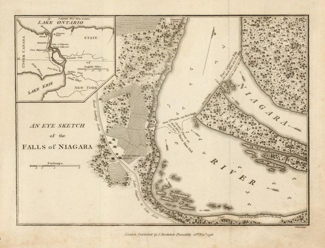
Auction 120, Lot 150
Subject: United States & Canada - Niagara Falls
Stockdale, John
An Eye Sketch of the Falls of Niagara, 1798
Size: 9 x 6.4 inches (22.9 x 16.3 cm)
Estimate: $100 - $150
Sold for: $130
Closed on 7/18/2007
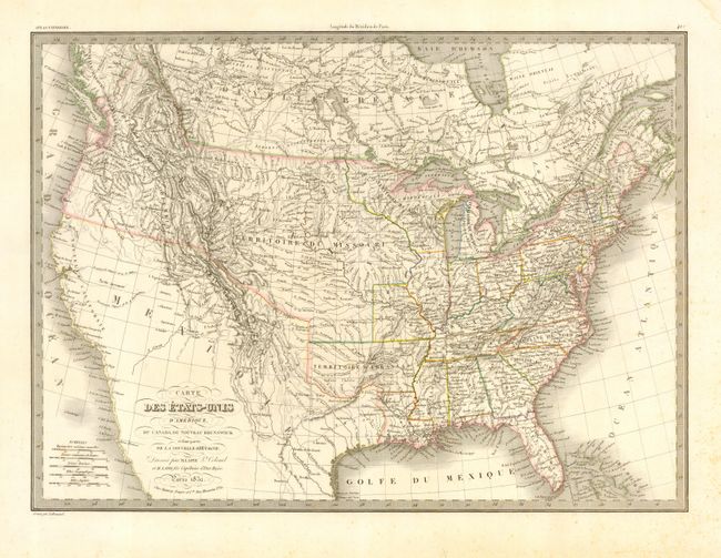
Auction 120, Lot 151
Subject: United States & Canada
Lapie, Alexander Emile & Pierre
Carte des Etats-Unis d'Amerique, du Canada, du Nouveau Brunswick et d'une partie de la Nouvelle Bretagne, 1832
Size: 21 x 15 inches (53.3 x 38.1 cm)
Estimate: $300 - $400
Sold for: $150
Closed on 7/18/2007
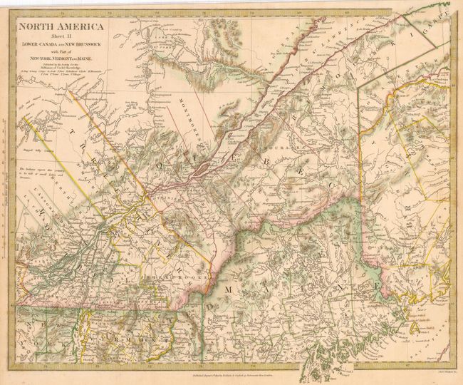
Auction 120, Lot 152
Subject: United States & Canada
SDUK Society for the Diffusion of Useful Knowledge
[Lot of 6] North America Sheet II, V, VIII, IX, X [and] XI, 1832-3
Size: See Description
Estimate: $275 - $325
Sold for: $200
Closed on 7/18/2007
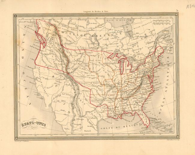
Auction 120, Lot 153
Subject: United States & Canada
Vuillemin, Alexander A.
Etats-Unis, 1840
Size: 10 x 7.5 inches (25.4 x 19.1 cm)
Estimate: $90 - $130
Sold for: $45
Closed on 7/18/2007
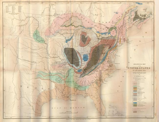
Auction 120, Lot 154
Subject: Eastern United States & Canada
Lyell, Charles
Geological Map of the United States Canada &c. Compiled from the State Surveys of the U.S. and Other Sources, 1845
Size: 19.8 x 15.3 inches (50.3 x 38.9 cm)
Estimate: $250 - $300
Sold for: $350
Closed on 7/18/2007
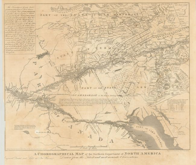
Auction 120, Lot 155
Subject: United States & Canada
Gavit, John
A Chorographical Map of the Northern Department of North America Drawn from the Latest and Most Accurate Observations, 1850
Size: 12.4 x 10 inches (31.5 x 25.4 cm)
Estimate: $100 - $150
Unsold
Closed on 7/18/2007
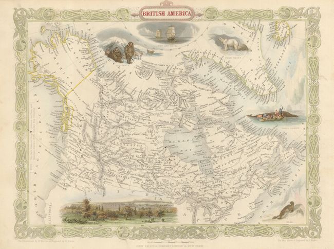
Auction 120, Lot 156
Subject: Canada and Alaska
Tallis, John
British America, 1865
Size: 13 x 10 inches (33 x 25.4 cm)
Estimate: $250 - $300
Sold for: $180
Closed on 7/18/2007
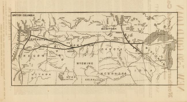
Auction 120, Lot 157
Subject: United States & Canada
Railroad Companies, (Various)
[Northern Pacific Railroad Route], 1870
Size: 13.7 x 6 inches (34.8 x 15.2 cm)
Estimate: $300 - $400
Sold for: $200
Closed on 7/18/2007
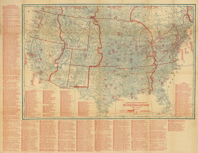
Auction 120, Lot 158
Subject: United States & Canada
Cram, George F. & Company
[Lot of 2] Cram's Detailed Radio Map of the United States and Canada [and] … Revised Edition 1923-1924, 1922-1923
Size: 29 x 19.8 inches (73.7 x 50.3 cm)
Estimate: $140 - $180
Sold for: $100
Closed on 7/18/2007
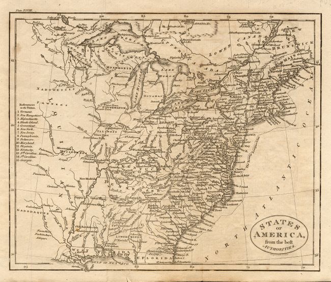
Auction 120, Lot 159
Subject: United States
[Lot of 7 - United States], 1821-1857
Size: See Description
Estimate: $200 - $250
Sold for: $250
Closed on 7/18/2007
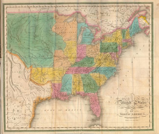
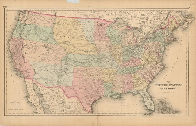
Auction 120, Lot 160
Subject: United States
Maas, Jacob
United States of North America, 1829
Size: 19 x 16 inches (48.3 x 40.6 cm)
Estimate: $800 - $1,000
Sold for: $600
Closed on 7/18/2007
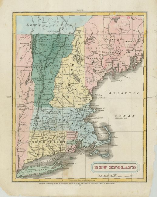
Auction 120, Lot 161
Subject: United States
Robinson, D.F. & Co.
[Lot of 4] New England [and] The Middle States and Part of the Southern States [and] Ohio & Indiana [and] North America, 1829
Size: 7.5 x 9.5 inches (19.1 x 24.1 cm)
Estimate: $150 - $250
Sold for: $100
Closed on 7/18/2007
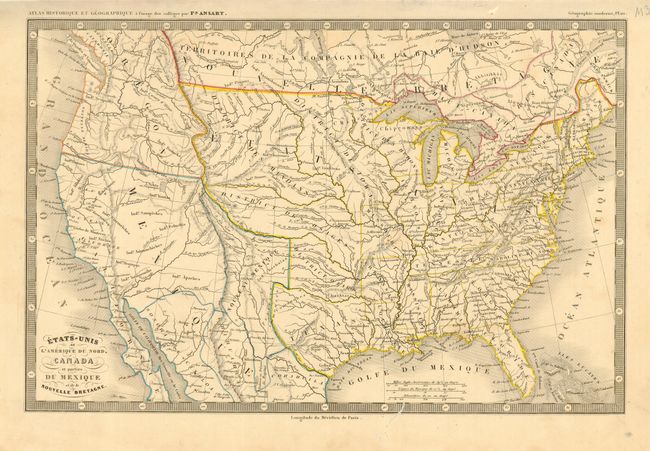
Auction 120, Lot 162
Subject: United States
Ansart, Felix
Etats-Unis de l'Amerique du Nord, Canada et parties du Mexique et de la Bretagne, 1846
Size: 14 x 9.2 inches (35.6 x 23.4 cm)
Estimate: $100 - $130
Sold for: $75
Closed on 7/18/2007
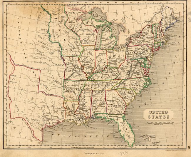
Auction 120, Lot 163
Subject: United States
[Lot of 2] United States [and] United States, 1846-48
Size: See Description
Estimate: $150 - $250
Sold for: $110
Closed on 7/18/2007
Auction 120, Lot 164
Subject: United States
Burr, David H.
Map of the United States Exhibiting the Several Collection Districts, 1856
Size: 48.1 x 31.25 inches (122.2 x 79.4 cm)
Estimate: $200 - $250
Sold for: $150
Closed on 7/18/2007
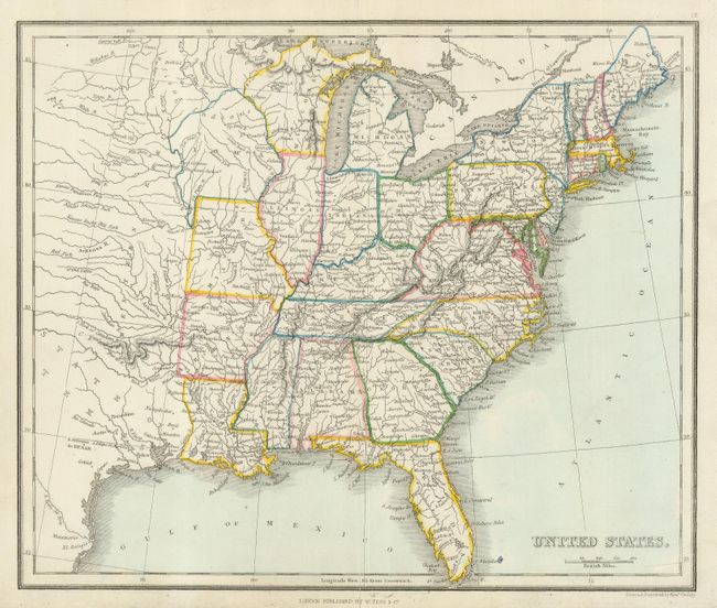
Auction 120, Lot 165
Subject: United States
Colton, Joseph Hutchins
The United States of America, 1857
Size: 25 x 14.5 inches (63.5 x 36.8 cm)
Estimate: $180 - $250
Unsold
Closed on 7/18/2007
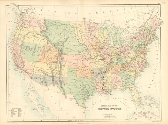
Auction 120, Lot 166
Subject: United States
Black, Adam & Charles
General Map of the United States, 1861
Size: 21.3 x 16.2 inches (54.1 x 41.1 cm)
Estimate: $200 - $300
Sold for: $150
Closed on 7/18/2007
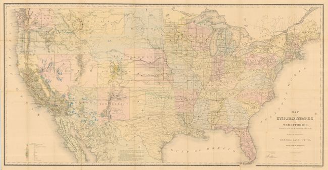
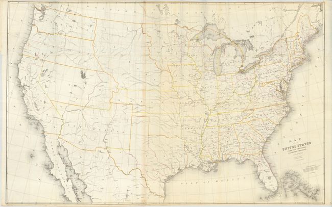
Auction 120, Lot 167
Subject: United States
General Land Office
Map of the United States and Territories Showing the extent of Public Surveys and other details constructed from the Plats and official sources of the General Land Office…, 1867
Size: 54.8 x 28 inches (139.2 x 71.1 cm)
Estimate: $250 - $350
Sold for: $180
Closed on 7/18/2007
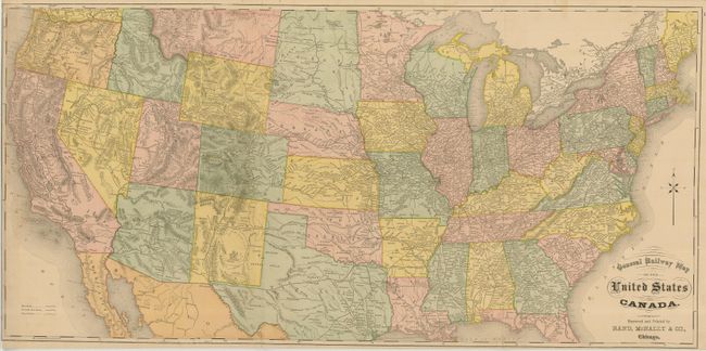
Auction 120, Lot 168
Subject: United States
Rand McNally & Co.
General Railway Map of the United States and Canada, 1874
Size: 36 x 17.6 inches (91.4 x 44.7 cm)
Estimate: $140 - $180
Sold for: $100
Closed on 7/18/2007

Auction 120, Lot 169
Subject: United States
Rand McNally & Co.
Map of the Missouri Pacific Ry, Missouri, Kansas and Texas Ry. St Louis, Iron Mountain and So. Ry. International and Gt. Northern R.R. Central Branch U.P.R.R. St. Louis, Ft. Scott and Wichita R.R. Little Rock, Miss. River and Texas Ry. And Connections., 1887
Size: 31 x 16.8 inches (78.7 x 42.7 cm)
Estimate: $250 - $300
Sold for: $210
Closed on 7/18/2007
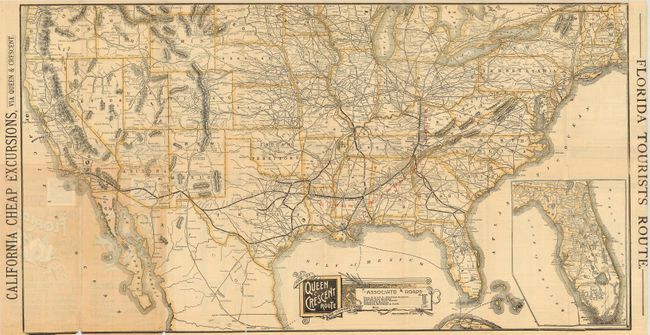
Auction 120, Lot 170
Subject: United States and Florida
Railroad Companies, (Various)
Map of Queen & Crescent Route and Connections, 1888
Size: 31 x 16.5 inches (78.7 x 41.9 cm)
Estimate: $250 - $350
Sold for: $180
Closed on 7/18/2007
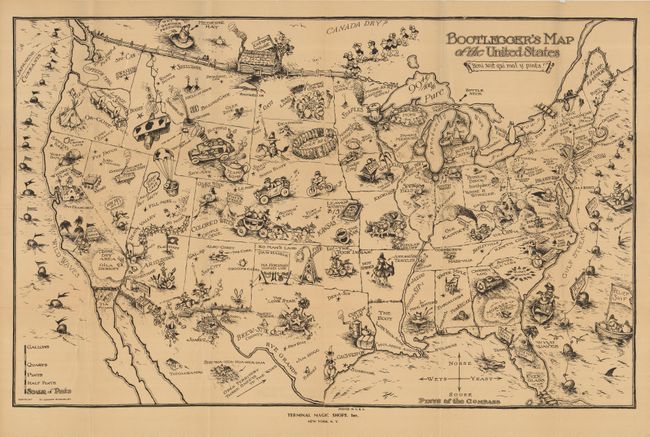
Auction 120, Lot 171
Subject: United States
Bootleggers Map of the United States for Light, Medium and Heavy Tipplers, 1925
Size: 32 x 22 inches (81.3 x 55.9 cm)
Estimate: $100 - $150
Sold for: $1,200
Closed on 7/18/2007
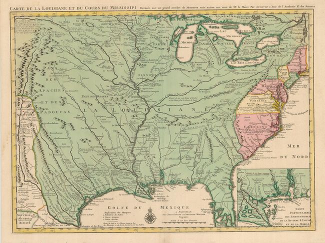
Auction 120, Lot 172
Subject: Colonial United States
Delisle/Covens & Mortier
Carte de la Louisiane et du Cours du Mississipi Dressee sur un Grand Nombre de Memoires entrautres sur ceux de Mr. le Maire, 1730
Size: 23.5 x 17.3 inches (59.7 x 43.9 cm)
Estimate: $2,500 - $3,000
Sold for: $5,000
Closed on 7/18/2007
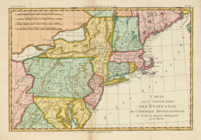
Auction 120, Lot 173
Subject: Eastern United States
Bonne, Rigobert
Carte de la Partie Nord, des Etats Unis, de l'Amerique Septentrionale, 1783
Size: 12.6 x 8.5 inches (32 x 21.6 cm)
Estimate: $160 - $200
Sold for: $120
Closed on 7/18/2007
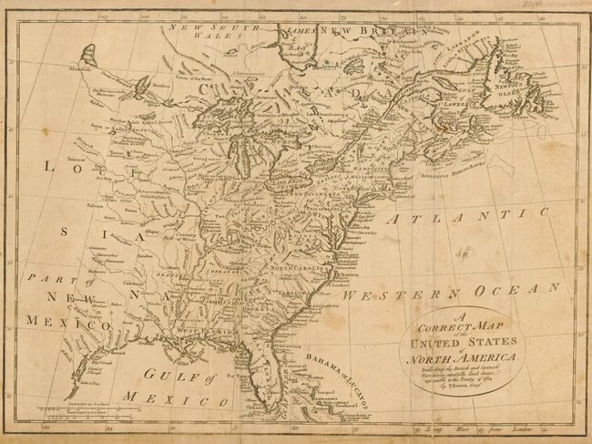
Auction 120, Lot 174
Subject: Eastern United States
Bowen, Thomas
A Correct Map of the United States of North America, Including the British and Spanish Territories, carefully laid down agreeable to the Treaty of 1784, 1784
Size: 17 x 12.5 inches (43.2 x 31.8 cm)
Estimate: $250 - $300
Sold for: $375
Closed on 7/18/2007
Auction 120, Lot 175
Subject: Eastern United States
Robert de Vaugondy
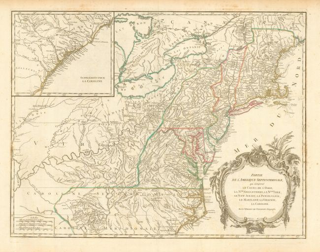
Partie de l'Amerique Septentrionale, qui comprend le Cours de l'Ohio, la Nlle. Angleterre, la Nlle York, le New Jersey, la Pensylvanie, le Maryland la Virginie, la Caroline, 1788
Size: 24 x 19 inches (61 x 48.3 cm)
Estimate: $800 - $1,000
Sold for: $600
Closed on 7/18/2007
Auction 120, Lot 176
Subject: Eastern United States
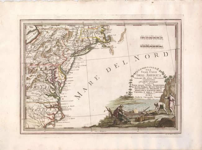
Cassini, Giovanni Maria
Gli Stati Uniti dell'America Delineati sulle ultime Osservazioni - Quarto Foglio che comprende Parte Della Nuova Inghilterra La Nuova York, il Nuovo Yersey, la Pensilvania, il Delaware, il Maryland, e Porzioni della Virginia, e della Carolina, 1797
Size: 18.8 x 13.4 inches (47.8 x 34 cm)
Estimate: $900 - $1,200
Sold for: $850
Closed on 7/18/2007
Auction 120, Lot 177
Subject: Eastern United States
Stockdale, John
Part of the United States of North America, 1798
Size: 18.5 x 16.2 inches (47 x 41.1 cm)
Estimate: $300 - $350
Sold for: $220
Closed on 7/18/2007
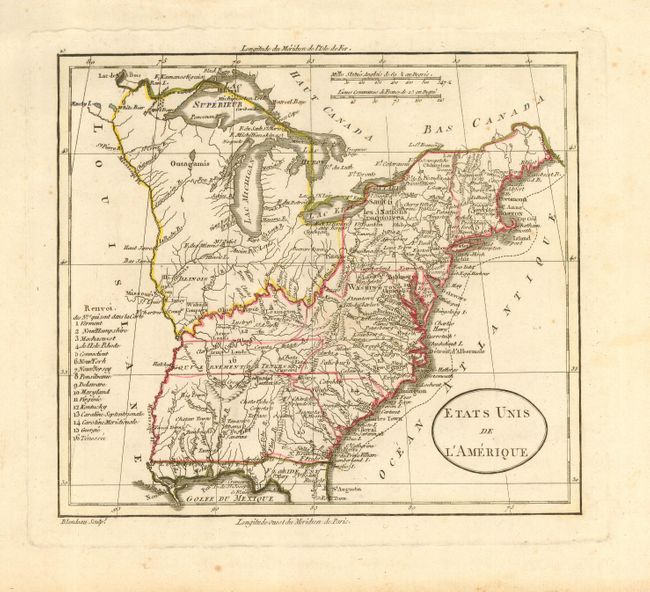
Auction 120, Lot 178
Subject: Eastern United States
Blondeau, Alexandre
Etats Unis de l'Amerique, 1798
Size: 8 x 7 inches (20.3 x 17.8 cm)
Estimate: $150 - $200
Sold for: $120
Closed on 7/18/2007
Auction 120, Lot 179
Subject: Eastern United States
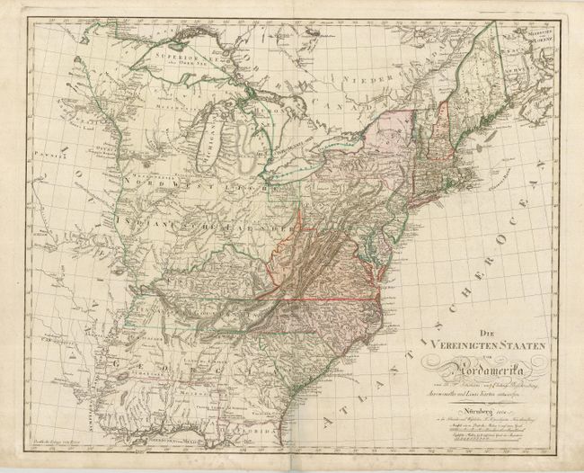
Sotzmann, Daniel Friedrich
Die Vereinigten Staaten von Nordamerika von D. F. Sotzmann…, 1804
Size: 26 x 21 inches (66 x 53.3 cm)
Estimate: $2,500 - $3,500
Sold for: $1,800
Closed on 7/18/2007
Auction 120, Lot 180
Subject: Eastern United States
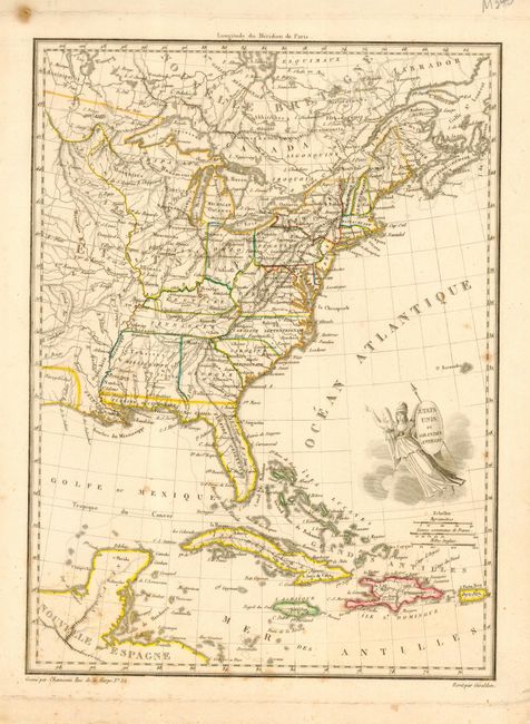
Chamouin, Jean Baptiste Marie
Etats Unis et Grandes Antilles, 1805
Size: 8.7 x 11.7 inches (22.1 x 29.7 cm)
Estimate: $150 - $200
Sold for: $75
Closed on 7/18/2007
Auction 120, Lot 181
Subject: Eastern United States
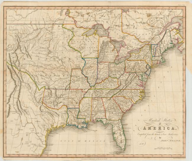
Melish, John
United States of America, Compiled from the Latest & Best Authorities, 1824
Size: 18.6 x 15.4 inches (47.2 x 39.1 cm)
Estimate: $800 - $1,000
Sold for: $750
Closed on 7/18/2007
Auction 120, Lot 182
Subject: Eastern United States
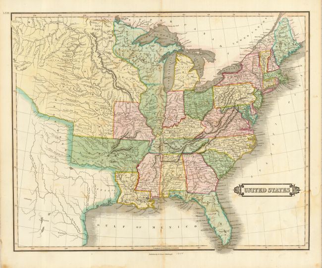
Lizars, Daniel
United States, 1831
Size: 19.8 x 16 inches (50.3 x 40.6 cm)
Estimate: $150 - $200
Sold for: $110
Closed on 7/18/2007
Auction 120, Lot 183
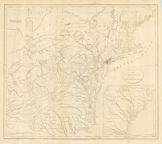
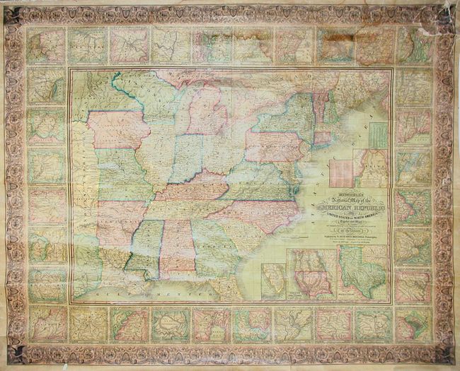
Subject: Eastern United States
Mitchell, Samuel Augustus
Mitchell's National Map of the American Republic or United States of North America, Together with Maps of the Vicinities of Thirty-Two of the Principal Cities and Towns in the Union, 1849
Size: 47.5 x 38 inches (120.7 x 96.5 cm)
Estimate: $900 - $1,200
Unsold
Closed on 7/18/2007
Auction 120, Lot 184
Subject: Eastern United States
Colton, Joseph Hutchins
Colton's United States shewing the Military Stations Forts &c., 1861
Size: 16 x 15 inches (40.6 x 38.1 cm)
Estimate: $300 - $350
Sold for: $375
Closed on 7/18/2007
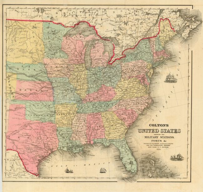
Auction 120, Lot 185
Subject: Eastern United States
Mitchell, Samuel Augustus
1776 Map of the Thirteen Original Colonies, 1881
Size: 13.5 x 11.5 inches (34.3 x 29.2 cm)
Estimate: $70 - $100
Sold for: $55
Closed on 7/18/2007
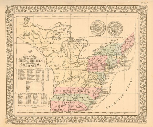
Auction 120, Lot 186
Subject: Eastern United States
Rand McNally & Co.
Map of the Hoosac Tunnel Route Comprising the Fitchburg and Troy & Boston Railroads, 1883
Size: 21.7 x 14.3 inches (55.1 x 36.3 cm)
Estimate: $200 - $250
Unsold
Closed on 7/18/2007
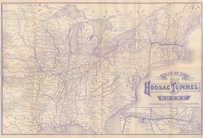
Auction 120, Lot 187
Subject: Eastern United States
[Lot of 7 - United States], 1763-1840
Size: See Description
Estimate: $180 - $250
Sold for: $425
Closed on 7/18/2007
225 lots
Page 1 of 5