Filtered by Category:United States(Show All Categories)
Showing results for:Auction 110
Catalog Archive
151 lots
Page 1 of 4
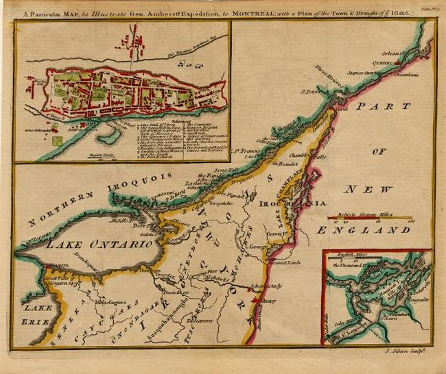
Auction 110, Lot 95
Subject: Canada
Gibson, John
A Particular Map, to Illustrate Gen. Amherst's Expedition, to Montreal; with a Plan of the Town & Draught of ye Island, 1760
Size: 9 x 7 inches (22.9 x 17.8 cm)
Estimate: $170 - $200
Sold for: $130
Closed on 3/2/2005
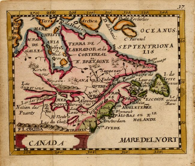
Auction 110, Lot 100
Subject: Colonial Great Lakes and Canada
Duval/Beer
Canada, 1679
Size: 4.8 x 4 inches (12.2 x 10.2 cm)
Estimate: $400 - $475
Sold for: $600
Closed on 3/2/2005
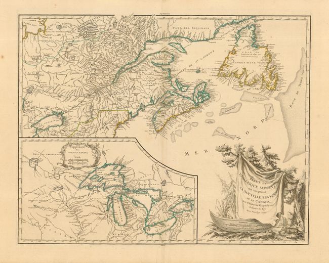
Auction 110, Lot 101
Subject: Colonial Great Lakes and Canada
Robert de Vaugondy
Partie de l'Amerique Septent? qui comprend la Nouvelle France ou le Canada, 1755
Size: 23.7 x 18.7 inches (60.2 x 47.5 cm)
Estimate: $750 - $900
Sold for: $800
Closed on 3/2/2005
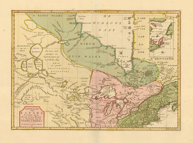
Auction 110, Lot 102
Subject: Colonial Great Lakes and Canada
Tirion, Isaac
Nieuwe Kaart van Kanada, de Landen aan de Hudsons-Baay en de Noordwestelyke deelen van Noord-Amerika, 1769
Size: 17 x 12 inches (43.2 x 30.5 cm)
Estimate: $425 - $475
Sold for: $350
Closed on 3/2/2005
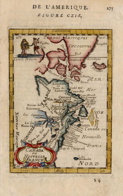
Auction 110, Lot 103
Subject: Colonial Canada and New England
Mallet, Alain Manesson
Canada ou Nouvelle France, 1683
Size: 4 x 5.5 inches (10.2 x 14 cm)
Estimate: $200 - $240
Sold for: $170
Closed on 3/2/2005
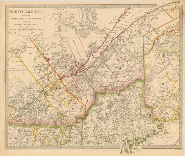
Auction 110, Lot 104
Subject: Canada and New England
SDUK Society for the Diffusion of Useful Knowledge
North America Sheet II Lower-Canada and New Brunswick with Part of New-York, Vermont and Maine, 1832
Size: 15.2 x 13.2 inches (38.6 x 33.5 cm)
Estimate: $100 - $125
Unsold
Closed on 3/2/2005
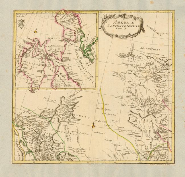
Auction 110, Lot 105
Subject: Colonial Canada and United States
Von Euler, Leonhard
Americae Septentrionalis Pars I, 1753
Size: 14.5 x 13.5 inches (36.8 x 34.3 cm)
Estimate: $300 - $400
Sold for: $275
Closed on 3/2/2005
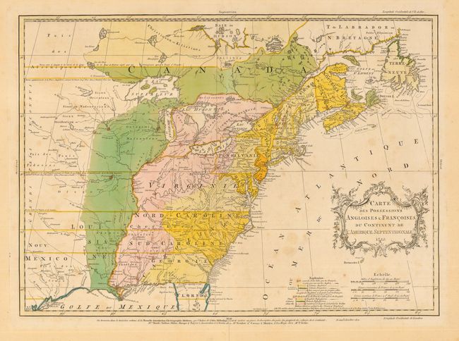
Auction 110, Lot 106
Subject: Colonial Canada and United States
Palairet, Jean
Carte des Possessions Angloises & Francoises du Continent de l'Amerique Septentrionale, 1755
Size: 22.7 x 16.2 inches (57.7 x 41.1 cm)
Estimate: $2,750 - $3,750
Sold for: $3,000
Closed on 3/2/2005
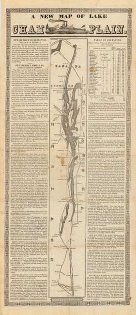
Auction 110, Lot 107
Subject: New York and Canada
A New Map of Lake Champlain, 1845
Size: 9.4 x 22 inches (23.9 x 55.9 cm)
Estimate: $275 - $325
Sold for: $275
Closed on 3/2/2005
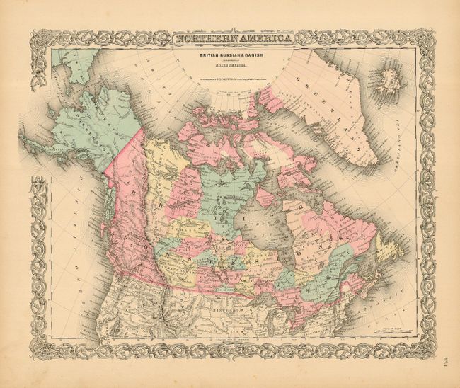
Auction 110, Lot 108
Subject: Canada & Alaska
Colton, Joseph Hutchins
Northern America British, Russian & Danish Possessions in North America, 1855
Size: 16 x 13 inches (40.6 x 33 cm)
Estimate: $120 - $140
Sold for: $90
Closed on 3/2/2005

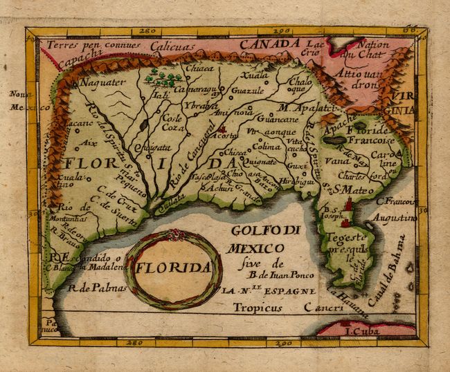
Auction 110, Lot 109
Subject: Colonial United States
Gibson, John
[Louisiana, Virginia, Carolina and Florida], 1763
Size: 9.5 x 7 inches (24.1 x 17.8 cm)
Estimate: $200 - $250
Sold for: $230
Closed on 3/2/2005
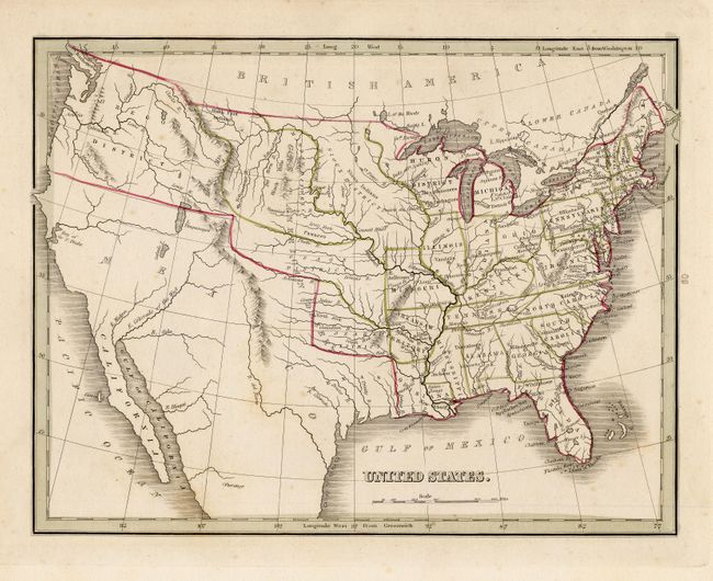
Auction 110, Lot 110
Subject: United States
Bradford, Thomas Gamaliel
United States, 1835-36
Size: 10 x 7.8 inches (25.4 x 19.8 cm)
Estimate: $220 - $275
Sold for: $150
Closed on 3/2/2005
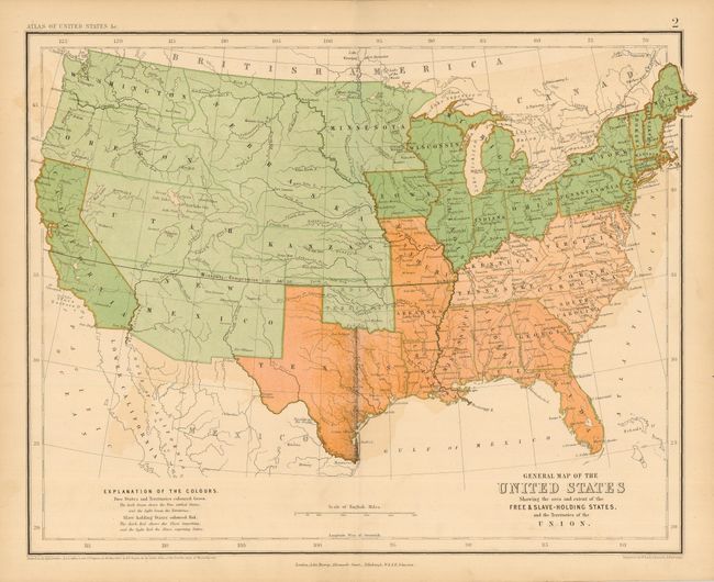
Auction 110, Lot 111
Subject: United States
Rogers & Johnston
General Map of the United States Showing the area and extent of the Free & Slave-Holding States, and the Territories of the Union, 1857
Size: 16 x 13 inches (40.6 x 33 cm)
Estimate: $150 - $200
Sold for: $275
Closed on 3/2/2005
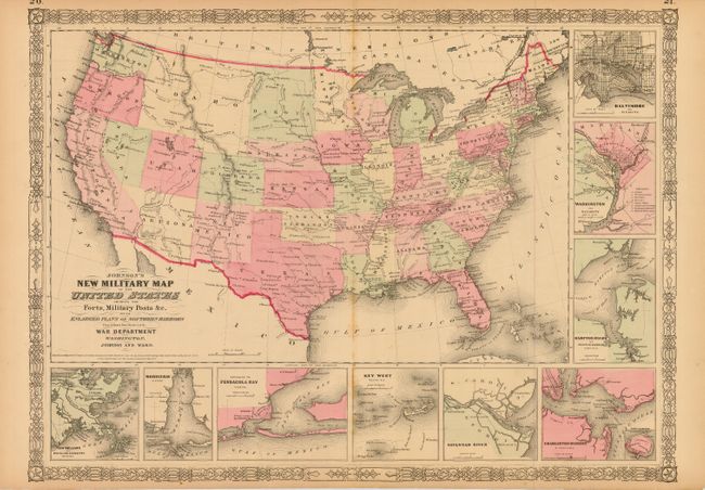
Auction 110, Lot 113
Subject: United States
Johnson & Ward
Johnson's New Military Map of the United States Showing the Forts, Military Posts &c. all the Military Divisions with Enlarged Plans of Southern Harbors…, 1861
Size: 23.5 x 17 inches (59.7 x 43.2 cm)
Estimate: $200 - $250
Sold for: $80
Closed on 3/2/2005
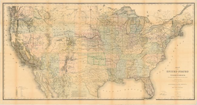
Auction 110, Lot 114
Subject: United States
General Land Office
Map of the United States and Territories Showing the extent of Public Surveys and other details constructed from the Plats and official sources of the General Land Office…, 1868
Size: 56 x 28.5 inches (142.2 x 72.4 cm)
Estimate: $300 - $400
Sold for: $200
Closed on 3/2/2005
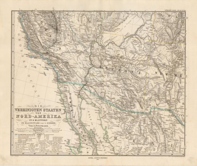
Auction 110, Lot 115
Subject: United States
Petermann, Augustus Herman
Die Vereinigten Staaten von Nord-America in 6 Blattern, 1873
Size: 15.7 x 13 inches (39.9 x 33 cm)
Estimate: $250 - $300
Sold for: $150
Closed on 3/2/2005
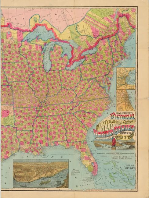
Auction 110, Lot 116
Subject: United States
Lubrecht, Charles
Chas. Lubrecht's Pictorial County, Rail-Road & Distance Map of the United States and Part of the Dominion of Canada, 1880
Size: 56.4 x 36.5 inches (143.3 x 92.7 cm)
Estimate: $1,500 - $2,000
Sold for: $1,300
Closed on 3/2/2005
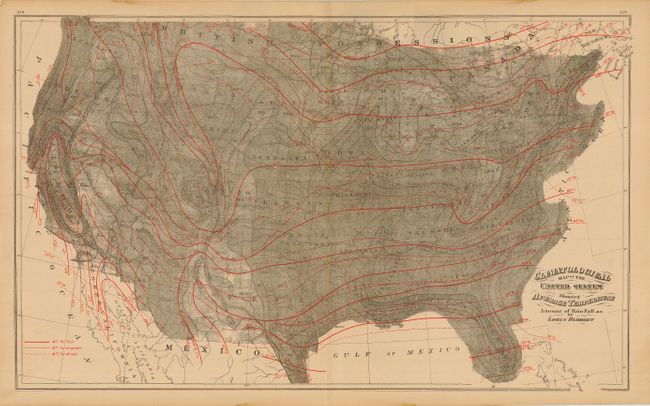
Auction 110, Lot 117
Subject: United States
Gray, Ormando Willis & Son
Climatological Map of the United States Showing Average Temperature Amount of Rain Fall &c. by Lorin Blodget, 1881
Size: 26.3 x 16 inches (66.8 x 40.6 cm)
Estimate: $80 - $100
Sold for: $60
Closed on 3/2/2005
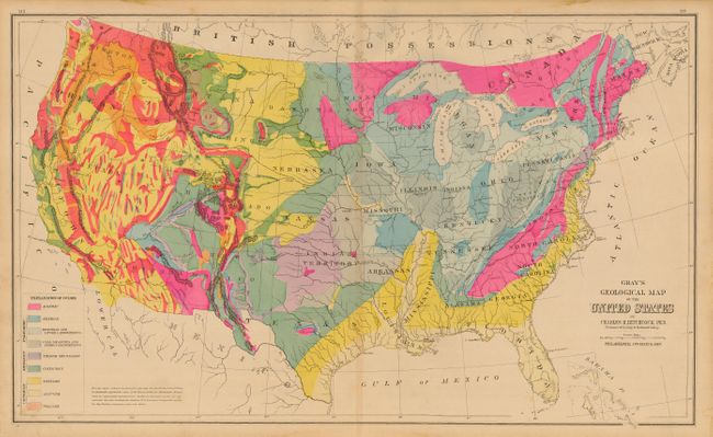
Auction 110, Lot 118
Subject: United States
Gray, Ormando Willis & Son
Gray's Geological Map of the United States by Charles H. Hitchcock Ph.D. Professor Geology in Dartmouth College, 1881
Size: 26.7 x 16.1 inches (67.8 x 40.9 cm)
Estimate: $100 - $140
Sold for: $110
Closed on 3/2/2005
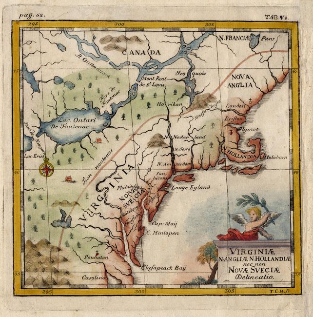
Auction 110, Lot 119
Subject: Colonial United States
Campanius Holm, Tomas
Virginiae N. Angliae N. Hollandiae nec non Novae Sveciae Delineatio, 1702
Size: 5.2 x 5 inches (13.2 x 12.7 cm)
Estimate: $350 - $400
Sold for: $550
Closed on 3/2/2005
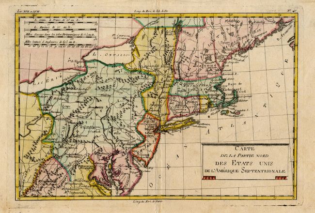
Auction 110, Lot 120
Subject: United States - Eastern
Bonne, Rigobert
Carte de la Partie Nord, des Etats Unis, de l'Amerique Septentrionale, 1782
Size: 12.5 x 8.4 inches (31.8 x 21.3 cm)
Estimate: $250 - $300
Sold for: $375
Closed on 3/2/2005
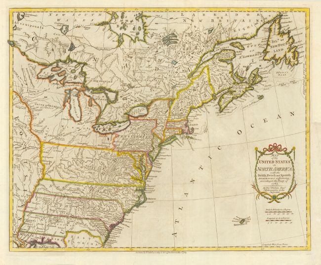
Auction 110, Lot 121
Subject: United States - Eastern
Kitchin, Thomas
Map of the United States in North America: with the British, French and Spanish Dominions adjoining, according to the Treaty of 1783, 1783
Size: 20 x 16 inches (50.8 x 40.6 cm)
Estimate: $1,000 - $1,200
Sold for: $3,500
Closed on 3/2/2005
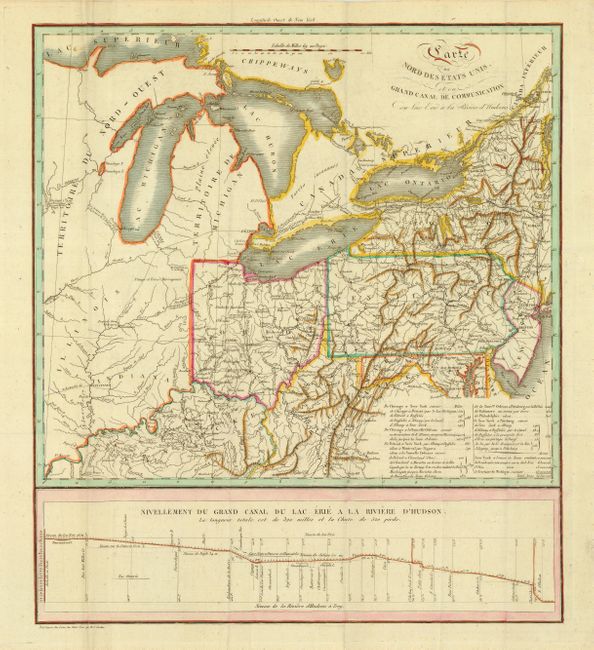
Auction 110, Lot 122
Subject: Eastern United States and Great Lakes
Cordier, Louis Etienne Joseph
[Lot of 2] Carte du Nord des Etats Unis et ou Grand Canal de Communication du Lac Erie a la Riviere d'Hudsons [with] Plan et Profil du Canal Projette du Lac Erie a la Riviere Hudson dans l'Etat de Neuwyork, 1820
Size: See Description
Estimate: $350 - $400
Sold for: $325
Closed on 3/2/2005
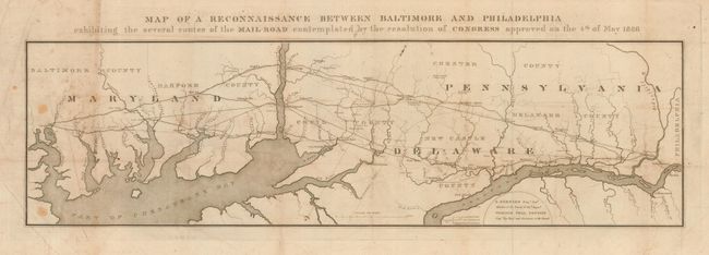
Auction 110, Lot 123
Subject: United States - Eastern
U.S. Corps of Engineers
Map of a Reconnaissance Between Baltimore and Philadelphia exhibiting the several routes of the Mail Road contemplated by the resolution of Congress approved on the 4th of May 1826, 1826
Size: 31 x 10 inches (78.7 x 25.4 cm)
Estimate: $240 - $275
Sold for: $180
Closed on 3/2/2005
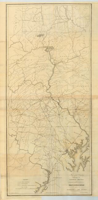
Auction 110, Lot 124
Subject: United States - Eastern
U.S. War Dept.
[Lot of 2] Map of the Country embracing the Several Routes examined with a view to a National Road from Washington to Lake Ontario, 1829
Size: See Description
Estimate: $300 - $350
Unsold
Closed on 3/2/2005
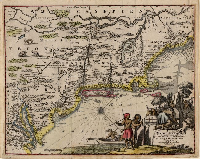
Auction 110, Lot 125
Subject: Colonial New England
Montanus, Arnoldus
Novi Belgii, quod nunc Novi Jorck Vocatur, Novae qz. Angliae & Partis Virginiae Accuratissima et Novissima Delineatio, 1671
Size: 14.5 x 11.5 inches (36.8 x 29.2 cm)
Estimate: $2,000 - $2,200
Sold for: $1,700
Closed on 3/2/2005
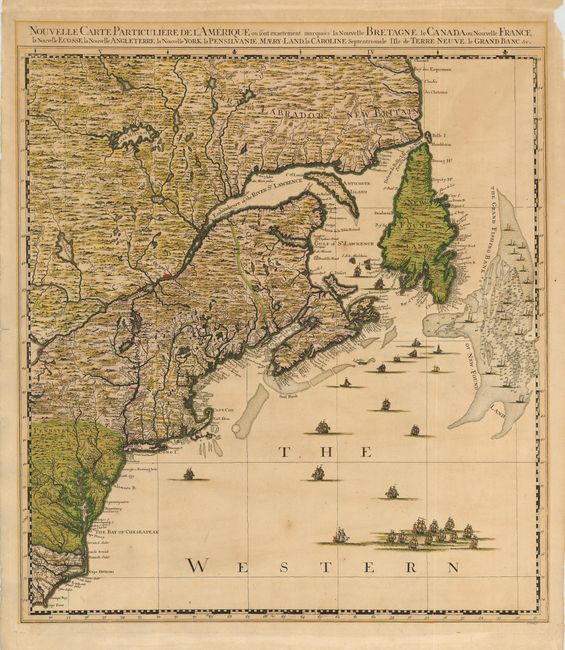
Auction 110, Lot 126
Subject: Colonial New England
Popple/Covens & Mortier
Nouvelle Carte Particuliere de l'Amerique ou sont exactement marquees la Nouvelle Bretagne, le Canada ou Nouvelle France, la Nouvelle Ecosse, la Nouvelle Angleterre, la Nouvelle York, la Pensilvanie, Maery-Land, la Caroline Septentrionale I' Ile de Terre, 1741
Size: 21 x 23.5 inches (53.3 x 59.7 cm)
Estimate: $3,000 - $3,500
Sold for: $3,250
Closed on 3/2/2005
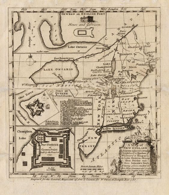
Auction 110, Lot 127
Subject: Colonial New England
Anon.
A Map of New England & ye Country adjacent, extending Northward to Quebec & Westward to Niagara, on Lake Ontairo, shewing Gen: Shirley and Gen: Johnson's Routs, & many places omitted in other Maps; Communicated by gentlemen who resided in these parts, 1755
Size: 7 x 8 inches (17.8 x 20.3 cm)
Estimate: $350 - $400
Sold for: $475
Closed on 3/2/2005
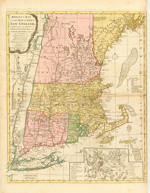
Auction 110, Lot 128
Subject: Colonial New England
Bowles, Carrington
Bowles's Map of the Seat of War in New England, Comprehending the Provinces of Massachusets Bay, and New Hampshire, with the Colonies or Connecticut and Rhode Island…, 1776
Size: 21 x 25 inches (53.3 x 63.5 cm)
Estimate: $3,000 - $4,000
Sold for: $3,000
Closed on 3/2/2005
Auction 110, Lot 129
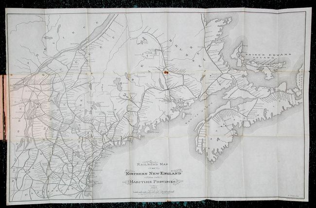
Subject: United States - New England
Foster, George
Railroad Map of Northern New England and the Maritime Provinces, 1882
Size: 25 x 15.7 inches (63.5 x 39.9 cm)
Estimate: $90 - $120
Sold for: $60
Closed on 3/2/2005
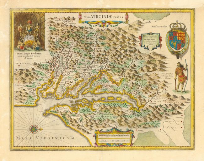
Auction 110, Lot 130
Subject: Colonial Mid Atlantic
Hondius, Henricus
Nova Virginiae Tabula, 1665
Size: 19.2 x 15 inches (48.8 x 38.1 cm)
Estimate: $2,300 - $2,750
Sold for: $1,700
Closed on 3/2/2005
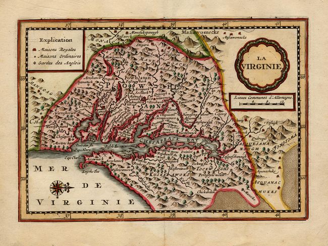
Auction 110, Lot 131
Subject: Colonial Mid Atlantic
Aa, Pieter van der
La Virginie, 1714
Size: 7.5 x 5.2 inches (19.1 x 13.2 cm)
Estimate: $1,100 - $1,300
Sold for: $3,750
Closed on 3/2/2005
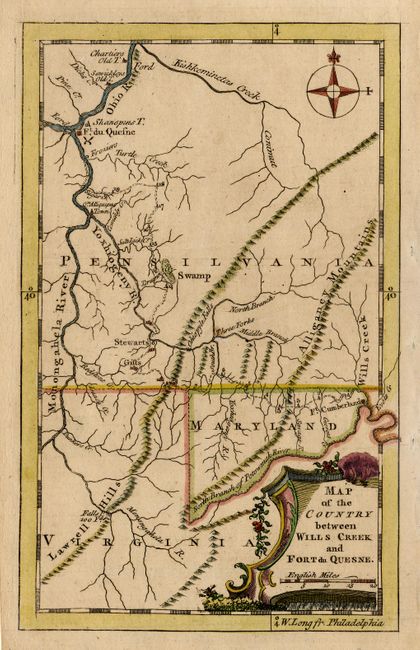
Auction 110, Lot 132
Subject: Colonial Mid Atlantic
Anon.
Map of the Country between Wills Creek and Fort du Quesne, 1758
Size: 4.6 x 7.4 inches (11.7 x 18.8 cm)
Estimate: $275 - $325
Sold for: $550
Closed on 3/2/2005
Auction 110, Lot 133
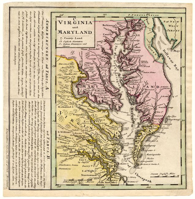
Subject: Colonial Mid Atlantic
Homann Heirs
C. Virginia und Maryland, 1765
Size: 7.8 x 10.2 inches (19.8 x 25.9 cm)
Estimate: $375 - $425
Sold for: $275
Closed on 3/2/2005
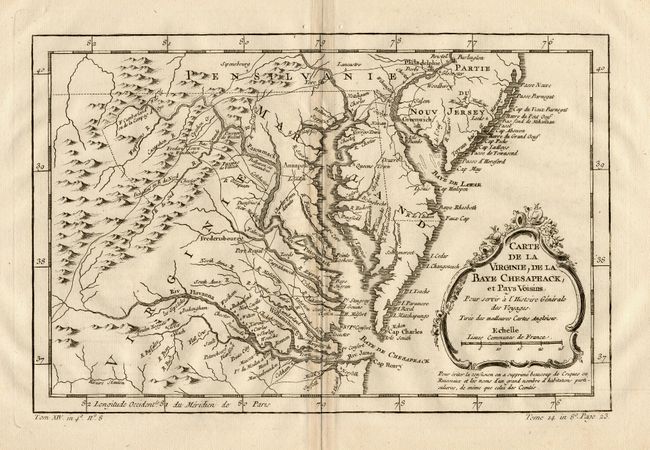
Auction 110, Lot 134
Subject: Colonial Mid Atlantic
Bellin, Jacques Nicolas
Carte de la Virginie, de la Baye Chesapeack, et Pays Voisins, 1773
Size: 11.5 x 7.5 inches (29.2 x 19.1 cm)
Estimate: $160 - $200
Sold for: $180
Closed on 3/2/2005
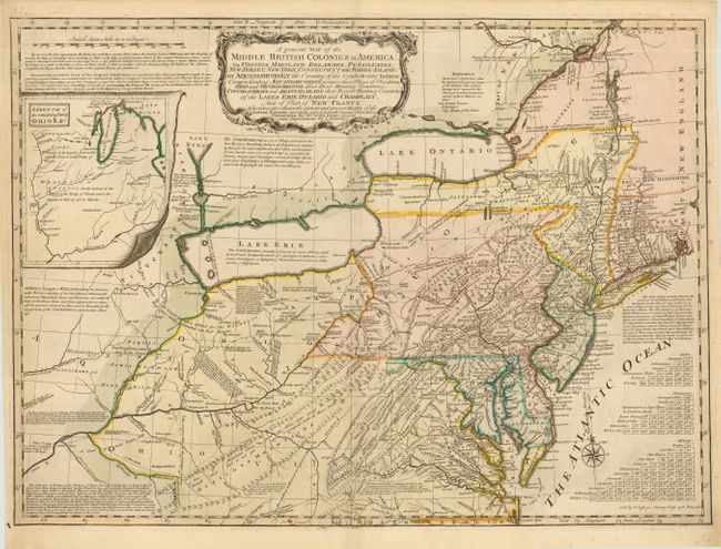
Auction 110, Lot 135
Subject: Colonial Mid Atlantic and Great Lakes
Evans/Jefferys
A general Map of the Middle British Colonies in America: viz. Virginia, Maryland, Delaware, Pensilvania, New Jersey, New York, Connecticut and Rhode-Island…, 1758
Size: 26.2 x 19 inches (66.5 x 48.3 cm)
Estimate: $5,000 - $6,000
Sold for: $6,500
Closed on 3/2/2005
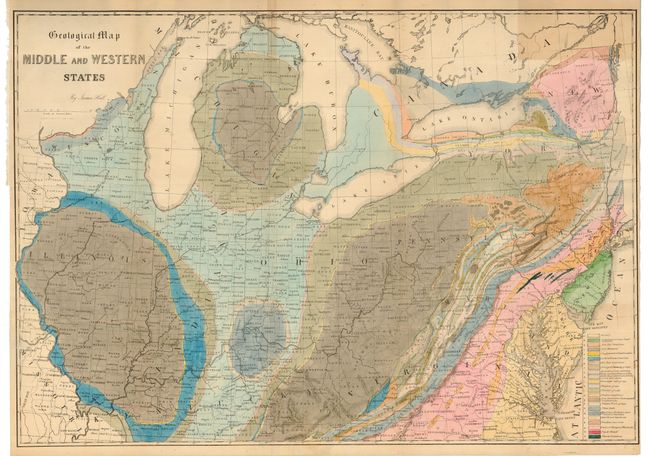
Auction 110, Lot 136
Subject: Mid Atlantic and Great Lakes
Hall, James
Geological Map of the Middle and Western States, 1843
Size: 32 x 22.5 inches (81.3 x 57.2 cm)
Estimate: $350 - $450
Sold for: $180
Closed on 3/2/2005
Auction 110, Lot 137
Subject: Colonial South
Duval/Beer
Florida, 1679
Size: 4.8 x 3.7 inches (12.2 x 9.4 cm)
Estimate: $400 - $450
Sold for: $300
Closed on 3/2/2005
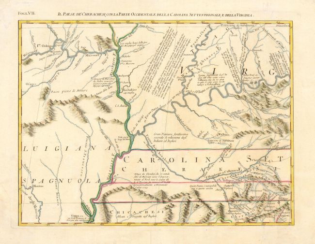
Auction 110, Lot 138
Subject: Colonial South
Zatta, Antonio
Il Paese de Cherachesi, con la Parte Occidentale della Carolina Settentrionale, e della Virginia, 1778
Size: 16.7 x 12.5 inches (42.4 x 31.8 cm)
Estimate: $400 - $475
Sold for: $300
Closed on 3/2/2005
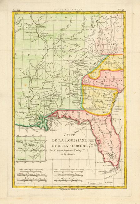
Auction 110, Lot 139
Subject: United States - Southern
Bonne, Rigobert
Carte de la Louisiane, et de la Floride, 1783
Size: 8.2 x 12.5 inches (20.8 x 31.8 cm)
Estimate: $230 - $275
Sold for: $230
Closed on 3/2/2005
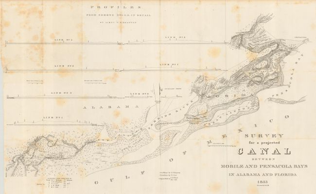
Auction 110, Lot 140
Subject: Florida and Alabama
U.S. Government
Survey for a projected Canal Between Mobile and Pensacola Bays in Alabama and Florida, 1833
Size: 33 x 20 inches (83.8 x 50.8 cm)
Estimate: $140 - $180
Sold for: $110
Closed on 3/2/2005
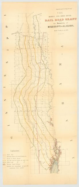
Auction 110, Lot 141
Subject: Alabama and Mississippi
U.S. Government
The Mobile and Ohio River Rail Road Grant in the States of Mississippi and Alabama, 1852
Size: 12.7 x 31 inches (32.3 x 78.7 cm)
Estimate: $130 - $170
Sold for: $95
Closed on 3/2/2005
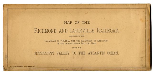
Auction 110, Lot 142
Subject: United States - Southern
Colton, G.W. & C.B.
Map of the Richmond and Louisville R.R. Connecting the Railroads of Virginia with the Railroads of Kentucky on the Shortest Route East and West from the Mississippi Valley to the Atlantic Ocean, 1882
Size: 50 x 25 inches (127 x 63.5 cm)
Estimate: $400 - $600
Sold for: $325
Closed on 3/2/2005
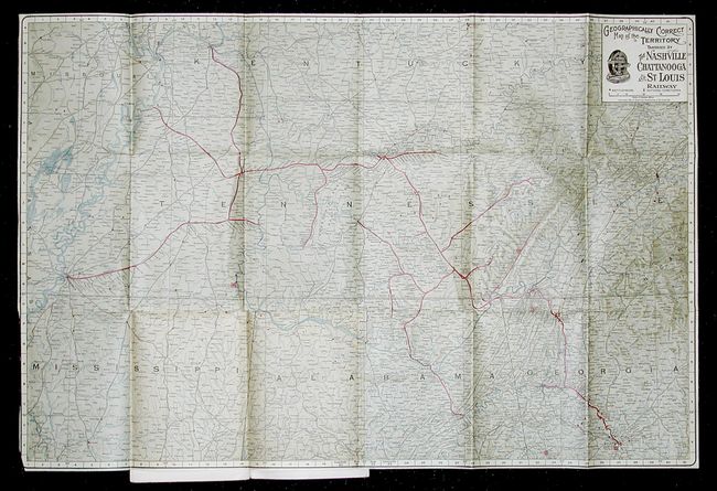
Auction 110, Lot 143
Subject: United States - Southern
Railroad Companies, (Various)
Geographically Correct Map of the Territory Traversed by The Nashville Chattanooga and St. Louis Railway [Southern Battlefields], 1906
Size: 30 x 20 inches (76.2 x 50.8 cm)
Estimate: $90 - $120
Sold for: $110
Closed on 3/2/2005
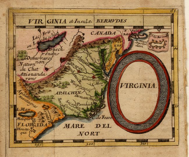
Auction 110, Lot 144
Subject: Colonial Southeast
Duval/Beer
Virginia, 1679
Size: 4.8 x 3.8 inches (12.2 x 9.7 cm)
Estimate: $400 - $450
Sold for: $1,100
Closed on 3/2/2005
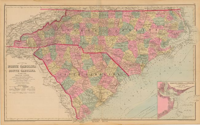
Auction 110, Lot 145
Subject: North Carolina and South Carolina
Gray, Ormando Willis & Son
Gray's New Map of North Carolina and South Carolina, 1881
Size: 26.5 x 16 inches (67.3 x 40.6 cm)
Estimate: $100 - $140
Sold for: $75
Closed on 3/2/2005
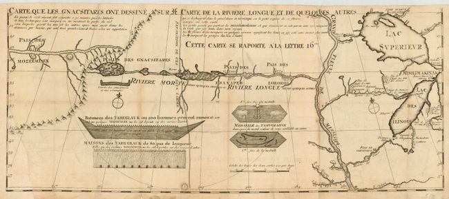
Auction 110, Lot 146
Subject: Colonial Midwest
Lahontan, Louis Armand
Carte que les Gnacsitares ont Dessine sur ... Carte de la Riviere Longue et de quelques Autres qui se Dechargent dans le Grand Fleuve Missisipi …, 1703
Size: 26.2 x 11 inches (66.5 x 27.9 cm)
Estimate: $700 - $800
Sold for: $700
Closed on 3/2/2005
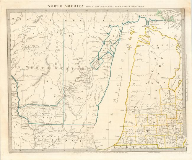
Auction 110, Lot 147
Subject: United States - Central
SDUK Society for the Diffusion of Useful Knowledge
North America Sheet V The North West and Michigan Territories, 1833
Size: 15 x 12 inches (38.1 x 30.5 cm)
Estimate: $120 - $160
Sold for: $65
Closed on 3/2/2005
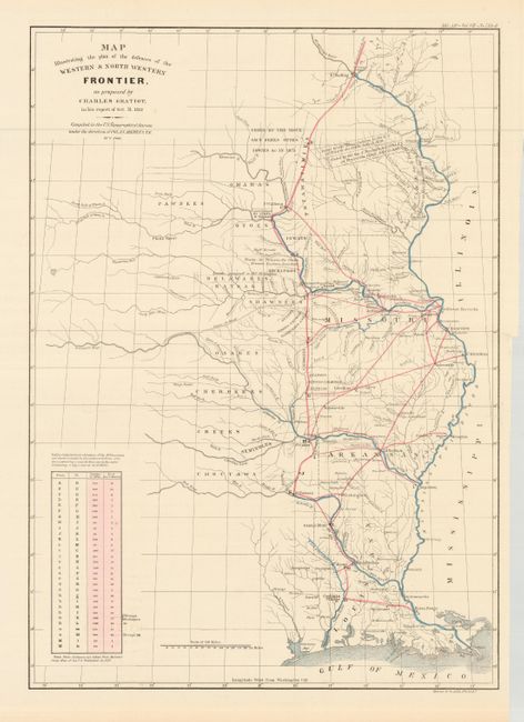
Auction 110, Lot 148
Subject: United States - Central
Gratiot, Charles
Map Illustrating the Plan of the Defences of the Western & North-Western Frontier, as proposed by Charles Gratiot, in his report of Oct. 31, 1837, 1860
Size: 15.2 x 21.5 inches (38.6 x 54.6 cm)
Estimate: $350 - $400
Sold for: $600
Closed on 3/2/2005
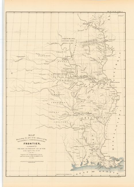
Auction 110, Lot 149
Subject: United States - Central
Poinsett, J. R.
Map Illustrating the plan of the defences of the Western & North-Western Frontier, as proposed by the Hon: J.R. Poinsett, Sec. of War, in his report of Dec. 30, 1837, 1860
Size: 15.5 x 21.5 inches (39.4 x 54.6 cm)
Estimate: $350 - $400
Sold for: $250
Closed on 3/2/2005
151 lots
Page 1 of 4