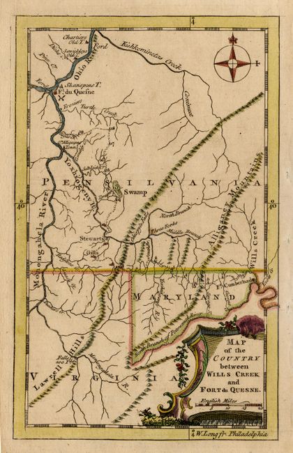
"Map of the Country between Wills Creek and Fort du Quesne", Anon.
Subject: Colonial Mid Atlantic
Period: 1758 (published)
Publication: Grand Magazine of Magazines
Color: Hand Color
Size:
4.6 x 7.4 inches
11.7 x 18.8 cm
This small map illustrates the infamous march of General Braddock's British Army to Fort Duquesne (Pittsburgh) at the beginning of the French and Indian War, which ended in the Battle of the Monongahela (or the Battle of the Wilderness, or just Braddock's Defeat). It is based on a drawing by Capt. William Orme, an aide-de-camp to General Braddock, showing the nineteen encampments along the route. It covers the region of southwestern Pennsylvania, northern Virginia and western Maryland. The map is decorative with a title cartouche and compass rose. Longitude is shown west from Philadelphia, which is unusual for a map published in England. The Grand Magazine of Magazines was a short-lived publication issued between July 1758 and December 1759. Maps from the magazine are very scarce.
References: Jolly GMOM-15.
Condition: A