Filtered by Category:United States(Show All Categories)
Showing results for:Auction 105
Catalog Archive
129 lots
Page 1 of 3

Auction 105, Lot 98
Subject: Colonial North America
Visscher/Schenk
Nova Tabula Geographica complectens Borealiorem Americae Partem; in qua exacte delineatae sunt Canada sive Nova Francia, Nova Scotia, Nova Anglia, Novum Belgium, Pensylvania, Virginia, Carolina, et Terra Nova, cum Omnibus Littorum, 1715
Size: 19.7 x 23.4 inches (50 x 59.4 cm)
Estimate: $1,800 - $2,000
Sold for: $1,300
Closed on 12/3/2003

Auction 105, Lot 99
Subject: Colonial North America
Tirion, Isaac
Nieuwe Kaart van de Grootbrittannische Volkplantingen in Noord America…, 1755
Size: 17.8 x 14.4 inches (45.2 x 36.6 cm)
Estimate: $750 - $900
Sold for: $950
Closed on 12/3/2003

Auction 105, Lot 101
Subject: Colonial United States and Canada
Lodge, John
A Map of the British and French Settlements in North America, 1755
Size: 15 x 10.8 inches (38.1 x 27.4 cm)
Estimate: $350 - $450
Sold for: $600
Closed on 12/3/2003

Auction 105, Lot 102
Subject: Colonial North America
Homann Heirs
America Septentrionalis a Domino d'Anville in Galliis edita nunc in Anglia Coloniis in Interiorem Virginiam deductis nec non Fluvii Ohio cursu…, 1756
Size: 20 x 18 inches (50.8 x 45.7 cm)
Estimate: $600 - $800
Sold for: $800
Closed on 12/3/2003
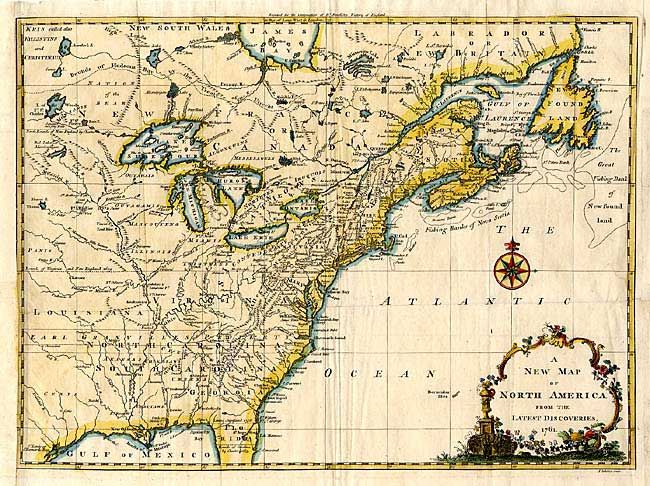
Auction 105, Lot 103
Subject: Colonial United States and Canada
Spilsbury, J.
A New Map of North America from the Latest Discoveries, 1761
Size: 14.5 x 10.8 inches (36.8 x 27.4 cm)
Estimate: $400 - $500
Sold for: $375
Closed on 12/3/2003
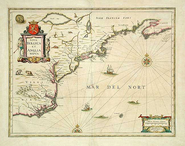
Auction 105, Lot 105
Subject: Colonial New England
Jansson, Jan
Nova Belgica et Anglia Nova, 1653-58
Size: 19.7 x 15.2 inches (50 x 38.6 cm)
Estimate: $2,000 - $2,400
Sold for: $2,000
Closed on 12/3/2003
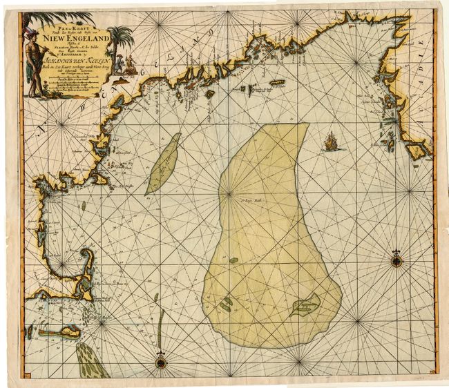
Auction 105, Lot 106
Subject: Colonial New England
Keulen, Johannes van
Pas-kaart Vande Zee Kusten inde Boght van Niew Engeland Tusschen de Staaten Hoek en C. de Sable…, 1684
Size: 23 x 20.2 inches (58.4 x 51.3 cm)
Estimate: $3,250 - $3,750
Sold for: $3,000
Closed on 12/3/2003
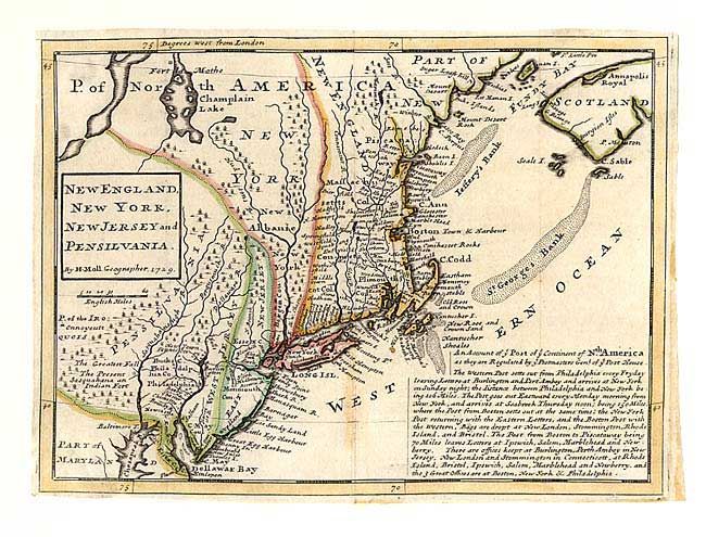
Auction 105, Lot 107
Subject: Colonial New England
Moll, Herman
New England, New York, New Jersey, and Pensilvania &c., 1729
Size: 10.7 x 7.8 inches (27.2 x 19.8 cm)
Estimate: $700 - $900
Sold for: $500
Closed on 12/3/2003
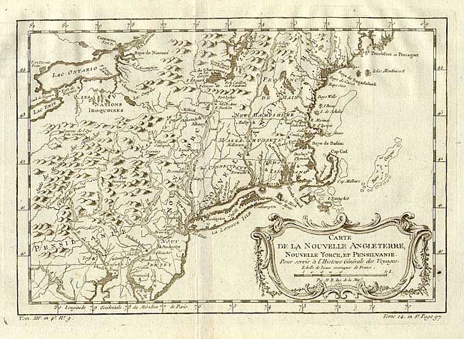
Auction 105, Lot 108
Subject: Colonial New England
Bellin, Jacques Nicolas
Carte de la Nouvelle Angleterre, Nouvelle Yorck, Pensilvanie…, 1760
Size: 11.7 x 8 inches (29.7 x 20.3 cm)
Estimate: $400 - $500
Sold for: $300
Closed on 12/3/2003
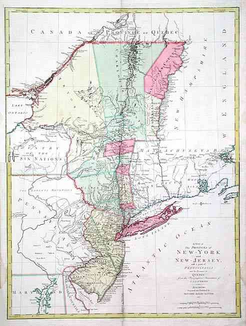
Auction 105, Lot 109
Subject: Colonial Northeast
Lotter, Mathias Albrecht
A Map of the Provinces of New-York and New-Jersey with a part of Pennsylvania and the Province of Quebec, 1777
Size: 22.5 x 30 inches (57.2 x 76.2 cm)
Estimate: $2,400 - $3,000
Sold for: $1,500
Closed on 12/3/2003
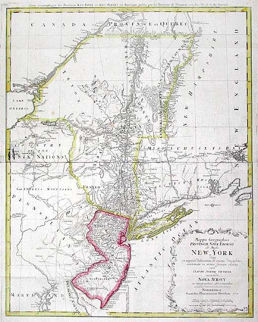
Auction 105, Lot 110
Subject: Colonial New England
Homann Heirs
Mappa Geographica Provinciae novae Eboraci ab Anglis New-York …Nova Jersey…, 1778
Size: 22.4 x 27.8 inches (56.9 x 70.6 cm)
Estimate: $2,200 - $2,500
Sold for: $1,600
Closed on 12/3/2003

Auction 105, Lot 111
Subject: Colonial Southeast
Blaeu, Willem
Virginiae partis australis, et Floridae partis orientalis, interjacentiumq regionum Nova Descriptio, 1662
Size: 19.7 x 15 inches (50 x 38.1 cm)
Estimate: $1,500 - $2,000
Sold for: $1,100
Closed on 12/3/2003

Auction 105, Lot 112
Subject: Colonial Southeast
Kitchin, Thomas
A New Map of the Cherokee Nation with the Names of the Towns & Rivers…, 1760
Size: 8.8 x 6.6 inches (22.4 x 16.8 cm)
Estimate: $550 - $650
Sold for: $1,100
Closed on 12/3/2003

Auction 105, Lot 113
Subject: Colonial Southern United States
Bellin, Jacques Nicolas
Carte de la Coste de la Floride depuis la Baye de la Mobile jusqu'aux Cayes de St. Martin, 1764
Size: 13.5 x 8.5 inches (34.3 x 21.6 cm)
Estimate: $300 - $350
Sold for: $550
Closed on 12/3/2003
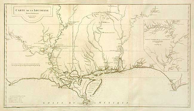
Auction 105, Lot 114
Subject: Colonial South
Anville, Jean Baptiste Bourguignon d'
Carte de la Louisiane, 1752
Size: 36.5 x 20.2 inches (92.7 x 51.3 cm)
Estimate: $1,000 - $1,400
Sold for: $1,100
Closed on 12/3/2003
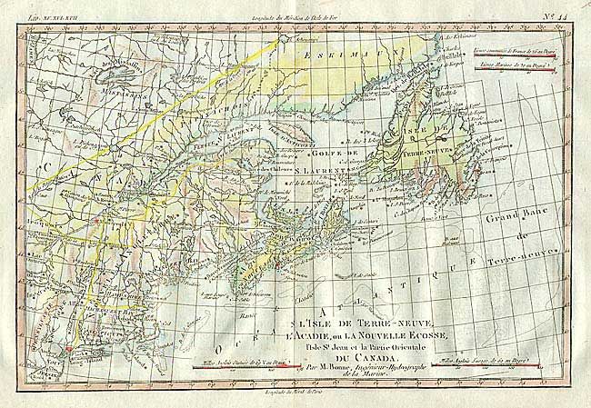
Auction 105, Lot 121
Subject: Canada and United States
Bonne, Rigobert
[Lot of 4], 1779
Size: 12.5 x 8.5 inches (31.8 x 21.6 cm)
Estimate: $600 - $700
Unsold
Closed on 12/3/2003
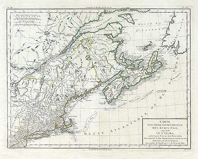
Auction 105, Lot 122
Subject: Canada & United States
Tardieu
Carte de la Partie Septentrionale des Etats Unis, comprenant le Canada, La Nouvelle Ecosse, New Hampshire, Massachuset's Bay, Rhode-Island, Connecticut, New-Yorck, Etat de Vermont avec partie de Pensilvanie et de New-Jersey, 1785
Size: 16.5 x 12.8 inches (41.9 x 32.5 cm)
Estimate: $450 - $550
Sold for: $425
Closed on 12/3/2003
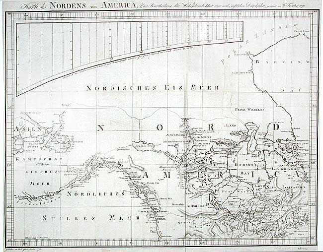
Auction 105, Lot 123
Subject: Canada & United States
Forster, Georg
Karte des Nordens von America…, 1791
Size: 25.4 x 19 inches (64.5 x 48.3 cm)
Estimate: $650 - $750
Sold for: $375
Closed on 12/3/2003
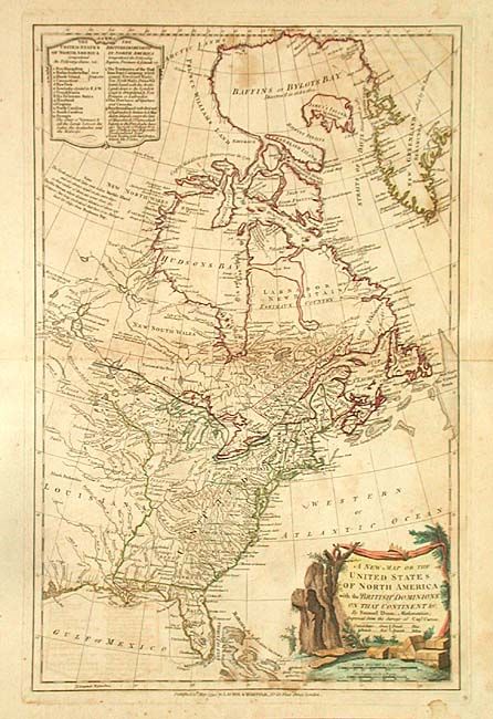
Auction 105, Lot 124
Subject: Canada & United States
Dunn, Samuel
A New Map of the United States of North America with the British Dominions on that Continent &c., 1794
Size: 12 x 18.6 inches (30.5 x 47.2 cm)
Estimate: $700 - $900
Sold for: $500
Closed on 12/3/2003
Auction 105, Lot 125
Subject: Canada & United States
Carey, Mathew
The British possessions in North America from the latest Authorites, 1814
Size: 17 x 14.6 inches (43.2 x 37.1 cm)
Estimate: $120 - $150
Sold for: $110
Closed on 12/3/2003
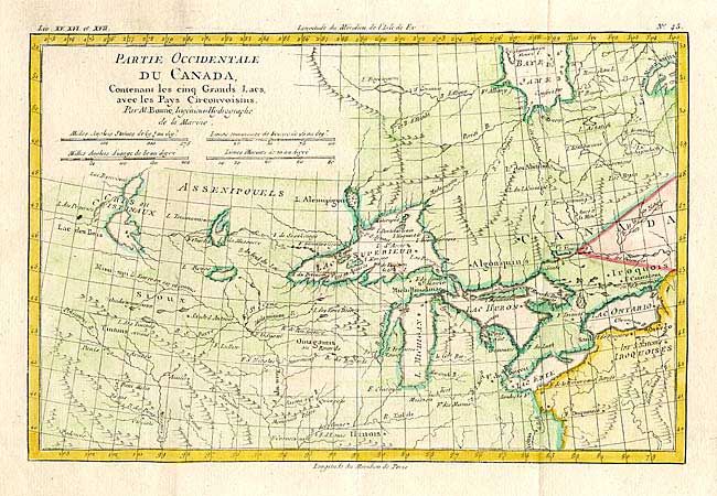
Auction 105, Lot 126
Subject: Canada & Great Lakes
Bonne, Rigobert
Partie Occidentale du Canada, Contenant les cinq Grands Lacs, avec les Pays Circonvoisins, 1780
Size: 12.5 x 8.4 inches (31.8 x 21.3 cm)
Estimate: $275 - $325
Sold for: $200
Closed on 12/3/2003

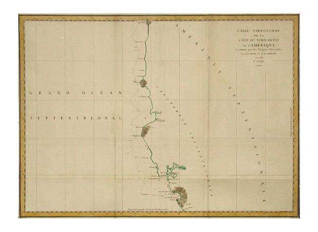
Auction 105, Lot 127
Subject: Western Canada & United States
La Perouse, Comte Jean F. Galoup, de
Carte Particuliere de la Cote du Nord-Ouest de l'Amerique reconnue par les Fregates Francaises la Boussole et l'Astrolabe en 1786. 2e. Feuille, 1799
Size: 27 x 19.6 inches (68.6 x 49.8 cm)
Estimate: $230 - $275
Unsold
Closed on 12/3/2003

Auction 105, Lot 128
Subject: Western Canada & United States
La Perouse, Comte Jean F. Galoup, de
Carte Generale d'une Partie de la Cote du Nord-Ouest de l'Amerique reconnue par les Fregates Francaises la Boussole et l'Astrolabe, 1797
Size: 19.5 x 27 inches (49.5 x 68.6 cm)
Estimate: $300 - $350
Sold for: $220
Closed on 12/3/2003

Auction 105, Lot 129
Subject: Western Canada & United States
Cook, James (Capt.)
Plan der Haven van Samgan Oodha in het Eiland van Oonalaska [together with] Schets van het Kanaal van Nootka, 1800
Size: See Description
Estimate: $100 - $140
Sold for: $80
Closed on 12/3/2003
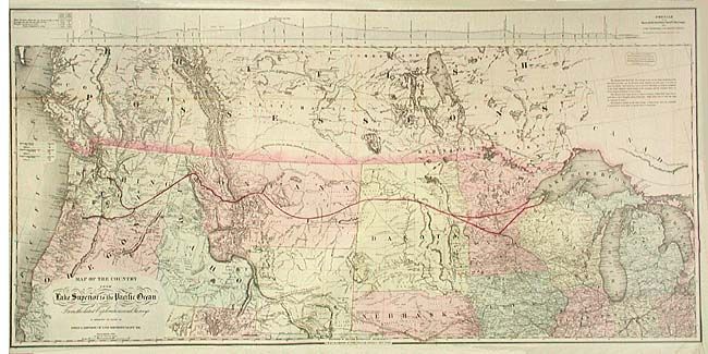
Auction 105, Lot 130
Subject: Western Canada and United States
Colton, G.W. & C.B.
Map of the Country from Lake Superior to the Pacific Ocean. From the latest Explorations and Surveys to accompany the Report of Edwin F. Johnson Chf. Engr. Northern Pacific R.R., 1867
Size: 45 x 21.8 inches (114.3 x 55.4 cm)
Estimate: $500 - $600
Sold for: $600
Closed on 12/3/2003
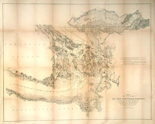
Auction 105, Lot 131
Subject: Canada & United States
U.S. Government
Map Showing the line of Boundary between The United States & British Possessions…, 1868
Size: 36 x 28.4 inches (91.4 x 72.1 cm)
Estimate: $300 - $400
Sold for: $325
Closed on 12/3/2003
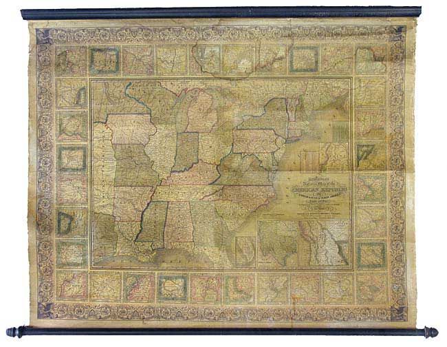
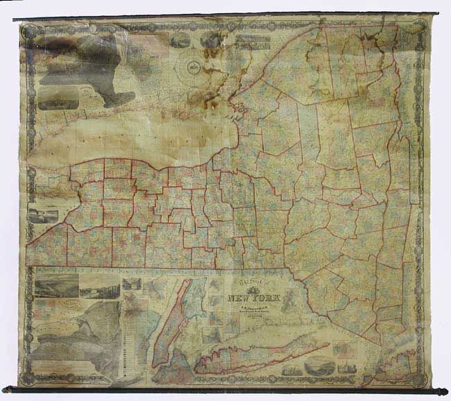
Auction 105, Lot 132
Subject: United States
Mitchell, Samuel Augustus
Mitchell's National Map of the American Republic or United States of North America, Together with Maps of the Vicinities of Thirty-Two of the Principal Cities and Towns in the Union, 1846
Size: 47.5 x 37 inches (120.7 x 94 cm)
Estimate: $1,400 - $1,600
Sold for: $1,600
Closed on 12/3/2003

Auction 105, Lot 133
Subject: United States
Colton, Joseph Hutchins
The United States of America, 1855
Size: 25 x 14.6 inches (63.5 x 37.1 cm)
Estimate: $300 - $350
Sold for: $400
Closed on 12/3/2003
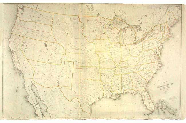
Auction 105, Lot 134
Subject: United States
Burr, David H.
Map of the United States Exhibiting the Several Collection Districts, 1856
Size: 48.5 x 38.5 inches (123.2 x 97.8 cm)
Estimate: $250 - $350
Sold for: $375
Closed on 12/3/2003

Auction 105, Lot 135
Subject: United States
Blackie, W. G. & Son
The United States of North America (General Map), 1860
Size: 19.7 x 13.5 inches (50 x 34.3 cm)
Estimate: $150 - $200
Sold for: $150
Closed on 12/3/2003
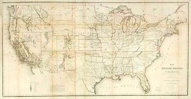
Auction 105, Lot 136
Subject: United States
General Land Office
Map of the United States and Territories Showing the extent of Public Surveys and other details constructed from the Plats and official sources of the General Land Office…, 1866
Size: 54.5 x 28 inches (138.4 x 71.1 cm)
Estimate: $400 - $500
Sold for: $500
Closed on 12/3/2003
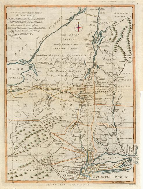
Auction 105, Lot 137
Subject: Eastern United States
Bew, John
A New and Accurate Map of the Province of New York and Part of the Jerseys, New England and Canada…, 1780
Size: 11.2 x 14.6 inches (28.4 x 37.1 cm)
Estimate: $350 - $400
Sold for: $750
Closed on 12/3/2003
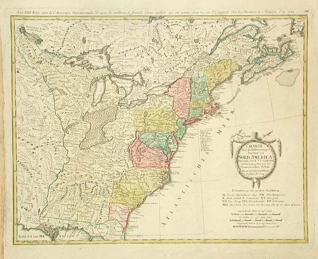
Auction 105, Lot 138
Subject: Eastern United States
Gussefeld/Homann Heirs
Charte uber die XIII Vereinigte Staaten von Nord-America, 1784
Size: 22.7 x 17.5 inches (57.7 x 44.5 cm)
Estimate: $800 - $900
Sold for: $900
Closed on 12/3/2003
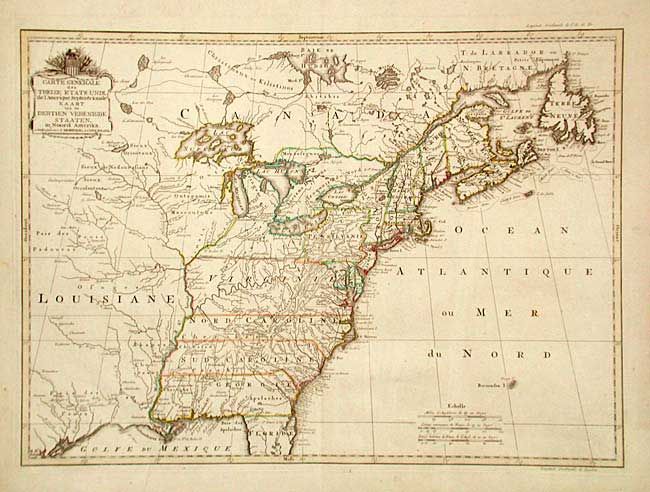
Auction 105, Lot 139
Subject: Eastern United States
Covens & Mortier
Carte Generale des Treize Etats Unis, de l'Amerique Septentrionale / Kaart van de Dertien Verenigde Staaten in Noord Amerika, 1785
Size: 22.5 x 16.2 inches (57.2 x 41.1 cm)
Estimate: $3,000 - $4,000
Unsold
Closed on 12/3/2003
Auction 105, Lot 140
Subject: Eastern United States
Stockdale, John
Part of the United States of North America, 1798
Size: 18.5 x 16.2 inches (47 x 41.1 cm)
Estimate: $300 - $350
Sold for: $350
Closed on 12/3/2003

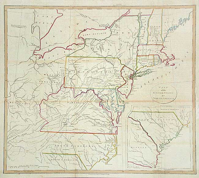
Auction 105, Lot 141
Subject: Eastern United States
Marshall, John
Carte des Provinces Septles. des Etats-Unis, 1807
Size: 19.7 x 12.5 inches (50 x 31.8 cm)
Estimate: $250 - $300
Sold for: $350
Closed on 12/3/2003

Auction 105, Lot 142
Subject: New England
Marshall, John
Kaart van de Landstreek die het Tooneel…Noordelijke Armee,…Wildernis, waar door Generaal Arnold heentrok, om Quebec aan te vallenl, 1809
Size: 8.2 x 10 inches (20.8 x 25.4 cm)
Estimate: $120 - $150
Sold for: $140
Closed on 12/3/2003

Auction 105, Lot 143
Subject: Mid Atlantic
Marshall, John
Kaart van het Land van Rariton Rivier in Oost Jerseij, tot Elk Head in Marijland…, 1809
Size: 15 x 9.6 inches (38.1 x 24.4 cm)
Estimate: $200 - $250
Sold for: $170
Closed on 12/3/2003
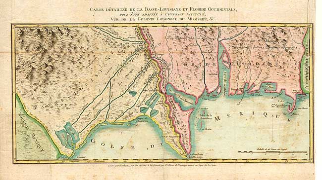
Auction 105, Lot 144
Subject: Southern United States
Blondeau, Alexandre
Carte Detaillee de la Basse-Louisiane et Floride Occidentale…, 1803
Size: 16.2 x 7.6 inches (41.1 x 19.3 cm)
Estimate: $250 - $300
Sold for: $750
Closed on 12/3/2003
Auction 105, Lot 145
Subject: United States - Midwest
U.S. Government
[Route of Col. Dodge's Expedition from Fort Leavenworth to the Rocky Mountains], 1836
Size: 35 x 19.5 inches (88.9 x 49.5 cm)
Estimate: $350 - $450
Sold for: $300
Closed on 12/3/2003

Auction 105, Lot 146
Subject: United States - Midwest
Beadle, D. W.
A New Map of the Great West, 1856
Size: 24.8 x 14.7 inches (63 x 37.3 cm)
Estimate: $150 - $200
Sold for: $170
Closed on 12/3/2003
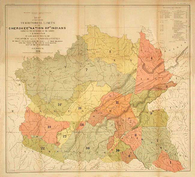
Auction 105, Lot 147
Subject: United States - Central & Oklahoma
Royce, C. C.
[Pair] Map of the Former Territorial Limits of the Cherokee Nation of Indians [together with] Map Showing the Territory Originally Assigned to the Cherokee Nation of Indians West of the Mississippi…, 1884
Size: See Description
Estimate: $350 - $450
Sold for: $250
Closed on 12/3/2003
Auction 105, Lot 148
Subject: United States - Western
La Perouse, Comte Jean F. Galoup, de
Carte Particuliere de la Cote du Nord-Ouest de l'Amerique reconnue par les Fregates Francaises la Boussole et l'Astrolabe en 1786. 3e. Feuille, 1799
Size: 27 x 19.6 inches (68.6 x 49.8 cm)
Estimate: $250 - $300
Unsold
Closed on 12/3/2003
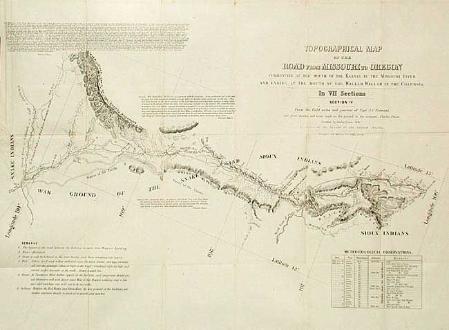
Auction 105, Lot 149
Subject: Western United States
Fremont/Preuss
Topographical Map of the Road from Missouri to Oregon in Seven Sections, 1846
Size: See Description
Estimate: $2,000 - $3,000
Sold for: $1,700
Closed on 12/3/2003
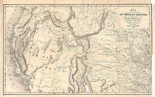
Auction 105, Lot 150
Subject: Western United States
Putnam/Colton
Map to Illustrate Capt. Bonneville's Adventures among the Rocky Mountains, 1849
Size: 18.2 x 11 inches (46.2 x 27.9 cm)
Estimate: $300 - $400
Sold for: $375
Closed on 12/3/2003
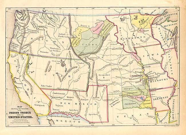
Auction 105, Lot 151
Subject: Western United States
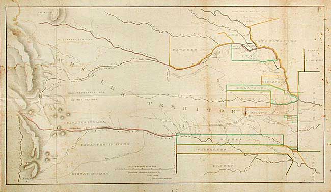
Eastman, Seth (Capt)
[Lot of 2] Map showing the location of the Indian Tribes within the United States [together with] Map of the Indian Colonies West of Missouri and Arkansas, 1852-53
Size: 11 x 7.5 inches (27.9 x 19.1 cm)
Estimate: $200 - $275
Sold for: $180
Closed on 12/3/2003
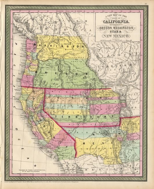
Auction 105, Lot 152
Subject: Western United States
Thomas, Cowperthwait & Co.
A New Map of the State of California, the Territories of Oregon, Washington, Utah & New Mexico, 1853
Size: 12.7 x 15.5 inches (32.3 x 39.4 cm)
Estimate: $500 - $600
Sold for: $550
Closed on 12/3/2003
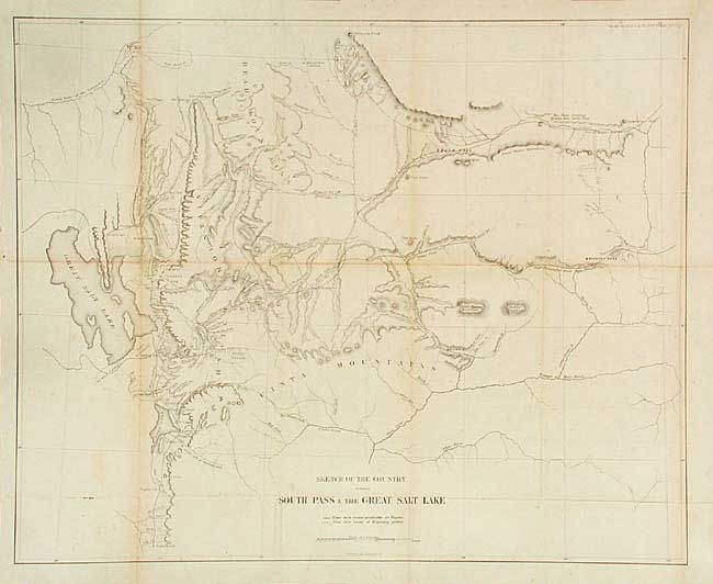
Auction 105, Lot 153
Subject: Utah and Wyoming
U.S. Government
Sketch of the Country between South Pass & the Great Salt Lake, 1857
Size: 21.6 x 17.5 inches (54.9 x 44.5 cm)
Estimate: $100 - $140
Sold for: $110
Closed on 12/3/2003

Auction 105, Lot 154
Subject: Western United States
U.S. War Dept.
Map of the Nez Perce Indian Campaign. Bbr. Gen. O.O. Howard, Commanding, 1877
Size: 46 x 21.4 inches (116.8 x 54.4 cm)
Estimate: $350 - $400
Sold for: $250
Closed on 12/3/2003
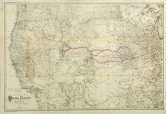
Auction 105, Lot 155
Subject: Western United States
Colton, G.W. & C.B.
Map Showing the Union Pacific Railway and Connecting Railroads, 1884
Size: 33 x 22 inches (83.8 x 55.9 cm)
Estimate: $300 - $350
Sold for: $170
Closed on 12/3/2003
129 lots
Page 1 of 3