Filtered by Category:United States(Show All Categories)
Showing results for:Auction 104
Catalog Archive
143 lots
Page 1 of 3
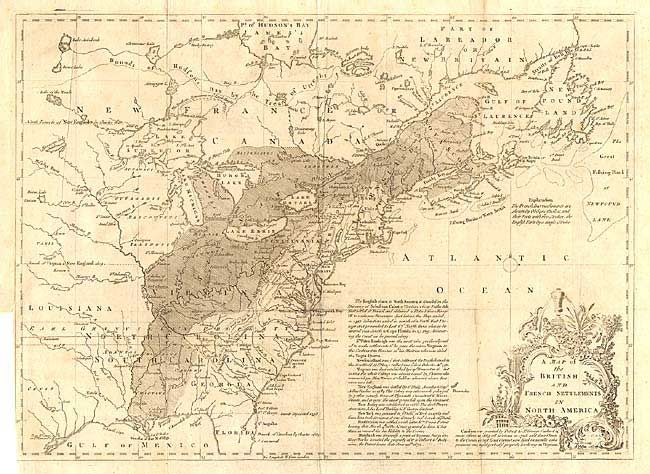
Auction 104, Lot 120
Subject: Colonial United States and Canada
Lodge, John
A Map of the British and French Settlements in North America, 1755
Size: 15 x 11 inches (38.1 x 27.9 cm)
Estimate: $350 - $400
Sold for: $300
Closed on 9/10/2003
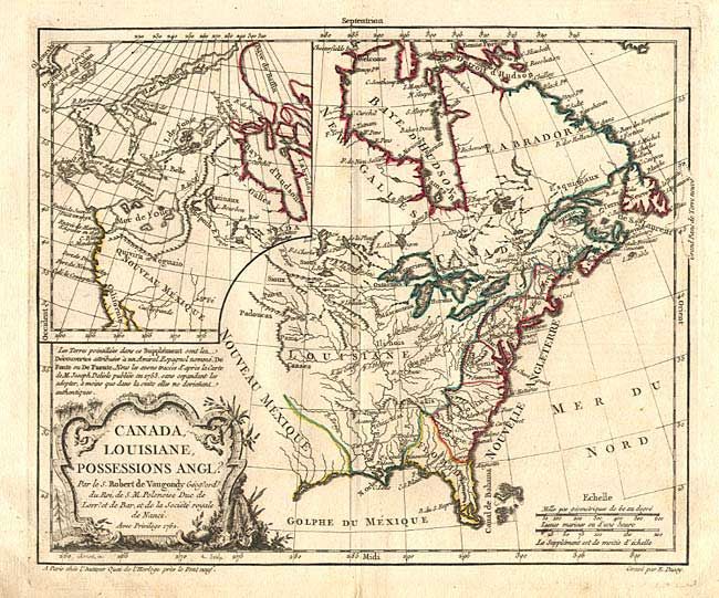
Auction 104, Lot 121
Subject: Colonial United States and Canada
Robert de Vaugondy, Didier
Canada, Louisiane, Possessions Angl?, 1762
Size: 11.4 x 9.5 inches (29 x 24.1 cm)
Estimate: $300 - $350
Sold for: $220
Closed on 9/10/2003
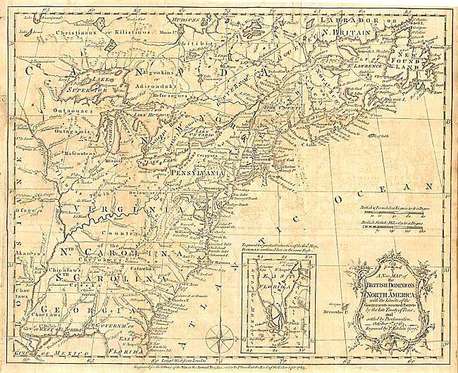
Auction 104, Lot 122
Subject: Colonial United States and Canada
Kitchin, Thomas
A New Map of the British Dominions in North America; with the Limits of the Governments Annexed thereto by the Late Treaty of Peace, and Settled by Proclamation, October 7th, 1763, 1763
Size: 11.9 x 9.5 inches (30.2 x 24.1 cm)
Estimate: $275 - $350
Sold for: $200
Closed on 9/10/2003
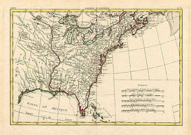
Auction 104, Lot 123
Subject: Colonial Midwest
Bonne, Rigobert
[Partie de L'Amerique Septentrionale…], 1771
Size: 17.1 x 11.6 inches (43.4 x 29.5 cm)
Estimate: $250 - $300
Sold for: $275
Closed on 9/10/2003
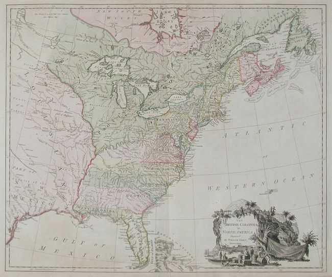
Auction 104, Lot 124
Subject: Colonial United States and Canada
Faden, William
The British Colonies in North America, 1777
Size: 24.5 x 20.5 inches (62.2 x 52.1 cm)
Estimate: $3,000 - $3,500
Sold for: $2,500
Closed on 9/10/2003
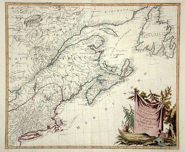
Auction 104, Lot 125
Subject: Colonial Great Lakes and Canada
Robert de Vaugondy, Didier
Partie de l'Amerique Septent? qui comprend la Nouvelle France ou le Canada, 1755
Size: 23.7 x 18.8 inches (60.2 x 47.8 cm)
Estimate: $750 - $850
Sold for: $550
Closed on 9/10/2003
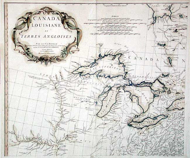
Auction 104, Lot 126
Subject: Colonial Great Lakes
D'Anville/Santini
Canada Louisiane et Terres Angloises, 1755
Size: 21.8 x 18.7 inches (55.4 x 47.5 cm)
Estimate: $450 - $500
Sold for: $425
Closed on 9/10/2003
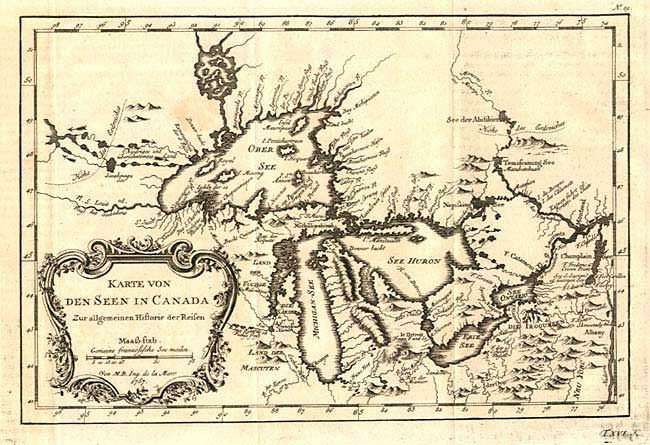
Auction 104, Lot 127
Subject: Colonial Great Lakes
Bellin, Jacques Nicolas
Karte von den Seen in Canada Zur allgemeinen Historie der Reisen, 1757
Size: 11.2 x 7.5 inches (28.4 x 19.1 cm)
Estimate: $350 - $400
Sold for: $325
Closed on 9/10/2003
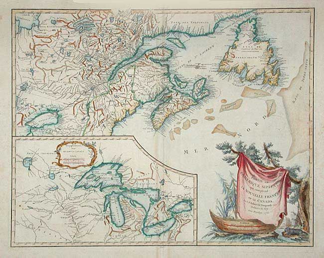
Auction 104, Lot 128
Subject: Colonial New England & Canada
D'Anville/Santini
Partie Orientale du Canada, avec la Nouvelle Angleterre, l'Acadie, et la Terre-Neuve, 1776
Size: 22.7 x 19.2 inches (57.7 x 48.8 cm)
Estimate: $750 - $850
Sold for: $550
Closed on 9/10/2003
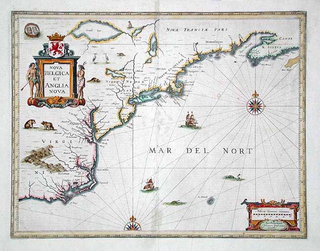
Auction 104, Lot 129
Subject: Colonial New England
Jansson, Jan
Nova Belgica et Anglia Nova, 1647
Size: 19.7 x 15.2 inches (50 x 38.6 cm)
Estimate: $2,300 - $2,500
Sold for: $2,000
Closed on 9/10/2003
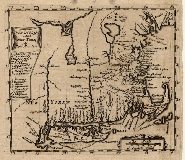
Auction 104, Lot 130
Subject: Colonial New England
Morden, Robert
New England and New York, 1680
Size: 4.9 x 4.2 inches (12.4 x 10.7 cm)
Estimate: $500 - $600
Sold for: $425
Closed on 9/10/2003
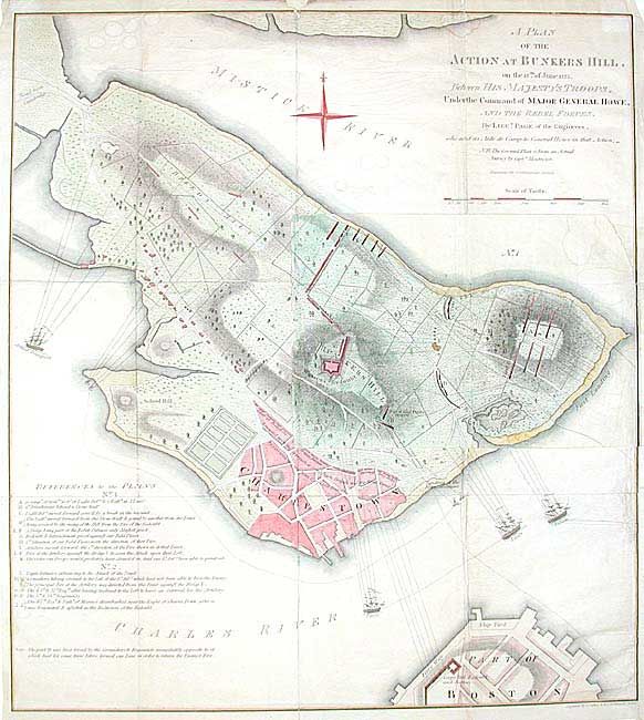
Auction 104, Lot 131
Subject: Massachusetts
Faden, William
A Plan of the Action at Bunkers Hill, on the 17th of June 1775 Between His. Majesty's Troops, Under the Command of Major General Howe, and the Rebel Forces, 1849
Size: 16.6 x 18.2 inches (42.2 x 46.2 cm)
Estimate: $400 - $500
Sold for: $300
Closed on 9/10/2003
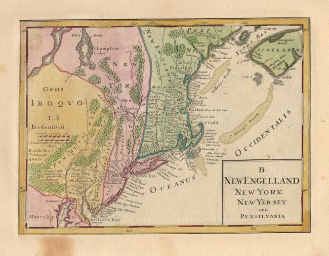
Auction 104, Lot 132
Subject: Colonial New England
Homann Heirs
B. New Engelland New York New Yersey und Pensilvania, 1740
Size: 10.7 x 8 inches (27.2 x 20.3 cm)
Estimate: $250 - $350
Sold for: $210
Closed on 9/10/2003
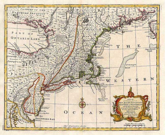
Auction 104, Lot 133
Subject: Colonial New England
Bowen, Emanuel
A New and Accurate Map of New Jersey, Pennsilvania, New York and New England, with the adjacent Countries…, 1747
Size: 17 x 13.7 inches (43.2 x 34.8 cm)
Estimate: $550 - $650
Sold for: $750
Closed on 9/10/2003
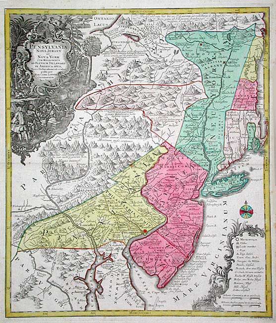
Auction 104, Lot 134
Subject: Colonial Mid Atlantic
Seutter/Lotter
Pensylvania Nova Jersey et Nova York cum Regionibus ad Fluvium Delaware in America Sitis…, 1760
Size: 19.4 x 22.5 inches (49.3 x 57.2 cm)
Estimate: $2,500 - $2,750
Sold for: $2,000
Closed on 9/10/2003
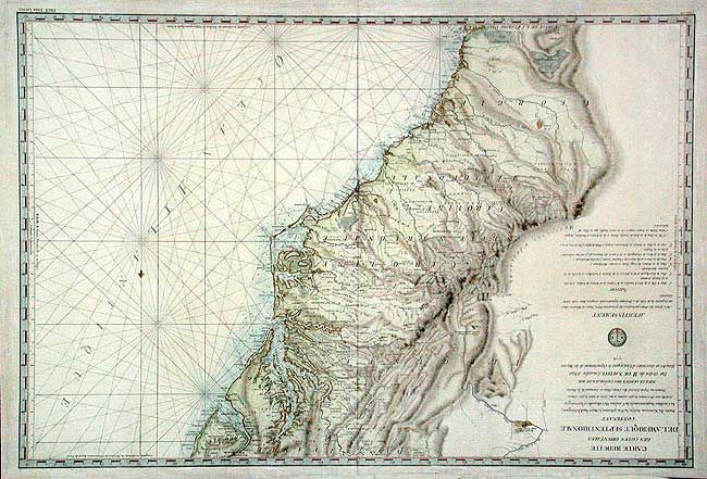
Auction 104, Lot 135
Subject: Colonial Mid-Atlantic and Southeast
Sartine
Carte Reduite des Cotes Orientales de l'Amerique Septentrionale Contenant Partie du Nouveau Jersey, La Pen-sylvanie, le Mary-land, la Virginie, la Caroline Septentrionale, la Caroline Meridionale et la Georgie…, 1778
Size: 34.4 x 23.4 inches (87.4 x 59.4 cm)
Estimate: $1,800 - $2,200
Sold for: $1,300
Closed on 9/10/2003
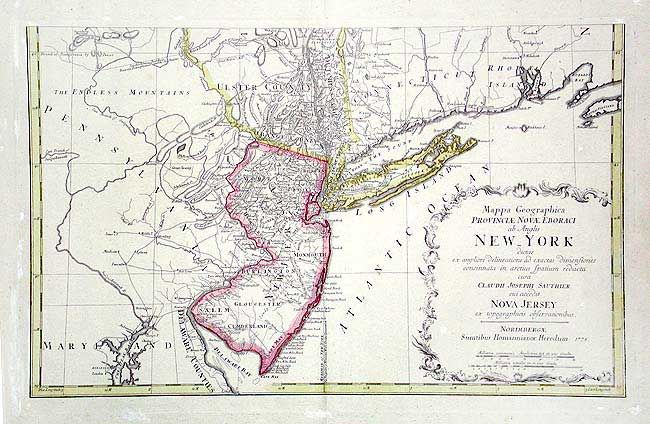
Auction 104, Lot 136
Subject: Colonial Mid Atlantic
Sauthier, Claude Joseph
Mappa Geographica Provinciae Novae Eboraci ab Anglis New-York…Nova Jersey ex topographicis observationibus, 1778
Size: 22.5 x 14.4 inches (57.2 x 36.6 cm)
Estimate: $500 - $600
Sold for: $375
Closed on 9/10/2003
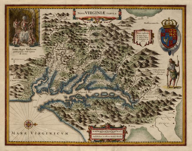
Auction 104, Lot 137
Subject: Colonial Southeast
Hondius, Henricus
Nova Virginiae Tabula, 1630-33
Size: 19.4 x 15 inches (49.3 x 38.1 cm)
Estimate: $2,500 - $3,000
Sold for: $4,500
Closed on 9/10/2003
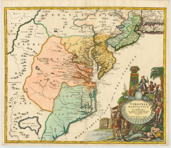
Auction 104, Lot 138
Subject: Colonial Southeast
Homann, Johann Baptist
Virginia Marylandia et Carolina in America Septentrionali Britannorum industria excultae, 1765
Size: 22.5 x 19 inches (57.2 x 48.3 cm)
Estimate: $1,800 - $2,200
Unsold
Closed on 9/10/2003
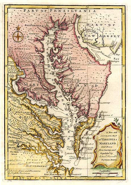
Auction 104, Lot 139
Subject: Colonial Mid-Atlantic
Bowen, Emanuel
A New and Accurate Map of Virginia & Maryland, Laid Down from Surveys and Regulated by Astronl. Observatns., 1757
Size: 9 x 12.8 inches (22.9 x 32.5 cm)
Estimate: $650 - $750
Sold for: $850
Closed on 9/10/2003
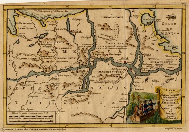
Auction 104, Lot 140
Subject: Colonial Louisiana
Aa, Pieter van der
Land en Volk-Ontdekking in't Noorder gedeelte van America, door P. Marquette en Joliet, 1708
Size: 9 x 6 inches (22.9 x 15.2 cm)
Estimate: $900 - $1,000
Sold for: $650
Closed on 9/10/2003
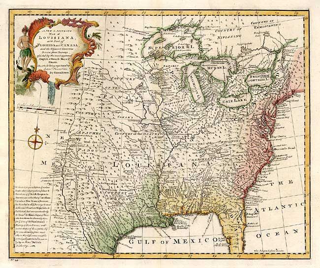
Auction 104, Lot 141
Subject: Colonial Louisiana
Bowen, Emanuel
A New & Accurate Map of Louisiana, with Part of Florida and Canada, and the Adjacent Countries Drawn from Surveys, assisted by the most approved English & French Maps & Charts, 1757
Size: 16.5 x 13.5 inches (41.9 x 34.3 cm)
Estimate: $700 - $900
Sold for: $500
Closed on 9/10/2003
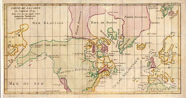
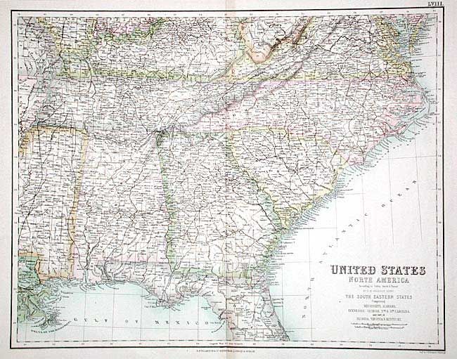
Auction 104, Lot 154
Subject: Canada & United States
Robert de Vaugondy, Didier
Partie de la Carte du Capitaine Cluny Auteur d'un ouvrage anglois intitule American Traveller, 1769
Size: 16 x 8.4 inches (40.6 x 21.3 cm)
Estimate: $200 - $240
Sold for: $150
Closed on 9/10/2003
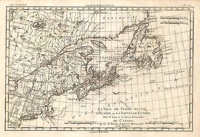
Auction 104, Lot 155
Subject: Canada & United States
Bonne, Rigobert
L'Isle de Terre-Neuve, L'Acadie, ou la Nouvelle Ecosse, l'Isle St Jean et la Partie Orientale du Canada, 1775
Size: 12.7 x 8.4 inches (32.3 x 21.3 cm)
Estimate: $100 - $150
Unsold
Closed on 9/10/2003
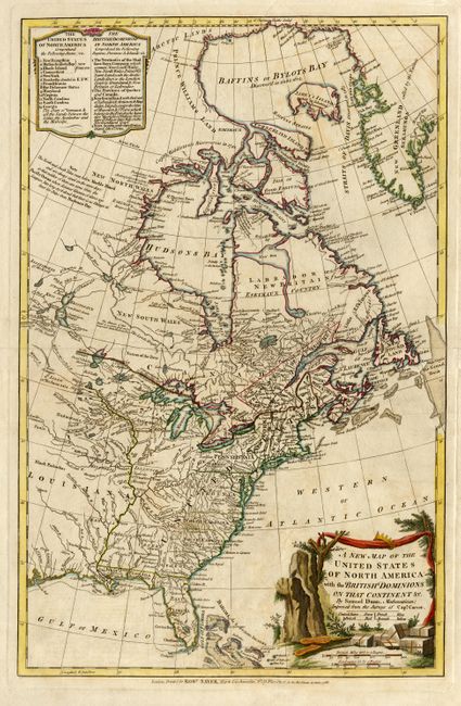
Auction 104, Lot 156
Subject: Canada & United States
Dunn, Samuel
A New Map of the United States of North America with the British Dominions on that Continent &c., 1786
Size: 12.3 x 19 inches (31.2 x 48.3 cm)
Estimate: $1,100 - $1,400
Sold for: $1,200
Closed on 9/10/2003
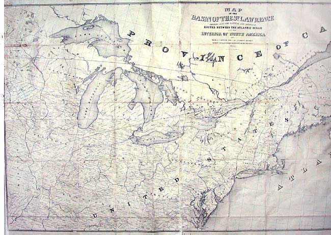
Auction 104, Lot 157
Subject: Canada & United States
Andrews, Israel D.
Map of the Basin of the St. Lawrence showing also the Natural and Artificial Routes between the Atlantic Ocean and the Interior of North America, 1852
Size: 75 x 35 inches (190.5 x 88.9 cm)
Estimate: $300 - $350
Unsold
Closed on 9/10/2003
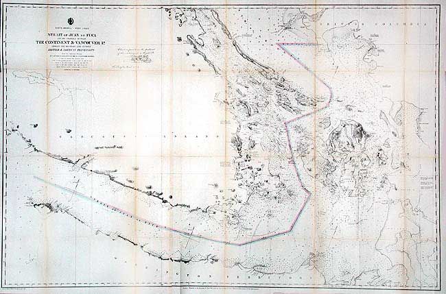
Auction 104, Lot 158
Subject: Washington & British Columbia
U.S. Coast Survey
North America - West Coast: Strait of Juan de Fuca and the Channels Between the Continent & Vancouver Id. Showing the Boundary Line Between British & American Possessions, 1873
Size: 44.7 x 28.7 inches (113.5 x 72.9 cm)
Estimate: $300 - $400
Sold for: $240
Closed on 9/10/2003
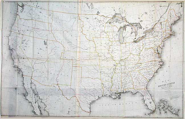
Auction 104, Lot 159
Subject: United States
Burr, David H.
Map of the United States Exhibiting the Several Collection Districts, 1856
Size: 49 x 31.5 inches (124.5 x 80 cm)
Estimate: $300 - $350
Sold for: $300
Closed on 9/10/2003
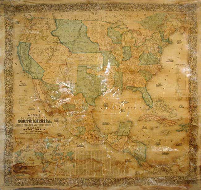
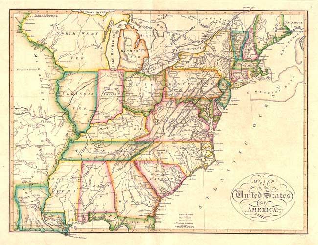
Auction 104, Lot 160
Subject: United States - Wall Map
Monk, Jacob
Monk's New American Map exhibiting the larger portion of North America; embracing the United States and Territories, Mexico and Central America including the West India Islands, Canadas, New Brunswick, Nova Scotia, 1856
Size: 57 x 60 inches (144.8 x 152.4 cm)
Estimate: $1,000 - $1,200
Sold for: $750
Closed on 9/10/2003
Auction 104, Lot 161
Subject: United States
Colton, Joseph Hutchins
[Lot of 5], 1857
Size: 14.7 x 11.7 inches (37.3 x 29.7 cm)
Estimate: $500 - $600
Unsold
Closed on 9/10/2003
Auction 104, Lot 162
Subject: United States
Cornell, Sarah Sophia
[Lot of 3], 1864
Size: 12.5 x 20 inches (31.8 x 50.8 cm)
Estimate: $60 - $80
Sold for: $0
Closed on 9/10/2003
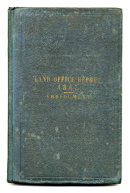
Auction 104, Lot 163
Subject: United States
General Land Office
Map of the United States and Territories, Showing the extent of Public Surveys…[together with] Report of The Commissioner of the General Land Office, 1867
Size: 55 x 28 inches (139.7 x 71.1 cm)
Estimate: $300 - $400
Sold for: $450
Closed on 9/10/2003
Auction 104, Lot 164
Subject: United States
Various
[Lot of 3], 1870
Size: See Description
Estimate: $200 - $250
Unsold
Closed on 9/10/2003
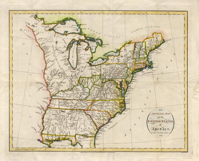
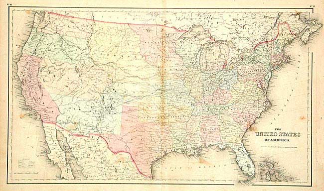
Auction 104, Lot 165
Subject: United States - Eastern
Russell, John C.
An Accurate Map of the United States of America according to the Treaty of Peace of 1783, 1794
Size: 18.4 x 14.4 inches (46.7 x 36.6 cm)
Estimate: $500 - $600
Sold for: $325
Closed on 9/10/2003
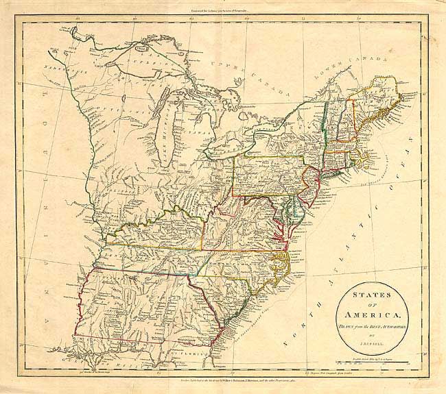
Auction 104, Lot 166
Subject: United States - Eastern
Russell, John C.
States of America, Drawn from the Best Authorities, 1811
Size: 17.5 x 15.5 inches (44.5 x 39.4 cm)
Estimate: $300 - $400
Sold for: $220
Closed on 9/10/2003
Auction 104, Lot 167
Subject: Eastern United States
Carey, Mathew
Map of the United States of America, 1818
Size: 17.4 x 13.4 inches (44.2 x 34 cm)
Estimate: $400 - $500
Sold for: $850
Closed on 9/10/2003
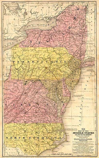
Auction 104, Lot 168
Subject: United States - Eastern
Mitchell, Samuel Augustus
[Lot of 2] Map of the Middle States and Part of the Southern [together with] Map of the Chief Part of the Western States and Part of Virginia, 1839
Size: 16.6 x 10.5 inches (42.2 x 26.7 cm)
Estimate: $90 - $140
Sold for: $65
Closed on 9/10/2003
Auction 104, Lot 169
Subject: United States - Eastern
Thomas, Cowperthwait & Co.
[Lot of 6], 1848
Size: 12.7 x 15.5 inches (32.3 x 39.4 cm)
Estimate: $250 - $300
Sold for: $275
Closed on 9/10/2003
Auction 104, Lot 170
Subject: United States - Eastern
Andrews, Israel D.
Map of the Railroads in the United States in operation and progress…, 1853
Size: 42 x 39.5 inches (106.7 x 100.3 cm)
Estimate: $300 - $350
Sold for: $220
Closed on 9/10/2003
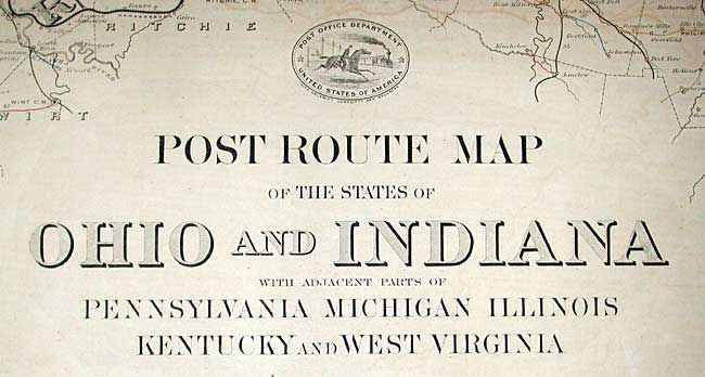
Auction 104, Lot 171
Subject: United States - Eastern
U.S. Government
[Lot of 11 Post Route Maps with Letter], 1879
Size: See Description
Estimate: $4,000 - $5,000
Sold for: $3,000
Closed on 9/10/2003
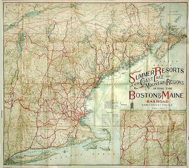
Auction 104, Lot 172
Subject: United States - Northeast
Matthews-Northrup Co
Summer Resorts of the Coast, Lake and Mountain Regions along the Boston & Maine Railroad and Connections, 1912
Size: 28.5 x 25.5 inches (72.4 x 64.8 cm)
Estimate: $120 - $150
Sold for: $90
Closed on 9/10/2003
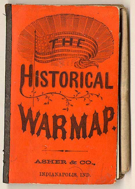
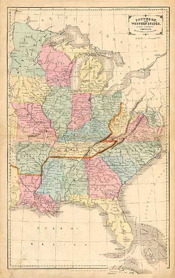
Auction 104, Lot 173
Subject: United States - Southern
Asher & Company
The Historical War Map, 1863
Size: 23.7 x 24.2 inches (60.2 x 61.5 cm)
Estimate: $550 - $600
Sold for: $400
Closed on 9/10/2003
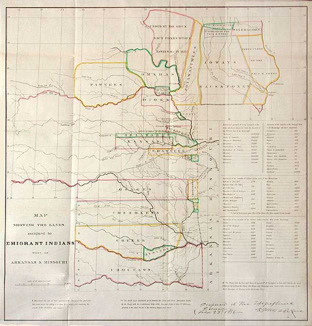
Auction 104, Lot 174
Subject: United States - Central
U.S. War Dept.
Map Showing the Lands Assigned to Emigrant Indians West of Arkansas & Missouri, 1836
Size: 17.7 x 18.5 inches (45 x 47 cm)
Estimate: $375 - $450
Sold for: $350
Closed on 9/10/2003
Auction 104, Lot 175
Subject: United States - Midwest
U.S. Government
[Route of Col. Dodge's Expedition from Fort Leavenworth to the Rocky Mountains], 1836
Size: 34.5 x 19.5 inches (87.6 x 49.5 cm)
Estimate: $450 - $550
Sold for: $475
Closed on 9/10/2003
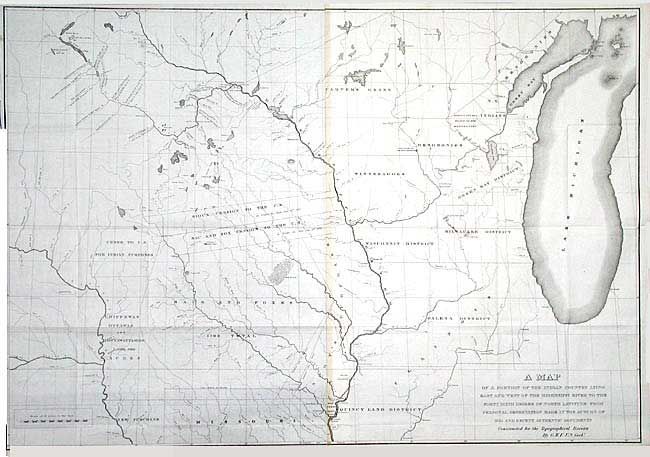
Auction 104, Lot 176
Subject: United States - Central
U.S. Government
A Map of a Portion of the Indian Country Lying East and West of the Mississippi River to the Forty Sixth Degree of North Latitude from Personal Observation Made in the Autumn of 1835 and Recent Authentic Documents…, 1836
Size: 37.9 x 26.2 inches (96.3 x 66.5 cm)
Estimate: $275 - $350
Sold for: $275
Closed on 9/10/2003
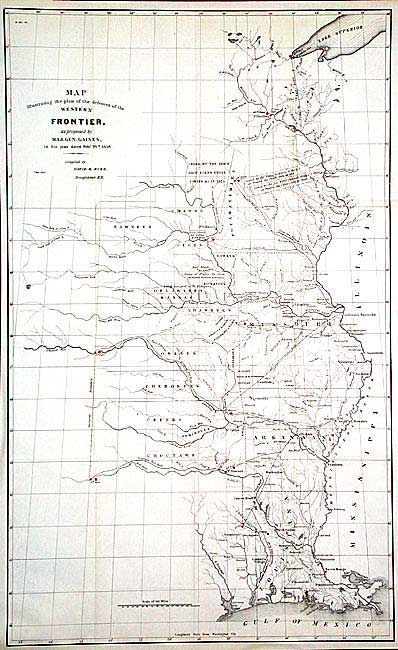
Auction 104, Lot 177
Subject: United States - Central
Various
[Lot of 3] Map Illustrating the plan of the defences of the Western & North-Western Frontier…, 1837-38
Size: 15.5 x 21.5 inches (39.4 x 54.6 cm)
Estimate: $850 - $1,000
Sold for: $535
Closed on 9/10/2003
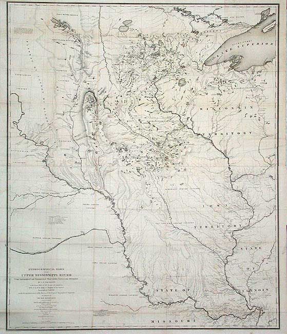
Auction 104, Lot 178
Subject: United States - Central
U.S. War Dept.
Hydrographical Basin of the Upper Mississippi River from Astronomical and Barometrical Observations Surveys and Information…, 1843
Size: 30.2 x 36 inches (76.7 x 91.4 cm)
Estimate: $350 - $450
Sold for: $650
Closed on 9/10/2003
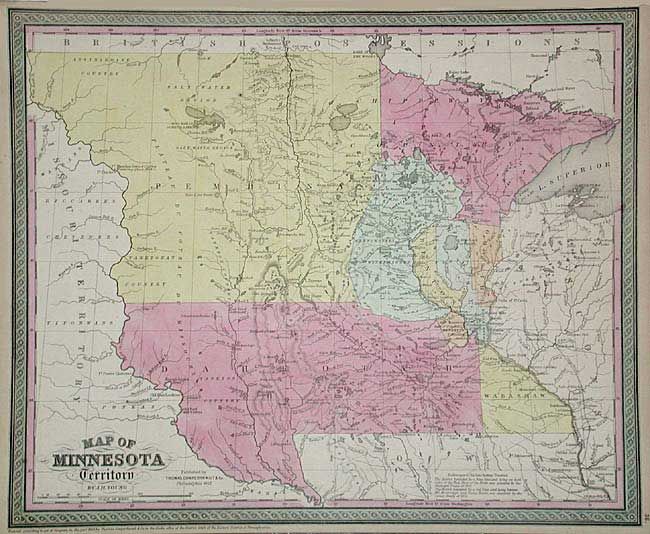
Auction 104, Lot 179
Subject: Minnesota and Dakota Territory
Thomas, Cowperthwait & Co.
Map of Minnesota Territory, 1853
Size: 16 x 12.8 inches (40.6 x 32.5 cm)
Estimate: $200 - $250
Sold for: $275
Closed on 9/10/2003
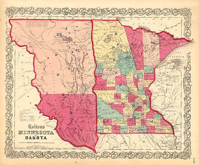
Auction 104, Lot 180
Subject: Minnesota and Dakota Territory
Colton, Joseph Hutchins
Colton's Minnesota and Dakota, 1855
Size: 16 x 13 inches (40.6 x 33 cm)
Estimate: $100 - $140
Sold for: $85
Closed on 9/10/2003
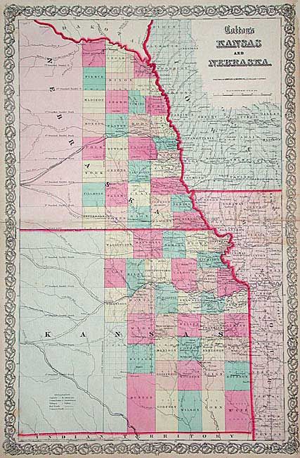
Auction 104, Lot 181
Subject: Kansas and Nebraska
Colton, Joseph Hutchins
Kansas and Nebraska, 1857
Size: 17 x 25.4 inches (43.2 x 64.5 cm)
Estimate: $120 - $180
Sold for: $60
Closed on 9/10/2003
143 lots
Page 1 of 3