Filtered by Category:Canada(Show All Categories)
Showing results for:Auction 104
Catalog Archive
26 lots
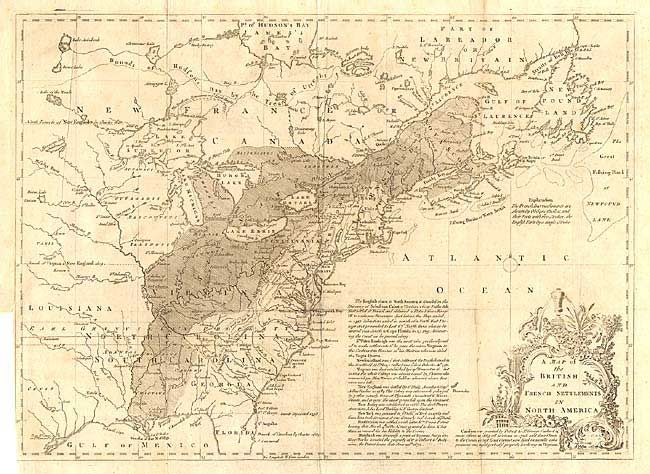
Auction 104, Lot 120
Subject: Colonial United States and Canada
Lodge, John
A Map of the British and French Settlements in North America, 1755
Size: 15 x 11 inches (38.1 x 27.9 cm)
Estimate: $350 - $400
Sold for: $300
Closed on 9/10/2003
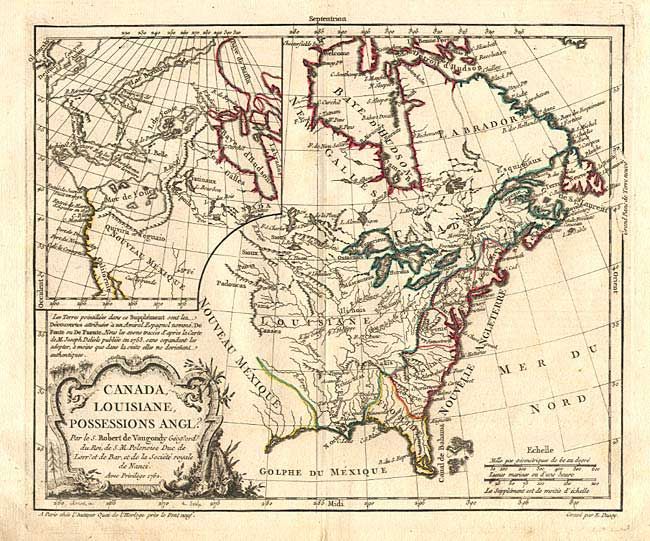
Auction 104, Lot 121
Subject: Colonial United States and Canada
Robert de Vaugondy, Didier
Canada, Louisiane, Possessions Angl?, 1762
Size: 11.4 x 9.5 inches (29 x 24.1 cm)
Estimate: $300 - $350
Sold for: $220
Closed on 9/10/2003
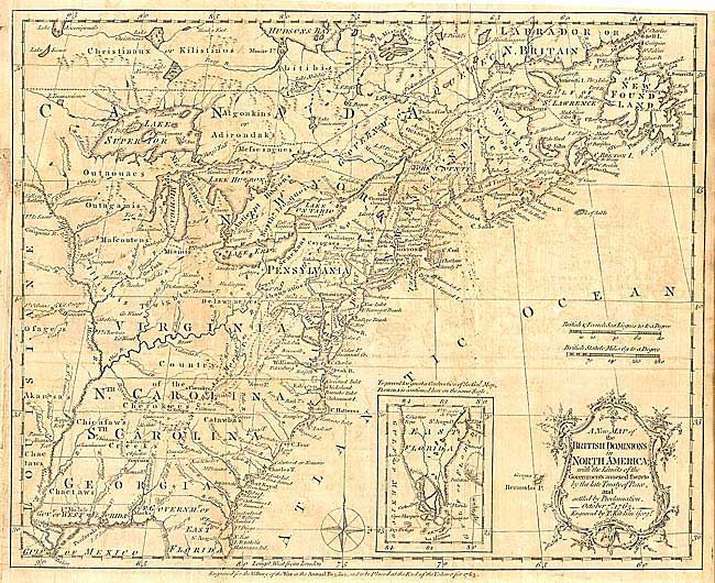
Auction 104, Lot 122
Subject: Colonial United States and Canada
Kitchin, Thomas
A New Map of the British Dominions in North America; with the Limits of the Governments Annexed thereto by the Late Treaty of Peace, and Settled by Proclamation, October 7th, 1763, 1763
Size: 11.9 x 9.5 inches (30.2 x 24.1 cm)
Estimate: $275 - $350
Sold for: $200
Closed on 9/10/2003
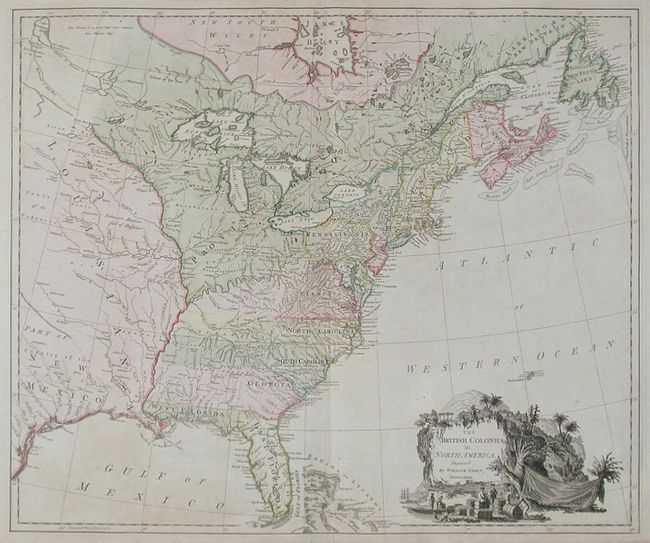
Auction 104, Lot 124
Subject: Colonial United States and Canada
Faden, William
The British Colonies in North America, 1777
Size: 24.5 x 20.5 inches (62.2 x 52.1 cm)
Estimate: $3,000 - $3,500
Sold for: $2,500
Closed on 9/10/2003
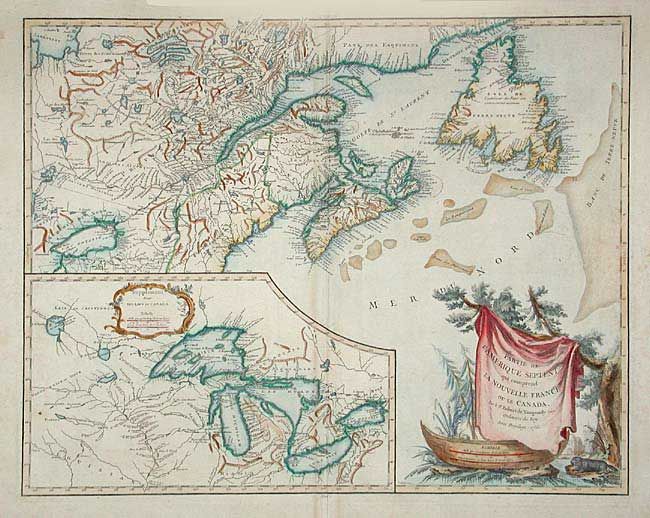
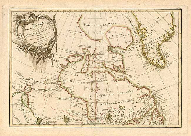
Auction 104, Lot 125
Subject: Colonial Great Lakes and Canada
Robert de Vaugondy, Didier
Partie de l'Amerique Septent? qui comprend la Nouvelle France ou le Canada, 1755
Size: 23.7 x 18.8 inches (60.2 x 47.8 cm)
Estimate: $750 - $850
Sold for: $550
Closed on 9/10/2003
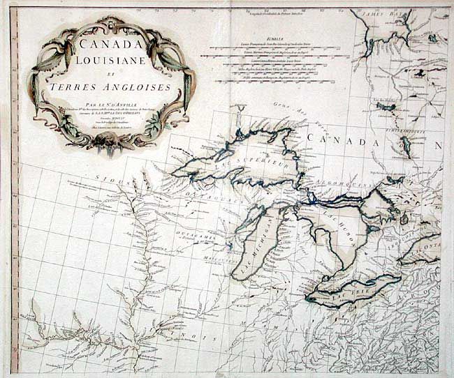
Auction 104, Lot 126
Subject: Colonial Great Lakes
D'Anville/Santini
Canada Louisiane et Terres Angloises, 1755
Size: 21.8 x 18.7 inches (55.4 x 47.5 cm)
Estimate: $450 - $500
Sold for: $425
Closed on 9/10/2003
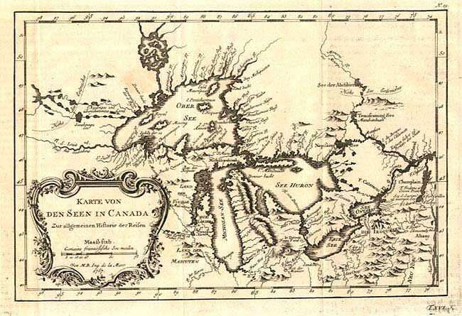
Auction 104, Lot 127
Subject: Colonial Great Lakes
Bellin, Jacques Nicolas
Karte von den Seen in Canada Zur allgemeinen Historie der Reisen, 1757
Size: 11.2 x 7.5 inches (28.4 x 19.1 cm)
Estimate: $350 - $400
Sold for: $325
Closed on 9/10/2003
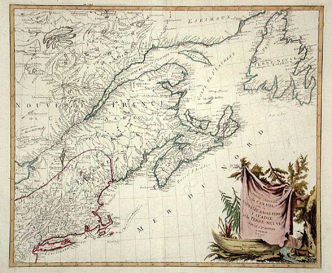
Auction 104, Lot 128
Subject: Colonial New England & Canada
D'Anville/Santini
Partie Orientale du Canada, avec la Nouvelle Angleterre, l'Acadie, et la Terre-Neuve, 1776
Size: 22.7 x 19.2 inches (57.7 x 48.8 cm)
Estimate: $750 - $850
Sold for: $550
Closed on 9/10/2003
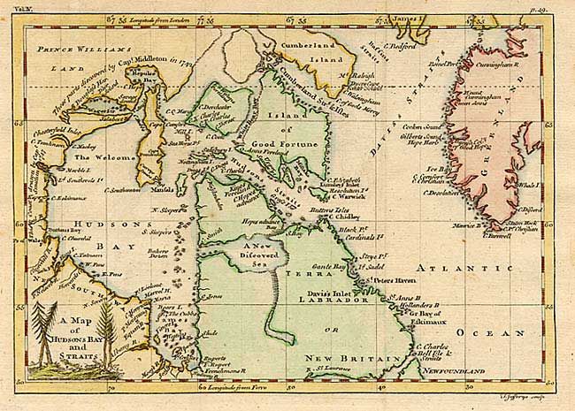
Auction 104, Lot 142
Subject: Canada
Jefferys & Faden
A Map of Hudsons Bay and Straits, 1756
Size: 8.4 x 5.9 inches (21.3 x 15 cm)
Estimate: $80 - $100
Sold for: $110
Closed on 9/10/2003
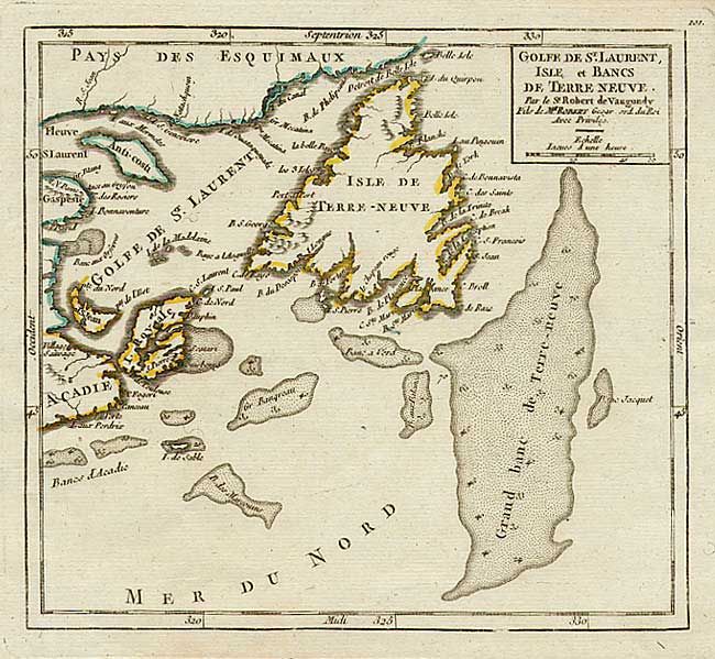
Auction 104, Lot 143
Subject: Canada
Robert de Vaugondy, Didier
Golfe de St. Laurent, Isle et Bancs de Terre Neuve, 1760
Size: 7 x 6.4 inches (17.8 x 16.3 cm)
Estimate: $100 - $150
Sold for: $85
Closed on 9/10/2003
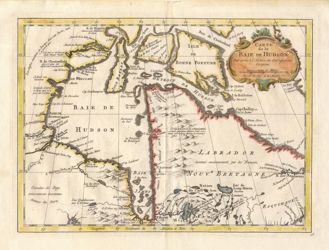
Auction 104, Lot 144
Subject: Canada
Bellin, Jacques Nicolas
[Lot of 2] Carte de la Baie de Hudson [together with] Idee de la Rade du Mingan, 1762-74
Size: 11.6 x 8.5 inches (29.5 x 21.6 cm)
Estimate: $90 - $120
Sold for: $85
Closed on 9/10/2003
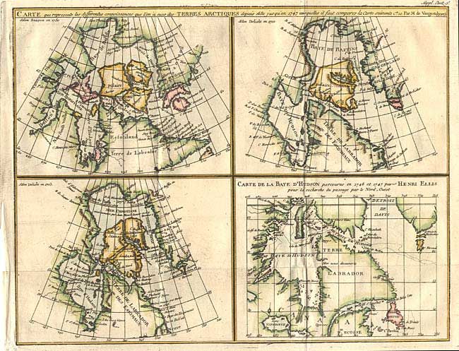
Auction 104, Lot 145
Subject: Canada
Robert de Vaugondy, Didier
Carte qui represente les differentes connoissances que l'on a eues des Terres Arctiques depuis 1650, jusqu ' en 1747…, 1773
Size: 14.7 x 11.5 inches (37.3 x 29.2 cm)
Estimate: $200 - $240
Sold for: $100
Closed on 9/10/2003
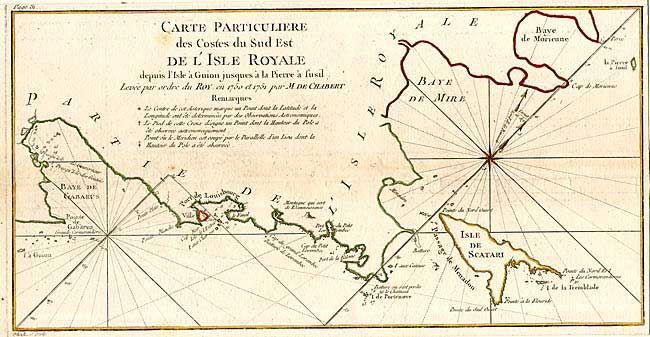
Auction 104, Lot 146
Subject: Canada - Nova Scotia
Chabert de Cogolin, Joseph Bernard Marquis de
[Lot of 4], 1780
Size: 12.9 x 6.4 inches (32.8 x 16.3 cm)
Estimate: $300 - $350
Unsold
Closed on 9/10/2003
Auction 104, Lot 147
Subject: Canada
Bonne, Rigobert
Partie de l'Amerique Septentrionale, qui comprend le Canada, la Louisiane, le Labrador, le Groenland, les Etats-Unis et la Floride, 1783
Size: 17.1 x 11.6 inches (43.4 x 29.5 cm)
Estimate: $250 - $300
Sold for: $130
Closed on 9/10/2003
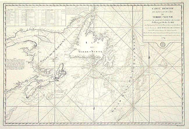
Auction 104, Lot 148
Subject: Canada
Bellin, Jacques Nicolas
Carte Reduite des Bancs et de l'Isle de Terre-Neuve avec les Cotes du Golfe de St. Laurent et de l'Acadie, 1784
Size: 33.5 x 22.7 inches (85.1 x 57.7 cm)
Estimate: $700 - $800
Unsold
Closed on 9/10/2003
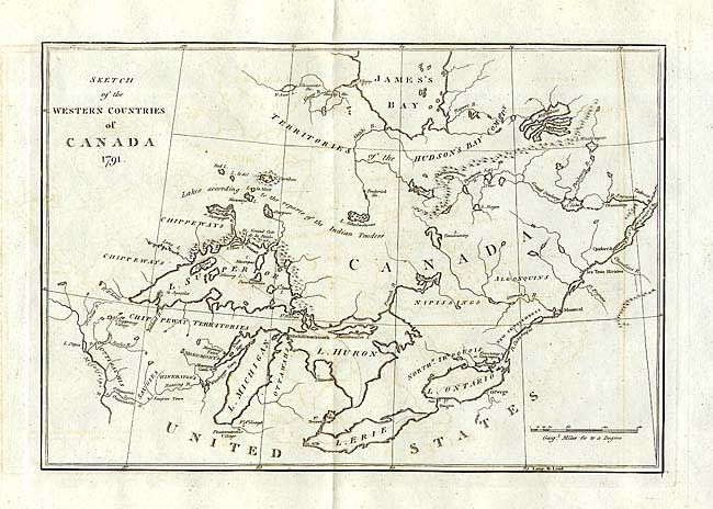
Auction 104, Lot 149
Subject: Canada
Long, John
Sketch of the Western Countries of Canada, 1791
Size: 11.7 x 8 inches (29.7 x 20.3 cm)
Estimate: $150 - $200
Sold for: $150
Closed on 9/10/2003
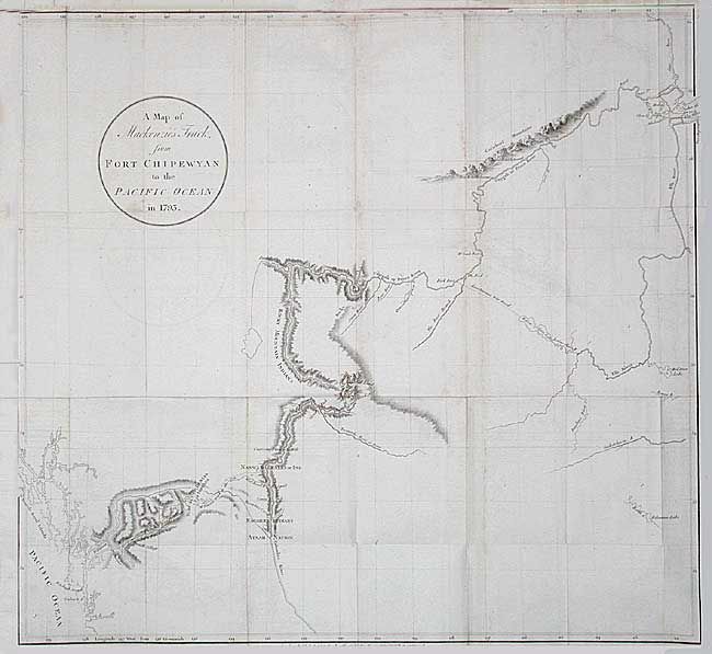
Auction 104, Lot 150
Subject: Canada
Mackenzie, Alexander
A Map of Mackenzie's Track, from Fort Chipewyan to the Pacific Ocean in 1793, 1801
Size: 24 x 22 inches (61 x 55.9 cm)
Estimate: $450 - $500
Sold for: $550
Closed on 9/10/2003
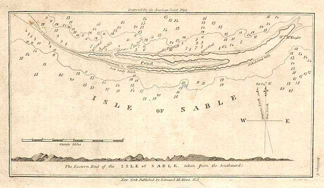
Auction 104, Lot 151
Subject: Canada
Blunt, Edmund
Isle of Sable, 1815
Size: 7 x 3.7 inches (17.8 x 9.4 cm)
Estimate: $50 - $70
Unsold
Closed on 9/10/2003
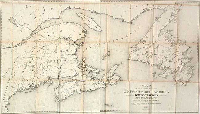
Auction 104, Lot 152
Subject: Canada
Andrews, Israel D.
Map of the Eastern Portion of British North America including the Gulf of St. Lawrence, and part of the New England States, 1853
Size: 45 x 25.5 inches (114.3 x 64.8 cm)
Estimate: $200 - $250
Sold for: $150
Closed on 9/10/2003
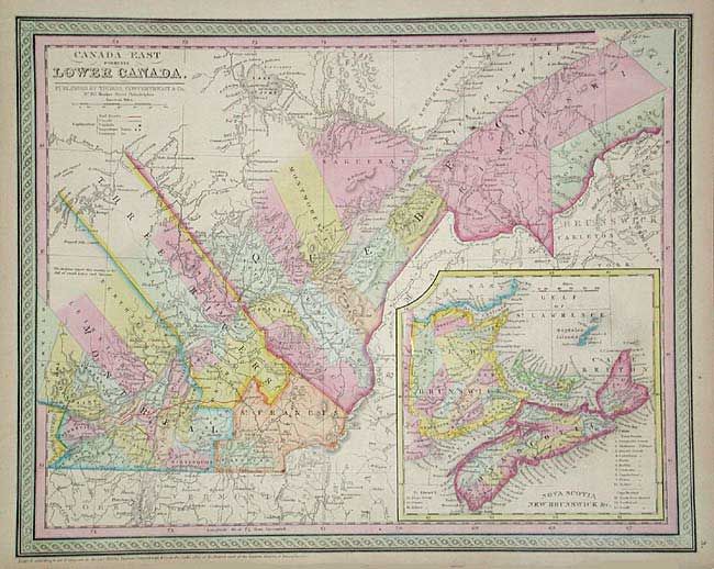
Auction 104, Lot 153
Subject: Canada
Thomas, Cowperthwait & Co.
[Lot of 2] Canada West formerly Upper Canada [together with] Canada East formerly Lower Canada, 1853
Size: 15.5 x 12.5 inches (39.4 x 31.8 cm)
Estimate: $150 - $200
Sold for: $110
Closed on 9/10/2003
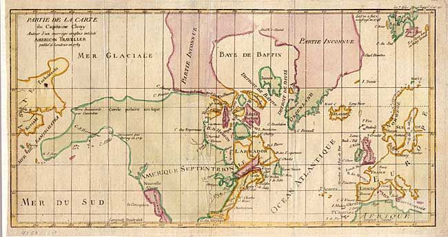
Auction 104, Lot 154
Subject: Canada & United States
Robert de Vaugondy, Didier
Partie de la Carte du Capitaine Cluny Auteur d'un ouvrage anglois intitule American Traveller, 1769
Size: 16 x 8.4 inches (40.6 x 21.3 cm)
Estimate: $200 - $240
Sold for: $150
Closed on 9/10/2003
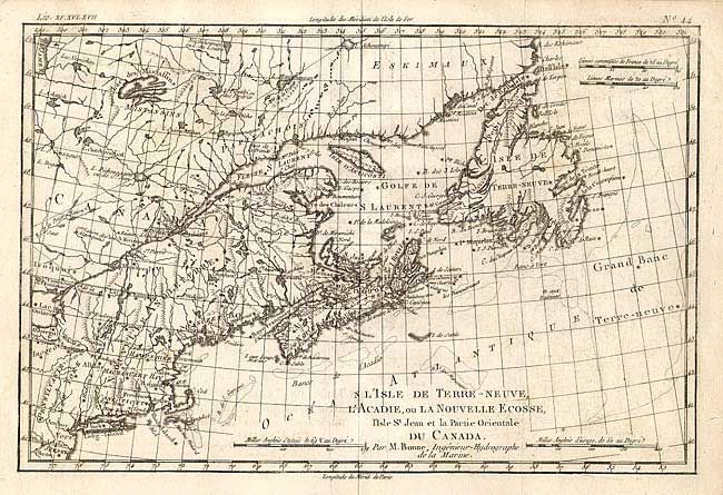
Auction 104, Lot 155
Subject: Canada & United States
Bonne, Rigobert
L'Isle de Terre-Neuve, L'Acadie, ou la Nouvelle Ecosse, l'Isle St Jean et la Partie Orientale du Canada, 1775
Size: 12.7 x 8.4 inches (32.3 x 21.3 cm)
Estimate: $100 - $150
Unsold
Closed on 9/10/2003
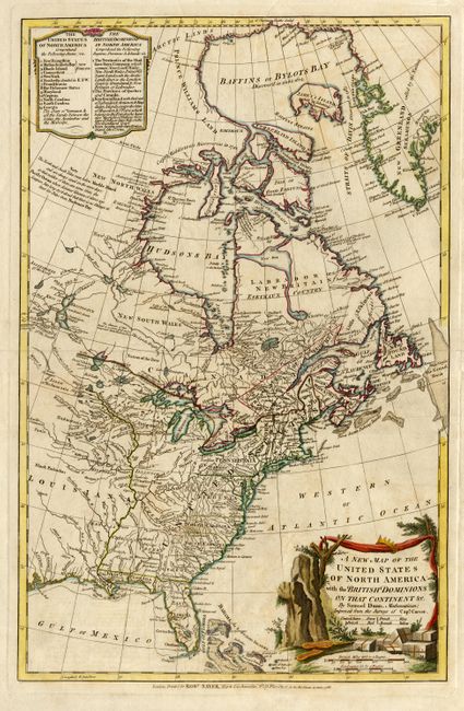
Auction 104, Lot 156
Subject: Canada & United States
Dunn, Samuel
A New Map of the United States of North America with the British Dominions on that Continent &c., 1786
Size: 12.3 x 19 inches (31.2 x 48.3 cm)
Estimate: $1,100 - $1,400
Sold for: $1,200
Closed on 9/10/2003
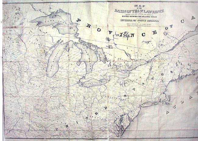
Auction 104, Lot 157
Subject: Canada & United States
Andrews, Israel D.
Map of the Basin of the St. Lawrence showing also the Natural and Artificial Routes between the Atlantic Ocean and the Interior of North America, 1852
Size: 75 x 35 inches (190.5 x 88.9 cm)
Estimate: $300 - $350
Unsold
Closed on 9/10/2003
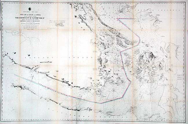
Auction 104, Lot 158
Subject: Washington & British Columbia
U.S. Coast Survey
North America - West Coast: Strait of Juan de Fuca and the Channels Between the Continent & Vancouver Id. Showing the Boundary Line Between British & American Possessions, 1873
Size: 44.7 x 28.7 inches (113.5 x 72.9 cm)
Estimate: $300 - $400
Sold for: $240
Closed on 9/10/2003
Auction 104, Lot 717
Subject: Exploration and Surveys
Parker, Samuel (Rev.)
Journal of an Exploring Tour Beyond the Rocky Mountains … with a Map of Oregon Territory, 1844
Size: 5 x 8 inches (12.7 x 20.3 cm)
Estimate: $300 - $350
Sold for: $350
Closed on 9/10/2003
26 lots