Precision & Exactitude: The Robert de Vaugondy Family
Precision & Exactitude: The Robert de Vaugondy Familyby Joe McAlhany
The mapmakers Gilles and Didier Robert de Vaugondy emerged during the golden age of French cartography, producing useful and elegant maps, atlases, globes, and other cartographic works from 1731 to 1778. Didier summarized their mission in his preface to Usage des Globes (1751): "My principal aim has been to satisfy the mind with precision and exactitude, but since it is also necessary to please the eyes, I have taken every care possible to insure that the execution of my work corresponds in its beauty to its underlying design." Even though it was not a terribly profitable enterprise for them, the Vaugondys pursued this mission with passion, dedication, and a sense of purpose. Their contemporaries Delisle, Buache, Cassini, and d'Anville may have been the more groundbreaking cartographers, but the Vaugondy family's unique mix of aesthetic and geographical rigor continues to fascinate map enthusiasts to this day.
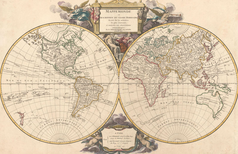
Mappemonde ou Description du Globe Terrestre, published in Atlas Universel with the imprints of Gilles Robert de Vaugondy and Antoine Boudet.
During the 16th and 17th century, the Dutch dominated the field of cartography with their ornate decorative maps, but in the 18th century, the French reigned supreme, rising to prominence with a more scientific approach to mapping. The shift started during the reign of Louis XIV, who established the Académie Royale des Sciences in 1666, and, along with it, a precedent of patronage and support for geographers that lasted until the French Revolution. Advances in geography brought changes in mapping, with precision taking priority over flourish. "Positive geography," the Enlightenment concept that the world could be accurately mapped through careful measurements and the comparison of various sources, took hold among French cartographers. The widely literate French public had a general knowledge of geography thanks to the efforts of Jesuit educators and followed the science's progress with great interest. By the early 18th century, Paris had become the cartographic capital of Europe; the stage was set for the Vaugondy family's mapmaking endeavor.
Gilles Robert Vaugondy was born in Paris on August 24, 1688, to Louis, a silk fabric maker, and Jeanne Renée Robert. (He would later take the surname "Robert" from his mother; Didier appended the noble "de" to the patronym.) He had a brother, Jean, who would become an enamellist (and alcoholic) of note. Very little is known about Gilles' education, although it is possible that he attended Lycée Louis-le-Grand, Paris' prestigious Jesuit secondary school. When he married Marie Magdeleine Blié in 1719, he listed his occupation as "géographe" on the marriage certificate. By the time his brother married Marie Magdeleine's sister in 1723, his profession had changed to professor of mathematics. That same year, his son (and later collaborator and partner), Didier, was born. (Another son, Martin Vaugondy de Savigny, was also part of the family business, although he has no maps explicitly credited to his name. Apparently he served as an "engineer-architect" for the company and assisted with various projects, including the preparation of the Atlas Universel.)
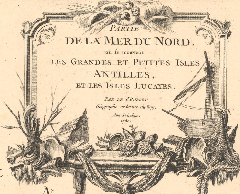
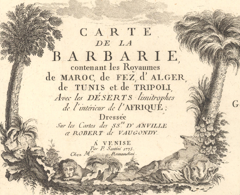
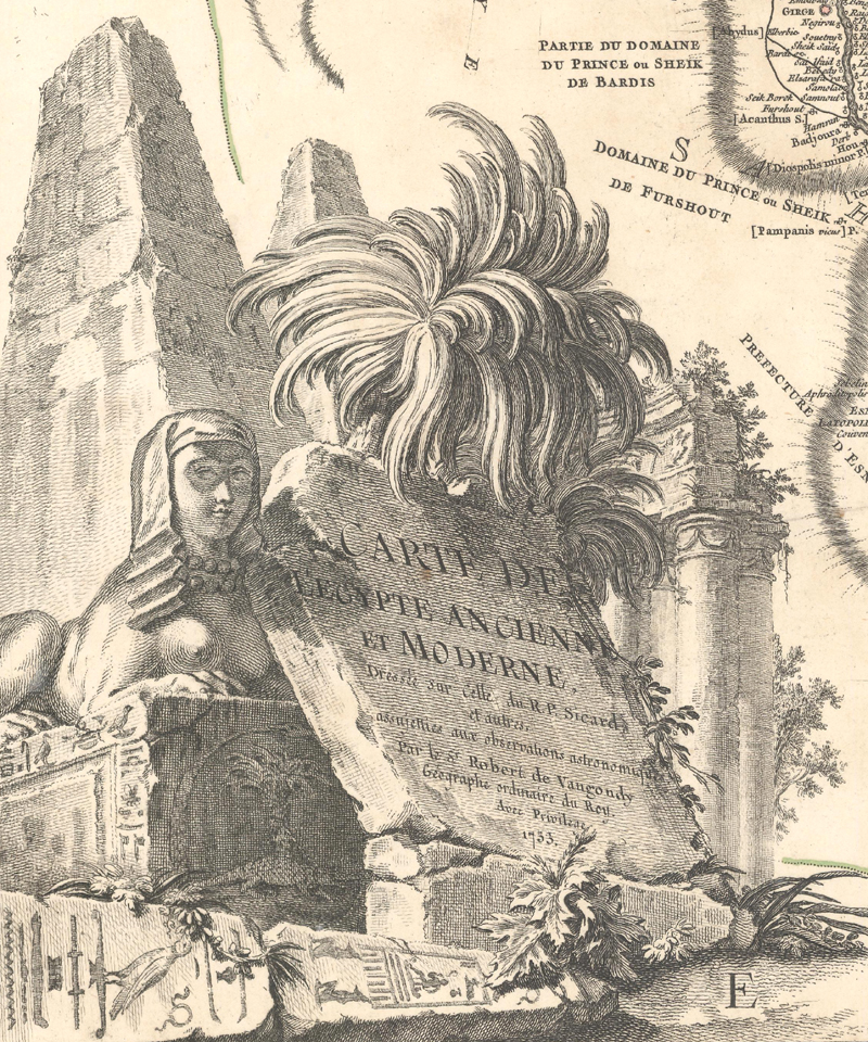
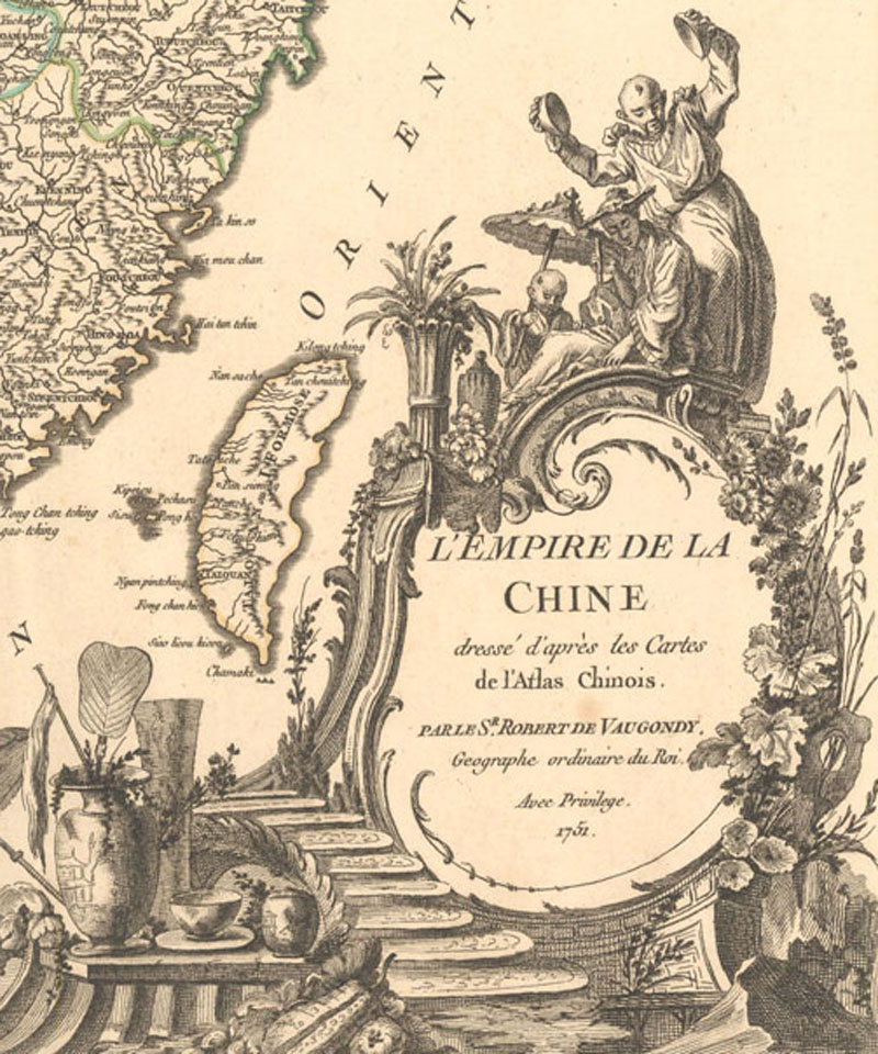
Examples of title cartouches from Atlas Universel:
In 1730, Pierre Moullart-Sanson, grandson of Nicolas Sanson (the "father of French cartography"), willed the Sanson inheritance to Gilles and two friends, Jacques Simon Perrier, a priest, and Jean Frémont, a lawyer, citing the trio's combined intelligence, integrity, and geographical knowledge as the reason for his selection. In addition to Sanson's stock of maps, globes, and other cartographic items, this inheritance included a roller press for copper plates and a house that would eventually serve as collateral for Gilles' early cartographic pursuits. The men set up shop in a rented house on the quai de l'Horloge, where the city's engravers, printers, and booksellers would be near at hand. Soon after, Perrier sold his share to Gilles and Frémont, leaving his partners to navigate the difficult early years of their new business venture.
Although he was not a man of spectacular wealth, Frémont bankrolled the business until his death in 1751. It was more a labor of love than a booming enterprise. Records from 1737 indicate an annual profit of only 625 livres. However, expenses may have been unusually high that year because that is when Gilles started producing his own original maps; his first was "Carte pour servir la lecture de l'histoire ancienne de M. Rollin," which was designed to accompany Charles Rollin's popular 13-volume study of ancient history. Throughout much of the 1740s, Gilles' new material took a backseat to reissues of classic Sanson maps. It was only at the end of the decade that Gilles and his son Didier produced their first original, complete collection, Atlas Portatif Universel et Militaire (1748-49). Consisting of 209 maps, the work was intended for both practical military use and general educational use for the public.
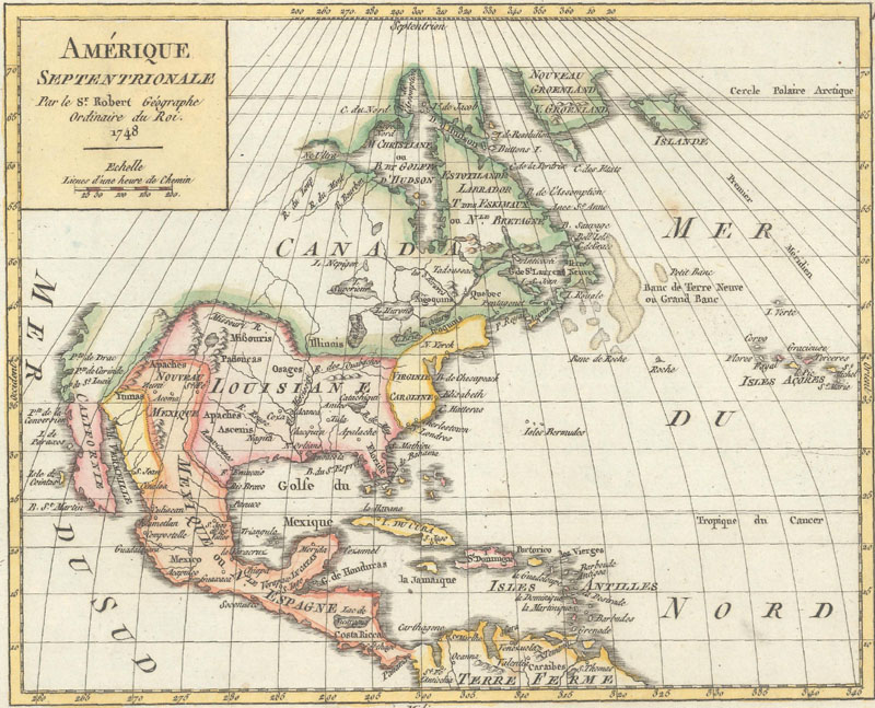
Amerique Septentrionale, by Gilles Robert de Vaugondy and published in Atlas Portatif Universel et Militaire.
After the accomplishment of Atlas Portatif, the Vaugondys undertook what would become their signature achievement, the Atlas Universel (1750-57), consisting of 109 maps. Their guiding principles in assembling the atlas were that it should be "commode, complet, uniforme, et suivi" (easy to handle, complete, unifom, and consistent); they wanted a practical, folio-sized volume, with a comprehensive view of the world and a consistent scale and style. Gilles and Didier worked diligently, drawing from a wide range of sources, including Sanson and Delisle (when their material was still relevant) and fifty 18th-century geographers. Still, even with the new sources at hand, the Robert de Vaugondys tended to be skeptical and cautious, preferring to update extant geographical sources rather than blazing new cartographic trails with unverified modern sources. The maps were decorated with elaborate title cartouches that were widely celebrated upon the atlas' publication. Antoine Boudet, the work's printer and publisher, came up with the idea of selling the atlas by subscription, in order to minimize his financial risk and save on overhead. Eleven hundred copies sold, in two different paper sizes. By all appearances, the work seemed a likely commercial hit.
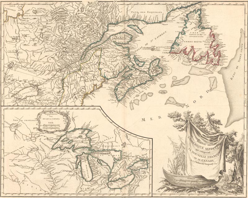
Partie de l'Amerique Septent? qui Comprend la Nouvelle France ou le Canada, by Didier Robert de Vaugondy and published in Atlas Universel.
Unfortunately, the Atlas Universel ran into many difficulties during its long gestation. Philippe Buache, who had had issues with both the Vaugondys and Boudet in the past, lobbed criticisms at the atlas, citing specific cartographic inaccuracies and questioning Boudet's involvement in the publication. Issues of authorship and plagiarism arose as well, which Didier attempted to tackle in Essai sur l'Histoire de la Géographie (1754), his overview of the history of geography and cartography. Then there was the complicated lawsuit between Boudet and the engraver Jean-Baptiste Henri Delahaye and his family. Despite the controversy and legal trouble, the atlas proved successful upon its arrival in 1757. It made Boudet (but not the Vaugondys) a heap of money and was published into the next century by Charles Delamarche, the Vaugondys' successor.
On top of his collaborations with his father, Didier was also making a name for himself as a globemaker. In 1745 he published his first map project, a set of terrestrial globe gores. Five years later, he presented a six-inch globe based on his gores to Louis XV, hoping to earn the title géographe ordinaire du roi. The king, who was well-versed in geography thanks to childhood lessons from Guillaume Delisle, thought that the earth could not be sufficiently represented by such a small globe. He insisted that a six-foot globe would be more appropriate and tasked Didier with designing one. He also requested eighteen-inch globes for the Navy's use. The six-foot globe project proved to be too impractical for Didier to pull off, but he successfully produced the smaller globes and sold them on a subscription basis. He became a respected authority on globemaking, writing the entry for globes for Diderot and d'Alembert's Encyclopédie.
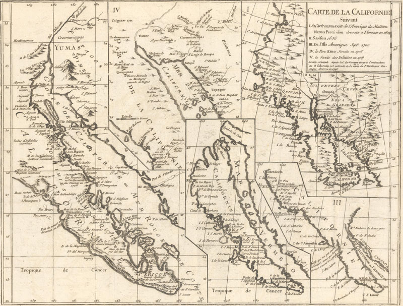
Carte de la Californie Suivant I. la Carte Manuscrite de l'Amerique de Mathieu Neron Pecci..., by Didier Robert de Vaugondy and published in Diderot's Encyclopédie.
By the time he was thirty years old, Didier was already an established figure in the world of French cartography, with a formidable body of work. He continued that prolific streak throughout the rest of his career. He made presentations on the latest polar explorations; contributed illustrations to other authors' works; taught generations geography with his educational books (which were much needed once the Jesuits were expelled from France in 1762); and churned out tourist guide maps of Paris. When Gilles died in 1766, Didier took the reins of the business; unfortunately, he was not much of a businessman and ran into a tragic streak of bad luck. Throughout the 1770s, he tried and failed to land a pensioned government position. After one such attempt, he was described by his peers in the Académie Royale des Sciences as "a worthy heir of the famous Sanson [...] industrious, precise, and enlightened." But the respect of his contemporaries did not translate to broader financial success. In 1778, he sold the business to the globemaker Jean Baptiste Fortin and used the money to move his wife to the country, where she could recuperate from a mental illness.
Even after selling the business, Didier would continue to correct and amend his old maps, although he received no financial gain from such work. His life continued to spiral downward, until he died practically penniless in 1786. That same year, Fortin sold the Vaugondy stock to the lawyer Charles-François Delamarche. Delamarche was able to turn a profit on the Vaugondy maps in a way that their creators could not. He published Vaugondy maps and atlases well into the 19th century. The Vaugondy heirs saw none of the profits and remained in poverty.
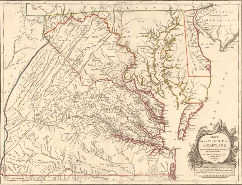
Carte de la Virginie et du Maryland Dressee sur la Grande Carte Angloise de Mrs. Josue Fry et Pierre Jefferson, by Didier Robert de Vaugondy and published in Atlas Universel.
The end of the Robert de Vaugondy story is undoubtedly bleak, but it is heartening that collectors still swoon for their maps today. After all, the Vaugondys struggled throughout their career to make ends meet, yet continued to produce quality maps, globes, and atlases at an astonishing clip. That suggests that what mattered most to Gilles and Didier was the work itself: the science of geography and the art of mapmaking. The "precision and exactitude" of their maps may not hold up to today's standards, but their painstaking dedication to detail remains awe-inspiring. As for the beauty of their works, it never fades.
Note: This article is but a brief overview of the prolific output of the Vaugondys. For a more in-depth look at the family, I highly recommend Mary Sponberg Pedley's Bel et Utile: The Work of the Robert de Vaugondy Family of Mapmakers, which is the authoritative text on these remarkable mapmakers.
Reference:
Pedley, Mary Sponberg, Bel et Utile: The Work of the Robert de Vaugondy Family of Mapmakers, Map Collector Publications Ltd., 1992.