Filtered by Category:United States(Show All Categories)
Showing results for:Auction 158
Catalog Archive
84 lots
Page 1 of 2
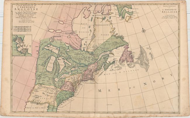
Auction 158, Lot 74
Subject: Colonial Eastern United States & Canada
Mortier, Pierre
Carte Nouvelle de l'Amerique Angloise Contenant la Virginie, Mary-Land, Caroline, Pensylvania Nouvelle Iorck, N: Iarsey N: France, et les Terres Nouvellement Decouerte..., 1700
Size: 35.8 x 23.4 inches (90.9 x 59.4 cm)
Estimate: $2,200 - $2,750
A Map Showing Fascinating Geographic Misconceptions
Unsold
Closed on 6/22/2016
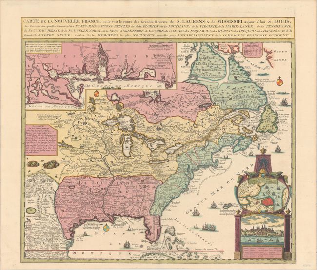
Auction 158, Lot 75
Subject: Colonial Eastern United States & Canada
Fer, Nicolas de
Carte de la Nouvelle France, ou Se Voit le Cours des Grandes Rivieres de S. Laurens & de Mississipi, Aujour d'hui S. Louis…, 1719
Size: 21.7 x 19.6 inches (55.1 x 49.8 cm)
Estimate: $2,750 - $3,500
Striking Map of French Colonial Possessions
Sold for: $2,100
Closed on 6/22/2016
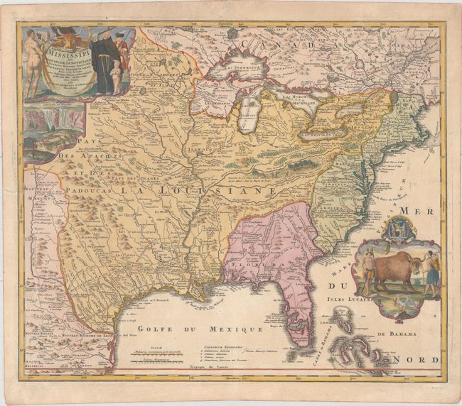
Auction 158, Lot 76
Subject: Colonial Eastern United States & Canada
Homann, Johann Baptist
Amplissimae Regionis Mississipi seu Provinciae Ludovicianae a R.P. Ludovico Hennepin Francisc Miss in America Septentrionali Anno 1687..., 1720
Size: 22.6 x 19.1 inches (57.4 x 48.5 cm)
Estimate: $1,800 - $2,200
Striking Map of Colonial America with Buffalo Vignette
Sold for: $2,300
Closed on 6/22/2016
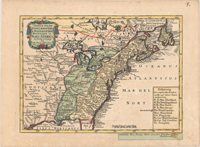
Auction 158, Lot 77
Subject: Colonial Eastern United States & Canada
Schreiber, Johann Georg
Charte von dem Engellaendischen u. Franzoesischen Besitzungen in Nord America, 1753
Size: 9.6 x 6.9 inches (24.4 x 17.5 cm)
Estimate: $400 - $500
Sold for: $250
Closed on 6/22/2016
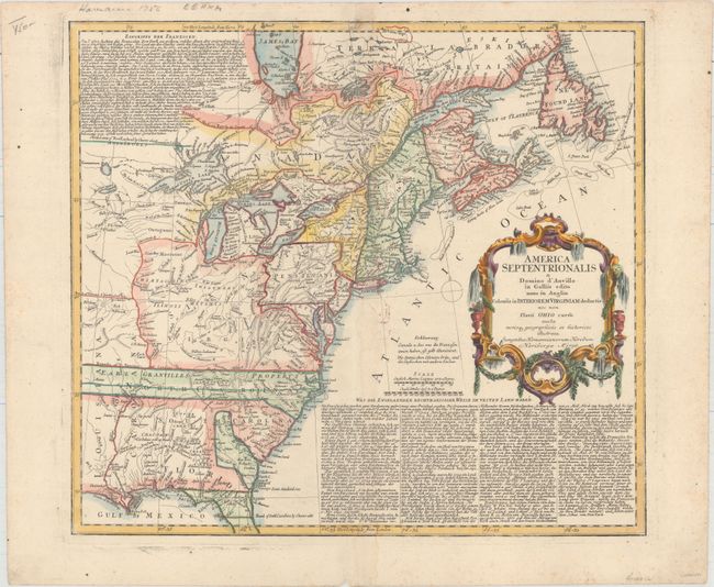
Auction 158, Lot 78
Subject: Colonial Eastern United States & Canada
Homann Heirs
America Septentrionalis a Domino d'Anville in Galliis Edita nunc in Anglia Coloniis in Interiorem Virginiam Deductis nec non Fluvii Ohio Cursu..., 1756
Size: 20.1 x 18 inches (51.1 x 45.7 cm)
Estimate: $600 - $750
Unsold
Closed on 6/22/2016
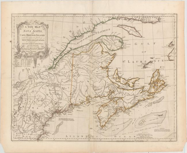
Auction 158, Lot 79
Subject: Colonial New England & Canada
Jefferys, Thomas
A New Map of Nova Scotia, and Cape Breton Island with the Adjacent Parts of New England and Canada…, 1775
Size: 24.1 x 18.5 inches (61.2 x 47 cm)
Estimate: $500 - $650
Sold for: $350
Closed on 6/22/2016
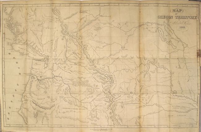
Auction 158, Lot 80
Subject: Western United States & Canada
Parker, Samuel (Rev.)
Journal of an Exploring Tour Beyond the Rocky Mountains … [with] Map of Oregon Territory, 1846
Size: 5 x 7.8 inches (12.7 x 19.8 cm)
Estimate: $400 - $500
Sold for: $300
Closed on 6/22/2016
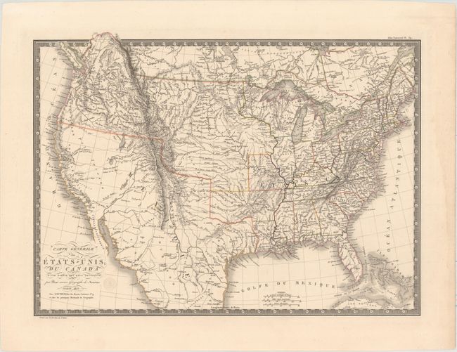
Auction 158, Lot 81
Subject: United States
Brue, Adrien Hubert
Carte Generale des Etats-Unis, du Canada et d'une Partie des Pays Adjacents, 1825
Size: 20 x 14.8 inches (50.8 x 37.6 cm)
Estimate: $350 - $425
Sold for: $250
Closed on 6/22/2016
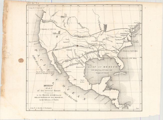
Auction 158, Lot 82
Subject: United States
U.S. Government
Mills' Map of the Several Routes Proposed to the Pacific Ocean from the Head Waters of the Missouri, to the Isthmus of Darien [with report], 1848
Size: 9 x 8.3 inches (22.9 x 21.1 cm)
Estimate: $100 - $130
Sold for: $120
Closed on 6/22/2016
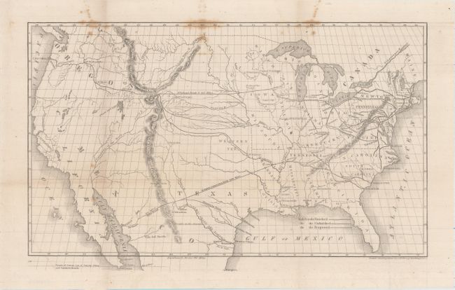
Auction 158, Lot 83
Subject: United States, Railroads
Throop, O. H.
[Untitled - Map of Proposed Routes of Western Railroads], 1848
Size: 16 x 9.5 inches (40.6 x 24.1 cm)
Estimate: $200 - $250
Sold for: $170
Closed on 6/22/2016
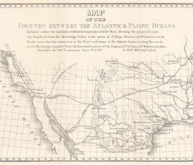
Auction 158, Lot 84
Subject: United States
Mills, Robert
Map of the Country Between the Atlantic & Pacific Oceans..., 1852
Size: 32 x 10.5 inches (81.3 x 26.7 cm)
Estimate: $200 - $230
Unsold
Closed on 6/22/2016
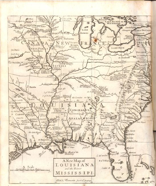
Auction 158, Lot 85
Subject: Colonial Eastern United States
Anon.
A New Map of Louisiana and the River Mississipi [within book] The Memoirs and Secret Negotiations of John Ker, 1726
Size: 9 x 10.2 inches (22.9 x 25.9 cm)
Estimate: $800 - $1,000
Unsold
Closed on 6/22/2016
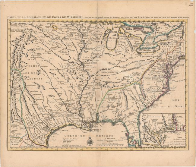
Auction 158, Lot 86
Subject: Colonial Eastern United States, Louisiana Territory
Delisle/Covens & Mortier
Carte de la Louisiane et du Cours du Mississipi Dressee sur un Grand Nombre de Memoires Entr' Autres sur Ceux de Mr. le Maire..., 1730
Size: 23.6 x 17.3 inches (59.9 x 43.9 cm)
Estimate: $2,750 - $3,500
Delisle's Influential Map of the Louisiana Territory
Sold for: $2,000
Closed on 6/22/2016
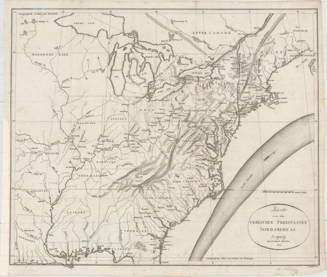
Auction 158, Lot 87
Subject: Eastern United States
Melish, John
Karte von dem Vereinten Freistaaten Nordamericas, 1821
Size: 16.6 x 13.9 inches (42.2 x 35.3 cm)
Estimate: $700 - $900
Unsold
Closed on 6/22/2016
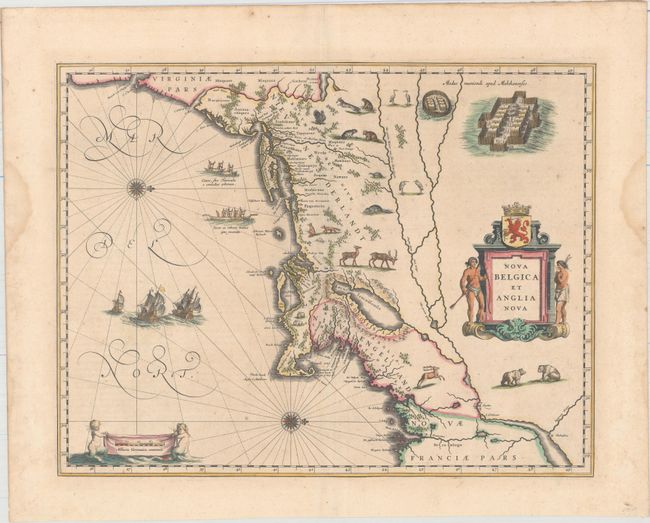
Auction 158, Lot 88
Subject: Colonial New England & Mid-Atlantic United States
Blaeu, Willem
Nova Belgica et Anglia Nova, 1640
Size: 19.9 x 15.3 inches (50.5 x 38.9 cm)
Estimate: $2,750 - $3,500
Important Map of Colonial New England and the Mid-Atlantic in Full Original Color
Unsold
Closed on 6/22/2016
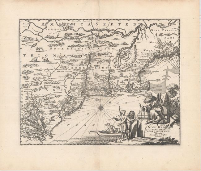
Auction 158, Lot 89
Subject: Colonial New England & Mid-Atlantic United States
Montanus/Ogilby
Novi Belgii, quod nunc Novi Jorck Vocatur, Novae qz. Angliae & Partis Virginiae Accuratissima et Novissima Delineatio, 1671
Size: 14.4 x 11.4 inches (36.6 x 29 cm)
Estimate: $950 - $1,200
Unsold
Closed on 6/22/2016
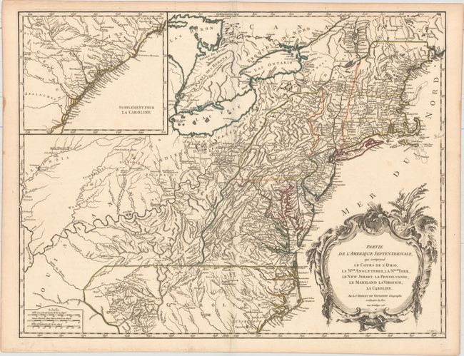
Auction 158, Lot 90
Subject: Colonial New England & Mid-Atlantic United States
Robert de Vaugondy, Didier
Partie de l'Amerique Septentrionale, qui Comprend le Cours de l'Ohio, la Nlle. Angleterre, la Nlle York, le New Jersey, la Pensylvanie, le Maryland la Virginie, la Caroline, 1755
Size: 24.6 x 18.9 inches (62.5 x 48 cm)
Estimate: $700 - $900
First State
Unsold
Closed on 6/22/2016
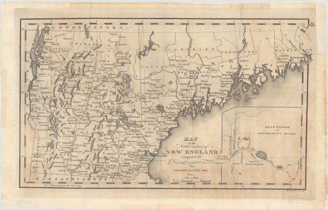
Auction 158, Lot 91
Subject: New England - United States
Gillet, George
Map of the Northern Part of New England Compiled for Prest. Dwights Travels, 1821
Size: 14.2 x 8.3 inches (36.1 x 21.1 cm)
Estimate: $150 - $180
Unsold
Closed on 6/22/2016
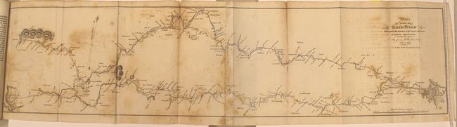
Auction 158, Lot 92
Subject: New England United States, Railroads
Report of the Board of Directors of Internal Improvements of the State of Massachusetts on the Practicability and Expediency of a Rail-Road from Boston to the Hudson River..., 1829
Size: 5.7 x 9.1 inches (14.5 x 23.1 cm)
Estimate: $800 - $1,000
Unsold
Closed on 6/22/2016
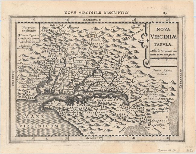
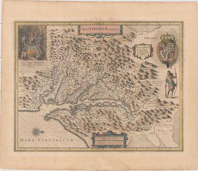
Auction 158, Lot 93
Subject: Colonial Mid-Atlantic United States
Cloppenburg, Johannes
Nova Virginiae Tabula, 1632
Size: 10.1 x 7.3 inches (25.7 x 18.5 cm)
Estimate: $800 - $1,000
Sold for: $600
Closed on 6/22/2016
Auction 158, Lot 94
Subject: Colonial Mid-Atlantic United States
Hondius, Henricus
Nova Virginiae Tabula, 1636
Size: 19.5 x 15.1 inches (49.5 x 38.4 cm)
Estimate: $2,000 - $2,300
One of the Most Important 17th Century Maps of the Chesapeake Bay
Unsold
Closed on 6/22/2016
Auction 158, Lot 95
Subject: Colonial Mid-Atlantic United States
Speed/Lamb
A Map of Virginia and Maryland, 1676
Size: 19.4 x 14.9 inches (49.3 x 37.8 cm)
Estimate: $4,750 - $6,000
The First Printed Map to Draw Upon the Legendary Herrman Map of the Chesapeake Bay
Unsold
Closed on 6/22/2016
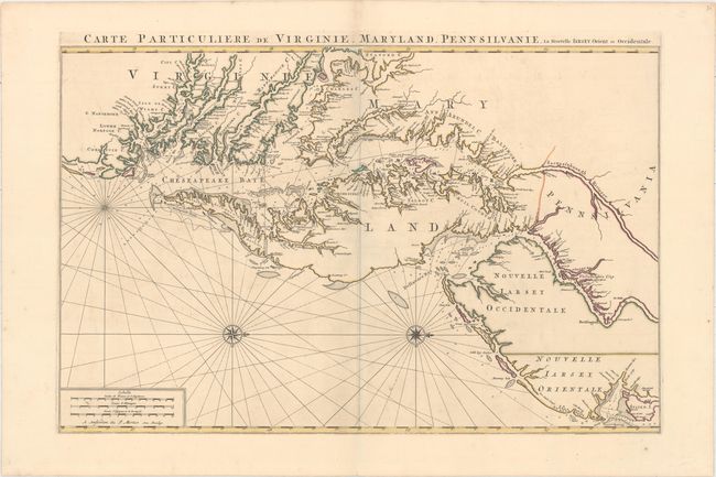
Auction 158, Lot 96
Subject: Colonial Mid-Atlantic United States
Jaillot/Mortier
Carte Particuliere de Virginie, Maryland, Pennsilvanie, la Nouvelle Iarsey. Orient et Occidentale, 1700
Size: 31.8 x 20.6 inches (80.8 x 52.3 cm)
Estimate: $6,000 - $7,500
One of the Most Beautiful Charts of Maryland and the Chesapeake Bay
Unsold
Closed on 6/22/2016
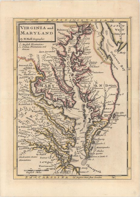
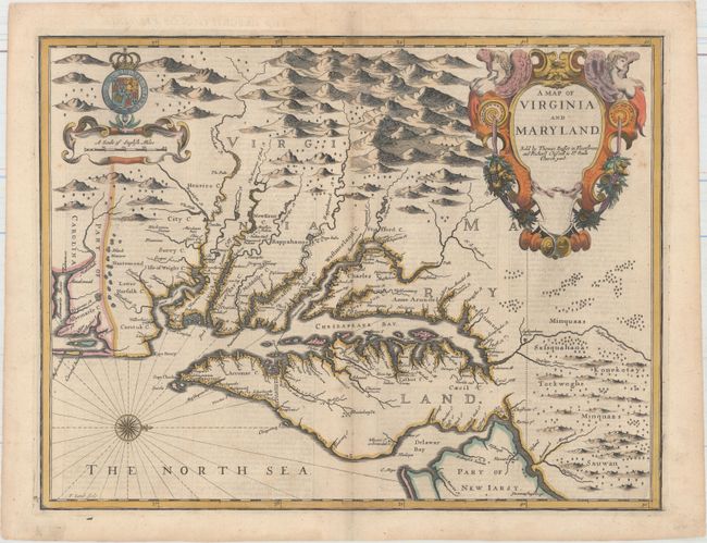
Auction 158, Lot 97
Subject: Colonial Mid-Atlantic United States
Moll, Herman
Virginia and Maryland, 1736
Size: 7.9 x 10.7 inches (20.1 x 27.2 cm)
Estimate: $550 - $650
Sold for: $350
Closed on 6/22/2016
Auction 158, Lot 98
Subject: Colonial Mid-Atlantic United States
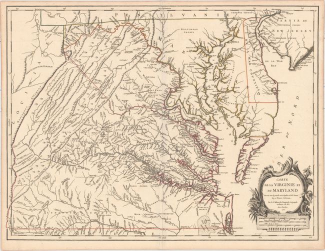
Robert de Vaugondy, Didier
Carte de la Virginie et du Maryland Dressee sur la Grande Carte Angloise de Mrs. Josue Fry et Pierre Jefferson..., 1755
Size: 25.4 x 19.1 inches (64.5 x 48.5 cm)
Estimate: $2,750 - $3,500
First State of Robert de Vaugondy's Essential Map of Virginia and Maryland
Sold for: $2,000
Closed on 6/22/2016
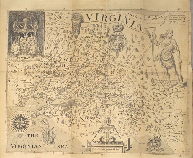
Auction 158, Lot 99
Subject: Mid-Atlantic United States
Smith, John (Capt.)
[2 Volumes] The True Travels, Adventures and Observations of Captaine John Smith, in Europe, Asia, Africke, and America..., 1819
Size: 5.5 x 8.6 inches (14 x 21.8 cm)
Estimate: $1,000 - $1,300
Sold for: $750
Closed on 6/22/2016
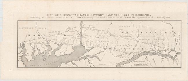
Auction 158, Lot 100
Subject: Mid-Atlantic United States
U.S. Government
Map of a Reconnaissance Between Baltimore and Philadelphia Exhibiting the Several Routes of the Mail Road Contemplated by the Resolution of Congress Approved on the 4th of May 1826, 1828
Size: 31.2 x 9.1 inches (79.2 x 23.1 cm)
Estimate: $220 - $250
Unsold
Closed on 6/22/2016
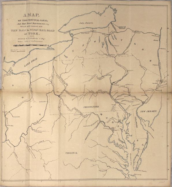
Auction 158, Lot 101
Subject: Mid-Atlantic United States
Railroad Companies, (Various)
A Map of the Principal Canal and Rail Road Improvements Which Will Connect With the Balt. & Susqa. Rail Road at York, 1835
Size: 15.5 x 16 inches (39.4 x 40.6 cm)
Estimate: $350 - $425
Unsold
Closed on 6/22/2016
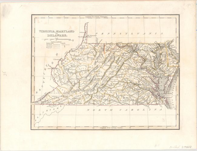
Auction 158, Lot 102
Subject: Mid-Atlantic United States
Bradford, Thomas Gamaliel
Virginia, Maryland and Delaware, 1835
Size: 10 x 7.8 inches (25.4 x 19.8 cm)
Estimate: $180 - $220
Sold for: $130
Closed on 6/22/2016
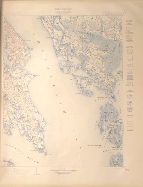
Auction 158, Lot 103
Subject: Maryland, Virginia
U.S. Geological Survey (USGS)
Geologic Atlas of the United States - St. Marys Folio Maryland-Virginia, 1906
Size: 18.6 x 21.8 inches (47.2 x 55.4 cm)
Estimate: $50 - $70
NO RESERVE
Sold for: $22
Closed on 6/22/2016
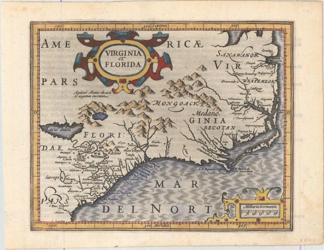
Auction 158, Lot 104
Subject: Colonial Southeast United States
Mercator/Hondius
Virginia et Florida, 1609
Size: 7.2 x 5.8 inches (18.3 x 14.7 cm)
Estimate: $550 - $700
Unsold
Closed on 6/22/2016
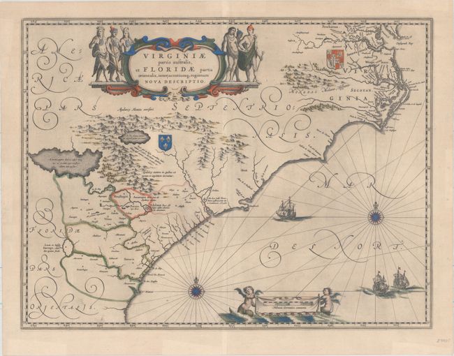
Auction 158, Lot 105
Subject: Colonial Southeastern United States
Blaeu, Willem
Virginiae Partis Australis, et Floridae Partis Orientalis, Interjacentiumq Regionum Nova Descriptio, 1643
Size: 19.6 x 15.2 inches (49.8 x 38.6 cm)
Estimate: $1,600 - $1,900
Blaeu's Decorative Map of the Southeast
Sold for: $1,200
Closed on 6/22/2016
Auction 158, Lot 106
Subject: Colonial Southeastern United States
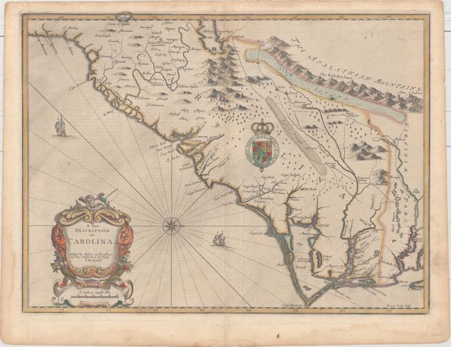
Speed/Lamb
A New Description of Carolina, 1676
Size: 20 x 14.8 inches (50.8 x 37.6 cm)
Estimate: $4,000 - $5,000
Speed's Map of the Carolinas Based Upon the Lords Proprietor's Map
Unsold
Closed on 6/22/2016
Auction 158, Lot 107
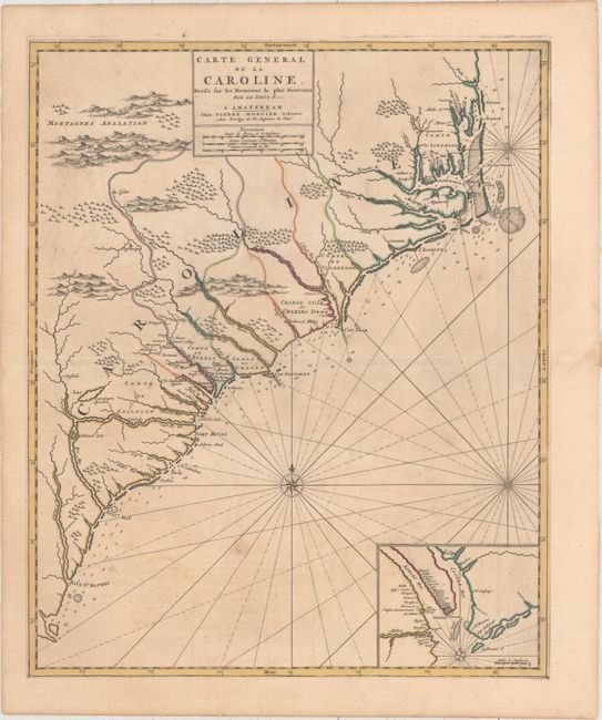
Subject: Colonial Southeastern, North Carolina, South Carolina
Mortier, Pierre
Carte General de la Caroline Dresse sur les Memoires le Plus Nouveaux..., 1700
Size: 18.3 x 22.2 inches (46.5 x 56.4 cm)
Estimate: $3,000 - $3,750
The First Map of the Carolinas Published Outside of England
Sold for: $2,000
Closed on 6/22/2016
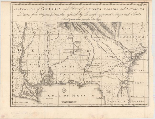
Auction 158, Lot 108
Subject: Colonial Southeastern United States
Bowen, Emanuel
A New Map of Georgia, with Part of Carolina, Florida and Louisiana. Drawn from Original Draughts, Assisted by the Most Approved Maps and Charts, 1748
Size: 18.8 x 14.3 inches (47.8 x 36.3 cm)
Estimate: $3,000 - $3,750
Important Map of the Georgia Colony
Unsold
Closed on 6/22/2016
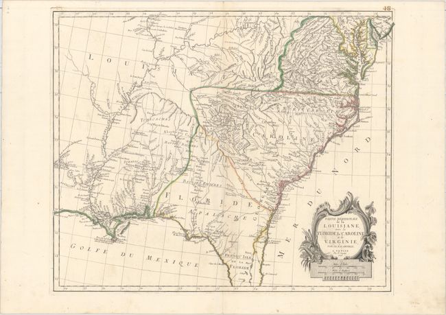
Auction 158, Lot 109
Subject: Colonial Southeast United States
D'Anville/Santini
Partie Meridionale de la Louisiane, avec la Floride, la Caroline et la Virginie, par le Sr. d Anville, 1776
Size: 22.8 x 18.8 inches (57.9 x 47.8 cm)
Estimate: $700 - $850
Unsold
Closed on 6/22/2016
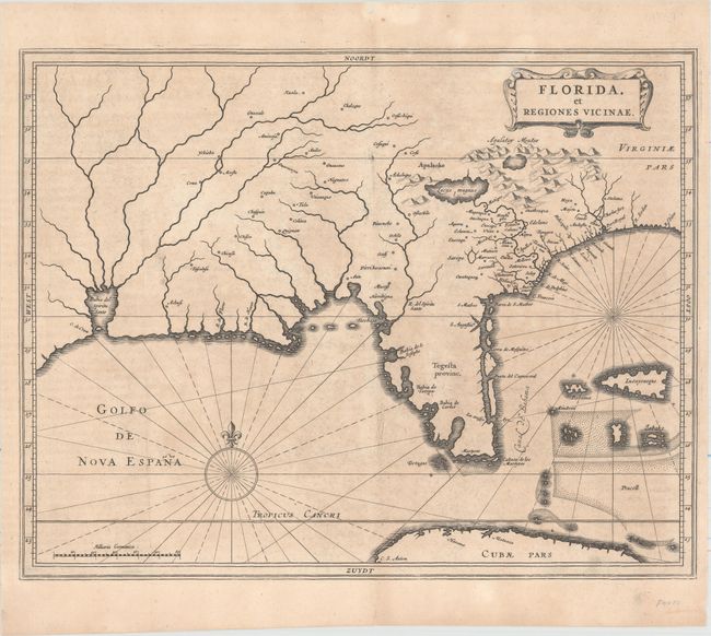
Auction 158, Lot 110
Subject: Colonial Southern United States
Gerritsz/De Laet
Florida, et Regiones Vicinae, 1630
Size: 14 x 11.3 inches (35.6 x 28.7 cm)
Estimate: $3,000 - $3,750
De Laet's Important Map of the South
Unsold
Closed on 6/22/2016
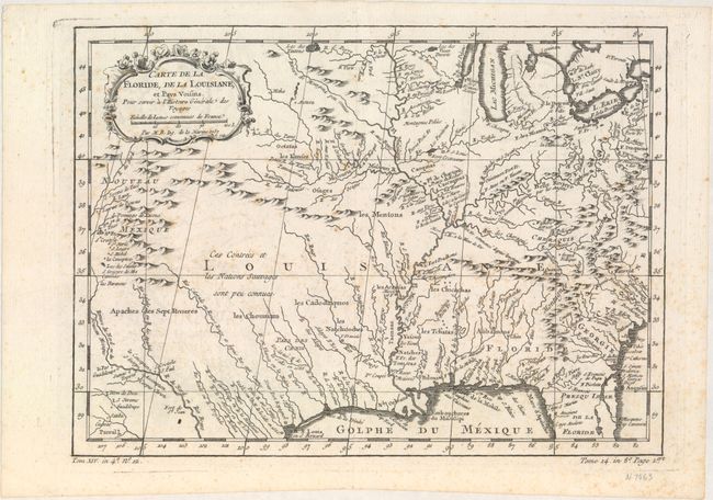
Auction 158, Lot 111
Subject: Colonial Southeastern United States
Bellin, Jacques Nicolas
Carte de la Floride, de la Louisiane, et Pays Voisins. Pour Servir a l'Histoire Generale des Voyages, 1757
Size: 12 x 8.8 inches (30.5 x 22.4 cm)
Estimate: $160 - $190
Sold for: $120
Closed on 6/22/2016
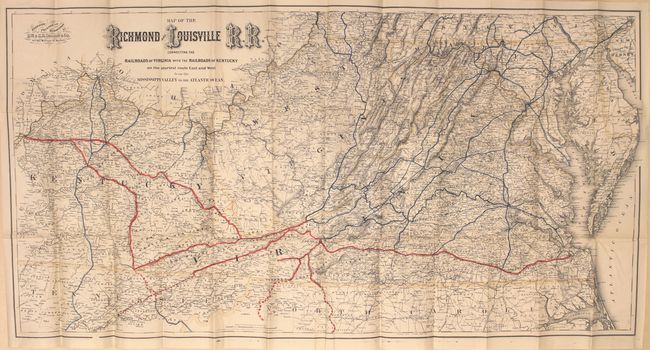
Auction 158, Lot 112
Subject: Southern United States
Colton, G.W. & C.B.
Map of the Richmond and Louisville R.R. Connecting the Railroads of Virginia with the Railroads of Kentucky..., 1882
Size: 50 x 25 inches (127 x 63.5 cm)
Estimate: $500 - $650
Unsold
Closed on 6/22/2016
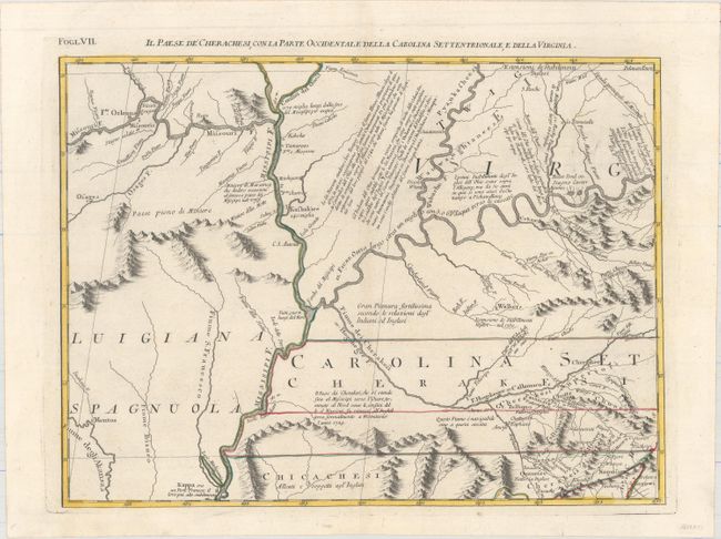
Auction 158, Lot 113
Subject: Colonial South Central United States
Zatta, Antonio
Il Paese de Cherachesi, con la Parte Occidentale della Carolina Settentrionale, e della Virgina, 1778
Size: 16.5 x 13 inches (41.9 x 33 cm)
Estimate: $250 - $325
Sold for: $180
Closed on 6/22/2016
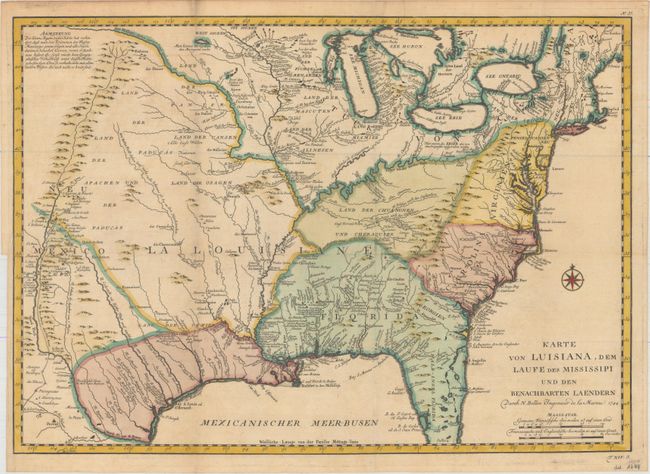
Auction 158, Lot 114
Subject: Colonial Eastern United States
Bellin, Jacques Nicolas
Karte von Luisiana, dem Laufe des Mississipi und den Benachbarten Laendern…, 1744
Size: 22 x 15.5 inches (55.9 x 39.4 cm)
Estimate: $1,000 - $1,200
Unsold
Closed on 6/22/2016
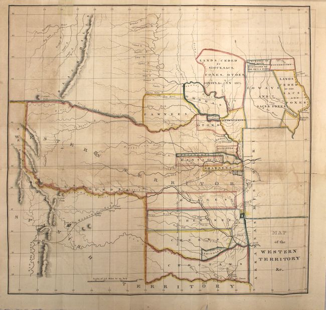
Auction 158, Lot 115
Subject: Central United States
Hood, Washington (Lt.)
Map of the Western Territory &c. [in report], 1834
Size: 17.7 x 17 inches (45 x 43.2 cm)
Estimate: $450 - $550
Sold for: $375
Closed on 6/22/2016
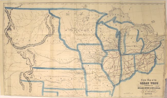
Auction 158, Lot 116
Subject: Central United States
The States and Territories of the Great West; Including Ohio, Indiana, Illinois, Missouri, Michigan, Wisconsin, Iowa, Minnesota, Kansas, and Nebraska…, 1856
Size: 5.3 x 7.8 inches (13.5 x 19.8 cm)
Estimate: $450 - $550
Unsold
Closed on 6/22/2016
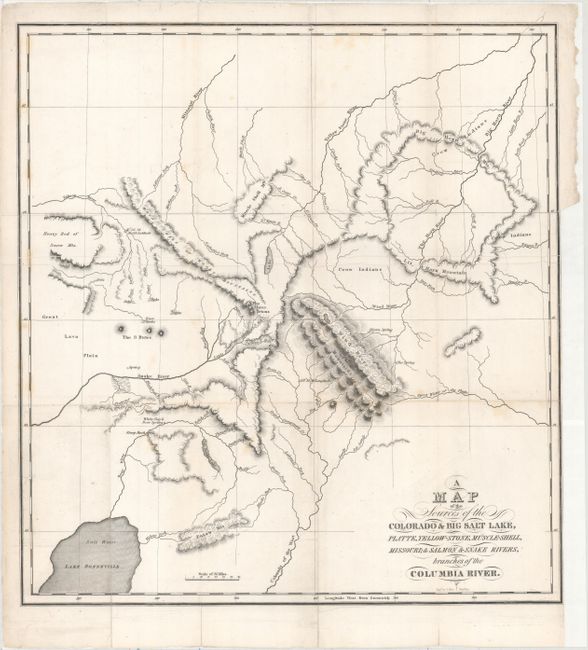
Auction 158, Lot 117
Subject: Western United States
Bonneville, Benjamin L. E. de
A Map of the Sources of the Colorado & Big Salt Lake, Platte, Yellow-Stone, Muscle-Shell, Missouri; & Salmon & Snake Rivers, Branches of the Columbia River, 1837
Size: 15.5 x 16.5 inches (39.4 x 41.9 cm)
Estimate: $700 - $900
Unsold
Closed on 6/22/2016
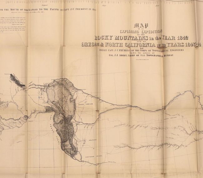
Auction 158, Lot 118
Subject: Western United States
Fremont/Preuss
Map of an Exploring Expedition to the Rocky Mountains in the Year 1842 and to Oregon & North California in the Years 1843-44 [with] Report of The Exploring Expedition to the Rocky Mountains…, 1845
Size: 51 x 30.5 inches (129.5 x 77.5 cm)
Estimate: $1,800 - $2,200
Fremont's Large Map of the American West
Unsold
Closed on 6/22/2016
Auction 158, Lot 119
Subject: Western United States
U.S. Government
[Lot of 6 - Pacific Wagon Roads Maps] [with] Letter from the Secretary of the Interior, Transmitting a Report Upon the Several Wagon Roads…, 1859
Size: 6 x 9.8 inches (15.2 x 24.9 cm)
Estimate: $650 - $800
Sold for: $475
Closed on 6/22/2016
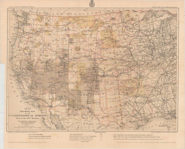
Auction 158, Lot 120
Subject: Western United States
Wheeler, George (Lt)
Progress Map of the U.S. Geographical Surveys West of the 100th Meridian..., 1878
Size: 22.3 x 16.2 inches (56.6 x 41.1 cm)
Estimate: $140 - $170
Sold for: $100
Closed on 6/22/2016
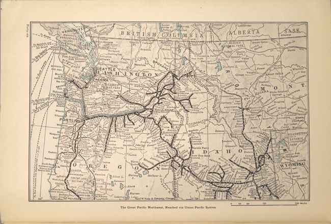
Auction 158, Lot 121
Subject: Northwestern United States
Railroad Companies, (Various)
The Pacific Northwest and Alaska, 1928
Size: 6.9 x 10.1 inches (17.5 x 25.7 cm)
Estimate: $40 - $50
NO RESERVE
Sold for: $15
Closed on 6/22/2016
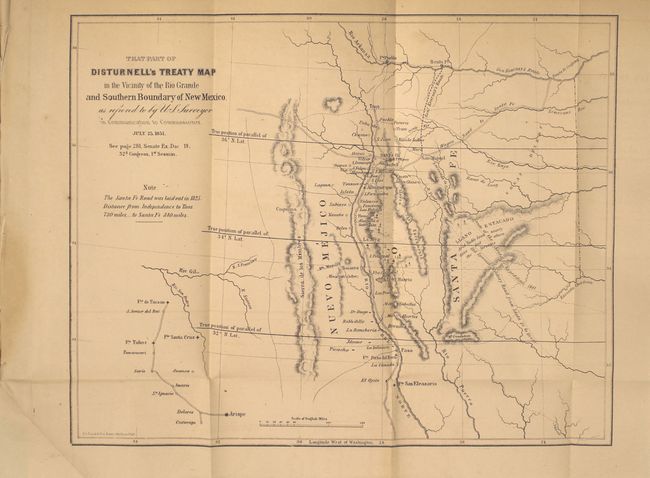
Auction 158, Lot 122
Subject: Southwestern United States
U.S. Government
[7 Maps of the Mexican Boundary Survey] [in report] Executive Documents Printed by Order of the Senate of the United States, During the First Session of the Thirty-Second Congress…, 1852
Size: 5.8 x 8.9 inches (14.7 x 22.6 cm)
Estimate: $450 - $550
Sold for: $325
Closed on 6/22/2016
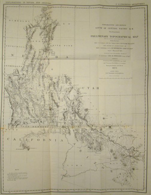
Auction 158, Lot 123
Subject: Southwestern United States
Wheeler, George (Lt)
Preliminary Topographical Map [with report] Preliminary Report Concerning Explorations and Surveys Principally in Nevada and Arizona, 1872
Size: 22 x 28.5 inches (55.9 x 72.4 cm)
Estimate: $240 - $275
Sold for: $180
Closed on 6/22/2016
84 lots
Page 1 of 2