Filtered by Category:United States(Show All Categories)
Showing results for:Auction 151
Catalog Archive
236 lots
Page 1 of 5
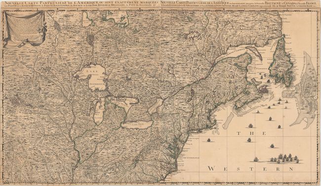
Auction 151, Lot 101
Subject: Colonial United States & Canada
Popple/Covens & Mortier
Nouvelle Carte Particuliere de l'Amerique, ou Sont Exactement Marquees, une Partie de la Baye d'Hudson… / … Ou sont Exactement Marquees la Nouvelle Bretagne, le Canada, ou Nouvelle France…, 1737
Size: 40.1 x 22.5 inches (101.9 x 57.2 cm)
Estimate: $3,500 - $4,500
The Two Northern Sheets of the Reduced Size Edition of Popple's Map
Sold for: $2,500
Closed on 11/19/2014
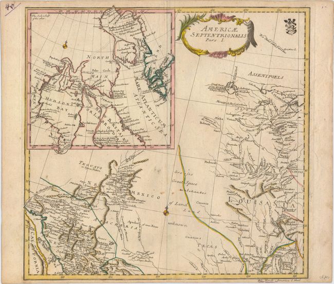
Auction 151, Lot 102
Subject: Colonial United States & Canada
Euler, Leonhard
Americae Septentrionalis Pars I, 1753
Size: 14.3 x 13.6 inches (36.3 x 34.5 cm)
Estimate: $400 - $500
NO RESERVE
Unsold
Closed on 11/19/2014
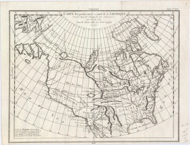
Auction 151, Lot 103
Subject: Colonial United States & Canada
Robert de Vaugondy, Didier
Carte des Parties Nord et Ouest de l'Amerique Dressee d'Apres les Relations les Plus Authentiques par M... en 1764, 1772
Size: 15.2 x 11.8 inches (38.6 x 30 cm)
Estimate: $200 - $230
Sold for: $110
Closed on 11/19/2014
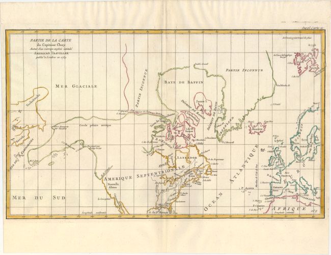
Auction 151, Lot 104
Subject: Colonial United States & Canada, Arctic
Robert de Vaugondy, Didier
Partie de la Carte du Capitaine Cluny Auteur d'un Ouvrage Anglois Intitule American Traveller Publie a ' Londres en 1769, 1772
Size: 19.2 x 11.6 inches (48.8 x 29.5 cm)
Estimate: $200 - $230
Unsold
Closed on 11/19/2014
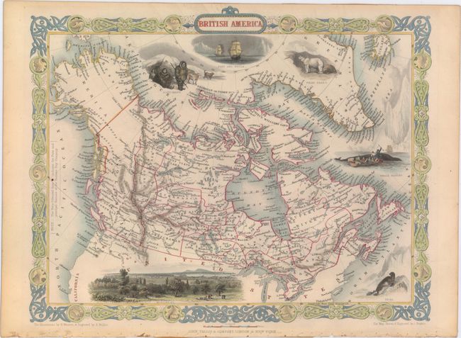
Auction 151, Lot 105
Subject: Canada & United States
Tallis, John
British America, 1850
Size: 13 x 10.3 inches (33 x 26.2 cm)
Estimate: $240 - $300
Sold for: $300
Closed on 11/19/2014
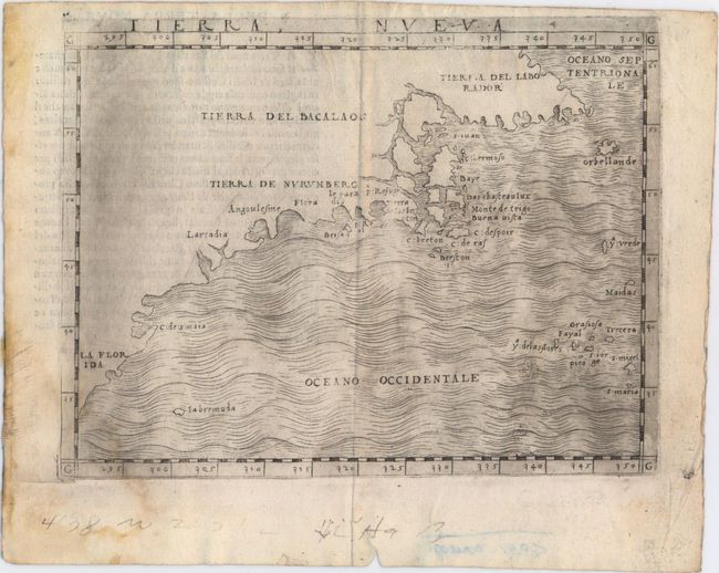
Auction 151, Lot 106
Subject: Eastern United States & Canada
Gastaldi, Giacomo
Tierra Nueva, 1548
Size: 6.7 x 5.1 inches (17 x 13 cm)
Estimate: $2,400 - $3,000
The First Published Map Devoted to the East Coast of North America
Sold for: $2,100
Closed on 11/19/2014
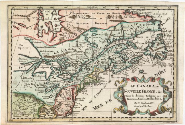
Auction 151, Lot 107
Subject: Colonial Eastern United States & Canada, Great Lakes
Sanson, Nicolas
Le Canada, ou Nouvelle France, &c. Tiree de Diverses Relations des Francois, Anglois, Hollandois, &c., 1700
Size: 12.1 x 8.3 inches (30.7 x 21.1 cm)
Estimate: $800 - $950
Small Version of a Keystone Map for Great Lakes Collections
Sold for: $550
Closed on 11/19/2014
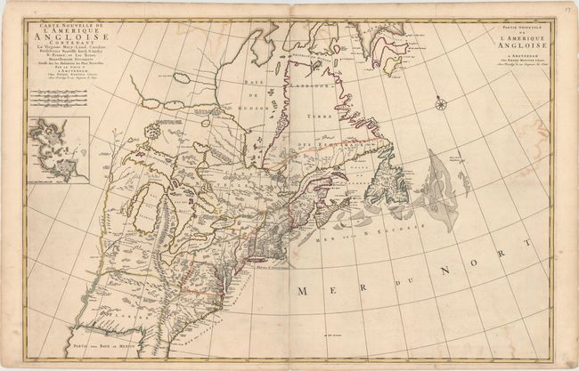
Auction 151, Lot 108
Subject: Colonial Eastern United States & Canada
Mortier, Pierre
Carte Nouvelle de l'Amerique Angloise Contenant la Virginie, Mary-Land, Caroline, Pensylvania Nouvelle Iorck, N: Iarsey N: France, et les Terres Nouvellement Decouerte..., 1700
Size: 35.8 x 23.4 inches (90.9 x 59.4 cm)
Estimate: $2,400 - $3,000
A Map Showing Fascinating Geographic Misconceptions
Unsold
Closed on 11/19/2014
Auction 151, Lot 109
Subject: Colonial Eastern United States & Canada
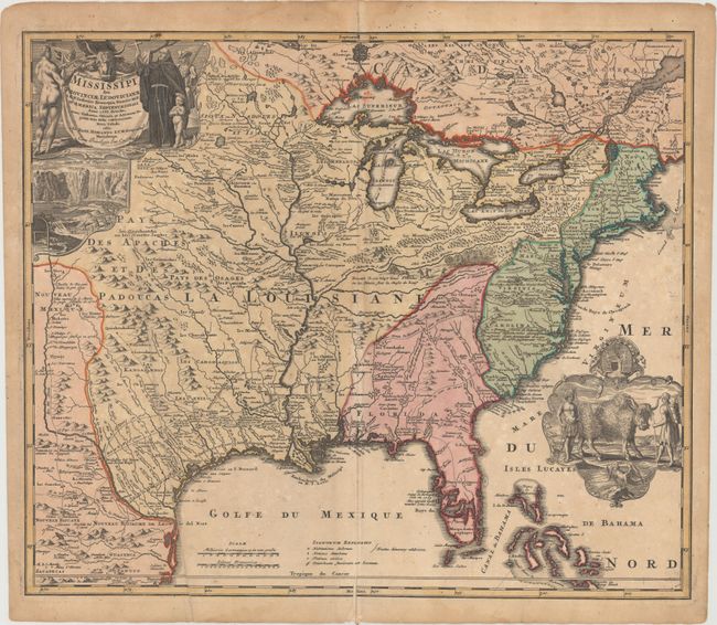
Homann, Johann Baptist
Amplissimae Regionis Mississipi Seu Provinciae Ludovicianae…, 1720
Size: 22.8 x 19.3 inches (57.9 x 49 cm)
Estimate: $1,500 - $1,800
Sold for: $1,500
Closed on 11/19/2014
Auction 151, Lot 110
Subject: Colonial Eastern United States & Canada, Great Lakes
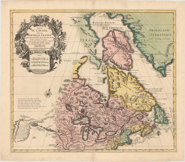
Delisle/Covens & Mortier
Carte du Canada ou de la Nouvelle France et des Decouvertes qui y ont ete Faites..., 1730
Size: 22.6 x 19.3 inches (57.4 x 49 cm)
Estimate: $1,400 - $1,700
One of the Most Influential Maps of Canada, the Great Lakes and Upper Midwest
Sold for: $1,400
Closed on 11/19/2014
Auction 151, Lot 111
Subject: Colonial Eastern United States & Canada
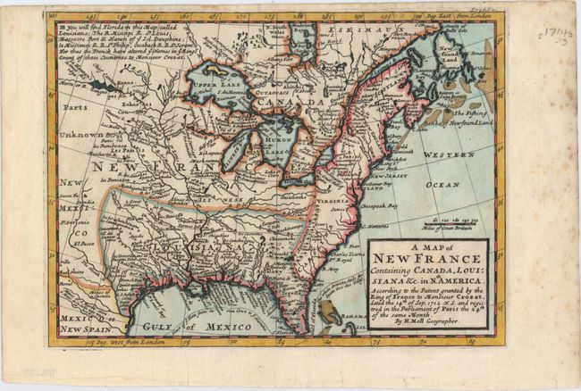
Moll, Herman
A Map of New France Containing Canada, Louisiana &c. in Nth. America..., 1717
Size: 10.2 x 7.2 inches (25.9 x 18.3 cm)
Estimate: $550 - $650
Sold for: $450
Closed on 11/19/2014
Auction 151, Lot 112
Subject: Colonial Eastern United States & Canada, Great Lakes
Robert de Vaugondy, Didier
Partie de l'Amerique Septent? qui Comprend la Nouvelle France ou le Canada, 1755
Size: 23.8 x 18.8 inches (60.5 x 47.8 cm)
Estimate: $700 - $850
Unsold
Closed on 11/19/2014
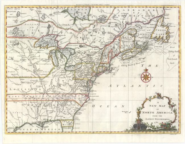
Auction 151, Lot 113
Subject: Colonial Eastern United States & Canada
Spilsbury, J.
A New Map of North America from the Latest Discoveries, 1761
Size: 14.8 x 10.8 inches (37.6 x 27.4 cm)
Estimate: $600 - $750
Sold for: $500
Closed on 11/19/2014
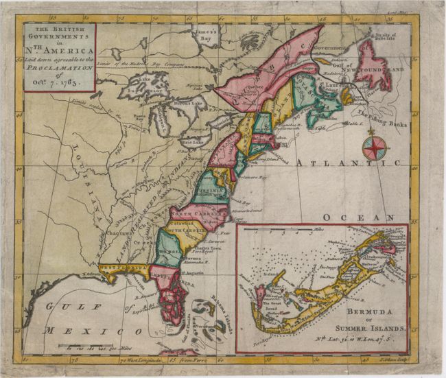
Auction 151, Lot 114
Subject: Colonial Eastern United States & Canada
Gibson, John
The British Governments in Nth. America Laid Down Agreeable to the Proclamation of Octr. 7. 1763, 1763
Size: 9.2 x 8 inches (23.4 x 20.3 cm)
Estimate: $300 - $400
Sold for: $600
Closed on 11/19/2014
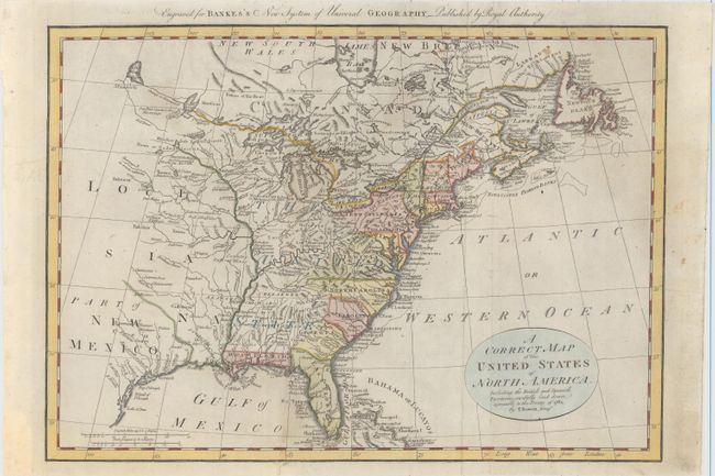
Auction 151, Lot 115
Subject: Eastern United States & Canada
Bowen, Thomas
A Correct Map of the United States of North America. Including the British and Spanish Territories, Carefully Laid Down Agreeable to the Treaty of 1784, 1787
Size: 17.6 x 12.4 inches (44.7 x 31.5 cm)
Estimate: $375 - $450
Sold for: $500
Closed on 11/19/2014
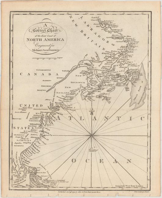
Auction 151, Lot 116
Subject: Eastern United States & Canada
Malham, John (Rev.)
A Correct Chart of the East Coast of North America Engraved for Malham's Naval Gazetteer, 1795
Size: 7.4 x 9.4 inches (18.8 x 23.9 cm)
Estimate: $120 - $150
Sold for: $75
Closed on 11/19/2014
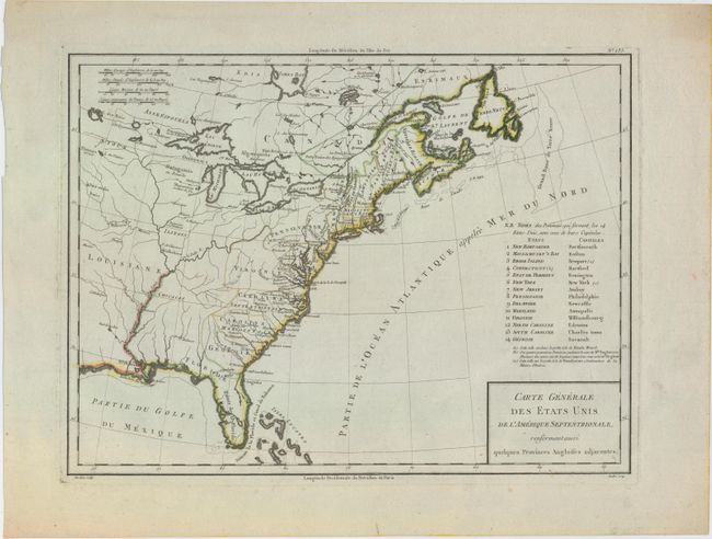
Auction 151, Lot 117
Subject: Eastern United States & Canada
Tardieu, Pierre Francois
Carte Generale des Etats Unis de l'Amerique Septentrionale, Renfermant Aussi Quelques Provinces Angloises Adjacentes, 1797
Size: 17 x 12.7 inches (43.2 x 32.3 cm)
Estimate: $350 - $425
Unsold
Closed on 11/19/2014
Auction 151, Lot 118
Subject: Eastern United States & Canada
Anon.
The United States of North America with the British Territorys, 1800
Size: 7.9 x 9.3 inches (20.1 x 23.6 cm)
Estimate: $170 - $200
Unsold
Closed on 11/19/2014
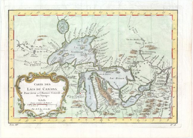
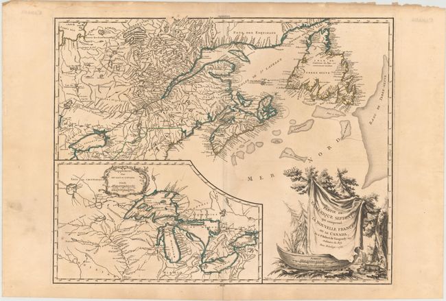
Auction 151, Lot 119
Subject: Colonial Great Lakes
Bellin, Jacques Nicolas
Carte des Lacs du Canada pour Servir a l'Histoire Generale des Voyages, 1757
Size: 11.5 x 7.8 inches (29.2 x 19.8 cm)
Estimate: $450 - $550
Sold for: $325
Closed on 11/19/2014
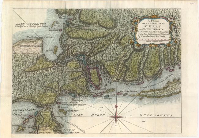
Auction 151, Lot 120
Subject: Colonial Great Lakes
Anon.
A Plan of the Straits of St. Mary, and Michilimakinac, to Shew the Situation & Importance of the two Westernmost Settlements of Canada for the Fur Trade, 1761
Size: 12.6 x 9.3 inches (32 x 23.6 cm)
Estimate: $350 - $425
Sold for: $550
Closed on 11/19/2014
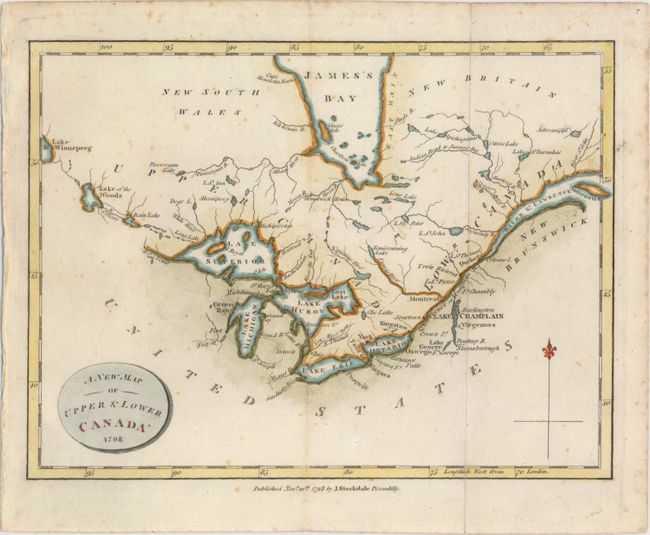
Auction 151, Lot 121
Subject: Canada, Great Lakes
Stockdale, John
A New Map of Upper & Lower Canada, 1798
Size: 9.1 x 6.8 inches (23.1 x 17.3 cm)
Estimate: $180 - $210
Sold for: $130
Closed on 11/19/2014
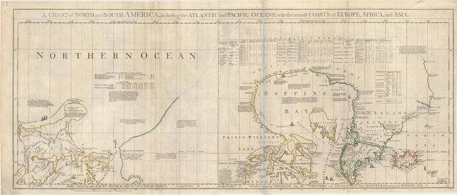
Auction 151, Lot 122
Subject: Colonial Canada & Alaska
Jefferys/Sayer & Bennett
A Chart of North and South America, Including the Atlantic and Pacific Oceans, with the Nearest Coasts of Europe, Africa, and Asia, 1775
Size: 43.6 x 17.9 inches (110.7 x 45.5 cm)
Estimate: $800 - $1,000
Sold for: $900
Closed on 11/19/2014
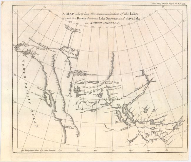
Auction 151, Lot 123
Subject: Western Canada & Alaska
Anon.
A Map Shewing the Communication of the Lakes and the Rivers Between Lake Superior and Slave Lake in North America, 1790
Size: 9.3 x 7.8 inches (23.6 x 19.8 cm)
Estimate: $240 - $300
Sold for: $170
Closed on 11/19/2014
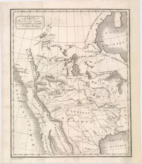
Auction 151, Lot 124
Subject: Western United States & Canada
Tardieu, Jean Baptiste Pierre
Carte pour Servir au Voyage des Capes. Lewis et Clarke, a l'Ocean Pacifique, 1810
Size: 7.9 x 9.6 inches (20.1 x 24.4 cm)
Estimate: $450 - $550
Sold for: $550
Closed on 11/19/2014
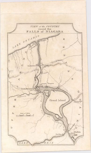
Auction 151, Lot 125
Subject: United States
Melish, John
[Lot of 4] View of the Country Round the Falls of Niagara [and] View of the Country Round Pittsburg [and] View of the Country Round Zanesville [and] Falls of Ohio, 1812
Size: 4.2 x 6.6 inches (10.7 x 16.8 cm)
Estimate: $240 - $300
Sold for: $150
Closed on 11/19/2014
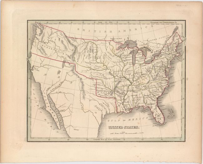
Auction 151, Lot 126
Subject: United States
Bradford, Thomas Gamaliel
United States, 1835
Size: 10 x 7.7 inches (25.4 x 19.6 cm)
Estimate: $110 - $140
Sold for: $90
Closed on 11/19/2014
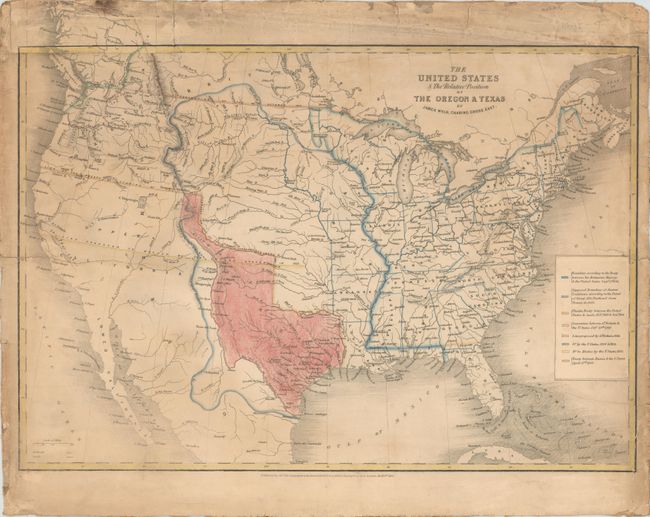
Auction 151, Lot 127
Subject: United States, Texas
Wyld, James
The United States & The Relative Position of the Oregon & Texas, 1845
Size: 21.5 x 15 inches (54.6 x 38.1 cm)
Estimate: $500 - $650
Sold for: $500
Closed on 11/19/2014
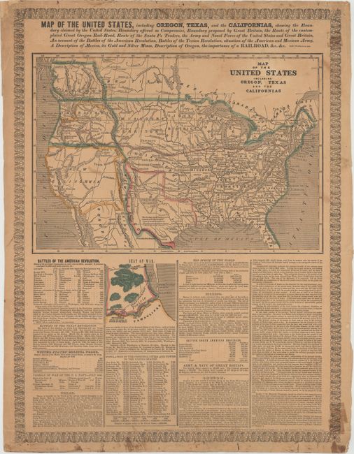
Auction 151, Lot 128
Subject: United States
Haven, John
Map of the United States Including Oregon, Texas and the Californias…, 1846
Size: 15.3 x 10.6 inches (38.9 x 26.9 cm)
Estimate: $800 - $1,000
Sold for: $700
Closed on 11/19/2014
Auction 151, Lot 129
Subject: United States, Texas
Gilman, E.
[Untitled - United States], 1848
Size: 33.4 x 13.8 inches (84.8 x 35.1 cm)
Estimate: $600 - $800
Sold for: $550
Closed on 11/19/2014
Auction 151, Lot 130
Subject: United States
Baedeker & Company
De Vereenigde Staten van Noord-Amerika, 1850
Size: 11.1 x 8.2 inches (28.2 x 20.8 cm)
Estimate: $120 - $150
Sold for: $80
Closed on 11/19/2014
Auction 151, Lot 131
Subject: United States
Marzolla, Benedetto
Stati-Uniti dell' America Settentrionale Coi Territorii Recentemente Annessi, 1854
Size: 24.3 x 17.1 inches (61.7 x 43.4 cm)
Estimate: $325 - $425
Unsold
Closed on 11/19/2014
Auction 151, Lot 132
Subject: United States, Civil War
London Printing & Publishing
United States, 1861
Size: 16.9 x 10.8 inches (42.9 x 27.4 cm)
Estimate: $250 - $325
Sold for: $180
Closed on 11/19/2014
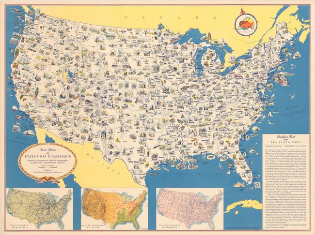
Auction 151, Lot 133
Subject: United States
Carte Illustree des Etats-Unis d'Amerique Montrant les Ressources, Produits, Topographie, et Principales Caracteristiques Regionales, 1944
Size: 31.3 x 23.4 inches (79.5 x 59.4 cm)
Estimate: $70 - $90
Sold for: $110
Closed on 11/19/2014
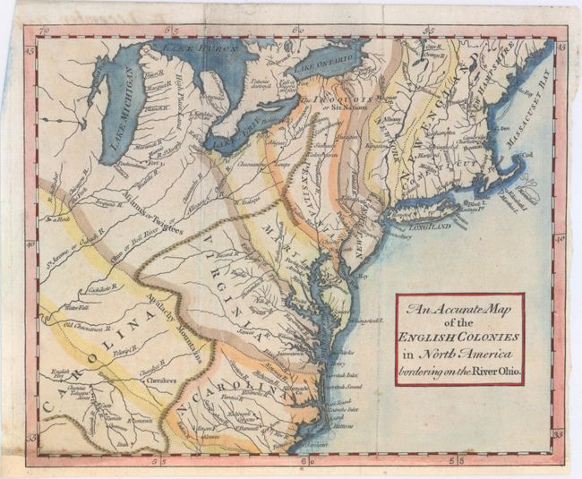
Auction 151, Lot 134
Subject: Colonial Eastern United States
Anon.
An Accurate Map of the English Colonies in North America Bordering on the River Ohio, 1754
Size: 9.6 x 7.9 inches (24.4 x 20.1 cm)
Estimate: $375 - $475
Sold for: $475
Closed on 11/19/2014
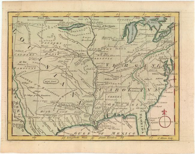
Auction 151, Lot 135
Subject: Colonial Eastern United States
Gibson, John
[Untitled - Louisiana, Virginia & Carolina], 1763
Size: 9.5 x 7.1 inches (24.1 x 18 cm)
Estimate: $250 - $325
Sold for: $180
Closed on 11/19/2014
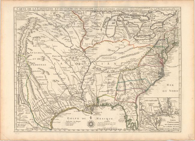
Auction 151, Lot 136
Subject: Colonial Eastern United States, Louisiana Territory
Delisle/Dezauche
Carte de la Louisiane et du Cours du Mississipi avec les Colonies Anglaises, 1782
Size: 25.6 x 19.3 inches (65 x 49 cm)
Estimate: $1,600 - $1,900
Delisle's Influential Map of the Louisiana Territory
Sold for: $1,300
Closed on 11/19/2014
Auction 151, Lot 137
Subject: Eastern United States
Crevecoeur, Michel Guillaume De
[Map and 3 Text Volumes] Carte Generale des Etats de Virginie, Maryland, Delaware, Pensilvanie, Nouveau-Jersey, New-York, Connecticut, et Isle de Rhodes...[and] Lettres d'un Cultivateur Americain…, 1787
Size: 25.8 x 18.9 inches (65.5 x 48 cm)
Estimate: $900 - $1,100
Sold for: $650
Closed on 11/19/2014
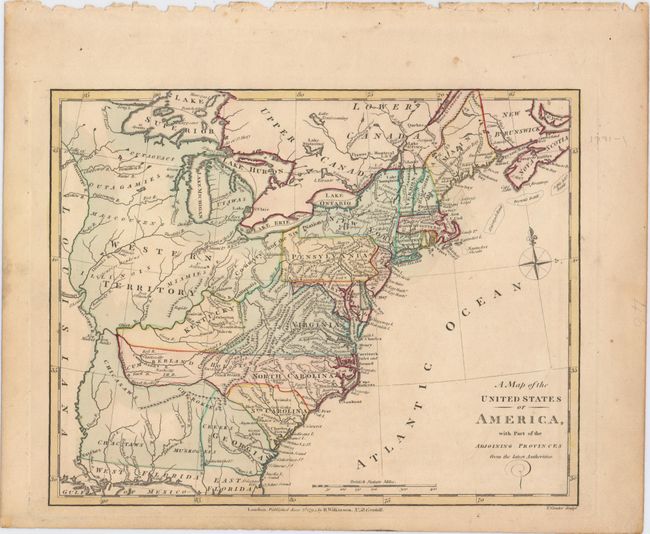
Auction 151, Lot 138
Subject: Eastern United States
Wilkinson, Robert
A Map of the United States of America, with Part of the Adjoining Provinces from the Latest Authorities, 1791
Size: 11 x 8.5 inches (27.9 x 21.6 cm)
Estimate: $200 - $230
Sold for: $240
Closed on 11/19/2014
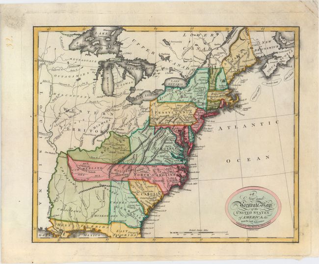
Auction 151, Lot 139
Subject: Eastern United States
Brown, Thomas
A New and Accurate Map of the United States of America, &c. from the Best Authorities, 1793
Size: 13.1 x 10.6 inches (33.3 x 26.9 cm)
Estimate: $500 - $650
Sold for: $600
Closed on 11/19/2014
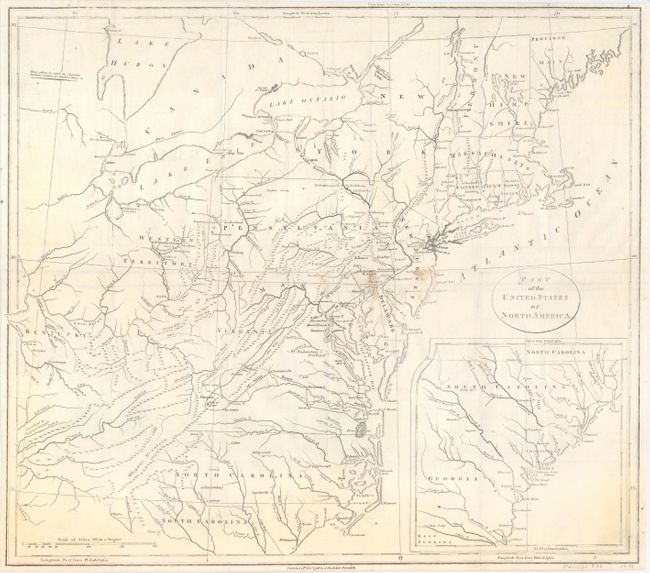
Auction 151, Lot 140
Subject: Eastern United States
Stockdale, John
Part of the United States of North America, 1798
Size: 18.4 x 16.2 inches (46.7 x 41.1 cm)
Estimate: $375 - $475
Unsold
Closed on 11/19/2014
Auction 151, Lot 141
Subject: Eastern United States
Russell, John C.
States of America, Drawn from the Best Authorities, 1801
Size: 18.1 x 15.7 inches (46 x 39.9 cm)
Estimate: $425 - $550
Sold for: $375
Closed on 11/19/2014
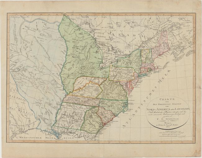
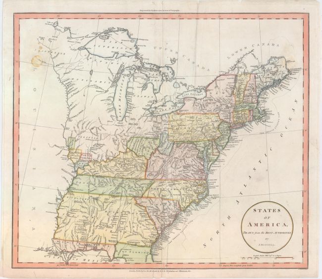
Auction 151, Lot 142
Subject: Eastern United States
Weimar Geographisches Institut
Charte von den Vereinigten Staaten von Nord-America nebst Louisiana..., 1805
Size: 26.9 x 18.6 inches (68.3 x 47.2 cm)
Estimate: $700 - $900
Sold for: $450
Closed on 11/19/2014
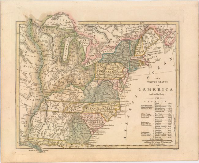
Auction 151, Lot 143
Subject: Eastern United States
Wilkinson, Robert
The United States of America Confirmed by Treaty. 1783, 1812
Size: 11.3 x 9.8 inches (28.7 x 24.9 cm)
Estimate: $900 - $1,100
Early Map of the United States Featuring Franklinia and the Indiana Land Company
Sold for: $700
Closed on 11/19/2014
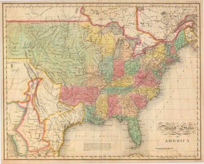
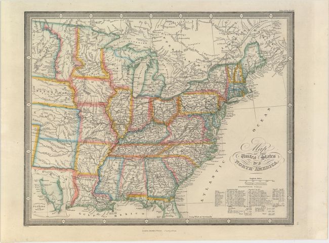
Auction 151, Lot 144
Subject: Eastern United States
Melish, John
United States of America, 1827
Size: 21.4 x 17 inches (54.4 x 43.2 cm)
Estimate: $500 - $650
Sold for: $550
Closed on 11/19/2014
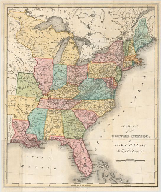
Auction 151, Lot 145
Subject: Eastern United States
Tanner, Henry Schenck
A Map of the United States, of America, 1828
Size: 12.8 x 15.1 inches (32.5 x 38.4 cm)
Estimate: $300 - $375
Unsold
Closed on 11/19/2014
Auction 151, Lot 146
Subject: Eastern United States
Wyld, James
Map of the United States of North America, 1860
Size: 10.8 x 8.6 inches (27.4 x 21.8 cm)
Estimate: $190 - $230
Unsold
Closed on 11/19/2014
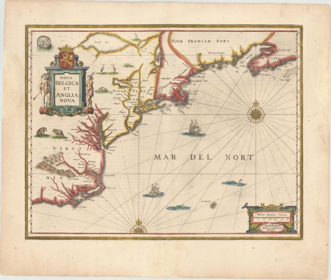
Auction 151, Lot 147
Subject: Colonial New England & Mid-Atlantic United States
Jansson, Jan
Nova Belgica et Anglia Nova, 1653
Size: 19.9 x 15.3 inches (50.5 x 38.9 cm)
Estimate: $1,600 - $1,900
Jansson's Influential Map of the East Coast
Sold for: $1,100
Closed on 11/19/2014
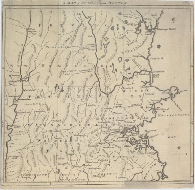
Auction 151, Lot 148
Subject: Colonial Massachusetts & New Hampshire
Anon.
A Map of 100 Miles Round Boston, 1775
Size: 9.7 x 8.9 inches (24.6 x 22.6 cm)
Estimate: $180 - $220
Sold for: $160
Closed on 11/19/2014
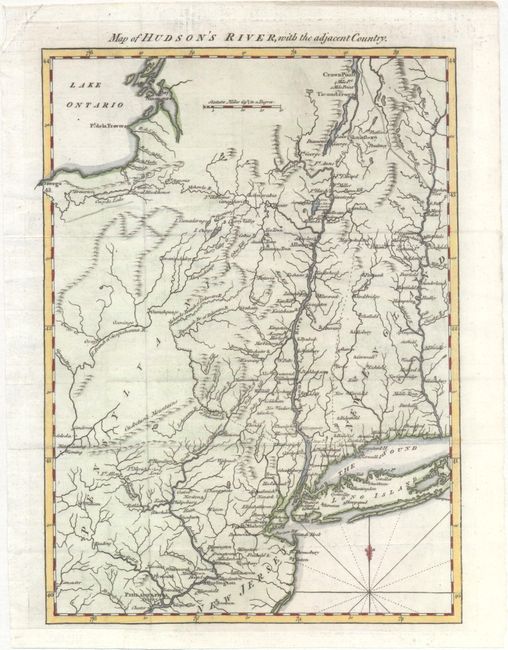
Auction 151, Lot 149
Subject: Colonial New England - United States, Revolutionary War
Anon.
Map of Hudson's River, with the Adjacent Country, 1778
Size: 8.4 x 11.6 inches (21.3 x 29.5 cm)
Estimate: $230 - $275
Sold for: $170
Closed on 11/19/2014
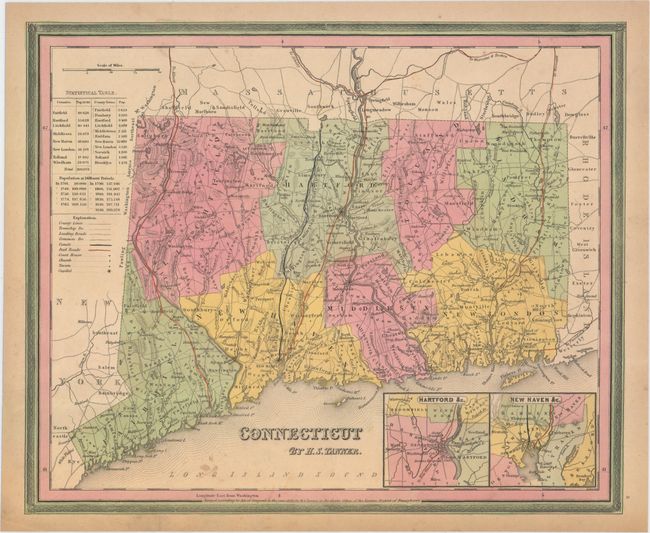
Auction 151, Lot 150
Subject: New England - United States
Tanner, Henry Schenck
[Lot of 4] Connecticut [and] Massachusetts and Rhode Island [and] New Hampshire & Vermont [and] A New Map of Maine, 1839-41
Size: See Description
Estimate: $350 - $425
Sold for: $200
Closed on 11/19/2014
236 lots
Page 1 of 5