Filtered by Category:United States(Show All Categories)
Showing results for:Auction 112
Catalog Archive
194 lots
Page 1 of 4
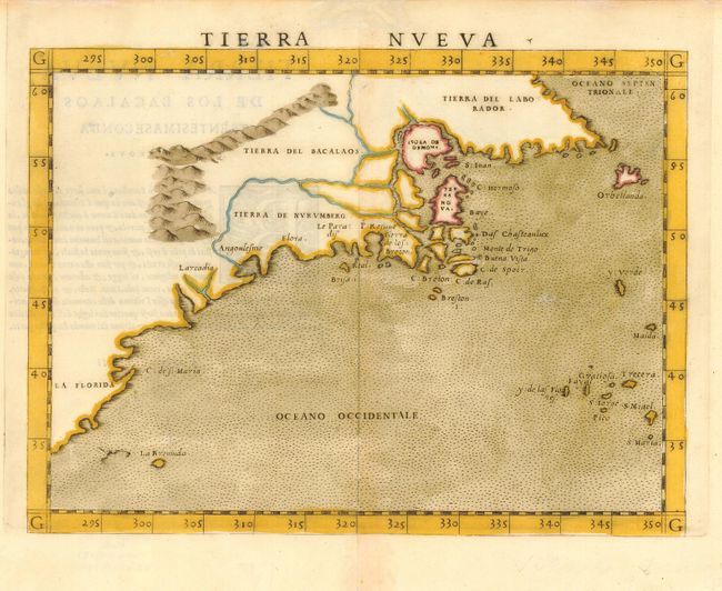
Auction 112, Lot 113
Subject: Colonial United States and Canada
Ruscelli, Girolamo
Tierra Nueva, 1561
Size: 9.8 x 7.5 inches (24.9 x 19.1 cm)
Estimate: $1,300 - $1,500
Sold for: $1,400
Closed on 9/28/2005
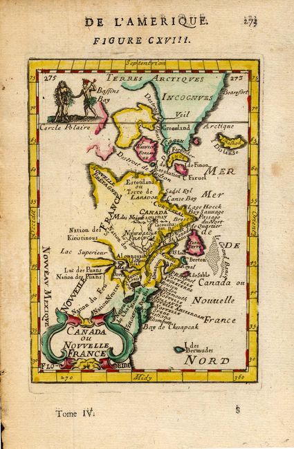
Auction 112, Lot 114
Subject: Colonial Canada and New England
Mallet, Alain Manesson
Canada ou Nouvelle France, 1683
Size: 4 x 5.5 inches (10.2 x 14 cm)
Estimate: $200 - $250
Sold for: $300
Closed on 9/28/2005
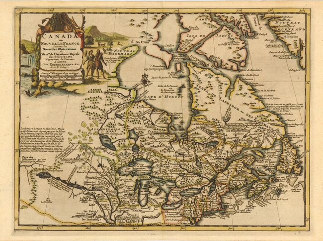
Auction 112, Lot 115
Subject: Colonial Canada and Great Lakes
Aa, Pieter van der
Canada ou Nouvelle France Suivant les Nouvelles Observations de Messrs. de l'Academie Royale des Sciences etc., 1714
Size: 12 x 9 inches (30.5 x 22.9 cm)
Estimate: $475 - $550
Sold for: $750
Closed on 9/28/2005
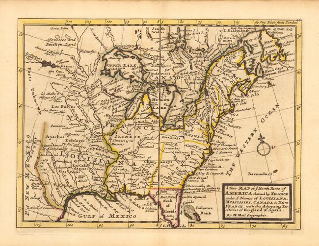
Auction 112, Lot 116
Subject: Colonial United States and Canada
Moll, Herman
A New Map of ye North Parts of America claimed by France under ye Names of Louisiana, Mississipi, Canada & New France, with the Adjoyning Territories of England & Spain, 1735
Size: 10.8 x 8 inches (27.4 x 20.3 cm)
Estimate: $550 - $650
Sold for: $425
Closed on 9/28/2005
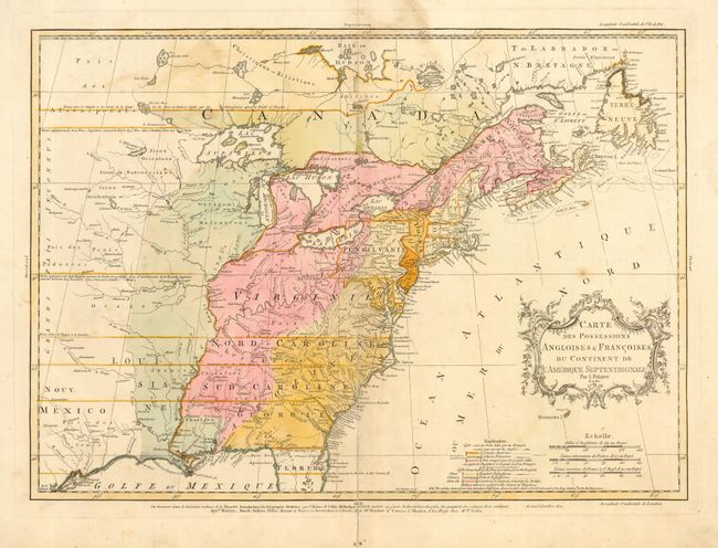
Auction 112, Lot 117
Subject: Colonial United States and Canada
Palairet, Jean
Carte des Possessions Angloises & Francoises du Continent de l'Amerique Septentrionale, 1756
Size: 22.5 x 16.7 inches (57.2 x 42.4 cm)
Estimate: $2,200 - $2,400
Unsold
Closed on 9/28/2005
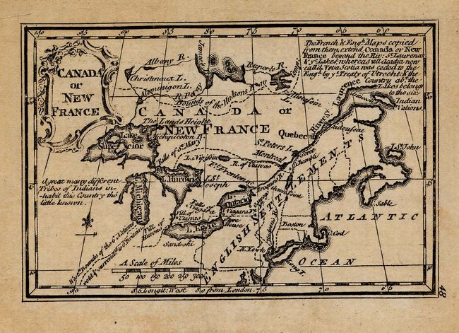
Auction 112, Lot 118
Subject: Colonial Canada and Great Lakes
Gibson, John
Canada or New France, 1758
Size: 3.8 x 2.5 inches (9.7 x 6.4 cm)
Estimate: $150 - $200
Sold for: $150
Closed on 9/28/2005
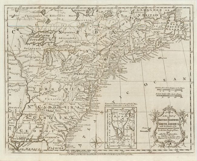
Auction 112, Lot 119
Subject: Colonial United States and Canada
Kitchin, Thomas
A New Map of the British Dominions in North America; with the Limits of the Governments Annexed thereto by the Late Treaty of Peace, and Settled by Proclamation, October 7th, 1763, 1763
Size: 11.8 x 9.4 inches (30 x 23.9 cm)
Estimate: $500 - $600
Sold for: $425
Closed on 9/28/2005
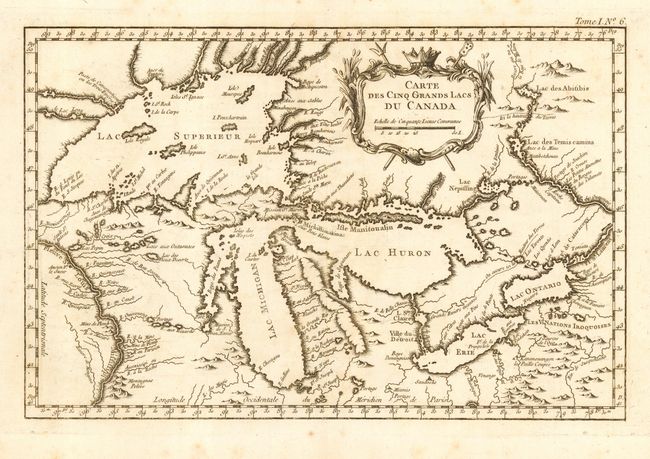
Auction 112, Lot 120
Subject: Colonial Great Lakes
Bellin, Jacques Nicolas
Carte des Cinq Grands Lacs du Canada, 1764
Size: 13.2 x 8.6 inches (33.5 x 21.8 cm)
Estimate: $700 - $800
Sold for: $650
Closed on 9/28/2005
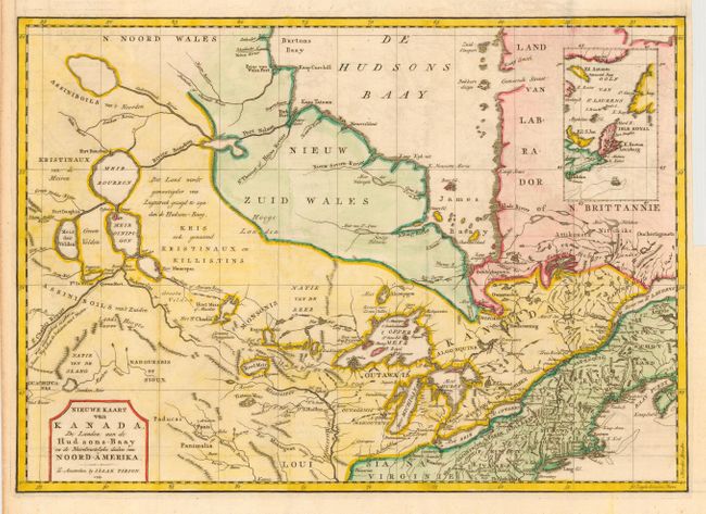
Auction 112, Lot 121
Subject: Colonial Canada and Great Lakes
Tirion, Isaac
Nieuwe Kaart van Kanada, de Landen aan de Hudsons-Baay en de Noordwestelyke deelen van Noord-Amerika, 1769
Size: 17 x 12.1 inches (43.2 x 30.7 cm)
Estimate: $325 - $375
Sold for: $375
Closed on 9/28/2005
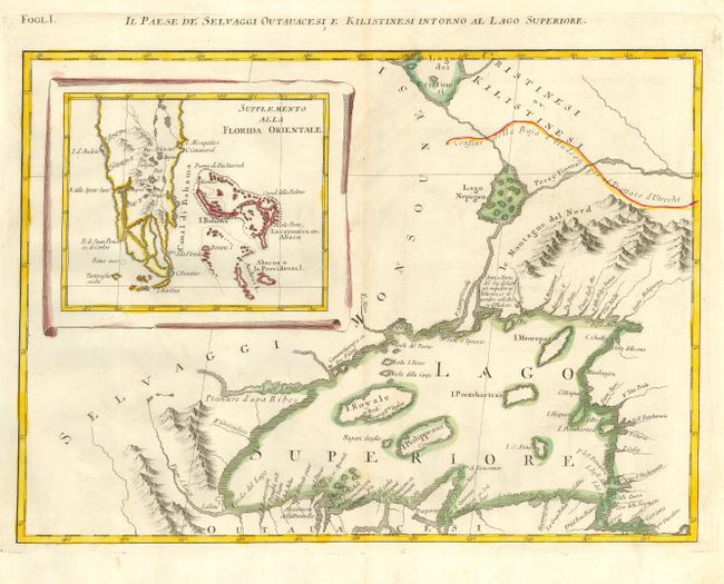
Auction 112, Lot 123
Subject: Colonial Great Lakes and Florida
Zatta, Antonio
Il Paese de Selvaggi Outauacesi e Kilistinesi Intorno al Lago Superiore, 1778
Size: 16.8 x 12.2 inches (42.7 x 31 cm)
Estimate: $400 - $500
Unsold
Closed on 9/28/2005
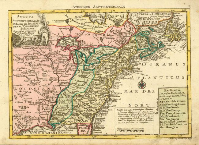
Auction 112, Lot 124
Subject: Eastern Canada & United States
Probst, Johann Michael
America Septentrionalis Coloniis in Interiorem Virginiam deductis &c., 1782
Size: 9.3 x 7 inches (23.6 x 17.8 cm)
Estimate: $400 - $450
Sold for: $650
Closed on 9/28/2005
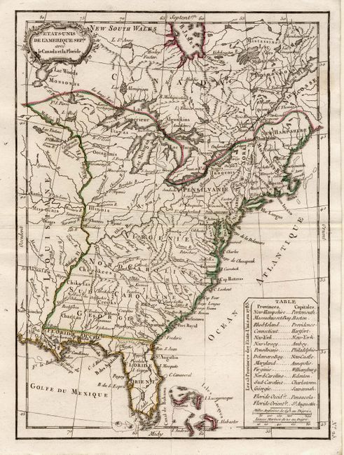
Auction 112, Lot 125
Subject: United States and Canada
Lattre, Jean
Etats-Unis de l'Amerique Seple avec le Canada et la Floride, 1790
Size: 7.2 x 9.7 inches (18.3 x 24.6 cm)
Estimate: $230 - $275
Unsold
Closed on 9/28/2005
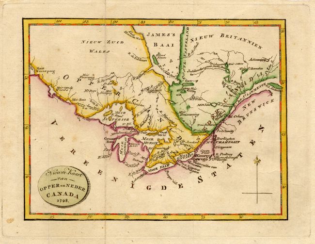
Auction 112, Lot 126
Subject: Canada and Great Lakes
Stockdale, John
Nieuwe Kaart van Opper en Neder Canada, 1798
Size: 9 x 6.8 inches (22.9 x 17.3 cm)
Estimate: $200 - $250
Unsold
Closed on 9/28/2005
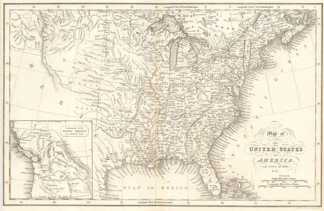
Auction 112, Lot 127
Subject: United States and Canada
Hinton, John Howard
Map of the United States of America and Nova Scotia, &c.&c., 1832
Size: 15.5 x 10 inches (39.4 x 25.4 cm)
Estimate: $150 - $200
Unsold
Closed on 9/28/2005
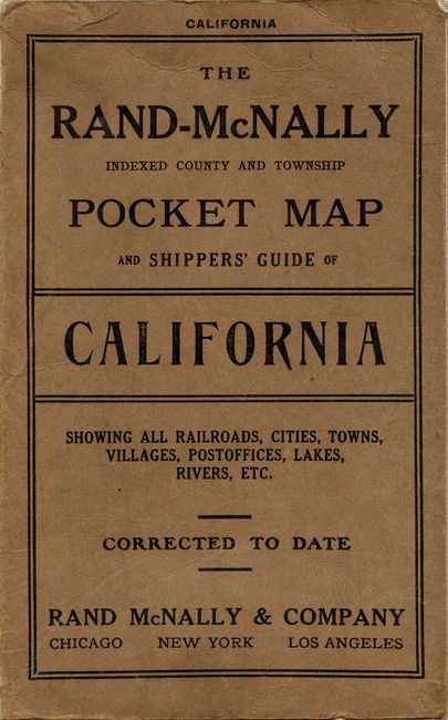
Auction 112, Lot 128
Subject: United States and Canada
Rand McNally & Co.
[Lot of 21 Pocket Maps], 1882-1921
Size: See Description
Estimate: $600 - $800
Sold for: $1,600
Closed on 9/28/2005
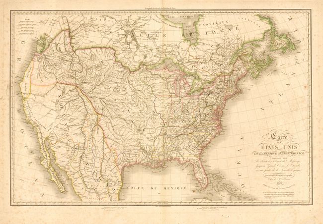
Auction 112, Lot 129
Subject: United States
Fremin, A. R.
Carte des Etats Unis de l'Amerique Septentrionale, 1820
Size: 31.5 x 20 inches (80 x 50.8 cm)
Estimate: $400 - $500
Sold for: $950
Closed on 9/28/2005
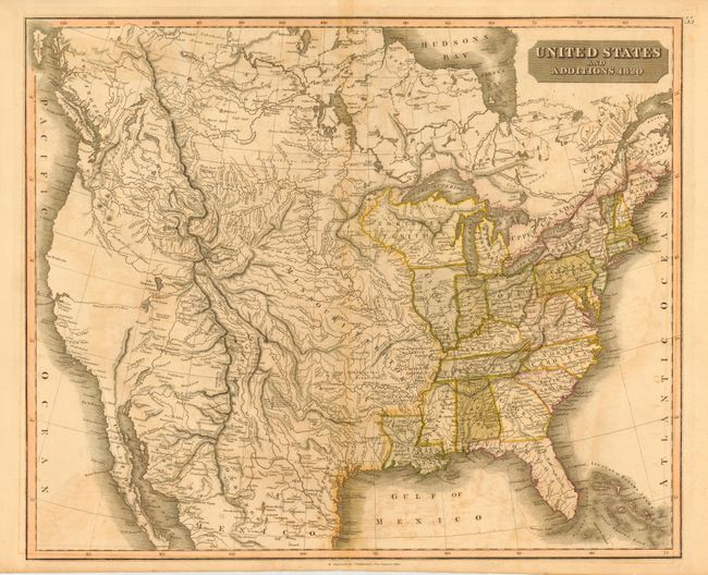
Auction 112, Lot 130
Subject: United States
Thomson, John
United States and Additions, 1820
Size: 23.8 x 20 inches (60.5 x 50.8 cm)
Estimate: $250 - $350
Sold for: $425
Closed on 9/28/2005
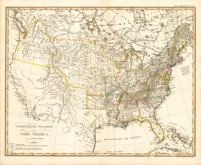
Auction 112, Lot 131
Subject: United States
Huebbe, Heinrich
Vereinigte Staaten von Nord-America, 1825
Size: 15.2 x 12 inches (38.6 x 30.5 cm)
Estimate: $200 - $250
Unsold
Closed on 9/28/2005
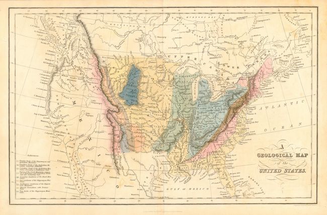
Auction 112, Lot 132
Subject: United States
Hinton, John Howard
A Geological Map of the United States, 1832
Size: 15.5 x 9.8 inches (39.4 x 24.9 cm)
Estimate: $150 - $200
Unsold
Closed on 9/28/2005
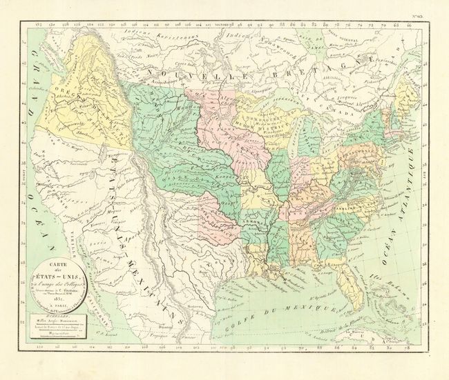
Auction 112, Lot 133
Subject: United States
Hachette, Louis Christophe Francois
Carte de Etats-Unis, a l'usage des Colleges…, 1832
Size: 15.8 x 12.7 inches (40.1 x 32.3 cm)
Estimate: $200 - $250
Sold for: $190
Closed on 9/28/2005
Auction 112, Lot 134
Subject: United States
U.S. Government
[Lot of 3 - Railroad Maps], 1844
Size: See Description
Estimate: $200 - $300
Sold for: $300
Closed on 9/28/2005
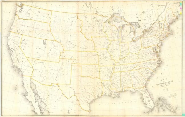
Auction 112, Lot 135
Subject: United States
Burr, David H.
Map of the United States Exhibiting the Several Collection Districts, 1856
Size: 49 x 31.5 inches (124.5 x 80 cm)
Estimate: $250 - $350
Sold for: $180
Closed on 9/28/2005
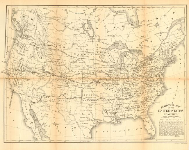
Auction 112, Lot 136
Subject: United States
U.S. Government
Statistical Map of the United States of America, 1864
Size: 19.8 x 14.8 inches (50.3 x 37.6 cm)
Estimate: $80 - $120
Sold for: $95
Closed on 9/28/2005
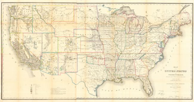
Auction 112, Lot 137
Subject: United States
General Land Office
Map of the United States and Territories Showing the extent of Public Surveys and other details constructed from the Plats and official sources of the General Land Office…, 1866
Size: 55.5 x 28.2 inches (141 x 71.6 cm)
Estimate: $400 - $500
Sold for: $475
Closed on 9/28/2005
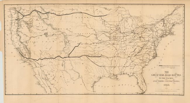
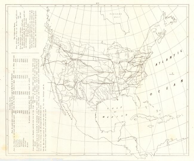
Auction 112, Lot 138
Subject: United States
Gorlinski, Joseph
The Great Railroad Routes to the Pacific, and Their Connections, 1869
Size: 27.5 x 14 inches (69.9 x 35.6 cm)
Estimate: $150 - $200
Sold for: $375
Closed on 9/28/2005
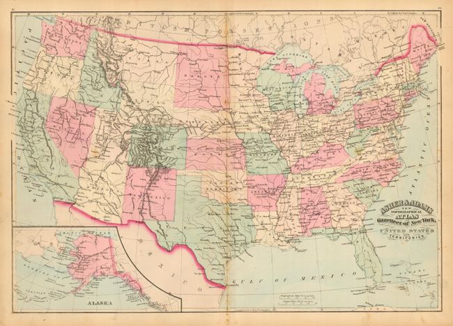
Auction 112, Lot 139
Subject: United States
Asher & Adams
United States and Territories, 1870
Size: 22 x 16 inches (55.9 x 40.6 cm)
Estimate: $70 - $100
Sold for: $75
Closed on 9/28/2005
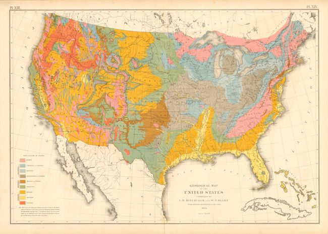
Auction 112, Lot 140
Subject: United States
Hitchcock, Charles Henry
Geological Map of the United States compiled by C.H. Hitchcock and W. P. Blake…, 1874
Size: 28.5 x 19.8 inches (72.4 x 50.3 cm)
Estimate: $200 - $300
Sold for: $190
Closed on 9/28/2005
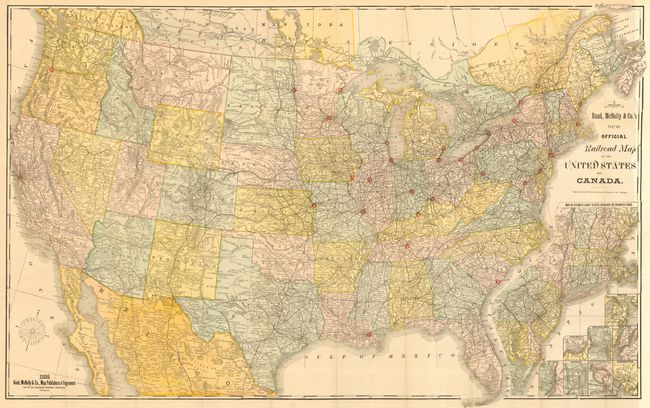
Auction 112, Lot 141
Subject: United States
Rand McNally & Co.
New Official Railroad Map of the United States and Canada, 1885
Size: 42.5 x 26.5 inches (108 x 67.3 cm)
Estimate: $200 - $250
Sold for: $210
Closed on 9/28/2005
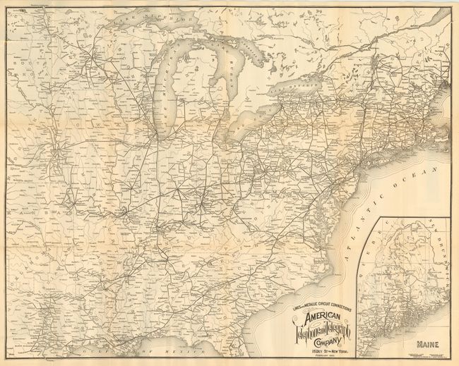
Auction 112, Lot 143
Subject: Eastern United States
Lines and Metallic Circuit Connections American Telephone and Telegraph Company, 1897
Size: 28.5 x 22.5 inches (72.4 x 57.2 cm)
Estimate: $180 - $220
Sold for: $425
Closed on 9/28/2005
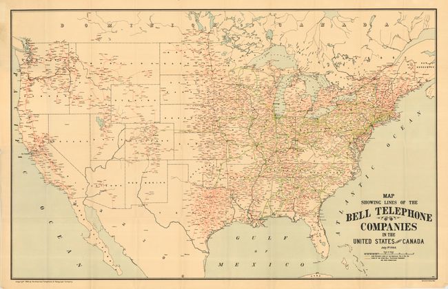
Auction 112, Lot 144
Subject: United States
Map Showing Lines of the Bell Telephone Companies in the United States and Canada July 1st 1904, 1904
Size: 39 x 25 inches (99.1 x 63.5 cm)
Estimate: $140 - $180
Sold for: $400
Closed on 9/28/2005
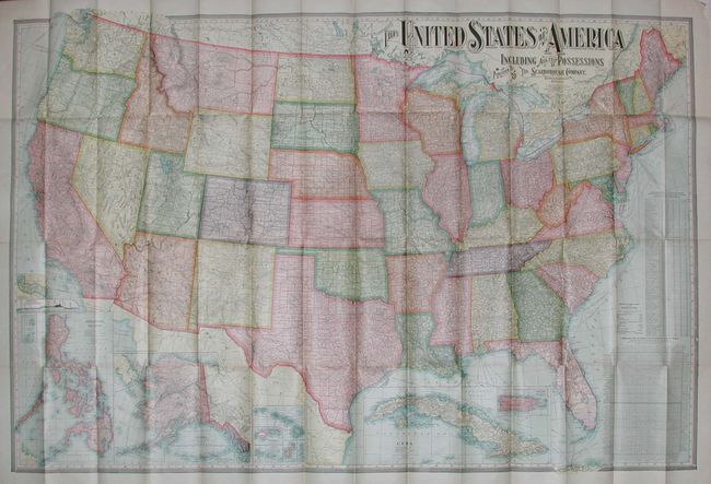
Auction 112, Lot 145
Subject: United States
Scarborough Company, The
The United States of America Including all Its Possessions, 1907
Size: 55.5 x 36.8 inches (141 x 93.5 cm)
Estimate: $75 - $100
Sold for: $65
Closed on 9/28/2005

Auction 112, Lot 146
Subject: Colonial United States
Delisle, Guillaume
Carte de la Louisiane et du Cours du Mississipi Dressee sur un Grand Nombre de Memoires entrautres sur ceux de Mr. le Maire, 1718
Size: 26 x 19.5 inches (66 x 49.5 cm)
Estimate: $4,000 - $5,000
Sold for: $4,750
Closed on 9/28/2005
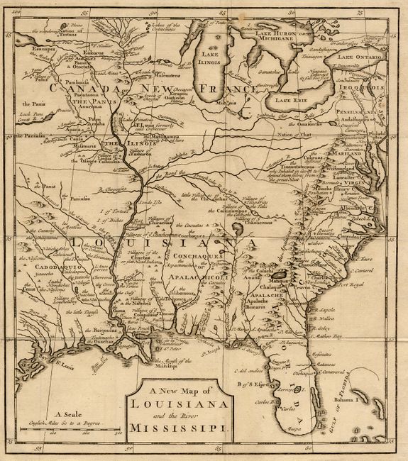
Auction 112, Lot 147
Subject: Colonial United States
Anon.
A New Map of Louisiana and the River Mississippi, 1720
Size: 9 x 10.2 inches (22.9 x 25.9 cm)
Estimate: $600 - $650
Sold for: $700
Closed on 9/28/2005
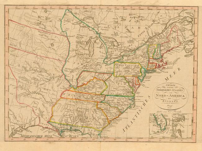
Auction 112, Lot 148
Subject: Eastern United States
Anon.
Charte von den Vereinigten Staaten von Nord-America mit Luisiana, 1818
Size: 16.4 x 11.6 inches (41.7 x 29.5 cm)
Estimate: $350 - $450
Sold for: $250
Closed on 9/28/2005
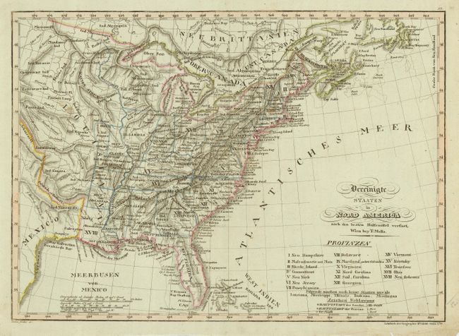
Auction 112, Lot 149
Subject: Eastern United States
Mollo, Tranquillo
Vereinigte Staaten in Nord America, 1818
Size: 17.6 x 13 inches (44.7 x 33 cm)
Estimate: $500 - $600
Sold for: $375
Closed on 9/28/2005
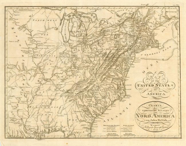
Auction 112, Lot 150
Subject: Eastern United States
Melish, John
Map of the United States of America (Charte der Vereinigten Staaten von Nord America), 1819
Size: 17 x 13 inches (43.2 x 33 cm)
Estimate: $400 - $500
Sold for: $375
Closed on 9/28/2005
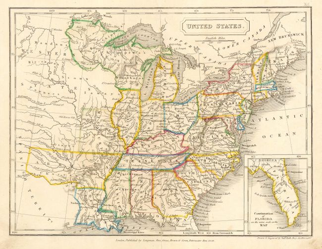
Auction 112, Lot 151
Subject: Eastern United States
Hall, Sidney
United States, 1829
Size: 9.8 x 7 inches (24.9 x 17.8 cm)
Estimate: $100 - $120
Sold for: $110
Closed on 9/28/2005
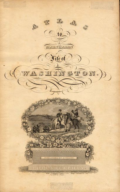
Auction 112, Lot 152
Subject: Eastern United States
Marshall, John
[Lot of 11 - Revolutionary War Plans], 1832
Size: 7 x 9.5 inches (17.8 x 24.1 cm)
Estimate: $350 - $450
Sold for: $425
Closed on 9/28/2005
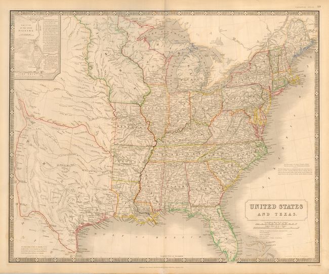
Auction 112, Lot 153
Subject: Eastern United States and Texas
Johnston, Alexander K.
United States and Texas, 1843
Size: 24.3 x 20 inches (61.7 x 50.8 cm)
Estimate: $1,200 - $1,500
Sold for: $1,200
Closed on 9/28/2005
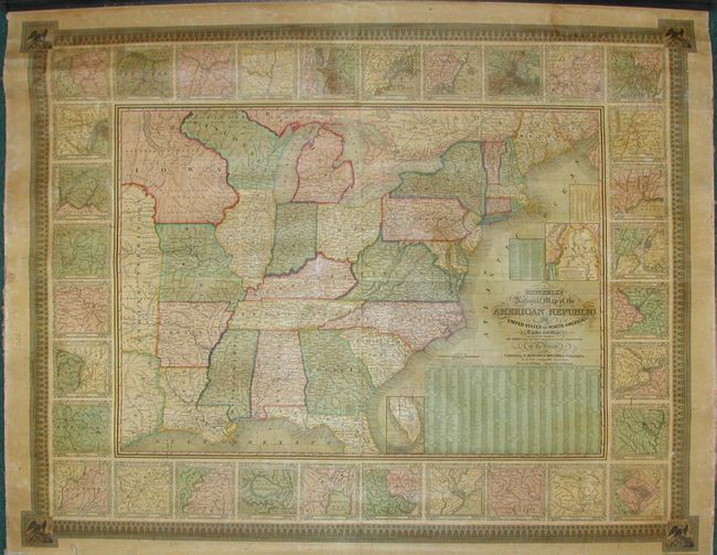
Auction 112, Lot 154
Subject: Eastern United States
Mitchell, Samuel Augustus
Mitchell's National Map of the American Republic or United States of North America, Together with Maps of the Vicinities of Thirty-Two of the Principal Cities and Towns in the Union, 1844
Size: 45.8 x 36 inches (116.3 x 91.4 cm)
Estimate: $1,200 - $1,600
Sold for: $950
Closed on 9/28/2005
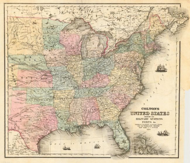
Auction 112, Lot 155
Subject: Eastern United States
Colton, Joseph Hutchins
Colton's United States Shewing the Military Stations Forts &c., 1861
Size: 17 x 14.5 inches (43.2 x 36.8 cm)
Estimate: $375 - $450
Sold for: $400
Closed on 9/28/2005
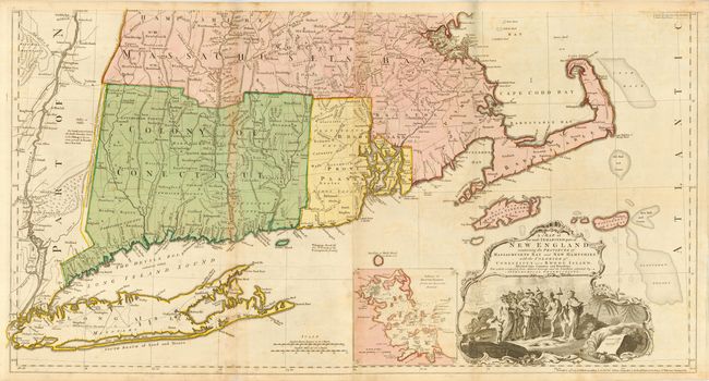
Auction 112, Lot 156
Subject: Colonial New England
Jefferys, Thomas
A Map of the Most Inhabited part of New England containing the Provinces of Massachusetts Bay and New Hampshire with the Colonies of Connecticut and Rhode Island Divided into Counties and Townships…, 1774
Size: 39.3 x 41.5 inches (99.8 x 105.4 cm)
Estimate: $7,000 - $9,000
Sold for: $7,500
Closed on 9/28/2005
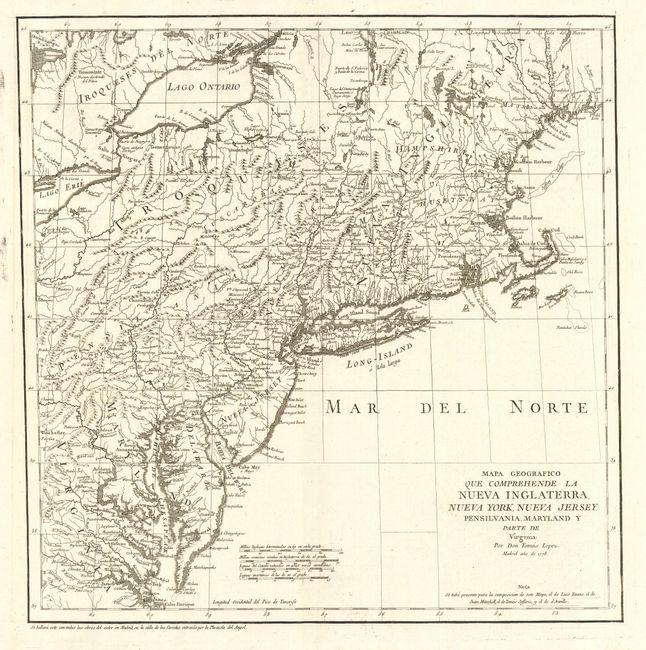
Auction 112, Lot 157
Subject: New England
Lopez de Vargas Machuca, Thomas (don)
Mapa Geografico Que Comprehende La Nueva Inglaterra, Nueva York, Nueva Jersey, Pensilvania, Maryland y Parte de Virginia, 1778
Size: 15.2 x 15.5 inches (38.6 x 39.4 cm)
Estimate: $800 - $900
Sold for: $600
Closed on 9/28/2005
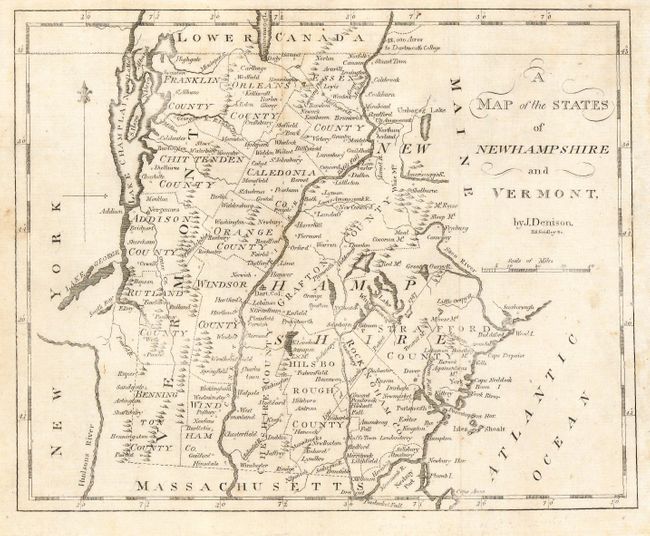
Auction 112, Lot 158
Subject: New Hampshire & Vermont
Morse, Jedidiah (Rev.)
A Map of Newhampshire and Vermont, 1802
Size: 9.2 x 7.4 inches (23.4 x 18.8 cm)
Estimate: $200 - $250
Sold for: $250
Closed on 9/28/2005
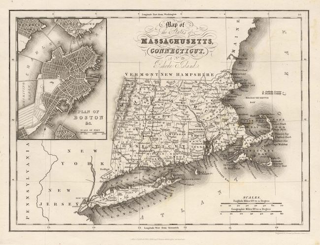
Auction 112, Lot 159
Subject: New England
Hinton, John Howard
[Lot of 2] Map of the States of Massachusetts, Connecticut, and Rhode Island [and] New England and New York in 1697 From the Magnalia Americana, 1832
Size: 10 x 7.2 inches (25.4 x 18.3 cm)
Estimate: $200 - $250
Sold for: $210
Closed on 9/28/2005
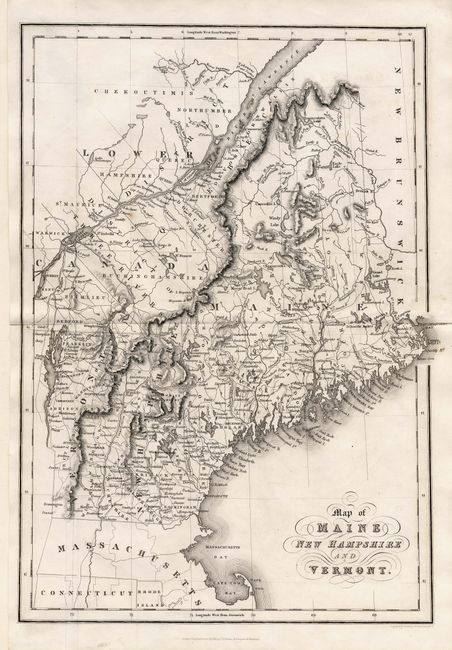
Auction 112, Lot 160
Subject: Maine, New Hampshire and Vermont
Hinton, John Howard
[Lot of 5] Map of the States of Maine, New Hampshire and Vermont [and 4 view of New Hampshire], 1832
Size: See Description
Estimate: $200 - $250
Sold for: $250
Closed on 9/28/2005
Auction 112, Lot 161
Subject: New England
U.S. Coast Survey
[Lot of 3] Coast of the United States. Monomoy and Nantucket Shoals to Block Island…, 1860
Size: 27 x 37.5 inches (68.6 x 95.3 cm)
Estimate: $500 - $600
Sold for: $550
Closed on 9/28/2005
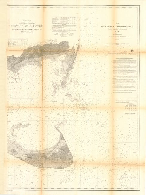
Auction 112, Lot 162
Subject: New England
Railroad Companies, (Various)
Map of the Housatonic Railroad and Connections [and] Map of the Housatonic System, 1891
Size: 6 x 9 inches (15.2 x 22.9 cm)
Estimate: $60 - $80
Sold for: $130
Closed on 9/28/2005
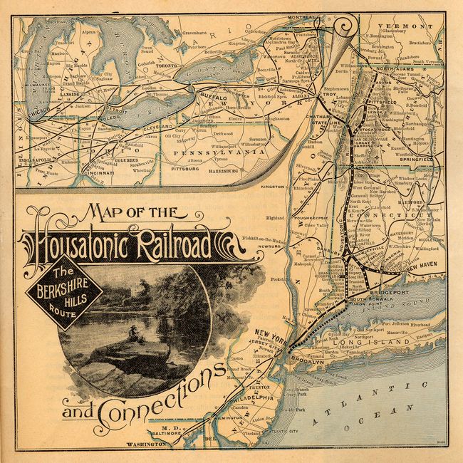
Auction 112, Lot 163
Subject: New England
Walker, George H. & Co.
Map of the New England States Showing State, County & Town Boundaries, Post Offices, Railroad Stations &c., 1894
Size: 26.5 x 41.5 inches (67.3 x 105.4 cm)
Estimate: $100 - $120
Sold for: $140
Closed on 9/28/2005
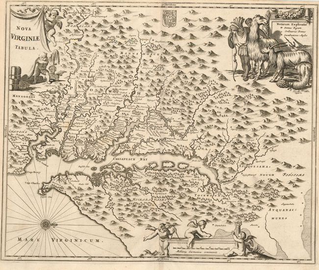
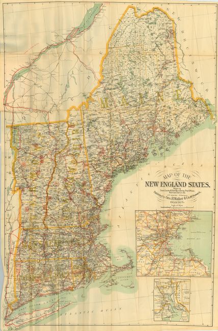
Auction 112, Lot 164
Subject: Colonial Mid-Atlantic - Virginia
Montanus, Arnoldus
Nova Virginiae Tabula, 1671
Size: 13.8 x 11.3 inches (35.1 x 28.7 cm)
Estimate: $1,400 - $1,600
Sold for: $850
Closed on 9/28/2005
194 lots
Page 1 of 4