Filtered by Category:Canada(Show All Categories)
Showing results for:Auction 131
Catalog Archive
33 lots
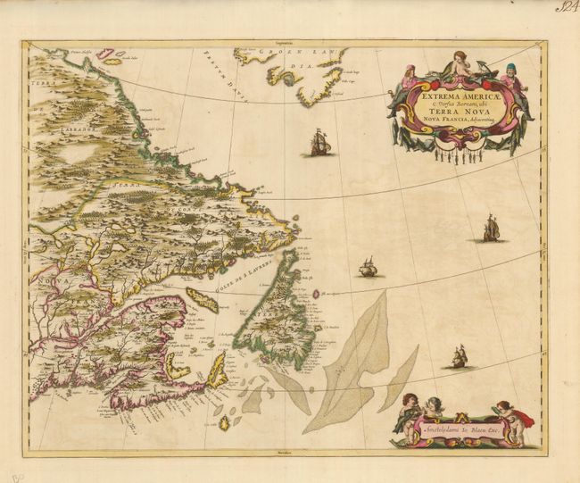
Auction 131, Lot 137
Subject: Canada
Blaeu, Johannes
Extrema Americae Versus Boream, ubi Terra Nova Nova Francia, Adjacentiaq, 1670
Size: 22.2 x 17.6 inches (56.4 x 44.7 cm)
Estimate: $1,800 - $2,200
Sold for: $1,900
Closed on 3/17/2010
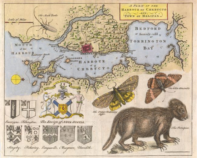
Auction 131, Lot 138
Subject: Halifax, Canada
Anon.
A Plan of the Harbour of Chebucto and Town of Halifax, 1750
Size: 10.6 x 8.6 inches (26.9 x 21.8 cm)
Estimate: $600 - $800
Sold for: $1,100
Closed on 3/17/2010
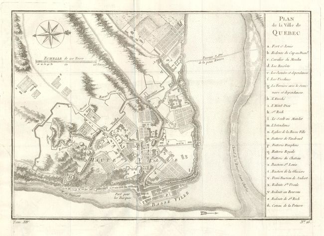
Auction 131, Lot 139
Subject: Quebec, Canada
Bellin, Jacques Nicolas
Plan de la Ville de Quebec, 1757
Size: 11 x 7.5 inches (27.9 x 19.1 cm)
Estimate: $190 - $230
Sold for: $140
Closed on 3/17/2010
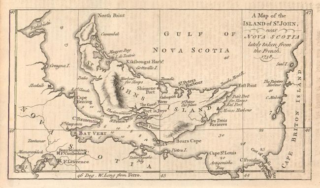
Auction 131, Lot 140
Subject: Canada
Anon.
[Lot of 3] A Map of the Island of St. John, near Nova Scotia lately taken from the French, 1758 [and] A Map of the Island of Cape Breton [and] A Plan of the City & Harbour of Louisburg., 1758
Size: See Description
Estimate: $200 - $300
Sold for: $325
Closed on 3/17/2010
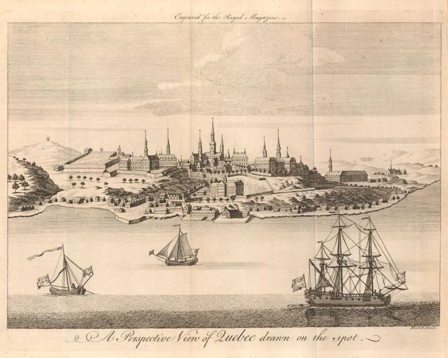
Auction 131, Lot 141
Subject: Quebec, Canada
Anon.
A Perspective View of Quebec drawn on the spot, 1759
Size: 9 x 6.5 inches (22.9 x 16.5 cm)
Estimate: $100 - $200
Sold for: $130
Closed on 3/17/2010
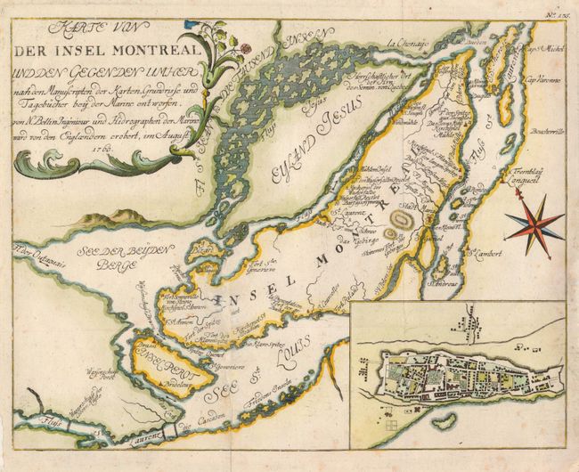
Auction 131, Lot 142
Subject: Montreal, Canada
Bellin, Jacques Nicolas
Karte von der Insel Montreal und den Gegenden Umher…, 1760
Size: 11.2 x 9.6 inches (28.4 x 24.4 cm)
Estimate: $240 - $300
Sold for: $210
Closed on 3/17/2010
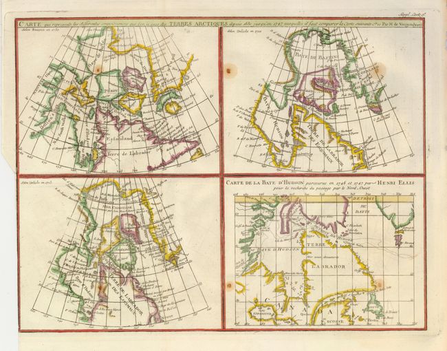
Auction 131, Lot 143
Subject: Canada
Robert de Vaugondy, Didier
Carte qui represente les differentes connoissances que l'on a eues des Terres Arctiques depuis 1650, jusqu ' en 1747…, 1770
Size: 15 x 11.5 inches (38.1 x 29.2 cm)
Estimate: $120 - $180
Sold for: $90
Closed on 3/17/2010
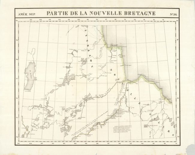
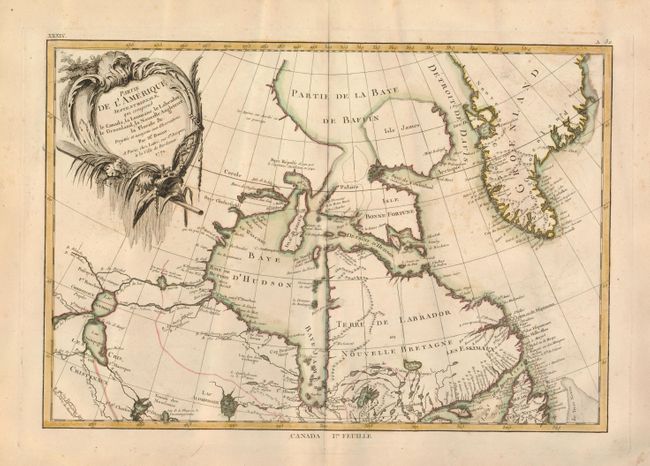
Auction 131, Lot 144
Subject: Canada, Hudson Bay
Vandermaelen, Philippe Marie Guillaume
[Lot of 4 - Canada], 1825
Size: See Description
Estimate: $200 - $275
Sold for: $130
Closed on 3/17/2010
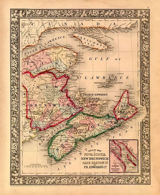
Auction 131, Lot 145
Subject: Canada
Mitchell, Samuel Augustus
[Lot of 3 - Canada], 1860
Size: See Description
Estimate: $120 - $160
Sold for: $160
Closed on 3/17/2010
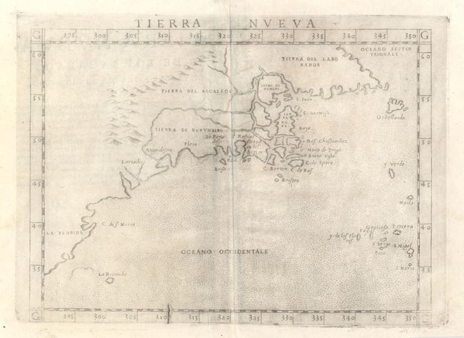
Auction 131, Lot 146
Subject: Canada & United States
Ruscelli, Girolamo
Tierra Nueva, 1564
Size: 9.7 x 7 inches (24.6 x 17.8 cm)
Estimate: $1,000 - $1,200
Sold for: $750
Closed on 3/17/2010
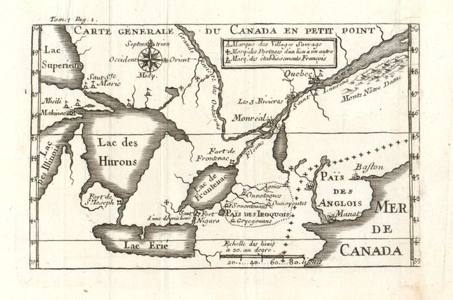
Auction 131, Lot 147
Subject: Colonial Canada & United States
Lahontan, Louis Armand
Carte Generale du Canada en Petit Point, 1704-09
Size: 5.5 x 3.5 inches (14 x 8.9 cm)
Estimate: $250 - $300
Sold for: $180
Closed on 3/17/2010
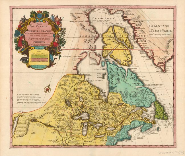
Auction 131, Lot 148
Subject: Colonial United States and Canada, Great Lakes
Delisle/Covens & Mortier
Carte du Canada ou de la Nouvelle France…, 1730
Size: 22.5 x 19.3 inches (57.2 x 49 cm)
Estimate: $800 - $1,000
Sold for: $1,000
Closed on 3/17/2010
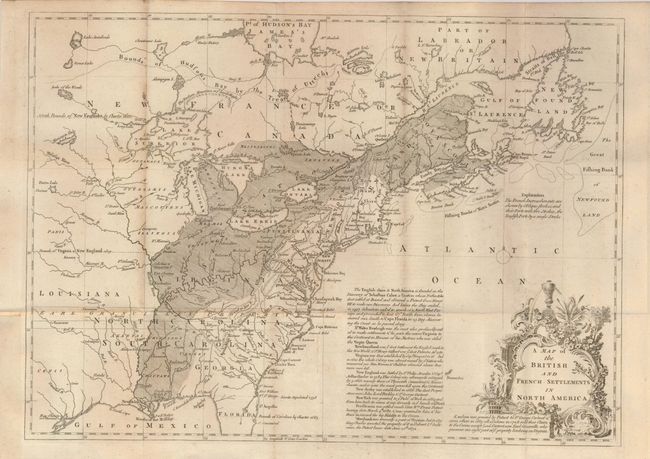
Auction 131, Lot 149
Subject: Colonial United States and Canada
Lodge, John
A Map of the British and French Settlements in North America, 1755
Size: 15 x 11 inches (38.1 x 27.9 cm)
Estimate: $350 - $450
Sold for: $600
Closed on 3/17/2010
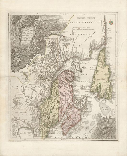
Auction 131, Lot 150
Subject: Colonial New England and Canada
Seutter/Lotter
Partie Orientale de la Nouvelle France ou du Canada avec l'Isle de Terre-Neuve et de Nouvelle Ecosse, Acadie et Nouv. Angleterre…, 1756
Size: 19.5 x 22.8 inches (49.5 x 57.9 cm)
Estimate: $800 - $900
Sold for: $600
Closed on 3/17/2010
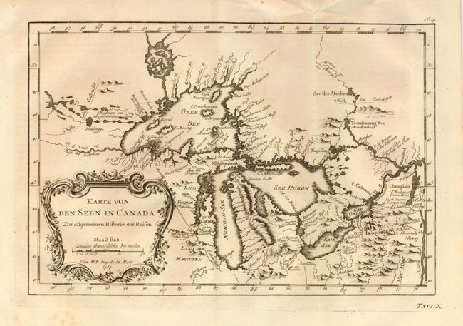
Auction 131, Lot 151
Subject: Great Lakes
Bellin, Jacques Nicolas
Karte von den Seen in Canada Zur allgemeinen Historie der Reisen, 1757
Size: 11.2 x 7.5 inches (28.4 x 19.1 cm)
Estimate: $400 - $450
Sold for: $300
Closed on 3/17/2010
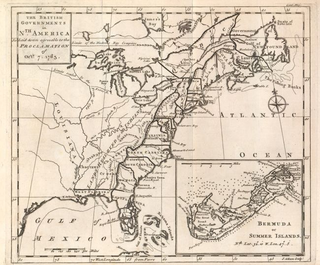
Auction 131, Lot 152
Subject: Colonial United States and Canada
Gibson, John
The British Governments in Nth. America laid down agreeable to the Proclamation of Octr. 7, 1763, 1763
Size: 9.3 x 8 inches (23.6 x 20.3 cm)
Estimate: $300 - $400
Sold for: $300
Closed on 3/17/2010
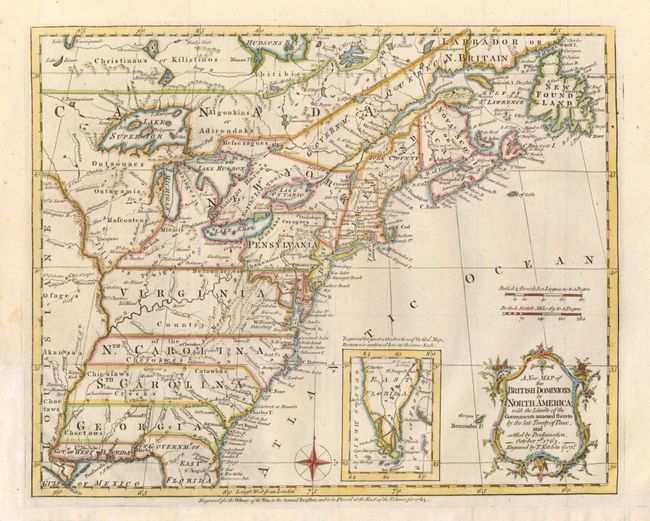
Auction 131, Lot 153
Subject: Colonial United States and Canada
Kitchin, Thomas
A New Map of the British Dominions in North America; with the Limits of the Governments Annexed thereto by the Late Treaty of Peace, and Settled by Proclamation, October 7th, 1763, 1763
Size: 12 x 9.5 inches (30.5 x 24.1 cm)
Estimate: $550 - $650
Sold for: $550
Closed on 3/17/2010
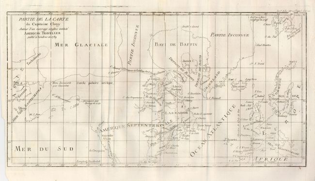
Auction 131, Lot 154
Subject: Arctic, Canada and Alaska
Robert de Vaugondy, Didier
Partie de la Carte du Capitaine Cluny Auteur d'un ouvrage Anglois Intitule American Traveller, 1769
Size: 19 x 11.5 inches (48.3 x 29.2 cm)
Estimate: $140 - $160
Sold for: $100
Closed on 3/17/2010
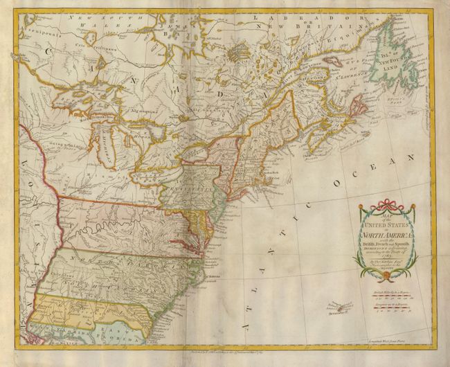
Auction 131, Lot 155
Subject: Colonial United States and Canada
Bonne/Lattre
[2 sheets] Partie de l'Amerique Septentrionale, qui comprend le Canada, la Louisiane, le Labrador, le Groenland, la Nouvelle Angleterre, la Florida &c., 1771
Size: 17.2 x 11.6 inches (43.7 x 29.5 cm)
Estimate: $475 - $600
Sold for: $500
Closed on 3/17/2010
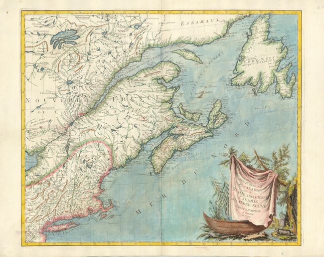
Auction 131, Lot 156
Subject: Colonial New England & Canada
D'Anville/Santini
Partie Orientale du Canada, avec la Nouvelle Angleterre, l'Acadie, et la Terre-Neuve, 1776
Size: 22.7 x 19.1 inches (57.7 x 48.5 cm)
Estimate: $750 - $900
Sold for: $550
Closed on 3/17/2010
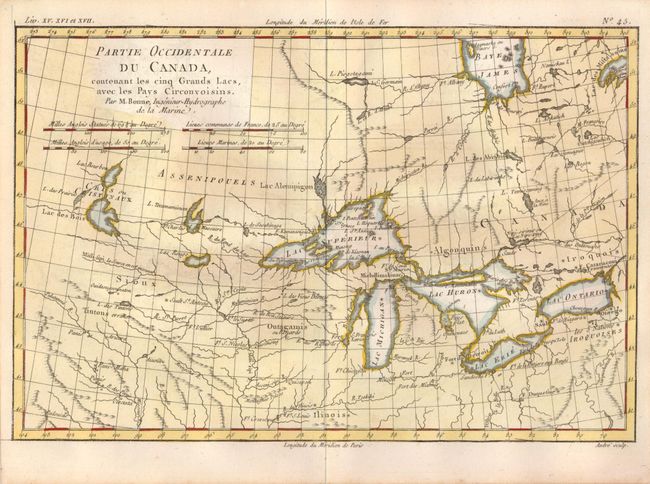
Auction 131, Lot 157
Subject: Great Lakes
Bonne, Rigobert
Partie Occidentale du Canada, contenant les cinq Grands Lacs, avec les Pays Circonvoisins, 1780
Size: 12.3 x 8.3 inches (31.2 x 21.1 cm)
Estimate: $300 - $400
Sold for: $500
Closed on 3/17/2010
Auction 131, Lot 158
Subject: Canada & United States
Kitchin, Thomas
Map of the United States in North America: with the British, French and Spanish Dominions adjoining, according to the Treaty of 1783, 1783
Size: 19.7 x 16 inches (50 x 40.6 cm)
Estimate: $1,000 - $1,400
Sold for: $2,200
Closed on 3/17/2010
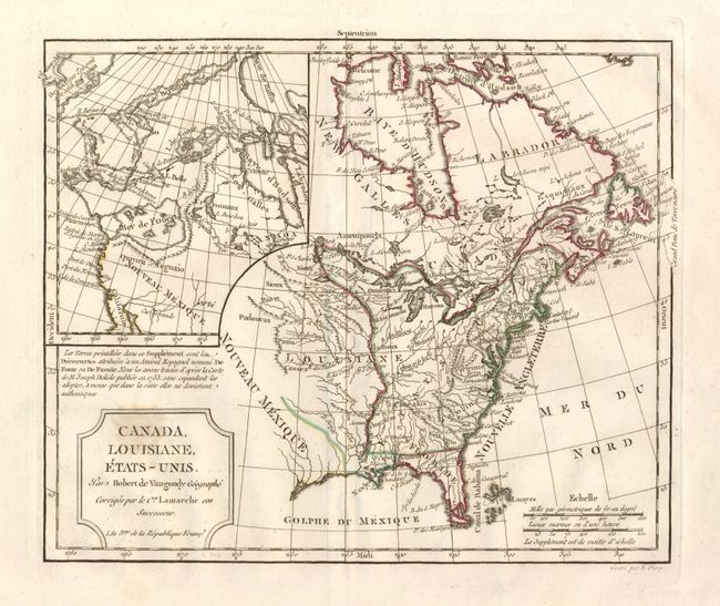
Auction 131, Lot 159
Subject: Canada & United States
Robert de Vaugondy
Canada, Louisiane, Etats-Unis, 1793
Size: 11.4 x 9.5 inches (29 x 24.1 cm)
Estimate: $250 - $300
Sold for: $150
Closed on 3/17/2010
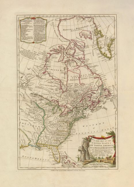
Auction 131, Lot 160
Subject: Canada & United States
Dunn, Samuel
A New Map of the United States of North America with the British Dominions on that Continent &c., 1794
Size: 12 x 18.5 inches (30.5 x 47 cm)
Estimate: $1,000 - $1,300
Sold for: $650
Closed on 3/17/2010
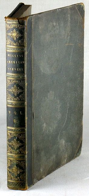
Auction 131, Lot 161
Subject: Eastern Canada and United States
Bartlett, W. H.
American Scenery Vol. II, 1840
Size: 9 x 11 inches (22.9 x 27.9 cm)
Estimate: $200 - $300
Sold for: $210
Closed on 3/17/2010
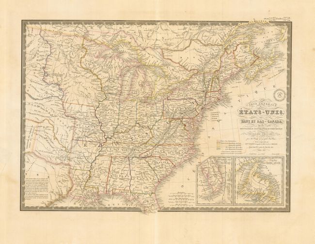
Auction 131, Lot 162
Subject: Eastern United States & Canada
Brue, Adrien Hubert
Carte Generale des Etats-Unis, des Haut et Bas-Canada…, 1843
Size: 20.2 x 14.2 inches (51.3 x 36.1 cm)
Estimate: $220 - $275
Sold for: $140
Closed on 3/17/2010
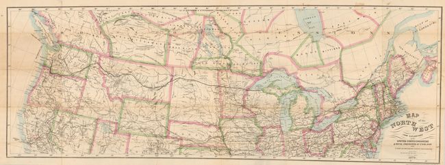
Auction 131, Lot 163
Subject: United States & Canada
Bien, Julius
Map of the Northwest from Explorations by the United States Engineers & Royal Engineers of England and Union & Northern Pacific R.R. Surveys, 1870
Size: 41 x 14.8 inches (104.1 x 37.6 cm)
Estimate: $100 - $200
Sold for: $160
Closed on 3/17/2010
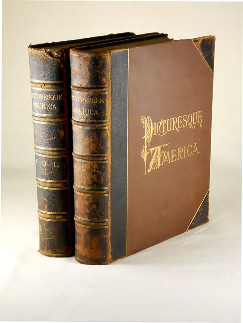
Auction 131, Lot 164
Subject: Canada & United States
Bryant, William C.
[2 Volumes] Picturesque America; or, the Land we Live in…, 1872-74
Size: 11 x 13 inches (27.9 x 33 cm)
Estimate: $140 - $160
Sold for: $100
Closed on 3/17/2010
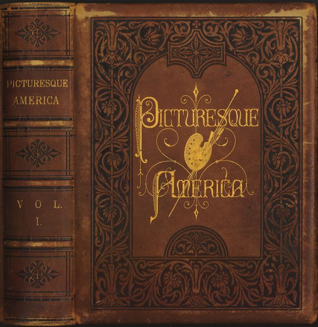
Auction 131, Lot 165
Subject: Canada and United States
Bryant, William C.
Picturesque America; or, the Land we Live in… Volume I, 1872-74
Size: 11 x 13 inches (27.9 x 33 cm)
Estimate: $300 - $400
Sold for: $150
Closed on 3/17/2010
Auction 131, Lot 166
Subject: Canada & United States
Rand McNally & Co.
Rand McNally & Co.'s New Official Railroad Map of the United States and Canada, 1887
Size: 42 x 27 inches (106.7 x 68.6 cm)
Estimate: $160 - $220
Sold for: $300
Closed on 3/17/2010
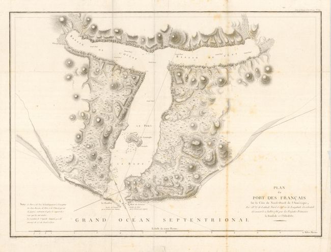
Auction 131, Lot 167
Subject: Western Canada & United States
La Perouse, Comte Jean F. Galoup, de
[Lot of 2] Plan du Port des Francais fur la Cote du Nord-Ouest de l'Amerique [and] Carte Particuliere de la Cote du Nord-Ouest del'Amerique reconnue par les Fregates Francaises la Boussole et l'Astrolabe en 1786. 1e. Feuille, 1797
Size: 27 x 19.5 inches (68.6 x 49.5 cm)
Estimate: $275 - $375
Sold for: $200
Closed on 3/17/2010
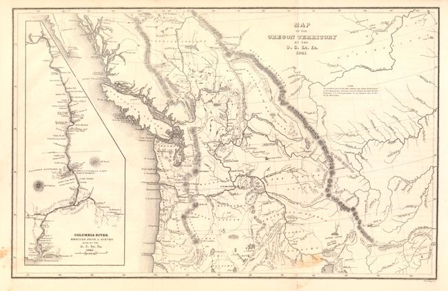
Auction 131, Lot 168
Subject: Western Canada & United States
Wilkes, Charles
Map of the Oregon Territory by the U.S. Ex. Ex., 1841
Size: 13.2 x 8.4 inches (33.5 x 21.3 cm)
Estimate: $140 - $180
Sold for: $200
Closed on 3/17/2010
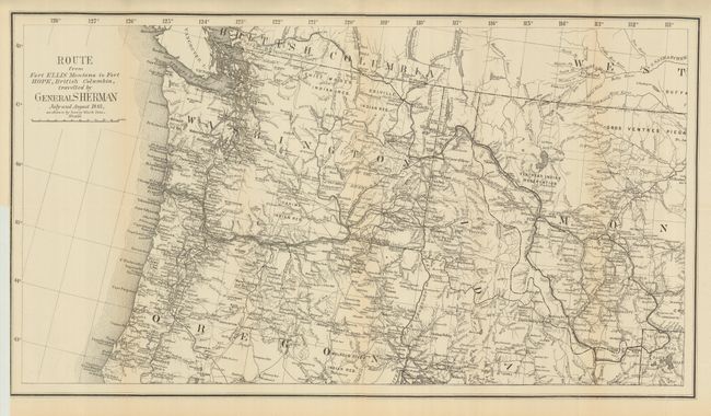
Auction 131, Lot 262
Subject: Northwestern United States
U.S. Government
Route from Fort Ellis Montana to Fort Hope, British Columbia Traveled by General Sherman July and August 1883…, 1883
Size: 27 x 15 inches (68.6 x 38.1 cm)
Estimate: $160 - $200
Sold for: $100
Closed on 3/17/2010
33 lots