Filtered by Category:Canada(Show All Categories)
Showing results for:Auction 101
Catalog Archive
12 lots
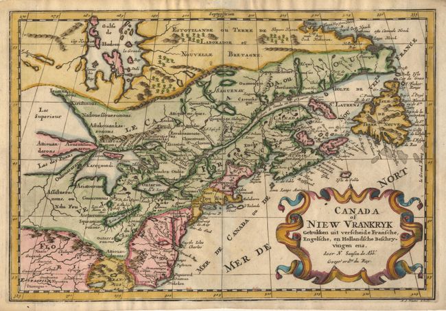
Auction 101, Lot 96
Subject: Colonial United States and Canada
Sanson, Nicolas
Canada of Niew Vrankryk Getrokken uit verscheide Fransche, Engelsche, en Hollandsche Beschryvingen enz, 1740
Size: 12 x 8.2 inches (30.5 x 20.8 cm)
Estimate: $500 - $600
Sold for: $500
Closed on 12/4/2002
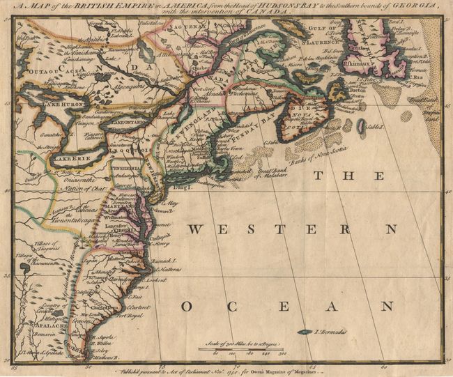
Auction 101, Lot 97
Subject: Colonial North America
Anon.
A Map of the British Empire in America, from the Head of Hudsons Bay to the Southern bounds of Georgia, with the intervention of Canada, 1750
Size: 11.8 x 9.5 inches (30 x 24.1 cm)
Estimate: $400 - $450
Sold for: $475
Closed on 12/4/2002
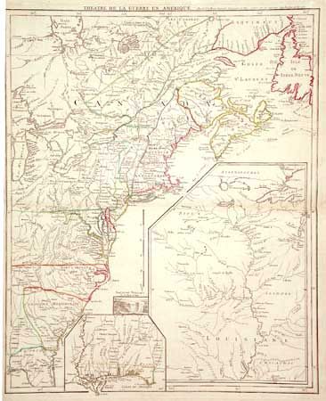
Auction 101, Lot 99
Subject: Colonial United States and Canada
Le Rouge, George Louis
Theatre de la Guerre en Amerique, 1777
Size: 19.5 x 24 inches (49.5 x 61 cm)
Estimate: $1,400 - $1,500
Unsold
Closed on 12/4/2002
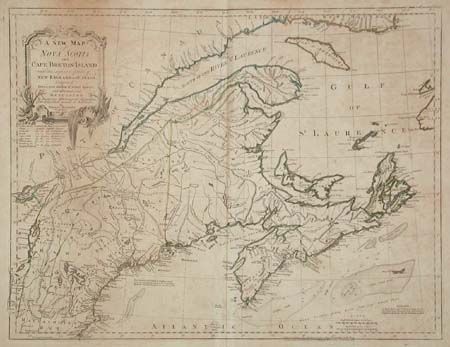
Auction 101, Lot 107
Subject: Colonial New England and Canada
Jefferys, Thomas
A New Map of Nova Scotia, and Cape Breton Island with the adjacent parts of New England and Canada…, 1775
Size: 24.1 x 18.5 inches (61.2 x 47 cm)
Estimate: $300 - $350
Sold for: $275
Closed on 12/4/2002
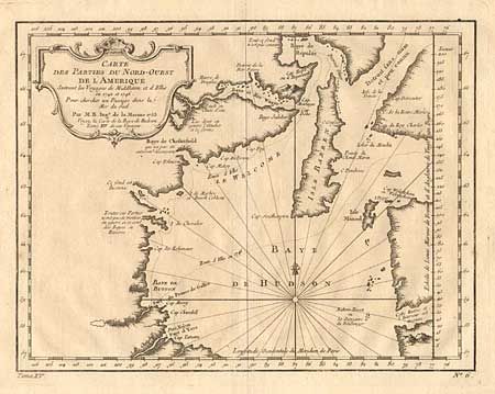
Auction 101, Lot 108
Subject: Canada
Bellin, Jacques Nicolas
Carte des Parties du Nord-Ouest de l'Amerique, 1753
Size: 10.8 x 8.3 inches (27.4 x 21.1 cm)
Estimate: $120 - $150
Sold for: $75
Closed on 12/4/2002
Auction 101, Lot 109
Subject: Canada
Bellin, Jacques Nicolas
Carte du Cours du Fleuve de Saint Laurent Depuis la Mer jusqu'a Quebec … II Fueille, 1761
Size: 33.3 x 22.5 inches (84.6 x 57.2 cm)
Estimate: $600 - $650
Unsold
Closed on 12/4/2002
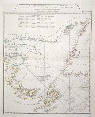
Auction 101, Lot 110
Subject: Canada
Jefferys/Sayer & Bennett
A Chart of the Gulf of St. Laurence, Composed from a Great Number of Actual Surveys and other Materials…, 1775
Size: 19.5 x 24 inches (49.5 x 61 cm)
Estimate: $300 - $350
Sold for: $220
Closed on 12/4/2002
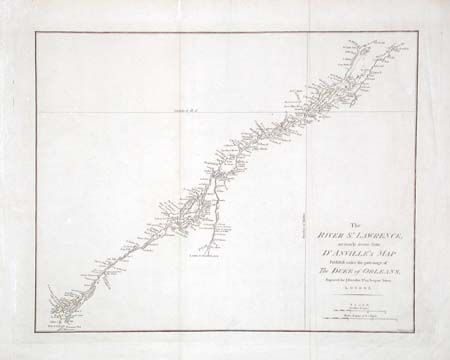
Auction 101, Lot 111
Subject: Canada
Harrison, John
The River St. Lawrence, accurately drawn from d'Anville's Map Published under the patronage of The Duke of Orleans, 1784
Size: 16.5 x 13.1 inches (41.9 x 33.3 cm)
Estimate: $100 - $130
Sold for: $75
Closed on 12/4/2002
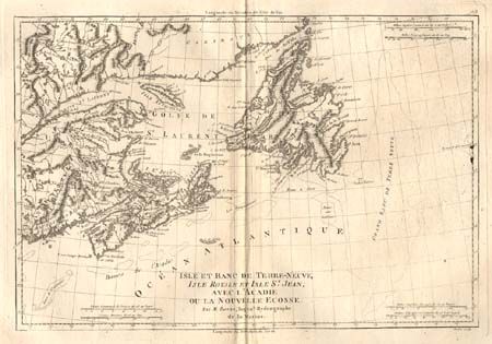
Auction 101, Lot 113
Subject: Canada
Bonne, Rigobert
Isle et Banc de Terre-Neuve, Isle Royale et Isle St. Jean; avec l'Acadie ou la Nouvelle Ecosse, 1787-88
Size: 13.5 x 9.2 inches (34.3 x 23.4 cm)
Estimate: $90 - $110
Sold for: $85
Closed on 12/4/2002
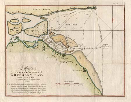
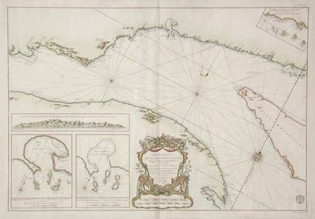
Auction 101, Lot 114
Subject: Canada
Hearne, Samuel
A Map Exhibiting Mr. Hearnes Tracks in his two Journies for the discovery of the Copper Mine River… [together with] A Plan of Albany River in Hudson's Bay, 1796
Size: See Description
Estimate: $275 - $325
Sold for: $230
Closed on 12/4/2002

Auction 101, Lot 115
Subject: Canada and United States
SDUK Society for the Diffusion of Useful Knowledge
North America Sheet II Lower-Canada and New Brunswick with Part of New-York, Vermont and Maine, 1832
Size: 15.3 x 12.5 inches (38.9 x 31.8 cm)
Estimate: $50 - $60
Sold for: $45
Closed on 12/4/2002
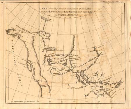
Auction 101, Lot 116
Subject: Canada and Alaska
Anon.
A Map Shewing the Communication of the Lakes and the Rivers between Lake Superior and Slave Lake in North America, 1790
Size: 9.3 x 7.8 inches (23.6 x 19.8 cm)
Estimate: $275 - $325
Sold for: $140
Closed on 12/4/2002
12 lots