Using the "New" to Research the "Old" & Condition Demystified
Using the "New" to Research the "Old"
Although we rely heavily on our in-house reference library of over 500 books and journals on antique maps, we have found a number of online resources that greatly assist in our research. These online resources can help identify cartographers, engravers, publication sources, and dates for a map, or even provide titles of reference books or articles for more information. While you can't believe everything you read online, here are some trustworthy top-notch resources for researching antique maps. And the best part is that they are all accessible for free to the public. (Click the name of each resource to go directly to the website.)
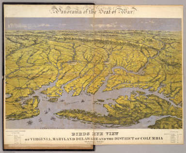
David Rumsey Map Collection David Rumsey is one of the largest private map collectors in the world, and has amassed over 150,000 maps over the last 25 years. In 2000, Rumsey launched the David Rumsey Map Collection online, featuring over 2,300 digitized maps using state-of-the-art technology. The number of digitized maps has now grown to over 48,000, all fully catalogued. The focus of the collection is 18th and 19th century maps of North and South America, although maps of the World, Europe, Asia, Africa, and Oceania are also well represented.
WorldCat WorldCat is a "global catalog of library collections" comprising approximately 72,000 libraries in 170 countries. The catalog was created in 1971 and now contains over 2 billion digital assets. When searching for a book, WorldCat will give bibliographic information on the title, and will list libraries around the world that hold the book in their collection. WorldCat also lists maps held in public and private libraries, and can therefore help determine how common or uncommon a particular map is.
Library of Congress The Library of Congress offers a wealth of information within its Maps & Geography division. Through the American Memory project and website, the Library of Congress has made available historical treasures to the general public. Although the Geography & Map division holds over 4.5 million items, only a fraction are currently digitized within their online Map Collections database, one of the collections featured within the American Memory project. The database is searchable by keyword, geography, subject, category, creator, and title. Each digitized item includes full bibliographical information as well as a downloadable image.
Johnson U.S. Map Project This project was founded by Dr. Ira Lourie, a map enthusiast who began his collection with maps of Maryland. His focus shifted to the atlases of Alvin J. Johnson after seeing an exhibition of Johnson's maps that highlighted the numerous different states and variations of the Maryland map from year to year. Dr. Laurie gradually expanded his scope to include all U.S. maps from Johnson atlases, which were published between 1860-87. The Johnson U.S. Map Project features an incredible online index to identify all of the known variations of each state map.
"A Carto-Bibliography of the Maps in Eighteenth-Century British and American Geography Books" by Barbara Backus McCorkle Barbara McCorkle, also known for her excellent reference book, "New England in Early Printed Maps 1513 to 1800," has made the full text to her reference book on 18th century geography books available for free to the public via the University of Kansas. The book contains a table of contents by author/publisher as well as a chronological list of publications. McCorkle's bibliography helps identify the different editions of the geography books as well as the various states of the maps.
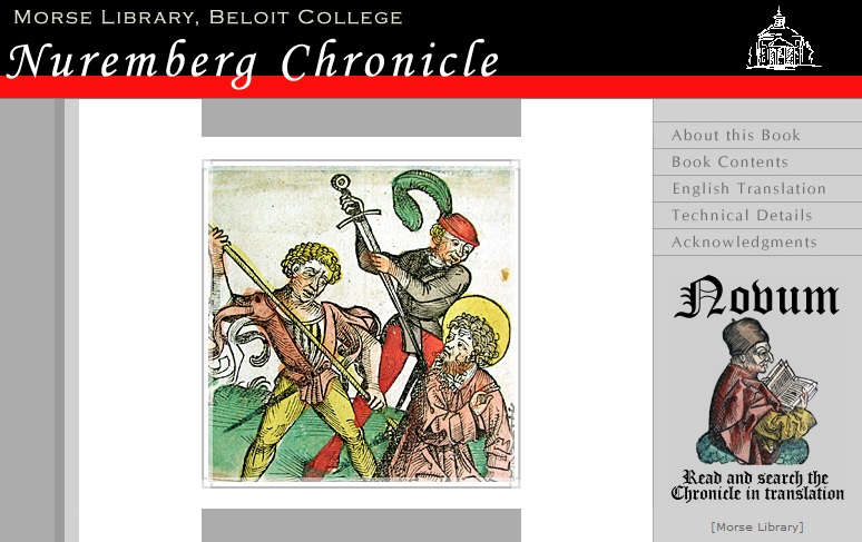
Nuremberg Chronicle Beloit College has put together a thorough overview of the Nuremberg Chronicle by Hartmann Schedel. Their site includes a fully digitized version of the college's colored example of the book, as well as the first full English translation of the text of the Chronicle (click here for the English translation). The English translation, created by Walter Schmauch and edited by Professor Constantine Hadavas, contains a table of contents by folio page and is also searchable. This is an excellent resource for those interested in Schedel's magnificent work.
Google Books Google Books has now digitized over 30 million books of the approximately 130 million unique books in the world. The books available through Google Books are those that are either out of copyright (and in the public domain) or those for which the copyright holders have given permission to Google to digitize their books. Many reference books on antique maps are now fully digitized and searchable on Google Books, including Philip Lee Phillips' "A List of Geographical Atlases in the Library of Congress." In addition, many maps that were originally published in books can be found through Google Books. Not all of the books can be read in full for free however, depending on the copyright laws associated with the book.
Collector's Corner: Condition Demystified
Evaluating the condition of a map requires a combination of objective and subjective judgment. On the one hand, describing the flaws and positive attributes of a map is primarily an objective task. Either the map has foxing, toning, tears, etc. or it doesn't. On the other hand, one must determine whether the defects outweigh the positives, and whether the defects and positives are unusual or to be expected for a specific type of material. Here are three common examples when subjective judgment must be used in evaluating condition:
A Tear Is a Tear Is a Tear - Or Is It? For instance, a binding tear on a late 19th century folding map is considered not nearly as serious as a tear on a 16th or 17th century folio atlas map, since 19th century paper is typically much thinner and weaker, and binding tears with folding maps are quite common. It is important to consider the type of paper and the way a map was issued (atlas, folding, wall, etc.) in determining the significance of a defect. With some maps, finding an example in B+ condition may be the best one could hope to find, while other maps are more commonly available in A or A+ condition.
Perfect...Almost In another situation, you might have a map that is on a full sheet of sturdy paper, with a strong impression and original color, but there are a few small spots of foxing or some worm holes. The map may still be considered near fine if the defects are not noticeable and are minor in comparison with all of the positive attributes. One must evaluate the severity of the flaws both on their own and in relation to the other characteristics of the map to decide whether the flaws truly detract from the appearance.
Band-Aids Another consideration with condition relates to repairs. Some repair work, if done professionally, can almost negate a defect. If the defect is no longer noticeable and the map is properly conserved to protect it for the future, the condition of the map might increase from a B to a B+ or even to an A. In our opinion, one exception to this can occur with facsimile work. If significant facsimile work was required to fully repair a tear or hole, the map will no longer be considered in A condition, even if all the repair work was seamless and the map looks excellent. In contrast, poor repairs can decrease the value further by causing additional blemishes or making the original defect even more noticeable. For example, using non-archival tape on a map will create a stain on the paper.
In Scientia Veritas, in Arte Honestas (In Science, Truth; in Art, Honor) At the end of the day, evaluating condition is part art and part science. The condition description is typically science, simply describing the map as it is. The condition grade, however, is mostly art, and is largely driven by the subjective circumstances described above. At Old World Auctions, every item listed in our auctions is carefully inspected by two people in order to ensure that all defects are properly described. The item is then assessed a condition grade, which is essentially our expert opinion on the overall appearance of the map and how it compares with other examples. Although most elements of the science of evaluating condition can be readily observed, it is the art of evaluating condition that requires both experience and comparative review.
For more information on our condition grading system, please click here.