Catalog Archive
Auction 99, Lot 611

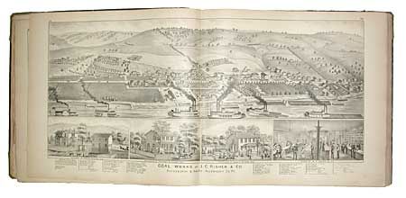
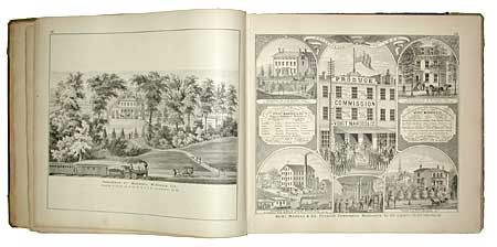
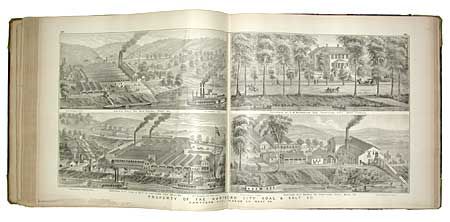
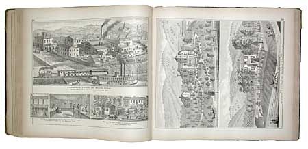
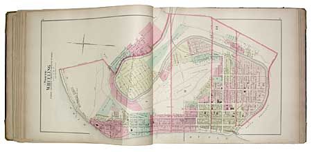
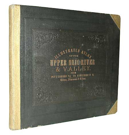
"Illustrated Atlas of the Upper Ohio River and Valley from Pittsburgh, Pa. To Cincinnati, Ohio. From United States Official and Special Surveys…", Hayes, E.L.

Subject: Atlases - Ohio

Period: 1877 (published)

Publication: Titus, Simmons & Titus (pub.)

Color: Hand Color

Size:
18 x 16.2 inches
45.7 x 41.1 cm
Download High Resolution Image
(or just click on image to launch the Zoom viewer)

Fabulous and rarely seen atlas filled with wonderful hand colored maps and uncolored views. Table of Contents lists 174 maps and city plans, 164 views, 103 Patron's business notices and 26 charts detailing the course of the Ohio River and keyed to the Index map. A remarkable body of work that offers a rare and detailed look at the region through maps naming thousands of homeowners with remarkable views of many homes and businesses. Many of the maps and views are double page. Crisp impressions and wonderful hand coloring of maps. Complete except for the map of Pittsburgh. Binding in black embossed leather with gilt title and gold leather spine and corners. A scarce and desirable atlas.

References: Phillips (A) #2348.

Condition: B

Title page, table of contents and first and last maps with marginal chipping and split at bottom, resulting in slight loss to first (index) map at edge. All other maps mostly VG. Binding with a few chips at bottom edge, otherwise remarkable condition.

Estimate: $7,000 - $8,000

Sold for: $4,000

Closed on 6/12/2002

Archived