Catalog Archive
Auction 99, Lot 330

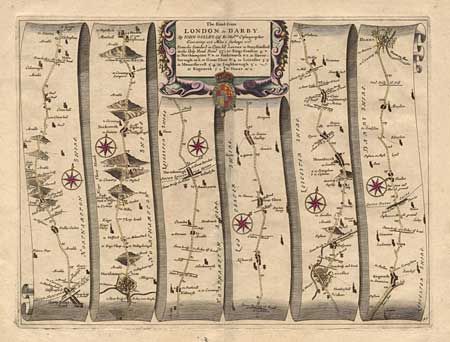
"The Road from London to Darby…", Ogilby, John

Subject: England

Period: 1675-98 (published)

Publication: Britannia

Color: Hand Color

Size:
17.1 x 12.6 inches
43.4 x 32 cm
Download High Resolution Image
(or just click on image to launch the Zoom viewer)

John Ogilby's 'Britannia' was published between 1675 and 1698. It is a landmark in the mapping of England and Wales. Its unique format constituted the first national road-atlas of any country in Western Europe. It was composed of maps of seventy-three major roads and cross-roads, presented in a continuous strip-form, on a uniform scale of one inch to a mile. Each beautiful map includes wonderful detail of the countryside with each strip containing a large compass rose to indicate changes in direction.

This is lovely map is a continuation of the road from London and covers the section from Stony Stratford through Leicester and on to Darby, altogether covering 122 miles. Of special interest is the gallows shown outside of Leicester. Finely engraved cartouche with gold highlights to the crown.

References:

Condition: A

Very nice impression and coloring on a fine sheet with full margins.

Estimate: $400 - $500

Sold for: $300

Closed on 6/12/2002

Archived