Catalog Archive
Auction 98, Lot 367

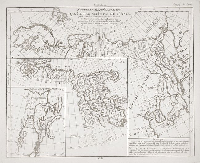
"Nouvelle Representation des Cotes Nord et Est de l'Asie pour servir d'eclaircissement aux Articles du Supplement de l'Encyclopedie qui concernent le Passage aux Indes par le Nord", Robert de Vaugondy, Didier

Subject: Northern Asia

Period: 1772 (dated)

Publication: Diderot's Encyclopedia (Supplement)

Color: Black & White

Size:
14.2 x 11.2 inches
36.1 x 28.4 cm
Download High Resolution Image
(or just click on image to launch the Zoom viewer)

When Charles Joseph Panckoucke took over publication of Diderot's Encyclopedie in 1768, he promised to correct the cursory treatment of geography for which the first seventeen volumes had been criticized, with emphasis on the discoveries of the last 25 years. He employed Samuel Engel, a Swiss geographer, to write a series of articles about the northern regions and Didier Robert de Vaugondy to prepare ten maps to illustrate them. Engel rejected the De la Fonte Northwest Passage discoveries and believed the most sensible route from the Atlantic to the Pacific was along the north coast of Siberia. These maps illustrate the discoveries and various cartographic theories concerning the Pacific Northwest, East Asia and the North Pacific Ocean and include some of the most interesting comparative cartography of the eighteenth century

Interesting map of the northeast coast of Asia depicting Kamchatka, Japan and Korea. It also shows part of what is present-day Alaska. The Tchutski (Chukotskiy) Peninsula stretches very close to the American landmass, hinting at a possible land bridge. Within the larger map are two insets (one within the other); each is a different depiction of Kamchatka.

References: Pedley #402.

Condition: A+

Estimate: $120 - $150

Unsold

Closed on 3/6/2002

Archived