Catalog Archive
Auction 98, Lot 221

"Map of Lincoln County", Snyder, Van Vechten & Co.

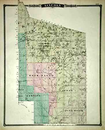
Subject: Lincoln County, Wisconsin

Period: 1878 (published)

Publication:

Color: Hand Color

Size:
13 x 16 inches
33 x 40.6 cm
Download High Resolution Image
(or just click on image to launch the Zoom viewer)

Uncommon map of the county well before it assumed its present square shape. Only four townships and a single town are shown. The map is dominated by the Lac de Flambeau Indian Reservation, established June 27, 1866. Numerous camps and stations shown. Verso is Taylor County, with two attractive small vignettes depicting farm life and education. Both with decorate borders and handsome titling.

References:

Condition: A

Estimate: $40 - $50

Sold for: $60

Closed on 3/6/2002

Archived