Catalog Archive
Auction 98, Lot 155

"Dakota", Gray
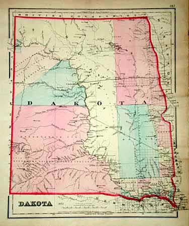
Subject: Dakota Territory

Period: 1873 (published)

Publication: Gray's Atlas of the United States

Color: Hand Color

Size:
11.7 x 14.7 inches
29.7 x 37.3 cm
Download High Resolution Image
(or just click on image to launch the Zoom viewer)

Handsome map of the territory with just a few counties in the southeast, a huge Pembina County in the northeast. The western portion labeled as land set-aside for various Indian tribes including Sioux, Arickaree [sic], Mandan, and Gros Venture Tribes. Great map of the region 16 years before statehood.

References:

Condition: A

Two short tears in right margin.

Estimate: $100 - $150

Sold for: $95

Closed on 3/6/2002

Archived