Catalog Archive
Auction 98, Lot 151

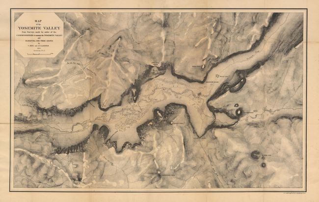
"Map of the Yosemite Valley from Surveys made by the order of the Commissioners to manage the Yosemite Valley and Mariposa Big Tree Grove…", Gardner, James Terry

Subject: California

Period: 1865 (dated)

Publication:

Color: Black & White

Size:
25.2 x 15.5 inches
64 x 39.4 cm
Download High Resolution Image
(or just click on image to launch the Zoom viewer)

The map is a product of Whitney's California Survey. In 1864 the governor of California accepted Yosemite for the State. King, Gardner and Cotter were ordered immediately to complete a survey of Yosemite before the onset of winter. This product of their efforts, despite frightful weather, is a superb early map of the valley. Locates the Merced River, Virgin Tears, Yosemite Falls, Sentinel Rock and Dome, Bridal Veil Falls and Creek, Mariposa Trail and much more. Topographical detail via hachure. A very early and desirable Yosemite piece.

References: Groetzmann "Exploration & Empire", p. 368-78.

Condition: B

Crisp impression with slight toning along some folds and a tiny loss at a few fold intersections. All stabilized with Japanese tissue backing.

Estimate: $300 - $400

Sold for: $450

Closed on 3/6/2002

Archived