Catalog Archive
Auction 98, Lot 14

"Mappe-Monde pour connoitre les progres & les conquestes plus Remarquables des Provinces-Unies, Ainsy que celles des Compagnies d'Orient et d'Occident, Et les Pais quelles possedent dans l'Un et dans lautre Hemisphere", Anon.
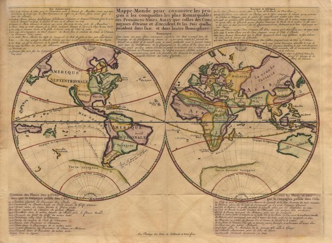
Subject: World

Period: 1701 (published)

Publication:

Color: Hand Color

Size:
17.8 x 13 inches
45.2 x 33 cm
Download High Resolution Image
(or just click on image to launch the Zoom viewer)

Scarce and unusual double hemisphere map with Dutch text describing the travels & colonial possessions of the Dutch East India and other trading companies. The world is shown in simple form with California as an Island. The principal countries are named and other locations are numbered and related to the keys above and below the map. The numbers 1 to 34 and the text refer to the voyages by Dutch explorers from 1594 (the first attempt to locate a Northeast Passage) to 1665 (when New York was recaptured by the British). Items 35-47 describes the Dutch colonial possessions in Asia. Published by Jean Malherbe. Listed by Shirley as scarce.

References: Shirley #447.

Condition: B

Issued folded with faint offsetting, overall very good.

Estimate: $1,000 - $1,100

Sold for: $900

Closed on 3/6/2002

Archived