Catalog Archive
Auction 98, Lot 144

"Cote Nord-Ouest de l'Amerique Reconnue par le Cap.e Vancouver. 2e. Partie", Vancouver, George (Capt)

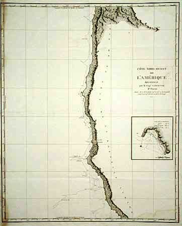
Subject: West Coast - California and Oregon

Period: 1799 (published)

Publication: Vancouver's Voyages (French Edition)

Color: Black & White

Size:
24 x 29.7 inches
61 x 75.4 cm
Download High Resolution Image
(or just click on image to launch the Zoom viewer)

Beautifully engraved, large-scale, map featuring the coastal topography from Point Arena to just below the mouth of the Columbia River. The track of Vancouver's exploration in 1792 is shown complete with soundings. Inset of "Baie de la Trinidad". During the summers of 1792-94, George Vancouver and the crew of the British naval ships Discovery and Chatham mapped the northwest coast of North America from Baja California to Alaska. Vancouver's voyage was the last, and longest, of the great Pacific voyages of the late eighteenth century. Taking the art and technique of distant voyaging to a new level, Vancouver eliminated the possibility of a Northwest Passage and his remarkably precise surveys completed the outline of the Pacific.

References: Wagner [NW] #853.

Condition: B

Slight damp stain at left and bottom border.

Estimate: $550 - $600

Sold for: $400

Closed on 3/6/2002

Archived