Catalog Archive
Auction 98, Lot 126

"A Correct Map of North America", Wooten, Joseph

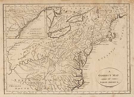
Subject: United States - Eastern

Period: 1808 (published)

Publication:

Color: Black & White

Size:
11.5 x 8.3 inches
29.2 x 21.1 cm
Download High Resolution Image
(or just click on image to launch the Zoom viewer)

Unusual, early map of the states. The Carolinas and Virginia extend to the Mississippi River. Pennsylvania is enlarged and shown taking in part of New York, which in turn encompasses all of New Jersey. New England consists of only Massachusetts and New Hampshire. Large inset titled "Supplement to Carolina". Filled with Indian names. Engraved by Paas.

References:

Condition: B

Scattered foxing.

Estimate: $200 - $250

Sold for: $170

Closed on 3/6/2002

Archived