Catalog Archive
Auction 98, Lot 118

"Map of the United States Drawn from the most approved Surveys", Merchant, G.W.

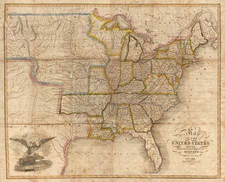
Subject: United States

Period: 1826 (dated)

Publication:

Color: Hand Color

Size:
20 x 16.2 inches
50.8 x 41.1 cm
Download High Resolution Image
(or just click on image to launch the Zoom viewer)

Scarce folding map published by Solomon Schoyer. The map extends to the Rocky Mountains with the huge Missouri Territory taking in the entire west. Missouri State is newly formed and shown here without its 'boot'. The large Arkansas Territory incorporates present-day Oklahoma. Texas is a part of Mexico. Large vignette of an American eagle. Folding between boards.

References:

Condition: B

Professionally backed with Japanese tissue, filling minor loss at a couple of fold intersections. Lightly toned with some scattered foxing.

Estimate: $600 - $800

Sold for: $900

Closed on 3/6/2002

Archived