Catalog Archive
Auction 97, Lot 212

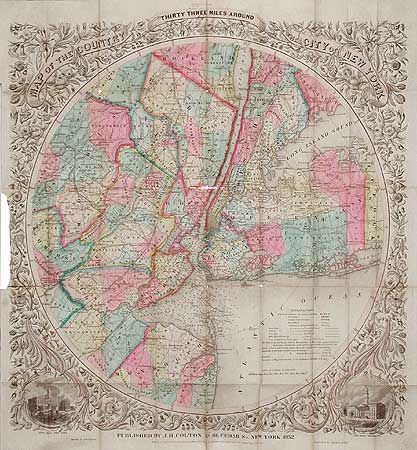
"Map of the Country Thirty-Three Miles Around the City of New York", Colton, Joseph Hutchins

Subject: New York

Period: 1852 (dated)

Publication:

Color: Hand Color

Size:
22 x 24 inches
55.9 x 61 cm
Download High Resolution Image
(or just click on image to launch the Zoom viewer)

Scarce and splendid circular map of New York City, part of Long Island, and part of New Jersey. The map is designed to show the transportation network of roads, canals and railways, with distances and terminals noted. It also depicts the telegraph lines and mills or manufactories. Harbor is marked with soundings and navigational hazards. Beautifully colored by county with the map surrounded by a wide floral border with vignettes of the City Halls of both NYC and Brooklyn at the bottom corners.

References:

Condition: D

Several separations along folds with minimal loss at fold intersections. Map has been torn from covers with 5 1/2" of complete loss of margin, affecting a couple of the leaves in the border. All faults can be easily corrected by a conservator.

Estimate: $750 - $850

Sold for: $450

Closed on 12/5/2001

Archived