Catalog Archive
Auction 97, Lot 137
"Geological Map of the United States", Hitchcock, Charles Henry
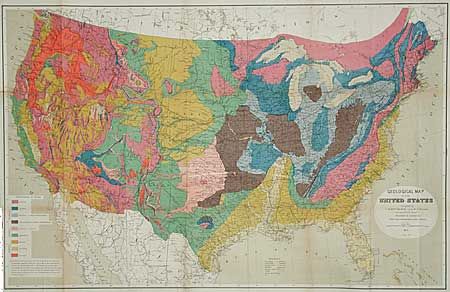
Subject: United States
Period: 1873 (dated)
Publication: Statistical Atlas of the United States…Ninth Census, 1870
Color: Printed Color
Size:
33.2 x 21.2 inches
84.3 x 53.8 cm
Download High Resolution Image
(or just click on image to launch the Zoom viewer)
(or just click on image to launch the Zoom viewer)