Catalog Archive
Auction 96, Lot 84

"North America Agreeable to the Most Approved Maps and Charts", Conder, Thomas

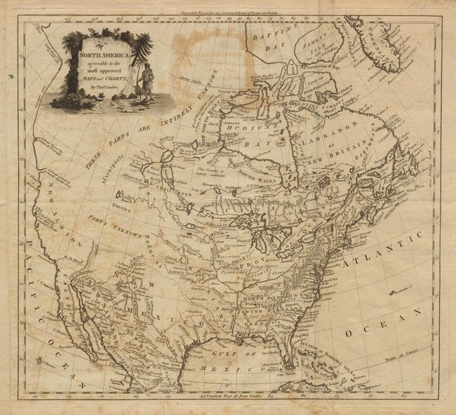
Subject: North America

Period: 1782 (circa)

Publication: Moore's New and Compleat Collection of Voyages and Travels

Color: Black & White

Size:
14.4 x 13.1 inches
36.6 x 33.3 cm
Download High Resolution Image
(or just click on image to launch the Zoom viewer)

Great map issued just before the United States is acknowledged by the British. The colonies of Virginia, Georgia and the Carolinas extend to the Mississippi. Filled with detail including forts, Indian tribes, and watershed. The West is nearly blank except several Pueblos are shown in the vicinity of Santa Fe. The West Coast is a blank, nearly straight line, above Drake's Port. Many interesting notations including "These Parts are Intirely [sic] Unknown." The Red River is here labeled "R. Rouge but little known."

References:

Condition: C

Offsetting throughout and a little foxing. Folded as issued with additional soft creases at one fold.

Estimate: $150 - $200

Sold for: $230

Closed on 9/12/2001

Archived