Catalog Archive
Auction 96, Lot 440

"Caerte vande Landen vande Papouas oste Nova Guinea…", Schouten, Willem Cornelisz

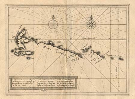
Subject: South East Asia

Period: 1622 (published)

Publication:

Color: Black & White

Size:
11.5 x 8.4 inches
29.2 x 21.3 cm
Download High Resolution Image
(or just click on image to launch the Zoom viewer)

Very uncommon small sea chart of the northwest coastline of Papua New Guinea and the Moluccas. The map illustrates part of one of the greatest Dutch voyages of exploration. Undertaken in 1615 and lasting until 1617, this important expedition was the third complete circumnavigation, after Magellan. It was headed by Jacob Le Maire and Capt. Schouten under the auspices of a group of merchants headed by Jacob's father, Isaac. The expedition was the first to round Cape Horn from the east, naming the cape after the Dutch town of Hoorn, whose aggressive traders sponsored the voyage. In doing so they proved that Tierra del Fuego was not a part of Terra Australis or the great southern landmass. In addition, the expedition explored the Pacific coast of South America and made numerous discoveries in the Pacific and along the coast of New Guinea. Title in Dutch, Latin and French.

References:

Condition: B

Even toning with faint foxing and some worm tracks in margins.

Estimate: $275 - $325

Sold for: $325

Closed on 9/12/2001

Archived