"Guadeloupe, Done from Actual Survey and Observations of the English, whilst the Island was in their Possession with material Improvements added since the Conquest in 1794", Jefferys, Thomas
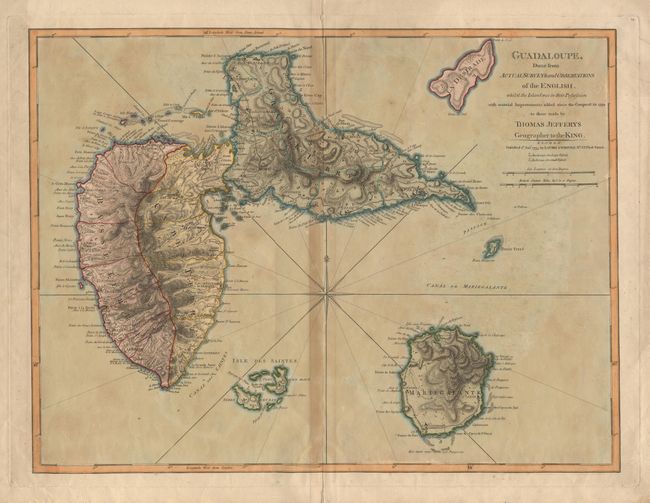
Subject: Guadeloupe
Period: 1795 (dated)
Publication: The West-India Atlas or, A Compendious Description of the West-Indies
A detailed map of the island issued during the revolutionary period marked by the return of the English who re-conquered the island in 1794. Jeffreys' excellent maps of the region were originally prepared from manuscripts previously taken from captured Spanish forces and issued in 1762 to illustrate the West Indian islands acquired by Britain in the Seven Years' War. The map was updated and reissued here by Lauri & Whittle. The map is very detailed, particularly of the important sugar refineries, which numbered close to 400 at the end of the 18th century. The map includes the offshore islands of Desirade, Marie-Galante and Isles des Saintes.
References: Phillips (A) #2703-51.
Condition: B
Dark toning on centerfold and slight oxidation of original color, else good.