Catalog Archive
Auction 95, Lot 61

"Americae Descriptio Nova", Seile, Henry

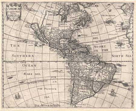
Subject: Western Hemisphere

Period: 1652 (dated)

Publication: Heylin's Cosmography

Color: Black & White

Size:
16.7 x 13.5 inches
42.4 x 34.3 cm
Download High Resolution Image
(or just click on image to launch the Zoom viewer)

Boldly engraved map of the Americas drawn directly from the previous map of Abraham Goos. It depicts CALIFORNIA AS AN ISLAND, no Great Lakes and a faint allusion to the Northwest coast of North America. On the east coast Maryland, 'No: Belgium', and 'Long Ile' are named. The name 'Carolina' also appears off the coast. According to Burden this may be an accidental misspelling of the 'Carolana' of Sir Robert Heath's grant from 1629, or a possible reference to the French fort in present day Florida. The name Carolina was not used until 1660. The map is decorated with a title cartouche, sea monsters, and sailing ships. This is the first state of the plate.

References: Burden 308; McLaughlin 13; Tooley (America) p.115, #11.

Condition: B

The impression includes scattered ink residue evidently caused by the printer not wiping the plate clean prior to impressing the paper. The map has closely trimmed margins as is usual with this map. It has been cleaned and backed with heavy Japanese tissue which extends the margins. Couple of faint spots.

Estimate: $1,800 - $1,900

Sold for: $1,000

Closed on 6/13/2001

Archived