Catalog Archive
Auction 95, Lot 147

"Maine", Sotzmann, Daniel Friedrich
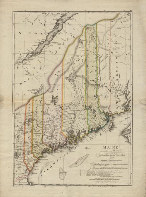
Subject: Maine

Period: 1798 (dated)

Publication: Atlas von Nordamerika

Color: Hand Color

Size:
17.2 x 25.2 inches
43.7 x 64 cm
Download High Resolution Image
(or just click on image to launch the Zoom viewer)

Scarce and important map of the state of Maine based primarily on a survey by Osgood Carleton. It provides excellent topographical and political detail, including land holdings of several individuals, townships, and 'Lottery Land'. One of the most interesting features of this map is the depiction of the conflicting British and United States boundary claims, as well as the line established in 1798 by a commission created by Jay's Treaty in 1794. This was one of the ten maps completed by Sotzman for Christoph Ebeling's planned atlas of the United States, which was published by Carl Ernst Bohn. This ambitious German atlas project faltered and the individual maps now very scarce. Ristow notes that these maps "are among the rarest of cartographic Americana for the closing decade of the eighteenth century".

References: Ristow p. 169-178.

Condition: A

Soiled with some repaired tears in margins, all well outside platemark. A bit of minor toning along fold, but still overall very good.

Estimate: $1,600 - $1,800

Sold for: $4,000

Closed on 6/13/2001

Archived