Catalog Archive
Auction 95, Lot 110

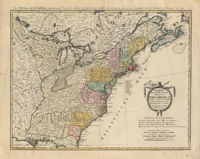
"Charte uber die XIII vereinigte Staaten von Nord-America…", Gussefeld/Homann Heirs
Subject: Eastern United States

Period: 1784 (dated)

Publication:

Color: Hand Color

Size:
22.6 x 17.6 inches
57.4 x 44.7 cm
Download High Resolution Image
(or just click on image to launch the Zoom viewer)

Fine large map of the newly formed United States of America drawn by F.J. Guttefeld. The southern states are shown with their western boundaries on the Mississippi River, although the coloring shows only regions east of the Appalachians as being organized. The interior regions are shown with considerable topographical detail and locate numerous Indian tribes. The uncolored title cartouche is garland draped with a hat and crossed swords.

References: McCorkle #784-7; Sellers & Van Ee #757.

Condition: A

Some staining and tissue repair of tears in margins, well away from the map. A couple of tiny unobtrusive spots within image, but still very good.

Estimate: $700 - $800

Sold for: $650

Closed on 6/13/2001

Archived