Catalog Archive
Auction 95, Lot 105

"Geologische Karte der Vereinigten Staaten und Britischen Provinzen von Nord-Amerika", Perthes, Justus

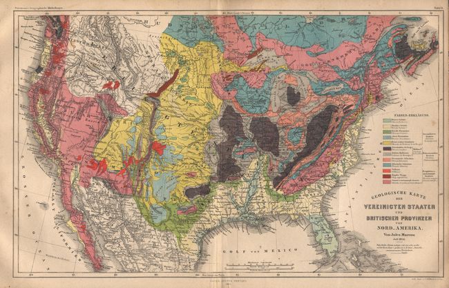
Subject: United States

Period: 1855 (dated)

Publication:

Color: Hand Color

Size:
15.2 x 9.6 inches
38.6 x 24.4 cm
Download High Resolution Image
(or just click on image to launch the Zoom viewer)

Extremely detailed map with full color keyed to a legend describing 12 different geological formations. The map was drawn by Jules Marcou, a French geologist and explorer who traveled to the U.S. in 1848. As a geologist for the Pacific Railroad Explorations and Surveys of the 35th parallel north, he drew a geological map of the U.S. that extended as far west as the 106th meridian. By 1855 he had returned to Germany, where he produced this map extending the coverage of his earlier map to encompass the entire United States.

References:

Condition: B

Estimate: $75 - $100

Sold for: $650

Closed on 6/13/2001

Archived