Catalog Archive
Auction 92, Lot 85

"A New Map of North America Shewing its Principal Divisions, Chief Cities, Townes, Rivers, Mountains, &c.", Wells, Edward

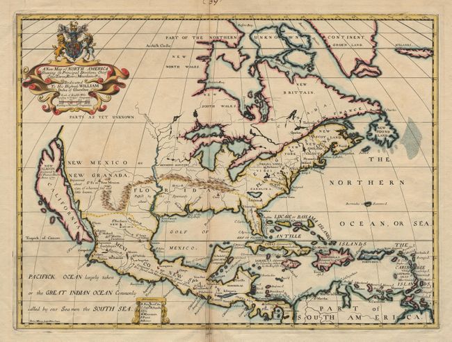
Subject: North America

Period: 1700 (published)

Publication: A New Sett of Maps

Color: Hand Color

Size:
19.5 x 14.5 inches
49.5 x 36.8 cm
Download High Resolution Image
(or just click on image to launch the Zoom viewer)

A handsome map with CALIFORNIA DEPICTED AS AN ISLAND on Sanson's second model. "New Albion" is placed in the upper part of the island with the notation that it was discovered by Sir Francis Drake in 1577. In this first state the distorted Great Lakes are not named, the Mississippi River flows into the Gulf in present-day Texas, and a mythical lake appears in Georgia. The northwest consists of 'Parts as yet unknown' and the map is filled with interesting notations. There are a few cities named in North America and the Caribbean, with the dates of discovery noted. The map is dedicated to His Highness William Duke of Gloucester, with his coat of arms in the title cartouche. Attractive outline color with a fully colored cartouche. $1,400 RESERVE.

References: McLaughlin #142; Tooley #69, plt. #53.

Condition: A

Old repair on bottom centerfold.

Estimate: $1,700 - $1,800

Sold for: $2,200

Closed on 9/13/2000

Archived