Catalog Archive
Auction 92, Lot 356

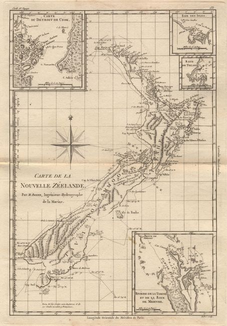
"Carte de la Nouvelle Zeelande", Bonne, Rigobert
Subject: New Zealand

Period: 1787-88 (published)

Publication: Atlas Encyclopedique

Color: Black & White

Size:
9.2 x 13.2 inches
23.4 x 33.5 cm
Download High Resolution Image
(or just click on image to launch the Zoom viewer)

Interesting and detailed chart of the islands with four insets: "Riviere de la Tamise et de la Baye de Mercure", "Carte du Detroit de Cook", "Baye des Isles", and "Baye de Tolaga". Capt. Cook's first voyage (1770) is shown. Large compass rose.

References:

Condition: B

Map is very clean and crisp, but margins are damp stained with edge damage and worm holes.

Estimate: $250 - $300

Sold for: $230

Closed on 9/13/2000

Archived