Catalog Archive
Auction 92, Lot 127

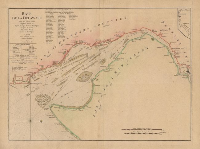
"Bay de la Delaware Avec les Ports, Sondes, Dangers, Bancs. &c. depuis les Caps, Jusqu'q Philadelphie de'Apres la Carte de Joshua Fisher publiee a Philadelphie", Le Rouge, George Louis

Subject: Colonial United States

Period: 1777 (dated)

Publication:

Color: Hand Color

Size:
25 x 18.2 inches
63.5 x 46.2 cm
Download High Resolution Image
(or just click on image to launch the Zoom viewer)

This is a French version of Joshua Fisher’s detailed map of the Delaware Bay and port of Philadelphia. The sailing chart shows the main ship channel with soundings, shoals, oyster beds, and navigational hazards. In addition, it shows some landowner's names, and the towns of Lewes, Newcastle, Wilmington, Chester, Gouester, Marcus Hood and Pilot Town. Included is a tide table, notes on tides and soundings, an a list of subscribers with 22 pilots and 22 masters of vessels. This chart is based on Fisher's second chart, which includes the Delaware River and a small plan of the city of Philadelphia. The chart had obvious importance during the Revolutionary War, and was reissued by several British and French cartographers during that period. North is oriented to the right. Ref: Sellers and Van Ee #1357. Expert and invisible repair of some tiny tears in margins, all well away from the map. $3,400 RESERVE

References:

Condition: A+

Estimate: $4,000 - $4,200

Unsold

Closed on 9/13/2000

Archived