Catalog Archive
Auction 92, Lot 115

"Pascaerte von Terra Nova Nova Francia Niew Englelandt en de groote Rivier van Canada", Colby, Charles G.

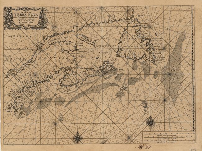
Subject: Colonial United States and Canada

Period: 1663-69 (published)

Publication: Atlas of Werelts-water-deel

Color: Black & White

Size:
20.7 x 14.8 inches
52.6 x 37.6 cm
Download High Resolution Image
(or just click on image to launch the Zoom viewer)

A very rare sea chart of the Maritimes. It is based on Joannes van Loon's chart of 1661, with the notable omission of Prince Edward Island. Jacob Aertsz. Colom was a respected mapmaker and Blaeu's major competitor in the Dutch chart trade. He founded the Navigation School in Amsterdam. This chart, one of only three North American related charts included in the atlas, appears in only one known state. It is a handsome chart with two compass roses, sailing ships, rhumb lines and a decorative title cartouche. Manuscript page number in bottom margin.

References: Burden #374; Kershaw #181.

Condition: A

This is a very dark impression, printed on heavy paper. Lightly toned with faint offsetting.

Estimate: $6,000 - $6,500

Sold for: $4,750

Closed on 9/13/2000

Archived