Catalog Archive
Auction 92, Lot 111

"The Course of the River St Laurence, from Lake Ontario to Manicougan Point. [on sheet with] United States of America", Thomson, John

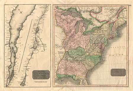
Subject: Canada and United States

Period: 1817 (circa)

Publication: Thomson's New General Atlas

Color: Hand Color

Size:
24 x 18 inches
61 x 45.7 cm
Download High Resolution Image
(or just click on image to launch the Zoom viewer)

Two maps on one sheet. The left side is a chart of the St. Lawrence River in two parts. At right is a map of the United States east of the Mississippi River. Maine is shown with British boundary claims. Georgia is shown with its western boundary on the Mississippi River, Florida is divided, and the region west of the Ohio River is name "The Western Territory". The map is filled with notations concerning the navigability of rivers and other items of interest.

References:

Condition: B

Minor damp stain and a couple of short tears in margin, well away from maps.

Estimate: $250 - $300

Sold for: $275

Closed on 9/13/2000

Archived