Catalog Archive
Auction 92, Lot 108
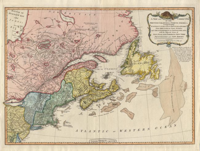
"A New and Correct Map of the British Colonies in North America Comprehending Eastern Canada with the Province of Quebec, New Brunswick, Nova Scotia, and the Government of Newfoundland: with the Adjacent States of New England, Vermont, New York…", Laurie & Whittle
Subject: Canada and United States
Period: 1794 (dated)
Publication:
Color: Hand Color
Size:
26 x 18.8 inches
66 x 47.8 cm
Download High Resolution Image
(or just click on image to launch the Zoom viewer)
(or just click on image to launch the Zoom viewer)