Catalog Archive
Auction 91, Lot 173

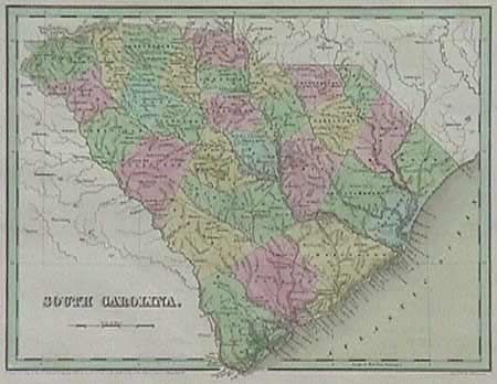
"South Carolina",

Subject: South Carolina

Period: 1838 (dated)

Publication: General Atlas of the World

Color: Hand Color

Size:
14.3 x 11.2 inches
36.3 x 28.4 cm
Download High Resolution Image
(or just click on image to launch the Zoom viewer)

Beautiful ante-bellum map of the state with 32 counties. A very interesting map with one interior railway line from Charleston to Columbia and Augusta and numerous canals, rivers, Post Offices, swamps (Hell Hole Swamp stands out) and some plantations. Excellent coastal detail of islands. Engraved by G.W. Boynton, dated 1838 but published in 1841. Excellent color and condition

References:

Condition: A+

Estimate: $120 - $150

Sold for: $160

Closed on 6/14/2000

Archived