Catalog Archive
Auction 91, Lot 158

"Grondvlakte von Nieuw Orleans, de Hoofdstad van Louisiana",
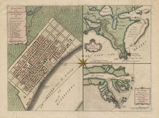
Subject: Louisiana

Period: 1763 (circa)

Publication:

Color: Hand Color

Size:
17.5 x 13 inches
44.5 x 33 cm
Download High Resolution Image
(or just click on image to launch the Zoom viewer)

A very handsome sheet with three maps. The map was first drawn by the Frenchman De la Tour in 1720, only two years after the founding of New Orleans. The first is a plan of the city of New Orleans (now the French Quarter) vividly depicting its protective canal, barracks and quays. The second is a map of the vicinity of New Orleans including the delta and surrounding bayou. The third is a map of the location of Fort la Balisle at the mouth of the river, which sank into the marsh in the late 1700's. Each map has a delicately engraved title cartouche. At the center of the sheet is a large (fully colored) compass rose. Light and barely noticeable scattered foxing, else very good. Ref: van Ermen #39.

References:

Condition: B

Estimate: $750 - $850

Sold for: $800

Closed on 6/14/2000

Archived