Catalog Archive
Auction 91, Lot 150

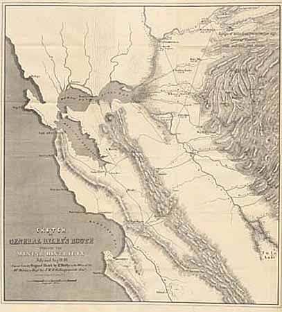
"Sketch of General Riley's Route through the Mining Districts July & August 1849. Lt Derby 1850.",

Subject: California & Gold Rush

Period: 1850 (published)

Publication:

Color: Black & White

Size:
20 x 21 inches
50.8 x 53.3 cm
Download High Resolution Image
(or just click on image to launch the Zoom viewer)

Important California Gold Rush map of the gold region in northern California. The map was made from the original sketch by Lt. Derby in the office of the 10th Military Dept. It is historically important, not only for its depiction of Gen. Riley's route, but because it names, for the first time, certain actual mining camps in the middle Sierra foothills, Mormon Island (misspelled Mormont), Coloma (mislabeled Colluma), Curtis, Sullivan's, Corons, Jamestown, Woods and Sonora. The entire route of the Riley party is noted, with the dates of their visits to the various camps, and covers the region from Monterrey Bay, north to Sacramento and east to the "gold diggings". Ref: Wheat (Gold) #79. A mint example of this important map.

References:

Condition: A+

Estimate: $475 - $550

Sold for: $800

Closed on 6/14/2000

Archived