Catalog Archive
Auction 91, Lot 107

"Nova Tabula Geographica Complectens Borealiorem Americae Partem; in qua exacte delineatae sunt Canada sive Nova Francia, Nova Scotia, Nova Anglia, Novum Belgium, Pensylvania, Virginia, Carolina, et Terra Nova…",

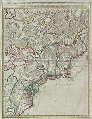
Subject: Colonial Canada and United States

Period: 1717-19 (published)

Publication:

Color: Hand Color

Size:
23.2 x 18.6 inches
58.9 x 47.2 cm
Download High Resolution Image
(or just click on image to launch the Zoom viewer)

Great map of the northeast coast of North America, from the Carolinas to Maine and inland to the Great Lakes. It depicts all of Lake Ontario and parts of Lakes Huron and Erie. The map is based on the western part of the Coronelli/Nolin map of 1689. It is beautifully engraved with topographical features. Colonial settlement is confined to the seaboard and rivers. In the interior a number of Indian nations are shown. Second state, with Schenk's name added. Old repair of a pair of tears near fold. Very crisp impression with fine original color. $1,800 RESERVE

References:

Condition: A

Estimate: $2,000 - $2,200

Sold for: $1,900

Closed on 6/14/2000

Archived