Catalog Archive
Auction 89, Lot 78
"Partie de l'Amerique Septentrionale qui comprend le Cours de l'Ohio, la Nlle Angleterre, la Nlle York, le New Jersey, la Pensylvanie, le Maryland, la Virginie, la Caroline"
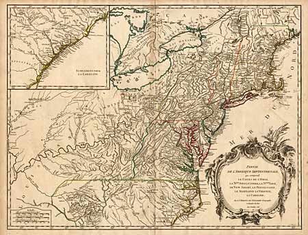
Subject: Colonial United States
Period: 1755 (dated)
Publication:
Color: Hand Color
Size:
24.5 x 18.7 inches
62.2 x 47.5 cm
Download High Resolution Image
(or just click on image to launch the Zoom viewer)
(or just click on image to launch the Zoom viewer)