Catalog Archive
Auction 89, Lot 67
"A Plan of the City & Harbour of Louisburg; shewing that part of Gabarus Bay in which the English landed, also their Encampment during the siege in 1745"
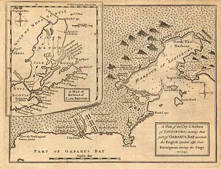
Subject: Canada
Period: 1758 (published)
Publication: Gentleman's Magazine
Color: Black & White
Size:
10 x 7.2 inches
25.4 x 18.3 cm
Download High Resolution Image
(or just click on image to launch the Zoom viewer)
(or just click on image to launch the Zoom viewer)