Catalog Archive
Auction 89, Lot 249

"Africae Nova Descriptio",
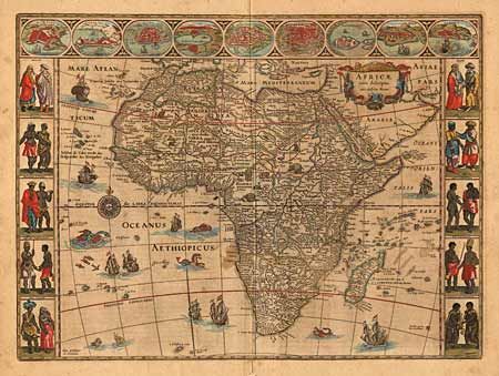
Subject: Africa

Period: 1631-67 (published)

Publication: Atlas Novus

Color: Hand Color

Size:
21.5 x 16 inches
54.6 x 40.6 cm
Download High Resolution Image
(or just click on image to launch the Zoom viewer)

One of the most decorative 17th Century maps of the continent. The map is surrounded on three sides with vignettes of native peoples and nine principal cities. The Nile is shown according to Ptolemy with its sources arising in the Lakes Zaire and Zaflan, the fictitious Lake Sachaf of Laurent Fries appears, as well as the R. de Spirito Santo. The map itself is further embellished with numerous ships, sea monsters, a compass rose and exotic animals wandering all over the continent. Ref: Norwich #32. Beautiful original coloring with minor oxidation of green. A small area of light discoloration in the map. Map has been de-acidified and professionally backed with Japanese tissue to repair split on bottom fold. $3,200 RESERVE.

References:

Condition: A

Estimate: $4,000 - $4,200

Sold for: $3,200

Closed on 12/8/1999

Archived